|
Hanskühnenburg
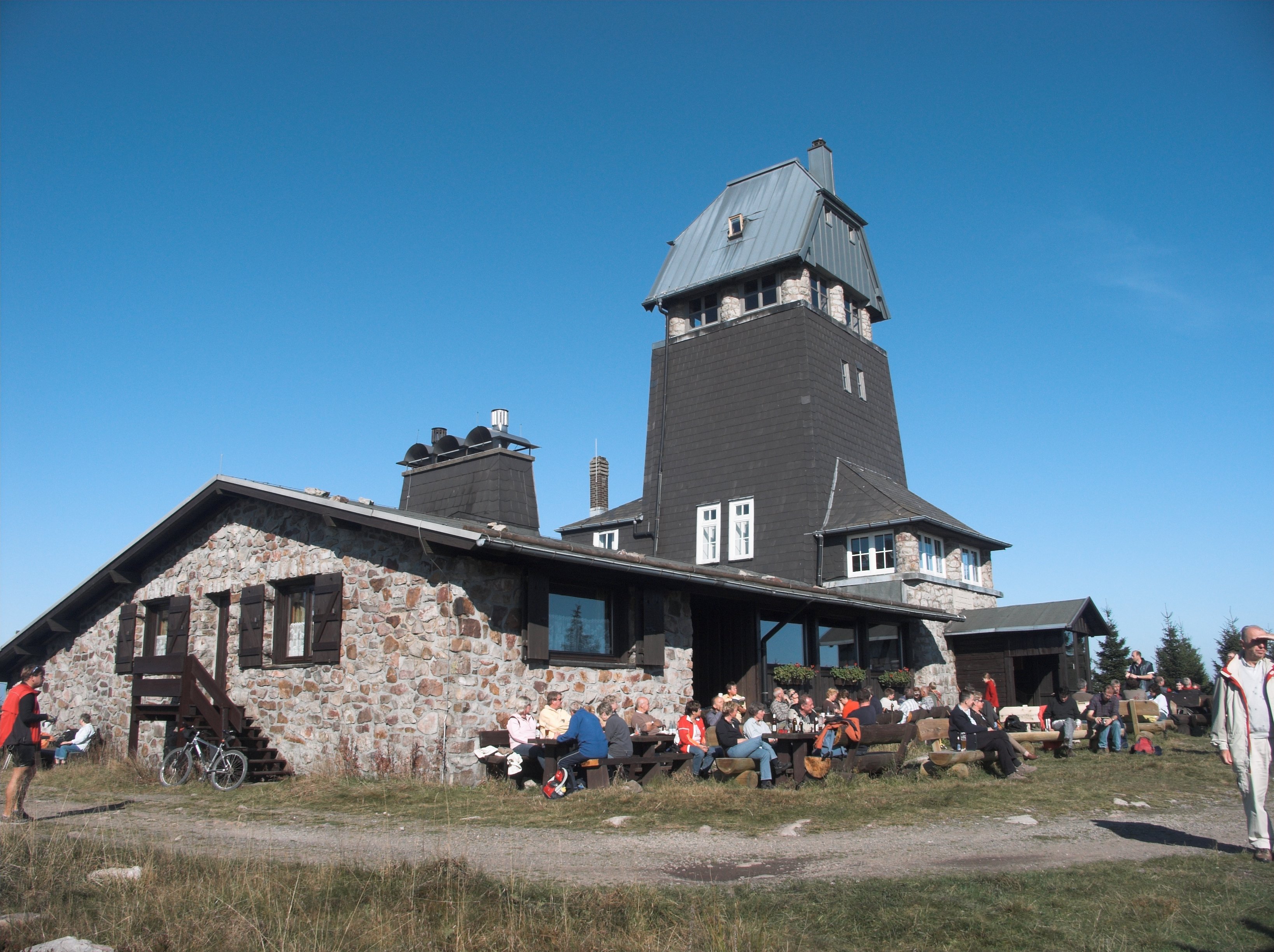
The Hanskühnenburg is a mountain hut (german: Bergbaude) in the Harz mountains. It is located at a height of above sea level in fields known as ''Auf dem Acker'', or simply ''Acker'', in the middle of the Harz National Park and has its own observation tower. Its name comes from the legendary Hanskühnenburg Crag (''Hanskühnenburg Klippe'') 300 metres to the northwest, which was visited on 14 August 1784 by Johann Wolfgang von Goethe. Opposite the tower are the Hanskühnenburg Rocks (''Hanskühnenburg Felsen'') that are relatively small by comparison with the ''Klippe''. A bronze plaque was mounted on these rocks in 1999 to commemorate Goethe's visit. In front of the Hanskühnenburg Rocks, a monument was erected in 1924 to Albert Leo Schlageter. It has since fallen over and is rather weathered. History At the end of the 19th century, the Osterode branch of the Harz Club built the first wooden observation tower and a managed refuge hut on the thickly wooded ''Acker'' cr ... [...More Info...] [...Related Items...] OR: [Wikipedia] [Google] [Baidu] |
Lonau
Lonau is a small village with a population of about 345 situated at an elevation of about 400m in the Harz Mountains of Northern Germany. Besides the clean air and lush forests, it is famous for the capercaillie. It belongs to the city of Herzberg am Harz which is about 4 km to the south. The rivers Große Lonau and Kleine Lonau join here. History The village of Lonau goes back to a settlement that was established here as a consequence of the setting up of iron ore mines and iron smelting huts at the beginning of the 16th century.''Lonau'' at www.herzberg.de. Accessed on 2 Nov 2010. Lonau was first mentioned in the records in ducal tax documents from 1615, although a smithy in Lonau had been named in 1525. Geography Lonau lies in the South Harz, in the middle of the[...More Info...] [...Related Items...] OR: [Wikipedia] [Google] [Baidu] |
Harzer Wandernadel
The Harzer Wandernadel is a system of hiking awards in the Harz mountains in central Germany. The hiker (or mountain biker) can earn awards at different levels of challenge by walking to the various checkpoints in the network and stamping his or her passbook to record the visit. With 222 checkpoints in three federal states and across five districts in the Harz and with membership in five figures, the system has gained a following Germany-wide. Purpose The idea of the ''Wandernadel'' (literally "hiking needle/pin" --> "hiking badge") is to give those holidaying in the Harz a worthwhile goal to achieve and encourage them to stay for longer or return. It also aims to encourage those who live in the local area to go hiking and improve their fitness. In addition the system helps tourists and locals to get to know the many different sights and hiking trails in the Harz. To that end, checkpoints have been located at scenic viewing points, places of geological or botanical, culturalbo ... [...More Info...] [...Related Items...] OR: [Wikipedia] [Google] [Baidu] |
Landkreis Osterode Am Harz
Osterode () was a district in Lower Saxony, Germany. It was bounded by (from the southwest and clockwise) the districts of Göttingen, Northeim and Goslar, and by the state of Thuringia (districts of Nordhausen and Eichsfeld). History This part of the Harz mountains was ruled by the Welfen dynasty from the 12th century on. Osterode was the centre of the Principality of Brunswick-Grubenhagen, one of many small states within Brunswick-Lüneburg. Later this principality became part of Hanover, which in turn fell to the Kingdom of Prussia in 1866. In 1885 the Prussian administration established districts, among them Osterode. On 1 November 2016, Osterode ceased to become a separate district and was merged with an enlarged Göttingen. Geography More than two thirds of the district's area were occupied by the southwestern part of the Harz mountains, including the southern portion of the Harz National Park. Coat of arms Towns and municipalities Towns: #Bad Lauterberg #Bad Sachsa ... [...More Info...] [...Related Items...] OR: [Wikipedia] [Google] [Baidu] |
Sieber (river)
Sieber is a river of Lower Saxony, Germany, in the Harz mountains. It is long and a right hand tributary of the Oder. The Sieber rises at 760 metres on the Bruchberg massif and flows through Herzberg before discharging at Hattorf into the Oder which, in turn, flows into the Rhume. Its tributaries include the Große Kulmke, Große Lonau and Goldenke. In February 1910, as part of his hydrological research into the '' Rhumequelle'', Karl Thürnau dyed the Sieber tributary of the ''Eichelbach'' (Herzberg) with six kilogrammes of fluorescein. Three days later, weakly dyed water appeared in the main source of the ''Rhumequelle''. This was confirmed in 1980 by dye tracing carried out by the Geological Survey of Lower Saxony (''Niedersächsischen Landesamtes für Bodenforschung''). This also indicated links between the ''Rhumequelle'' and the Sieber near Hörden and the Oder near Scharzfeld. The construction of a dam was planned but never realised. As a result the Sieber valle ... [...More Info...] [...Related Items...] OR: [Wikipedia] [Google] [Baidu] |
Herzberg Am Harz
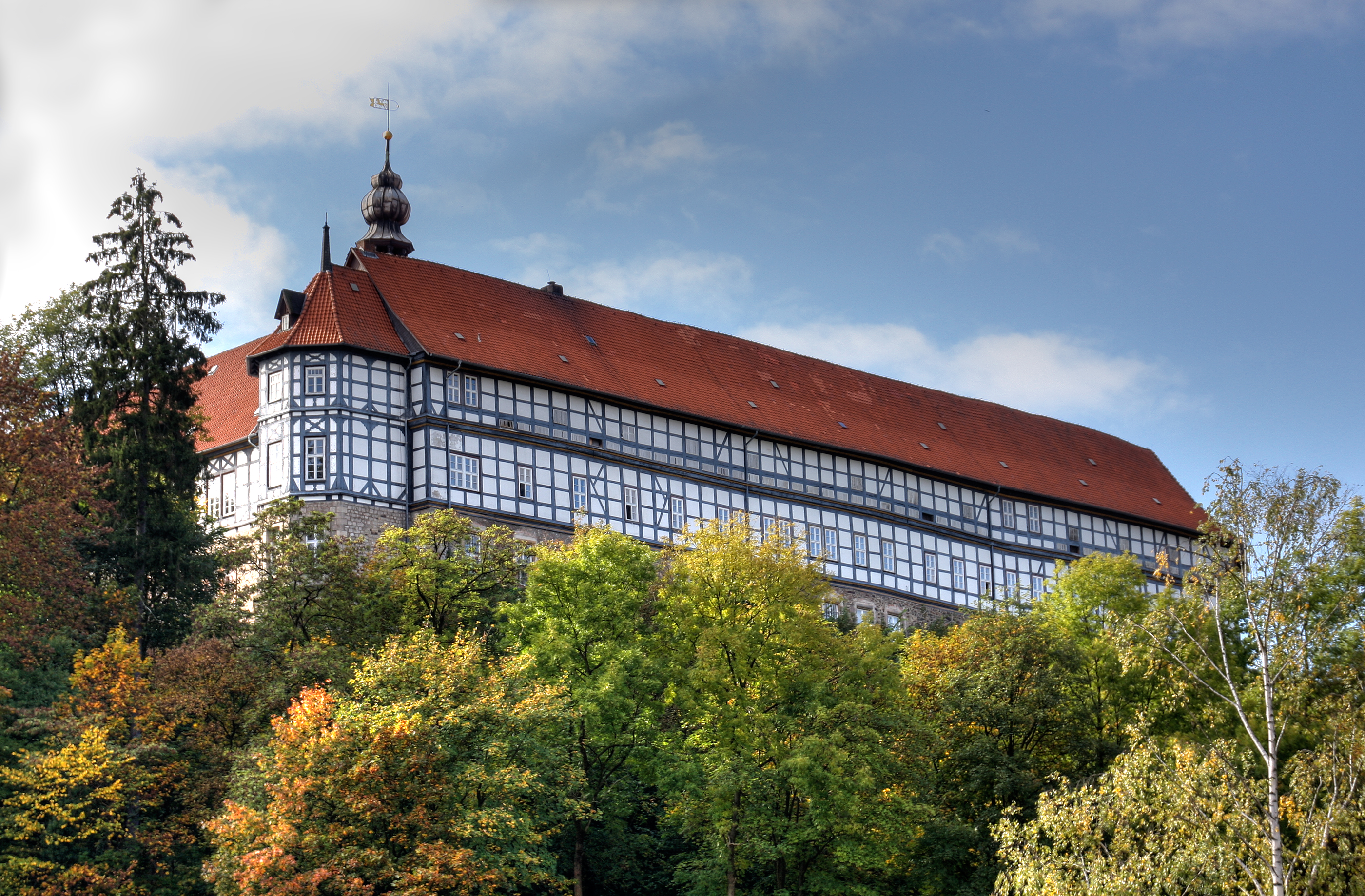
Herzberg am Harz is a town in the Göttingen district of Lower Saxony, Germany. Geography Herzberg is situated on the southwestern rim of the Harz mountain range and the Harz National Park. Natural monuments in the surrounding area include the Unicorn Cave, the Karst Trail, and the Rhume Spring. The town centre is located on the Sieber river, about northeast of Göttingen and southeast of the state capital Hanover. The municipal area comprises the villages of Lonau, Pöhlde, Scharzfeld, and Sieber. History Herzberg Castle in the Duchy of Saxony was first mentioned in an 1143 deed. A hunting lodge at the site was already erected from 1024 to 1029 by King Lothair II. It was seized by the Saxon Welf dynasty in 1144 and in 1158 became a property of Duke Henry the Lion with consent of the Hohenstaufen emperor Frederick Barbarossa. The castle was part of the Grubenhagen estates of the Welf duke Henry I of Brunswick he received in 1291, when he and his brothers divided the ... [...More Info...] [...Related Items...] OR: [Wikipedia] [Google] [Baidu] |
Söse Dam
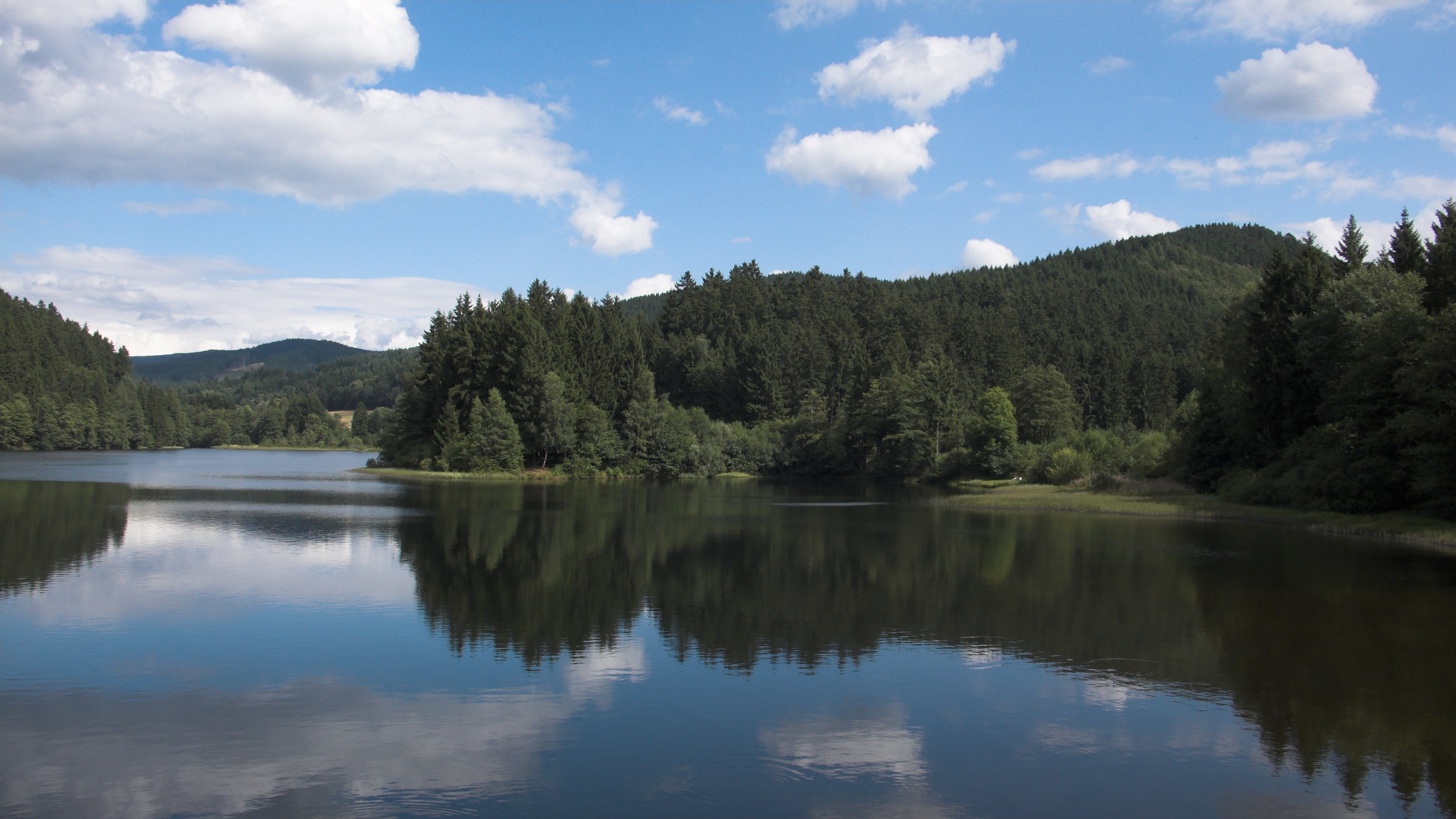
The Söse Dam is a dam in the Lower Saxon part of the Harz mountains near Osterode in the German state of Lower Saxony. It was the first modern dam and reservoir complex (German: ''Talsperre'') to be built in the Harz and was constructed by the '' Harzwasserwerke'' between 1928 and 1931. It is used for flood prevention, electricity generation, supplying drinking water and for raising water levels during times of low water. The construction of the dam cost 14.7 million Reichsmarks at the time. The ''Harzwasserwerke'' still operate the dam today. In 1933 construction began on a long-distance water pipe from the Söse reservoir, whose northern branch goes as far as Bremen. Today it mainly supplies towns and communities in the Hildesheim and Hanover areas. Since 1980 the town of Göttingen has also been supplied with drinking water from the reservoir. Main dam The main barrier is an earth-fill dam with a central concrete core and clay sealing. The hydro-electric power station, w ... [...More Info...] [...Related Items...] OR: [Wikipedia] [Google] [Baidu] |
Osterode Am Harz
Osterode am Harz, often simply called Osterode (; Eastphalian: ''Ostroe''), is a town in south-eastern Niedersachsen on the south-western edge of the Harz mountains. It was the seat of government of the district of Osterode. Osterode is located on the German Timber-Frame Road. Geography Water The Söse river flows through the town from the Söse Dam lake about 5 km upstream. The dam was built in 1931 and has a capacity of 25.5 million m³. The Harzwasserwerke water company pipes drinking water as far away as Bremen. Districts The following districts (mainly surrounding villages) are part of the borough of Osterode am Harz, with populations in brackets (as of 1 July 2012): * Dorste (1,650) * Düna (140) * Förste (2,000) * Freiheit (2,100) * Kazenstein (1,200) * Lasfelde (1,300) * Lerbach (1,000) * Marke (150) * Nienstedt am Harz (440) * Osterode am Harz (11,500) * Petershütte (800) * Riefensbeek-Kamschlacken (350) * Schwiegershausen (1,800) * Ührde (100) ... [...More Info...] [...Related Items...] OR: [Wikipedia] [Google] [Baidu] |
Sankt Andreasberg
Sankt Andreasberg is a former town in the district of Goslar, in Lower Saxony, Germany. Since 1 November 2011, it is part of the town Braunlage. It is situated in the Harz, approximately 7 km west of Braunlage proper, and 20 km east of Osterode am Harz. History Sankt Andreasberg was founded in the 1480s. It was first mentioned in a letter from the Count Heinrich zu Stolberg to Dietrich von Witzlebenon on 3 November 1487. The establishment of the village took place around the market. The first silver mines are assumed to be the St. Andrews Cross Mine (german: Grube St. Andreaskreuz) at the foot of the ''Beerberg'' and the St. Andrews Mine (''Grube St. Andreas'') by the market. In 1521, St. Andreasberg received the right to mine from Counts Heinrich and Ernst von Hohenstein. It was proclaimed in Mansfelder Land and in the mining areas of Saxony and miners were invited to dig for silver and other metals. Natural monuments The area around Sankt Andreasberg is esp ... [...More Info...] [...Related Items...] OR: [Wikipedia] [Google] [Baidu] |
Clausthal
Clausthal-Zellerfeld is a town in Lower Saxony, Germany. It is located in the southwestern part of the Harz mountains. Its population is approximately 15,000. The City is the location of the Clausthal University of Technology. The health resort is located in the Upper Harz at an altitude between 390 and 821 m Metres above sea level, above sea level. Geography Clausthal-Zellerfeld is located on the Upper Harz Plateau. The environment is less mountainous compared to most of the Harz, but only hilly. As a result, the immediate surrounding area is less wooded and there are more meadow areas. Scattered in and around Clausthal-Zellerfeld are numerous dams and streams of the Upper Harz Water Regale. The depression between Clausthal and Zellerfeld marks a natural "borderline". Southwest extends the "Small Clausthal valley". City districts * Altenau, Lower Saxony, Altenau-Schulenberg im Oberharz (since 2015) * Buntenbock (since 1972) * Clausthal-Zellerfeld * Wildemann (since 2015) ... [...More Info...] [...Related Items...] OR: [Wikipedia] [Google] [Baidu] |
Upper Harz Mining Industry
Mining in the Upper Harz region of central Germany was a major industry for several centuries, especially for the production of silver, lead, copper, and, latterly, zinc as well. Great wealth was accumulated from the mining of silver from the 16th to the 19th centuries, as well as from important technical inventions. The centre of the mining industry was the group of seven Upper Harz mining towns of Clausthal, Zellerfeld, Sankt Andreasberg, Wildemann, Grund, Lautenthal und Altenau. History The Upper Harz was once one of the most important mining regions in Germany. The major products of its mines were silver, copper, lead, iron and, from the 19th century, zinc as well. The main source of income, however, was silver. From the 16th to the middle of the 19th centuries about 40–50% of the entire German silver production originated in the Upper Harz. The taxes raised from this contributed significantly to the revenue of the royal houses in Hanover and Brunswick-Wolfenbüttel and ... [...More Info...] [...Related Items...] OR: [Wikipedia] [Google] [Baidu] |
Upper Harz
The Upper Harz (german: Oberharz, ) refers to the northwestern and higher part of the Harz mountain range in Germany. The exact boundaries of this geographical region may be defined differently depending on the context. In its traditional sense, the term Upper Harz covers the area of the seven historical mining towns (''Bergstädte'') - Clausthal, Zellerfeld, Andreasberg, Altenau, Lautenthal, Wildemann and Grund - in the present-day German federal state of Lower Saxony. Orographically, it comprises the Harz catchment areas of the Söse, Innerste and Grane, Oker and Abzucht mountain streams, all part of the larger Weser watershed. Much of the Upper Harz area is up to above sea level. In a wider sense, it also comprises the adjacent High Harz (''Hochharz'') range in the east, climbing to over in the Brocken massif. Geography The region is centred on the geological structure of the region around the municipality of Clausthal-Zellerfeld, merged in 1924. From the Clausthal ... [...More Info...] [...Related Items...] OR: [Wikipedia] [Google] [Baidu] |


