|
Hann, Senegal
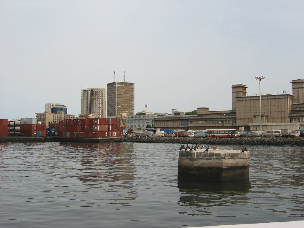
Hann is a neighbourhood of Dakar, the capital of Senegal. It is located on the eastern side of the small south facing peninsula on which the old city of Dakar was built. Hann neighborhood sits along a crescent shaped beach called Hann Bay. Hann is part of the Hann Bel-Air commune d'arrondissement: a part of the municipal Dakar Department which covers the city of Dakar. Hann is one of the four original Lebou villages of the Cap-Vert Peninsula, along with Yoff, Ngor, and Ouakam. Neighbourhood Hann sits just north of the Bel-Air peninsula, a rocky outcropping which juts east from the Dakar Plateau. To the south is the Port of Dakar. To the west is the HLM and Grand Yoff neighbourhoods. To the north is Patte d'Oie and to the northeast, Niayes. Gently sloping from the higher plateau of the city centre, Hann forms a long crescent sand beach, also known as ''Yarakh''. Among the landmarks of Hann is the large park Parc Forestier de Hann, laying just northeast of the Dakar ci ... [...More Info...] [...Related Items...] OR: [Wikipedia] [Google] [Baidu] |
Dakar
Dakar ( ; ; ) is the capital city, capital and List of cities in Senegal, largest city of Senegal. The Departments of Senegal, department of Dakar has a population of 1,278,469, and the population of the Dakar metropolitan area was at 4.0 million in 2023. Dakar is situated on the Cap-Vert peninsula, the westernmost point of mainland Africa. Cap-Vert was colonized by the Portuguese people, Portuguese in the early 15th century. The Portuguese established a presence on the island of Gorée off the coast of Cap-Vert and used it as a base for the Atlantic slave trade. Kingdom of France, France took over the island in 1677. Following the abolition of the slave trade and French annexation of the mainland area in the 19th century, Dakar grew into a major regional port and a major city of the French colonial empire. In 1902, Dakar replaced Saint-Louis, Senegal, Saint-Louis as the capital of French West Africa. From 1959 to 1960, Dakar was the capital of the short-lived Mali Federation. ... [...More Info...] [...Related Items...] OR: [Wikipedia] [Google] [Baidu] |
Railway Stations In Senegal
List of Railway stations in Senegal include: Maps UN Map Towns served by rail Existing * Dakar ― port and national capital (0 km) * Hann, Senegal, Hann ― truncated terminus (3 km) * Bargny, Senegal, Bargny ― proposed List of deep water ports, deepwater port. * Rufisque ― Cement in Africa, cement works ---- * Kirène ― Cement in Africa, cement works to be expanded in 2008. - nearest station is Thiès about 20 km away. ---- * Thiès ― junction for Saint-Louis, Senegal, St-Louis and Linguere; workshops * Bambey * Diourbel ― junction for Touba, Senegal, Touba, Mbaké * Gossas * Guinguinéo ― junction for Kaolack and Lydiane ** Kaolack ― provincial capital ** Lydiane ― branch terminus * Kaffrine * Niahène * Koungheul * Koumpentoum * Koussanar * Tambacounda ― provincial capital and proposed junction * Bala, Senegal, Bala * Goudiry * Kidira ― border with Mali * Nayé, Seneg ... [...More Info...] [...Related Items...] OR: [Wikipedia] [Google] [Baidu] |
Train Express Regional
A train (from Old French , from Latin">-4; we might wonder whether there's a point at which it's appropriate to talk of the beginnings of French, that is, when it wa ... , from Latin , "to pull, to draw") is a series of connected vehicles that run along a railway track and Passenger train, transport people or Rail freight transport, freight. Trains are typically pulled or pushed by locomotives (often known simply as "engines"), though some are self-propelled, such as multiple units or railcars. Passengers and cargo are carried in railroad cars, also known as wagons or carriages. Trains are designed to a certain gauge, or distance between rails. Most trains operate on steel tracks with steel wheels, the low friction of which makes them more efficient than other forms of transport. Many countries use rail transport. Trains have their roots in wagonways, which used railway tracks and were powered by horses or pulled by cables. Following the invention of the steam locomotive i ... [...More Info...] [...Related Items...] OR: [Wikipedia] [Google] [Baidu] |
European Investment Bank
The European Investment Bank (EIB) is the European Union's investment bank and is owned by the 27 member states. It is the largest multilateral financial institution in the world. The EIB finances and invests both through equity and debt solutions companies and projects that achieve the policy aims of the European Union through loans, equity and guarantees. The EIB focuses on the areas of climate, environment, small and medium-sized enterprises (SMEs), development, cohesion and infrastructure. It has played a large role in providing finance during crises including the 2008 financial crisis and the COVID-19 pandemic. Over 60 years since its inception in 1958 to 2018 the EIB has invested over 1.1 trillion euros. It primarily funds projects that "cannot be entirely financed by the various means available in the individual Member States". The EIB is one of the biggest financiers of Sustainable finance, green finance in the world. In 2007, the EIB became the first institution in ... [...More Info...] [...Related Items...] OR: [Wikipedia] [Google] [Baidu] |
Port Of Dakar
The Autonomous Port of Dakar (French: ''Port autonome de Dakar'', abbreviation: ''PAD'') is a Senegalese public enterprise which is headquartered in Dakar, located in the east of city. Thanks to the strategic position that gives it a sheltered harbor, it is now the third largest port in West Africa after the Autonomous Port of Abidjan and the Port of Lagos It is also the ninth-largest port on the African continent. The port has one of the largest deep-water seaports along the West African coast. Its deep-draft structure and access channel allows round-the-clock access to the port. Its current infrastructure includes tanker vessel loading and unloading terminals, a container terminal with a storage capacity of 3000 20-foot-equivalent units, a cereals and fishing port, a dedicated phosphate terminal and a privately run ship repair facility. The port's location at the extreme western point of Africa, at the crossroad of the major sea-lanes linking Europe to South America, makes it a ... [...More Info...] [...Related Items...] OR: [Wikipedia] [Google] [Baidu] |
Pirogue
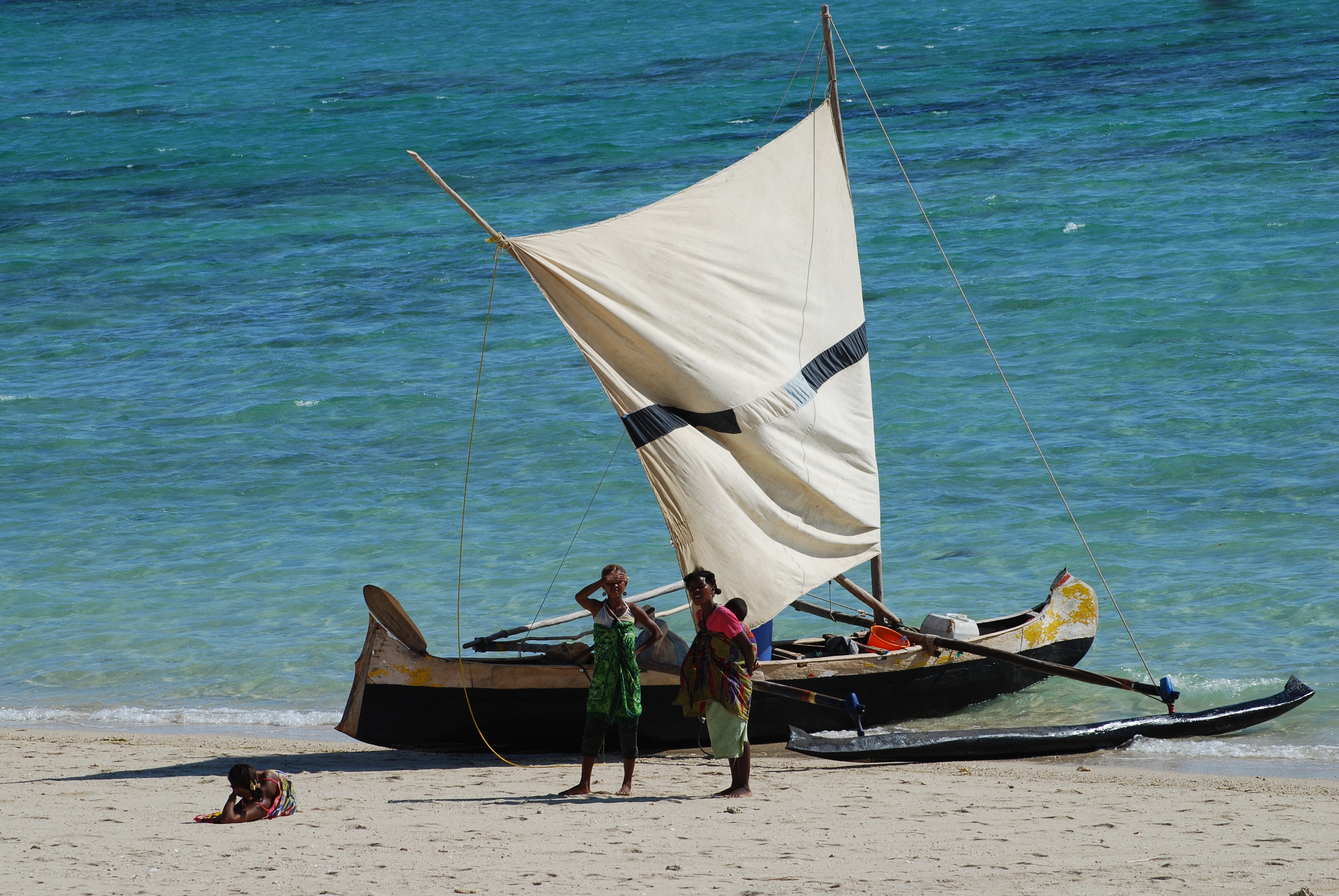
A pirogue ( or ), also called a piragua or piraga, is any of various small boats, particularly dugouts and canoes. The word is French and is derived from Spanish ''piragua'' , which comes from the Carib '. Description The term 'pirogue' does not refer to a specific kind of boat, but is a generic term for small boats in regions once colonized by France and Spain, particularly dugouts made from a log. In French West Africa, the term refers to handcrafted banana-shaped boats used by traditional fishermen. In Madagascar, it also includes the more elaborate Austronesian ''lakana'' outrigger canoe. Pirogues are usually propelled by paddles that have one blade (as opposed to a kayak paddle, which has two). It can also be punted with a push pole in shallow water. Small sails are built by local fishermen and they can also be employed. There are two types of sails with differences in their shapes, the square one is used mainly for fishing near the coast and is only useful for ... [...More Info...] [...Related Items...] OR: [Wikipedia] [Google] [Baidu] |
Cours Sainte Marie De Hann
Cours Sainte Marie de Hann is a school for different group of ages ranging from Kindergarten to high school in Dakar, Senegal. It was founded in 1949–1950 and belongs to a group of private schools in the Dakar Diocese of the Catholic Church.UNESCO Prize 1991 for Peace Education In 1991 it was awarded the UNESCO Prize for Peace Education
The UNESCO Prize for Peace Education was awarded annually beginning 1981. The main goal of UNESCO education prize was to encourage excellent effort in the drive to reach a better quality education. The prize endowed up to US$60,000 and a statuett ... . [...More Info...] [...Related Items...] OR: [Wikipedia] [Google] [Baidu] |
Niayes
Niayes is a geographical area in northwestern Senegal which forms a coastal strip, with sand dunes adjoining the sea being backed by a string of fresh water lakes. The land is used for horticulture and the grazing of cattle, and provides suitable habitat for waterfowl and other birds. The Niayes Arrondissement is subdivided into four administrative regions. The area is important both economically and for conservation, but is threatened by desertification. Geography Niayes occupies a narrow strip of land along the Atlantic coast of Senegal, varying in length from and in width from . It extends from the peninsula of Cap-Vert to the Mauritanian border and from the coast roughly to the road leading from Dakar to Saint-Louis. The Niayes Arrondissement is divided into four administrative subdivisions: the Dakar Region, the Thiès Region, the Louga Region and the Saint-Louis Region. The area has a ridge of coastal sand dunes, behind which is a series of permanent, fresh water lake ... [...More Info...] [...Related Items...] OR: [Wikipedia] [Google] [Baidu] |


