|
Haneda, Ōta, Tokyo
is a district of Ōta, Tokyo, Japan. As of January 1, 2011, Haneda had a total population of 14,885. The district gives its name to Haneda Airport, the busiest airport in Japan by passenger traffic. History Before the construction of Haneda Airport, the area was a prosperous mineral springs and beach resort centered around . In 1930, the Japanese postal ministry purchased a portion of reclaimed land in Tokyo Bay to the east of Haneda from a private individual in order to construct an airport. Haneda Airfield first opened in 1931 with a flight from the airport on August 25. In 1932, the was merged into the newly created Tokyo City ward of Kamata, which was in turn merged with Ōmori is a district located a few kilometres south of Shinagawa, Tokyo, Japan accessed by rail via the Keihin-Tohoku Line, Keihin Tohoku line, or by road via Japan National Route 15, Dai Ichi Keihin. Ōmorikaigan, the eastern area of Ōmori, can be ... to form Ōta in 1947. Climate Reference ... [...More Info...] [...Related Items...] OR: [Wikipedia] [Google] [Baidu] |
Clam Digging In Haneda 1937
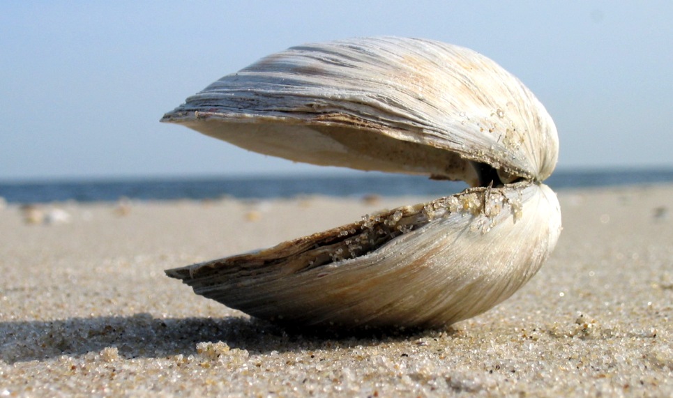
Clam is a common name for several kinds of bivalve mollusc. The word is often applied only to those that are deemed edible and live as infauna, spending most of their lives halfway buried in the sand of the sea floor or riverbeds. Clams have two shells of equal size connected by two adductor muscles and have a powerful burrowing foot. They live in both freshwater and marine environments; in salt water they prefer to burrow down into the mud and the turbidity of the water required varies with species and location; the greatest diversity of these is in North America. Clams in the culinary sense do not live attached to a substrate (whereas oysters and mussels do) and do not live near the bottom (whereas scallops do). In culinary usage, clams are commonly eaten marine bivalves, as in clam digging and the resulting soup, clam chowder. Many edible clams such as palourde clams are ovoid or triangular; however, razor clams have an elongated parallel-sided shell, suggesting an old-fash ... [...More Info...] [...Related Items...] OR: [Wikipedia] [Google] [Baidu] |
Ōta, Tokyo
is a Special wards of Tokyo, special ward in the Tokyo, Tokyo Metropolis in Japan. The ward refers to itself in English as Ōta City. It was formed in 1947 as a merger of Ōmori, Ōta, Tokyo, Ōmori and Kamata, Ōta, Tokyo, Kamata following Tokyo City's Local Autonomy Act, transformation into Tokyo Metropolis. The southernmost of the 23 special wards, Ōta borders the special wards of Shinagawa, Tokyo, Shinagawa, Meguro, Tokyo, Meguro and Setagaya, Tokyo, Setagaya to the north, and Kōtō, Tokyo, Kōtō to the east. Across the Tama River in Kanagawa Prefecture is the city of Kawasaki, Kanagawa, Kawasaki, forming the boundaries to the south and west. Ōta is the largest special ward in Tokyo by area, spanning 59.46 square kilometres (22.96 sq mi). As of 2024, the ward has an estimated population of 744,849, making it the third largest special ward by population, with a population density of 12,041 inhabitants per square kilometre (31,190/sq mi). Notable neighborhoods and districts ... [...More Info...] [...Related Items...] OR: [Wikipedia] [Google] [Baidu] |
Haneda Airport
, also known as and sometimes abbreviated to ''Tokyo-Haneda'', is the busier of the two international airports serving the Greater Tokyo Area, the other one being Narita International Airport (NRT). It serves as the primary domestic base of Japan's two largest airlines, Japan Airlines (Terminal 1) and All Nippon Airways (Terminal 2), as well as RegionalPlus Wings Corp. (Air Do and Solaseed Air), Skymark Airlines, and StarFlyer. It is located in Ōta, Tokyo, south of Tokyo Station. The facility covers 1,522 hectares (3,761 acres) of land. Haneda previously carried the IATA airport code TYO, which is now used by airline reservation systems and travel agencies within the Greater Tokyo Area, and was the primary international airport serving Tokyo until 1978; from 1978 to 2010, Haneda handled almost all domestic flights to and from Tokyo as well as "scheduled charter" flights to a small number of major cities in East Asia, East and Southeast Asia, while Narita handled the vast maj ... [...More Info...] [...Related Items...] OR: [Wikipedia] [Google] [Baidu] |
List Of The Busiest Airports In Japan
Japan's busiest airports are a series of lists ranking the fifty busiest airports in the country according to the number of total passengers, and also including statistics for total aircraft movements and total cargo movements, following the official register yearly. The data here presented are provided by the Ministry of Land, Infrastructure, Transport and Tourism (MLIT), and the results are for the calendar year (as the Ministry also presents yearly results for the fiscal year). The lists are presented in chronological order starting from the latest year. The number of total passengers is measured in persons and includes any passenger that arrives, depart or travel on transit in every airport in the country. The number of total aircraft movements is estimated, measuring airplane-times and includes the departures and arrivals of any kind of aircraft in schedule or charter conditions. The number of total cargo movements in metric tonnes and includes all the movements of cargo an ... [...More Info...] [...Related Items...] OR: [Wikipedia] [Google] [Baidu] |
Tokyo Bay
is a bay located in the southern Kantō region of Japan spanning the coasts of Tokyo, Kanagawa Prefecture, and Chiba Prefecture, on the southern coast of the island of Honshu. Tokyo Bay is connected to the Pacific Ocean by the Uraga Channel. The Tokyo Bay region is the most populous and the largest industrialized area in Japan. Names In ancient times, the Japanese knew Tokyo Bay as the . By the Azuchi–Momoyama period (1568–1600) the area had become known as after the city of Edo. The bay took its present name in modern times, after the Imperial court moved to Edo and renamed the city Tokyo in 1868. Geography Tokyo Bay juts prominently into the Kantō Plain. It is surrounded by the Bōsō Peninsula in Chiba Prefecture to the east and the Miura Peninsula in Kanagawa Prefecture to the west. The shore of Tokyo Bay consists of a Diluvium, diluvial plateau and is subject to rapid marine erosion. Sediments on the shore of the bay make for a smooth, continuous shoreline. Bound ... [...More Info...] [...Related Items...] OR: [Wikipedia] [Google] [Baidu] |
Japan Science And Technology Agency
The Japan Science and Technology Agency (JST; Japanese: 科学技術振興機構) is a Japanese government agency which aims to build infrastructure that supports knowledge creation and dissemination in Japan. It is one of the National Research and Development Agency (Japan), National Research and Development Agencies, overseen by the Ministry of Education, Culture, Sports, Science and Technology (MEXT) and the Council for Science, Technology and Innovation (CSTI). It operates from headquarters in Kawaguchi, Saitama in the Greater Tokyo Area, and in Chiyoda, Tokyo, Chiyoda in central Tokyo. The agency formed in 2003, as successor to the Japan Science and Technology Corporation. The corporation had formed in 1996 through the merging of the Japan Information Center of Science and Technology (JICST, est. 1957) and the Research Development Corporation of Japan (JRDC, est. 1961). Among other activities, the agency runs J-STAGE, an "electronic journal platform for science and technolog ... [...More Info...] [...Related Items...] OR: [Wikipedia] [Google] [Baidu] |
Tokyo City
was a Cities of Japan, municipality in Japan and capital of Tokyo Prefecture (1868–1943), Tokyo Prefecture (or ''Tokyo-fu'') which existed from 1 May 1889 until the establishment of Tokyo Metropolis on 1 July 1943. The historical boundaries of Tokyo City are now occupied by the Special wards of Tokyo, special wards of Tokyo. The defunct city and its prefecture became what is now Tokyo, also known as the Tokyo Metropolis or, ambiguously, Tokyo Prefecture. History In 1868, the city of Edo, seat of the Tokugawa shogunate, Tokugawa government, was renamed Tokyo, and the offices of Tokyo Prefecture (''-fu'') were opened. The extent of Tokyo Prefecture was initially limited to the former Edo city, but rapidly augmented to be comparable with the present Tokyo Metropolis. In 1878, the Meiji government's reorganization of local governments subdivided prefectures into Counties of Japan, counties or districts (''gun'', further subdivided into Towns of Japan, towns and Villages of J ... [...More Info...] [...Related Items...] OR: [Wikipedia] [Google] [Baidu] |
Kamata, Tokyo
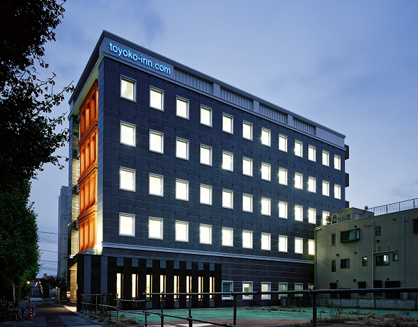
is a district of Ōta, Tokyo, Japan. Features include the Kamata Station, Kamata High School, and the headquarters of Toyoko Inn. History The name "Kamata" has been used to refer to the area since at least the 900s AD. Historically, the area was famous for Japanese apricots (''ume''). Kamata was first linked to nearby towns of Kawasaki, Kanagawa and Ōmori, Tokyo by rail in 1901 with the opening of Kamata Station (now Keikyu Kamata Station) on the Keihin Electric Railway. This was followed in 1904 by the opening of a separate Kamata Station on the Tokaido Line providing connection to Tokyo and Yokohama. Kamata became a ward of Tokyo City was a Cities of Japan, municipality in Japan and capital of Tokyo Prefecture (1868–1943), Tokyo Prefecture (or ''Tokyo-fu'') which existed from 1 May 1889 until the establishment of Tokyo Metropolis on 1 July 1943. The historical boundari ... in October 1932, incorporating the historical towns of Kamata, Yaguchi, Rokugo ... [...More Info...] [...Related Items...] OR: [Wikipedia] [Google] [Baidu] |
Ōmori
is a district located a few kilometres south of Shinagawa, Tokyo, Japan accessed by rail via the Keihin-Tohoku Line, Keihin Tohoku line, or by road via Japan National Route 15, Dai Ichi Keihin. Ōmorikaigan, the eastern area of Ōmori, can be reached via the Keihin Electric Express Railway, Keikyu line. Ōmori is one of many areas in Tokyo's largest ward, Ōta, Tokyo, Ōta-ku, but as Ōmori Station (Tokyo), Ōmori train station is located close to the border with Shinagawa, Tokyo, Shinagawa-ku, some buildings bearing the name Ōmori, such as the Omori Bell Port complex, are located in Shinagawa-ku. Prior to its development as a residential and business location, Ōmori was a fishing village along the Tōkaidō (road), Tōkaidō Highway and famous for its farming of nori seaweed, a staple of the Japanese diet. Areas There are six neighbourhoods in Ōta with the place name Ōmori: Ōmorihonchō, Ōmorihigashi, Ōmorikita, Ōmoriminami, Ōmorinaka and Ōmorinishi. All of them a ... [...More Info...] [...Related Items...] OR: [Wikipedia] [Google] [Baidu] |
Japan Meteorological Agency
The Japan Meteorological Agency (JMA; ''気象庁, Kishō-chō'') is a division of the Ministry of Land, Infrastructure, Transport and Tourism dedicated to the Scientific, scientific observation and research of natural phenomena. Headquartered in Minato, Tokyo the government agency, agency collects data on meteorology, hydrology, seismology, volcanology, and other related fields. The JMA is responsible for collecting and disseminating weather data and Forecasting, forecasts to the public, as well as providing specialized information for aviation and Marine weather forecasting, marine sectors. Additionally, the JMA issues warnings for volcanic eruptions and is integral to the nationwide Earthquake Early Warning (Japan), Earthquake Early Warning (EEW) system. As one of the Regional Specialized Meteorological Centers designated by the World Meteorological Organization (WMO), the JMA also Forecasting, forecasts, Tropical cyclone naming, names, and distributes warnings for tropical ... [...More Info...] [...Related Items...] OR: [Wikipedia] [Google] [Baidu] |


