|
Gwanda District
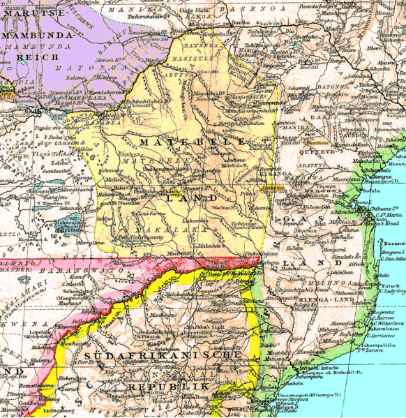
Gwanda District is located in Matabeleland South Province of Zimbabwe. Its administrative seat is Gwanda, the biggest city of the province. The main language spoken by the people from Gwanda is Sotho. The center is Gwanda Gwanda is a town in Zimbabwe. It is the capital of the province of Matabeleland South, one of the ten administrative provinces in the country. It is also the district capital of Gwanda District, one of the seven administrative districts in t .... Districts of Matabeleland South Province {{zimbabwe-geo-stub ... [...More Info...] [...Related Items...] OR: [Wikipedia] [Google] [Baidu] |
Matabeleland South Districts
Matabeleland is a region located in southwestern Zimbabwe that is divided into three provinces: Matabeleland North, Bulawayo, and Matabeleland South. These provinces are in the west and south-west of Zimbabwe, between the Limpopo and Zambezi rivers and are further separated from Midlands by the Shangani River in central Zimbabwe. The region is named after its inhabitants, the Ndebele people who were called "Amatabele"(people with long spears - Mzilikazi 's group of people who were escaping the Mfecani wars). Other ethnic groups who inhabit parts of Matabeleland include the Tonga, Bakalanga, Venda, Nambya, Khoisan, Xhosa, Sotho, Tswana, and Tsonga. The population of Matabeleland is just over 20% of the Zimbabwe's total. The capital and largest city is Bulawayo, other notable towns are Plumtree, Victoria Falls, Beitbridge, Lupane, Esigodini, Hwange and Gwanda. The land is fertile but semi arid. This area has coal and gold deposits. Industries include gold and other mine ... [...More Info...] [...Related Items...] OR: [Wikipedia] [Google] [Baidu] |
Matabeleland South
Matabeleland South is a province in southwestern Zimbabwe. With a population of 683,893 as of the 2012 Zimbabwean census, it is the country's least populous province. After Matabeleland North, it is Zimbabwe's second-least densely populated province. Matabeleland South was established in 1974, when the original Matabeleland Province was divided into two provinces, the other being Matabeleland North. The province is divided into six districts. Gwanda is the capital, and Beitbridge is the province's largest town. The name "Matabeleland" is derived from Ndebele, the province's largest ethnic group. Matabeleland South is bordered by Bulawayo and Matabeleland North to the north, Midlands to the northeast, Masvingo to the southeast, South Africa to the south, and Botswana to the west. It has an area of , equal to 13.86% of the total area of Zimbabwe. It is the fourth-largest of the country's ten provinces in area. Matabeleland South sits on the edge of the Kalahari Desert, giving i ... [...More Info...] [...Related Items...] OR: [Wikipedia] [Google] [Baidu] |
Zimbabwe
Zimbabwe (), officially the Republic of Zimbabwe, is a landlocked country located in Southeast Africa, between the Zambezi and Limpopo Rivers, bordered by South Africa to the south, Botswana to the south-west, Zambia to the north, and Mozambique to the east. The capital and largest city is Harare. The second largest city is Bulawayo. A country of roughly 15 million people, Zimbabwe has 16 official languages, with English, Shona language, Shona, and Northern Ndebele language, Ndebele the most common. Beginning in the 9th century, during its late Iron Age, the Bantu peoples, Bantu people (who would become the ethnic Shona people, Shona) built the city-state of Great Zimbabwe which became one of the major African trade centres by the 11th century, controlling the gold, ivory and copper trades with the Swahili coast, which were connected to Arab and Indian states. By the mid 15th century, the city-state had been abandoned. From there, the Kingdom of Zimbabwe was established, fol ... [...More Info...] [...Related Items...] OR: [Wikipedia] [Google] [Baidu] |
Gwanda
Gwanda is a town in Zimbabwe. It is the capital of the province of Matabeleland South, one of the ten administrative provinces in the country. It is also the district capital of Gwanda District, one of the seven administrative districts in the province. Location The town is located , by road, south east of the city of Bulawayo, Zimbabwe's second largest city. This location lies on the Bulawayo–Beitbridge Road and the Beitbridge Bulawayo Railway. The town of Beitbridge, at Zimbabwe's border with the Republic of South Africa, lies approximately , further southeast on Highway A-6. The coordinates of Gwanda, Zimbabwe are: 20°56'20.0"S, 29°01'07.0"E (Latitude:-20.938889; Longitude:29.018611). Gwanda sits at an average elevation of above mean sea level. Gwanda is known to have long, hot summers, and short, cool winters. Gwanda is also quite dry as compared to the rest of the country, and is therefore prone to drought. Overview Gwanda was founded in 1900 as a settlement of ... [...More Info...] [...Related Items...] OR: [Wikipedia] [Google] [Baidu] |
Gwanda District
Gwanda District is located in Matabeleland South Province of Zimbabwe. Its administrative seat is Gwanda, the biggest city of the province. The main language spoken by the people from Gwanda is Sotho. The center is Gwanda Gwanda is a town in Zimbabwe. It is the capital of the province of Matabeleland South, one of the ten administrative provinces in the country. It is also the district capital of Gwanda District, one of the seven administrative districts in t .... Districts of Matabeleland South Province {{zimbabwe-geo-stub ... [...More Info...] [...Related Items...] OR: [Wikipedia] [Google] [Baidu] |

