|
Grand Marais, Michigan
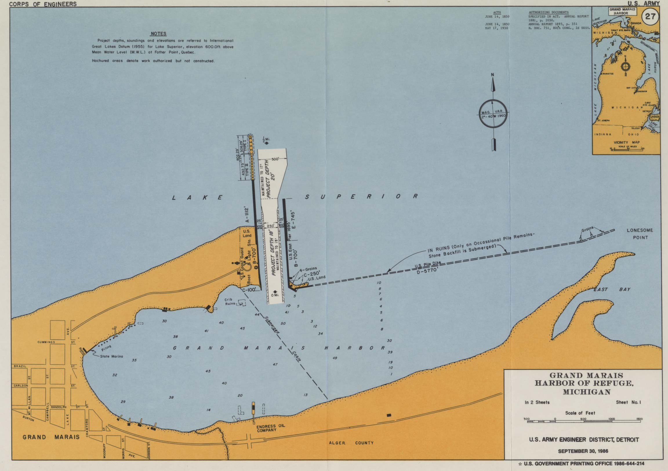
Grand Marais ( ) is an unincorporated community and census-designated place (CDP) in Alger County in the U.S. state of Michigan. It is located within Burt Township on the shores of Lake Superior, and the community is the eastern gateway to the Pictured Rocks National Lakeshore via H-58. History The name ''Grand Marais'' (French: great marsh) is a reference to the large, shallow harbor. French explorers and fur traders from the time of New France used the word "marais" to mean "harbor of refuge" as well as "marsh." A breakwater was later built that extends from the bay into Lake Superior. The Grand Marais Outer Range Light is at its end, and the Fresnel lens is still operative. It is one of only 70 such lenses that remain operational in the United States; 16 of these are in use on the Great Lakes, eight of which are in Michigan. Many controversies in the little town relate to the costs of dredging and breakwall-repair operations to keep the harbor functioning. See Grand Mara ... [...More Info...] [...Related Items...] OR: [Wikipedia] [Google] [Baidu] |
Census-designated Place
A census-designated place (CDP) is a concentration of population defined by the United States Census Bureau for statistical purposes only. CDPs have been used in each decennial census since 1980 as the counterparts of incorporated places, such as self-governing cities, towns, and villages, for the purposes of gathering and correlating statistical data. CDPs are populated areas that generally include one officially designated but currently unincorporated community, for which the CDP is named, plus surrounding inhabited countryside of varying dimensions and, occasionally, other, smaller unincorporated communities as well. CDPs include small rural communities, edge cities, colonias located along the Mexico–United States border, and unincorporated resort and retirement communities and their environs. The boundaries of any CDP may change from decade to decade, and the Census Bureau may de-establish a CDP after a period of study, then re-establish it some decades later. Most unin ... [...More Info...] [...Related Items...] OR: [Wikipedia] [Google] [Baidu] |
Lake Superior
Lake Superior in central North America is the largest freshwater lake in the world by surface areaThe Caspian Sea is the largest lake, but is saline, not freshwater. and the third-largest by volume, holding 10% of the world's surface fresh water. The northern and westernmost of the Great Lakes of North America, it straddles the Canada–United States border with the province of Ontario to the north and east, and the states of Minnesota to the northwest and Wisconsin and Michigan to the south. It drains into Lake Huron via St. Marys River, then through the lower Great Lakes to the St. Lawrence River and the Atlantic Ocean. Name The Ojibwe name for the lake is ''gichi-gami'' (in syllabics: , pronounced ''gitchi-gami'' or ''kitchi-gami'' in different dialects), meaning "great sea". Henry Wadsworth Longfellow wrote this name as "Gitche Gumee" in the poem ''The Song of Hiawatha'', as did Gordon Lightfoot in his song " The Wreck of the ''Edmund Fitzgerald''". According to oth ... [...More Info...] [...Related Items...] OR: [Wikipedia] [Google] [Baidu] |
Vermilion Point
Vermilion Point is a remote, undeveloped shore in Chippewa County, Michigan, United States. Located west of Whitefish Point, Michigan, this historic spot lies on a stretch of Lake Superior’s southeast coast known as the " Graveyard of the Great Lakes" or the "Shipwreck Coast". The servicemen of Vermilion Lifesaving Station performed daring rescues of shipwrecks from 1877 until 1944 when it was closed after modern navigational technology made this service obsolete. Vermilion Point was a popular stopover for Native Americans, early travelers, and explorers. Early settlers used its bogs and marshes to grow cranberries that were shipped to Chicago, Illinois, and Duluth, Minnesota. Today it is protected as a nature preserve for study of avian ecology and research of the piping plover and beach plant community succession. Ecology Its sand and pebble beach is intermingled with agates that are churned ashore during storms. Pounding surf and buffeting winds keep the low barrier ... [...More Info...] [...Related Items...] OR: [Wikipedia] [Google] [Baidu] |
Crisp Point Light
Crisp Point was one of five U.S. Life-Saving Service Stations along the coast of Lake Superior between Munising and Whitefish Point in the Upper Peninsula of Michigan. The lighthouse is within McMillan Township in Luce County. Located about west of Whitefish Point, in 1876 it became Life Saving Station Number Ten, of the U.S. Life-Saving Service District 10 (later part of District 11). Crisp Point is named from one of the Life Saving Station keepers, Christopher Crisp, who is said to have been "an iron-willed boatman." Surfmen were stationed there to aid mariners and ships in distress. The station, along with the rest of the United States Life-Saving Service, was integrated into the United States Coast Guard in 1915. (In 1939 the U.S. Lighthouse Service also merged under the control of the Coast Guard). Due to the fact that the US Life-Saving Service and the US Lighthouse Service were originally two distinct entities, the Crisp Point Life Saving Station and the Crisp Poin ... [...More Info...] [...Related Items...] OR: [Wikipedia] [Google] [Baidu] |
Two Hearted River
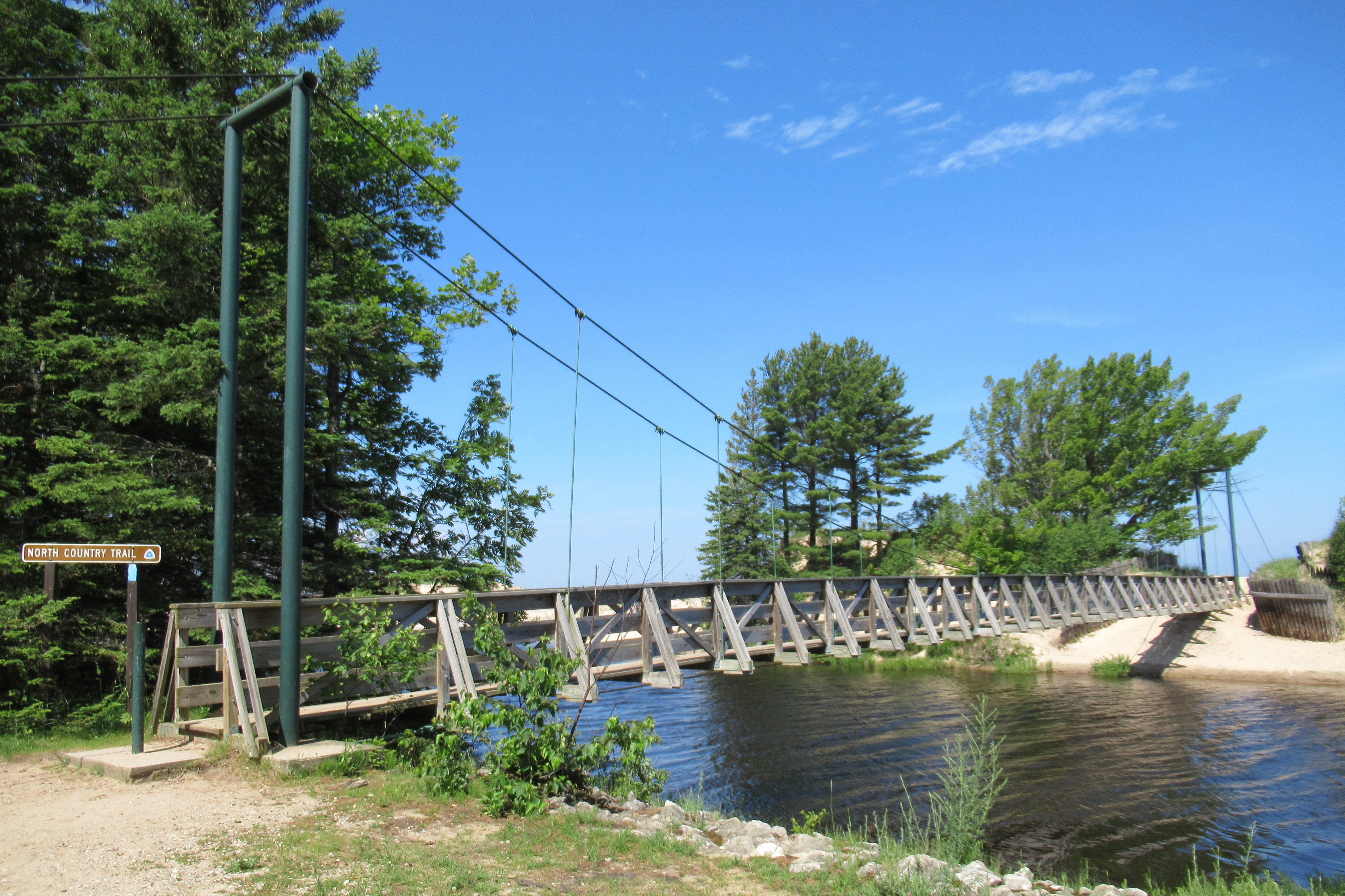
The Two Hearted River is a river in the eastern Upper Peninsula of the U.S. state of Michigan. It is located entirely within McMillan Township in Luce County. The river runs approximately through forested wilderness,U.S. Geological Survey. National Hydrography Dataset high-resolution flowline dataThe National Map accessed January 3, 2012 and drains into Lake Superior. It rises in several short branches in northeastern Luce County, about southeast of Grand Marais. The north and west branches meet approximately south-southeast of Muskallonge Lake State Park. The main branch flows generally northeast, approaching Lake Superior at a sharp angle. It enters the lake approximately east of Deer Park. The Little Two Hearted River has its river mouth about to the east of Two Hearted River. The North Country Trail crosses near the mouth of the Two Hearted River along Lake Superior. History A Michigan Historic Marker commemorates the Two-Hearted Life-Saving Station built in 187 ... [...More Info...] [...Related Items...] OR: [Wikipedia] [Google] [Baidu] |
Muskallonge Lake State Park
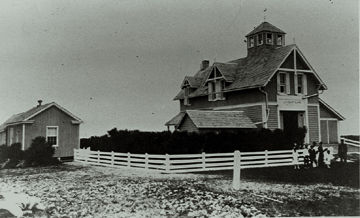
Muskallonge Lake State Park is a state park located in Luce County in the U.S. state of Michigan. It is located in Deer Park about west of Grand Marais along H-58. The park encompasses between the shores of Lake Superior and Muskallonge Lake where Native Americans once had an encampment and where a station of the United States Life-Saving Service once stood. History The park occupies land just west of Deer Park, a 19th-century mill town that all but disappeared once the forests on which its mill depended were gone. The state park is also the site of former Station Muskallong Lake (Coast Guard Station #295; later called Station Deer Park), one of five such stations along the coast of Lake Superior between Munising and Whitefish Point in the Upper Peninsula. It was part of U.S. Life-Saving Service District 10 (later part of District 11). The other four stations along Lake Superior's "Shipwreck Coast" were Grand Marais, Two Heart, Crisp Point Light, and Vermilion Point ... [...More Info...] [...Related Items...] OR: [Wikipedia] [Google] [Baidu] |
Upper Peninsula Of Michigan
The Upper Peninsula of Michigan – also known as Upper Michigan or colloquially the U.P. – is the northern and more elevated of the two major landmasses that make up the U.S. state of Michigan; it is separated from the Lower Peninsula by the Straits of Mackinac. It is bounded primarily by Lake Superior to the north, separated from the Canadian province of Ontario at the east end by the St. Marys River, and flanked by Lake Huron and Lake Michigan along much of its south. Although the peninsula extends as a geographic feature into the state of Wisconsin, the state boundary follows the Montreal and Menominee rivers and a line connecting them. First inhabited by Algonquian-speaking native American tribes, the area was explored by French colonists, then occupied by British forces, before being ceded to the newly established United States in the late 18th century. After being assigned to various territorial jurisdictions, it was granted to the newly formed state of Michigan as ... [...More Info...] [...Related Items...] OR: [Wikipedia] [Google] [Baidu] |
Whitefish Point
Whitefish Point is a cape of Michigan's Upper Peninsula, United States, marking the entry point of Whitefish Bay. It is north of the unincorporated community of Paradise, Michigan. Whitefish Point is known for the Great Lakes Shipwreck Museum, its Lake Superior shoreline, the Whitefish Point Lighthouse and as a prime birding area. Whitefish Point is a designated Important Bird Area. The Whitefish Point Bird Observatory, an affiliate of the Michigan Audubon Society, operates a research and education facility at Whitefish Point. At 17 miles away, Whitefish Point is the nearest navigation mark to the wreckage of the ore freighter SS ''Edmund Fitzgerald'', which sank in 1975. Whitefish Point remains one of the most dangerous shipping areas in the Great Lakes, Known as the graveyard of the Great Lakes, more vessels have been lost in the Whitefish Point area than any other part of Lake Superior. The Whitefish Point Underwater Preserve protects the shipwrecks in a portion of the bay f ... [...More Info...] [...Related Items...] OR: [Wikipedia] [Google] [Baidu] |
Munising, Michigan
Munising ( ') is a city in Alger County in the U.S. state of Michigan. The population was 2,355 at the 2010 census. It is the county seat of Alger County. The city is partially surrounded by Munising Township, but the two are administered autonomously. Located on the southern shore of Lake Superior in the Upper Peninsula, it serves as the western gateway to Pictured Rocks National Lakeshore. History The name for the city comes from the Ojibwe word ''minisiing'', "at the island". A post office was established as the Munising post office on December 22, 1868. It was renamed as Gogarnville on October 23, 1889, when Julius Gogarn was appointed as postmaster. The office was moved to his farm. He was a German-born American Civil War veteran and first Supervisor of Munising Township. That post office continued until July 15, 1893. Geography Munising is located on the southern edge of Munising Bay at , also known as the South Bay of Grand Island Harbor, across from Grand Island aroun ... [...More Info...] [...Related Items...] OR: [Wikipedia] [Google] [Baidu] |
United States Life-Saving Service
The United States Life-Saving ServiceDespite the lack of hyphen in its insignia, the agency itself is hyphenated in government documents including: and was a United States government agency that grew out of private and local humanitarian efforts to save the lives of shipwrecked mariners and passengers. It began in 1848 and ultimately merged with the Revenue Cutter Service to form the United States Coast Guard in 1915. Early years The concept of assistance to shipwrecked mariners from shore-based stations began with volunteer lifesaving services, spearheaded by the Massachusetts Humane Society. It was recognized that only small boats stood a chance of assisting those close to the beach. A sailing ship trying to help near to the shore stood a good chance of also running aground, especially if there were heavy onshore winds. The Massachusetts Humane Society founded the first lifeboat station at Cohasset, Massachusetts. The stations were small shed-like structures, holding rescue e ... [...More Info...] [...Related Items...] OR: [Wikipedia] [Google] [Baidu] |
Great Lakes
The Great Lakes, also called the Great Lakes of North America, are a series of large interconnected freshwater lakes in the mid-east region of North America that connect to the Atlantic Ocean via the Saint Lawrence River. There are five lakes, which are Lake Superior, Superior, Lake Michigan, Michigan, Lake Huron, Huron, Lake Erie, Erie, and Lake Ontario, Ontario and are in general on or near the Canada–United States border. Hydrologically, lakes Lake Michigan–Huron, Michigan and Huron are a single body joined at the Straits of Mackinac. The Great Lakes Waterway enables modern travel and shipping by water among the lakes. The Great Lakes are the largest group of freshwater lakes on Earth by total area and are second-largest by total volume, containing 21% of the world's surface fresh water by volume. The total surface is , and the total volume (measured at the low water datum) is , slightly less than the volume of Lake Baikal (, 22–23% of the world's surface fresh water ... [...More Info...] [...Related Items...] OR: [Wikipedia] [Google] [Baidu] |
Grand Marais Harbor Of Refuge Inner And Outer Lights
The Grand Marais Harbor of Refuge Inner and Outer Lights are a pair of lighthouses located on the west pier at the entry to Grand Marais Harbor of Refuge, in Grand Marais, Michigan. They were listed on the National Register of Historic Places in 2012. History: harbor and light construction In the 1870s, shipping traffic through Lake Superior increased tremendously. Realizing the lack of a safe harbor between Whitefish Bay and Grand Island, the Army Corps of Engineers began upgrading the harbor at Grand Marais in 1881. Over the next ten years, the Corps dredged the harbor and constructed a timber pile breakwater stretching across the harbor. A shipping channel was dredged into the harbor, and two timber crib piers long were built to each side of the channel. These piers were extended one section at a time. As the work on the harbor neared completion, the Lighthouse Board decided that navigation into the harbor would be improved by the addition of a light and fog signal on t ... [...More Info...] [...Related Items...] OR: [Wikipedia] [Google] [Baidu] |


