|
Goslar (district)
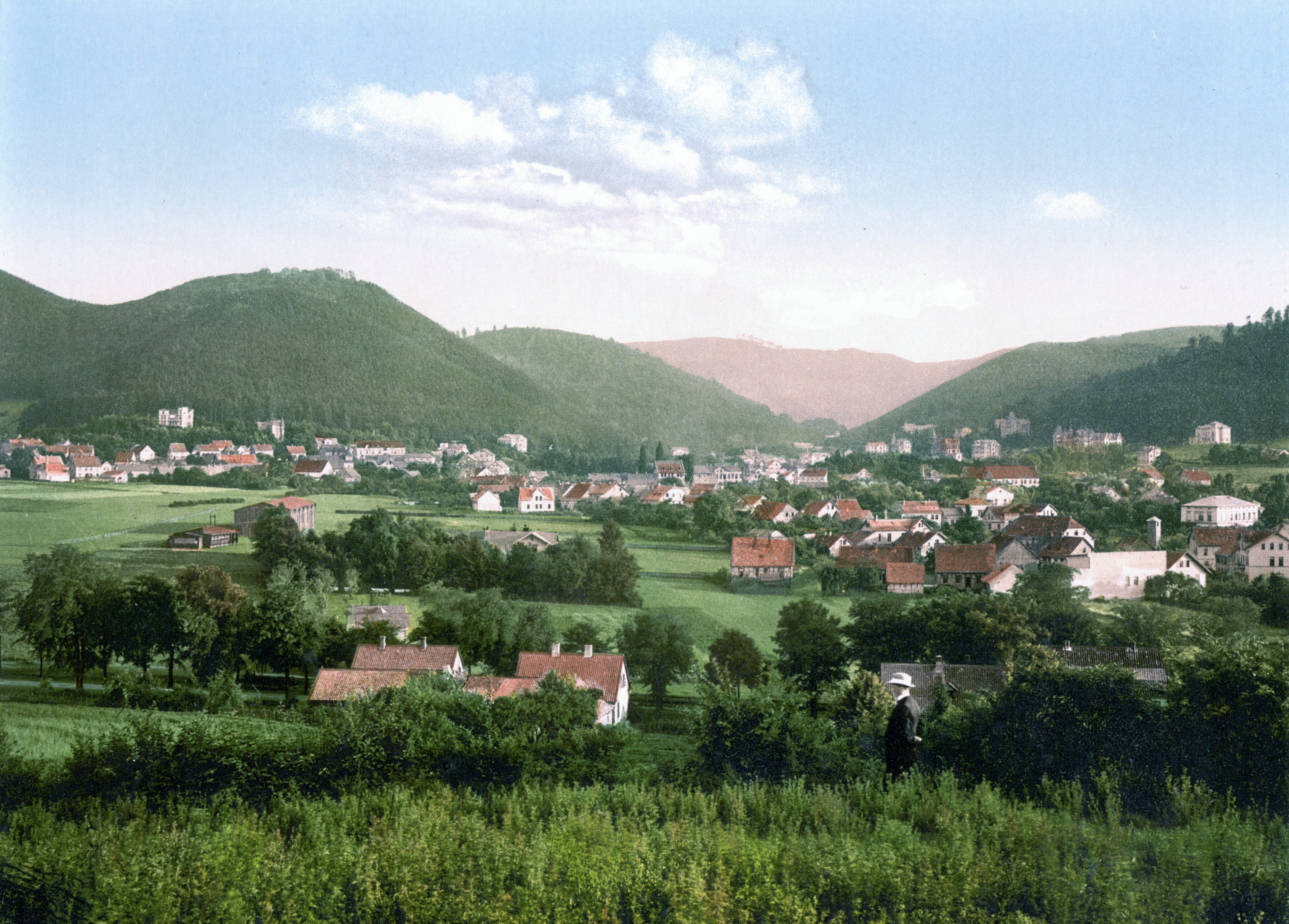
Goslar () is a district in Lower Saxony, Germany. It is bounded by (from the south and clockwise) the districts of Göttingen, Northeim, Hildesheim and Wolfenbüttel, the city of Salzgitter, and by the states of Saxony-Anhalt (district of Harz) and Thuringia ( Nordhausen). History The history of the district is linked with the city of Goslar. The district of Goslar was established in the 19th century by the Prussian government. The city of Goslar did not belong to the district until 1972, when it was eventually incorporated into the district. Langelsheim merged 1 November 2021 with the three municipalities of the Samtgemeinde Lutter am Barenberge, which was abolished. Geography The region comprises the northwestern part of the Harz mountains. The Harz National Park is part of this district. The highest peak is the Wurmberg (971 m) near Braunlage, also being the highest elevation of Lower Saxony. Above the small town of Altenau there is the source of the Oker river, which run ... [...More Info...] [...Related Items...] OR: [Wikipedia] [Google] [Baidu] |
Goslar
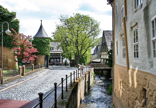
Goslar (; Eastphalian: ''Goslär'') is a historic town in Lower Saxony, Germany. It is the administrative centre of the district of Goslar and located on the northwestern slopes of the Harz mountain range. The Old Town of Goslar and the Mines of Rammelsberg are UNESCO World Heritage Sites for their millenium-long testimony to the history of ore mining and their political importance for the Holy Roman Empire and Hanseatic League. Each year Goslar awards the Kaiserring to an international artist, called the "Nobel Prize" of the art world. Geography Goslar is situated in the middle of the upper half of Germany, about south of Brunswick and about southeast of the state capital, Hanover. The Schalke (Harz), Schalke mountain is the highest elevation within the municipal boundaries at . The lowest point of is near the Oker river. Geographically, Goslar forms the boundary between the Hildesheim Börde which is part of the North German Plain, Northern German Plain, and the Harz r ... [...More Info...] [...Related Items...] OR: [Wikipedia] [Google] [Baidu] |
Braunlage
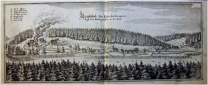
Braunlage () is a town and health resort in the Goslar district of Lower Saxony in Germany. Situated within the Harz mountain range, south of the Brocken massif, Braunlage's main business is tourism, particularly skiing. Nearby ski resorts include the Sonnenberg and the slopes on the Wurmberg. Geography Braunlage is located on the Warme Bode, a headstream of the river Bode, close to the border with Elend in the state of Saxony-Anhalt. The municipal area stretches along the south-eastern rim of the Harz National Park from an elevation of up to at the summit of the Wurmberg. Other peaks in the vicinity include the Achtermannshöhe and the Hahnenklee Crags. Districts The town consists of three districts: * Braunlage proper * Hohegeiß*, incorporated on 1 July 1972 * Sankt Andreasberg**, incorporated on 1 November 2011 * with the village of Königskrug ** with the villages of Sonnenberg, Oderhaus, Oderbrück, Oderberg, Odertaler Sägemühle and Silberhütte Transportat ... [...More Info...] [...Related Items...] OR: [Wikipedia] [Google] [Baidu] |
Bundesstraße 241
The B 241 is a federal road (''Bundesstraße'') in Germany. It runs from Hohenwepel (near Warburg) to Vienenburg. Course States and districts * North Rhine-Westphalia ** Höxter district *** Hohenwepel, Borgentreich, Dalhausen, Beverungen * Lower Saxony ** Holzminden district *** Lauenförde ** Northeim district *** Amelith, Schönhagen, Kammerborn, Sohlingen, Uslar, Bollensen, Gierswalde, Volpriehausen, Goseplack, Hardegsen, Lutterhausen, Moringen, Höckelheim, Northeim, Hammenstedt, Katlenburg ** Göttingen district *** Dorste *** Osterode ** Goslar district *** Clausthal-Zellerfeld, Goslar, Vienenburg, Wiedelah River crossings * Weser, between Beverungen and Lauenförde * Ahle, in Uslar * Leine The Leine (; Old Saxon ''Lagina'') is a river in Thuringia and Lower Saxony, Germany. It is a left tributary of the Aller and the Weser and is long. The river's source is located close to the town of Leinefelde in Thuringia. About downriv . ... [...More Info...] [...Related Items...] OR: [Wikipedia] [Google] [Baidu] |
Bundesstraße 82
''Bundesstraße'' (German language, German for "federal highway"), abbreviated ''B'', is the denotation for Germany, German and Austrian national highways. Germany Germany's ''Bundesstraßen'' network has a total length of about 40,000 km. German ''Bundesstraßen'' are labelled with rectangular yellow signs with black numerals, as opposed to the white-on-blue markers of the ''Autobahn'' controlled-access highways. ''Bundesstraßen'', like autobahns, are maintained by the Federal agency (Germany), federal agency of the Federal Ministry of Transport, Building and Urban Development, Transport Ministry. In the German highway system they rank below autobahns, but above the ''Landesstraßen'' and ''Kreisstraßen'' maintained by the States of Germany, federal states and the Districts of Germany, districts respectively. The numbering was implemented by law in 1932 and has overall been retained up to today, except for those roads located in the former eastern territories of Germany. ... [...More Info...] [...Related Items...] OR: [Wikipedia] [Google] [Baidu] |
Bundesstraße 6n
The Bundesstraße 6n is a German federal road that runs east-west from the Vienenburg district of Goslar to Bernburg, where it connects to the A14. It was originally planned to be the A 36 motorway. It is intended to have four lanes running from the A 395 near Vienenburg through Wernigerode, Blankenburg, Quedlinburg, Aschersleben over the A 14 to Bernburg (Saale). The designation B 6n has been given to distinguish it from the old B 6 and B 185 during the planning and construction phase. After it is opened to traffic and the old ''Bundesstraße'' is downgraded to a ''Landesstraße'' or '' Kreisstraßen'' the B 6n will be renumbered the B 6 from Goslar to Aschersleben, the remaining section to the A 14 will become the B 185. For the most part the signs have already been changed accordingly. Route The B 6n is signed off the A 14 (Magdeburg–Halle/Leipzig) motorway at Bernburg motorway junction and, after Braunschweig (Brunswick), it joins the A 395 at ... [...More Info...] [...Related Items...] OR: [Wikipedia] [Google] [Baidu] |
Bundesstraße 6
The Bundesstraße 6 (abbr. B6) is a German federal highway running from Bremerhaven on the North Sea coast in a southeasterly direction through the states of Lower Saxony, Bremen, Saxony-Anhalt and Saxony to Görlitz on the Polish border. History East of Leipzig, the B6 (except of the ring roads around Meißen, Dresden and Bischofswerda) largely follows the historic course of the '' Via Regia Lusatiae Superioris'', part of the medieval ''Via Regia''. In 1937, the northwestern section of the former ''Reichsstraße 6'' (R6) was extended from Bremerhaven (Wesermünde) to Cuxhaven. Before World War II and the implementation of the Oder–Neisse line, the R6 road continued southeastwards from Görlitz via Hirschberg (present-day Jelenia Góra, Poland) and Schweidnitz (Świdnica) to the Silesian capital Breslau (Wrocław) and from there via Oels (Oleśnica) as far as the former Polish border near Groß Wartenberg (Syców). The sections between Görlitz/ Zgorzelec and ... [...More Info...] [...Related Items...] OR: [Wikipedia] [Google] [Baidu] |
Bundesstraße 4
The Bundesstraße 4 (abbr. B4) is a German federal highway running in a northwesterly to southly direction from the state of Schleswig-Holstein to Bavaria. It provides a direct route for motorists traveling between Hamburg and Nuremberg. The section north of Hamburg is paralleled by Bundesautobahn 7 and the road is down-graded to a ''Landstraße'' (country road); the section between Hallstadt and Erlangen is paralleled by the A 70 and A 73 and is also down-graded to a ''Staatsstraße'' (state road, same as country road). The Bundesstraße 4 is the former Reichsstraße 4 (imperial road), on which north of Quickborn the last Commanding Admiral of the Kriegsmarine Friedeburg met with officers of the 2nd British Army to negotiate a truce with the Western Allied forces on May 4, 1945. See also *Transport in Hamburg Transport in Hamburg comprises an extensive, rail system, subway system, airports and maritime services for the more than 1.8 million inhabitants of t ... [...More Info...] [...Related Items...] OR: [Wikipedia] [Google] [Baidu] |
Liebenburg
Liebenburg is a municipality in the district of Goslar, in Lower Saxony, Germany. Geography The municipal area is situated north of the Harz mountain range, within the eastern Salzgitter Hills of the Innerste Uplands. It borders on the district capital Goslar, approx. in the south; the adjacent municipalities in the north are Salzgitter-Bad and Schladen in Wolfenbüttel District. Subdivisions The municipality comprises Liebenburg proper (with 2,140 inhabitants) and the following nine villages, which were incorporated on 1 July 1972 with the following population as of 30 June 2018: * Dörnten (1,189 inhabitants) with Kunigunde * Groß Döhren (872) * Heißum (301) * Klein Döhren (420) * Klein Mahner (333) * Neuenkirchen (206) * Ostharingen (246) * Othfresen (1,902) with Heimerode and Posthof * Upen (317) History Archaeological excavations of a gallery grave indicate a settlement of the area in the Late Neolithic. The former Saxon estates in 1235 belonged to the ter ... [...More Info...] [...Related Items...] OR: [Wikipedia] [Google] [Baidu] |
Seesen
Seesen is a town and municipality in the district of Goslar, in Lower Saxony, Germany. It is situated on the northwestern edge of the Harz mountain range, approx. west of Goslar. History The Saxon settlement of ''Sehusa'' was first mentioned in a 974 deed issued by Emperor Otto II and Chancellor Willigis, from 1235 on it belonged to the Welf dukes of Brunswick-Lüneburg who had a castle erected. In 1428 Seesen received town privileges by Duke Otto II the One-Eyed of Brunswick-Göttingen. On 17 July 1810, Israel Jacobson dedicated in Seesen the first synagogue which employed an organ and a choir during prayer and introduced some German liturgy. This day is celebrated by Reform Judaism worldwide as its foundation date. In 1836 Heinrich Engelhard Steinweg (later named Henry E. Steinway) built his first grand piano in his kitchen in Seesen; the instrument is today on display at New York's Metropolitan Museum of Art. Politics Seats in the municipal assembly (''Stadtrat'') as of 2 ... [...More Info...] [...Related Items...] OR: [Wikipedia] [Google] [Baidu] |
Langelsheim
Langelsheim is a town in the district of Goslar in Lower Saxony, Germany. Geography The municipality is situated between the river Innerste and its tributary Grane, on the northern edge of the Harz mountain range and the Harz National Park, located about northwest of Goslar. Subdivisions Langelsheim is divided into eight ''Ortschaften''Hauptsatzung der Stadt Langelsheim § 4, November 2021. with the following population as of 30 June 2020: * Astfeld (2,097 inhabitants) * Bredelem (438 inhabitants) * Hahausen (765 inhabitants) * Langelsheim (5,06 ... [...More Info...] [...Related Items...] OR: [Wikipedia] [Google] [Baidu] |
Clausthal-Zellerfeld
Clausthal-Zellerfeld is a town in Lower Saxony, Germany. It is located in the southwestern part of the Harz mountains. Its population is approximately 15,000. The City is the location of the Clausthal University of Technology. The health resort is located in the Upper Harz at an altitude between 390 and 821 m above sea level. Geography Clausthal-Zellerfeld is located on the Upper Harz Plateau. The environment is less mountainous compared to most of the Harz, but only hilly. As a result, the immediate surrounding area is less wooded and there are more meadow areas. Scattered in and around Clausthal-Zellerfeld are numerous dams and streams of the Upper Harz Water Regale. The depression between Clausthal and Zellerfeld marks a natural "borderline". Southwest extends the "Small Clausthal valley". City districts * Altenau-Schulenberg im Oberharz (since 2015) * Buntenbock (since 1972) * Clausthal-Zellerfeld * Wildemann (since 2015) History Clausthal-Zellerfeld originally c ... [...More Info...] [...Related Items...] OR: [Wikipedia] [Google] [Baidu] |
Bad Harzburg
Bad Harzburg (; Eastphalian: ''Bad Harzborch'') is a spa town in central Germany, in the Goslar district of Lower Saxony. It lies on the northern edge of the Harz mountains and is a recognised saltwater spa and climatic health resort. Geography Bad Harzburg is situated at the northern foot of the Harz mountain range on the edge of the Harz National Park. To the east of the borough is the boundary between the states of Lower Saxony and Saxony-Anhalt, the former Inner German Border. The small '' Radau'' river, a tributary to the Oker, has its source in the Harz mountains and flows through the town. Nearby are the towns of Goslar to the west, Vienenburg to the north, Braunlage to the south and Ilsenburg and Osterwieck in the east. Bad Harzburg is rich in natural resources such as gabbro, chalk, gravel, and oolithic iron ore (former Hansa Pit), all of which are or were mined in today's city's area. Climatically Bad Harzburg is a transition zone to a pure alpine region with ... [...More Info...] [...Related Items...] OR: [Wikipedia] [Google] [Baidu] |


