|
Grobiņa
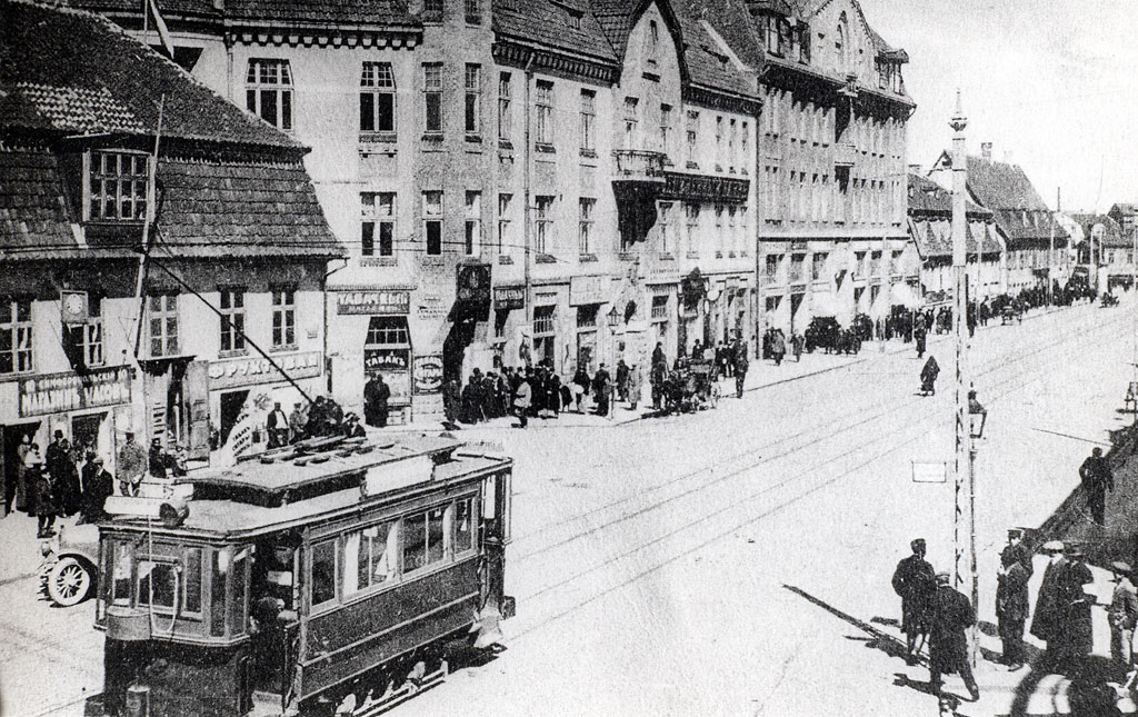
Grobiņa (; ) is a town in South Kurzeme Municipality in the Courland region of Latvia, eleven kilometers east of Liepāja. It was founded by the Teutonic Knights in the 13th century. Some ruins of their Grobina castle are still visible. The town was given its charter in 1695. During the Early Middle Ages, Grobiņa (or Grobin) was the most important political centre on the territory of Latvia. There was a centre of Scandinavian settlement on the Baltic Sea, comparable in many ways to Hedeby and Birka but probably predating them both. About 3,000 surviving burial mounds contain the most impressive remains of the Vendel Age in Northern Europe. Scandinavian settlement The settlement at Grobin was excavated by Birger Nerman in 1929 and 1930. Nerman found remains of an earthwork stronghold, which had been protected on three sides by the Ālande River. Three Vendel Age cemeteries may be dated to the period between 650 and 800 AD. One of them was military in character and ana ... [...More Info...] [...Related Items...] OR: [Wikipedia] [Google] [Baidu] |
South Kurzeme Municipality
South Kurzeme Municipality () is one of the 35 Municipalities of Latvia, municipalities established in Latvia in 2021. It surrounds Liepāja, Latvia's third largest city. Its first elected municipal council took office on 1 July 2021. Its seat is at Grobiņa. Geography South Kurzeme is Latvia's largest municipality, covering an area of . It is located in the southwestern part of the Courland region in western Latvia, on the coast of the Baltic Sea. It borders Ventspils Municipality to the north, Kuldīga Municipality to the northeast, and Saldus Municipality (2021–present), Saldus Municipality to the east. It surrounds the port city of Liepāja in the west. It also borders the Lithuanian Counties of Lithuania, counties of Klaipėda County, Klaipėda and Telšiai County, Telšiai to the south and southeast respectively. The List of extreme points of Latvia, westernmost point of Latvia is located at Cape Bernāti in Nīca Parish south of Liepāja. The coastline of South Kurze ... [...More Info...] [...Related Items...] OR: [Wikipedia] [Google] [Baidu] |
Liepāja
Liepāja () (formerly: Libau) is a Administrative divisions of Latvia, state city in western Latvia, located on the Baltic Sea. It is the largest city in the Courland region and the third-largest in the country after Riga and Daugavpils. It is an important ice-free port. In the 19th and early 20th century, it was a favourite place for sea-bathers and travellers, with the town boasting a fine park, many pretty gardens and a theatre. Liepāja is however known throughout Latvia as the "City where the wind is born", likely because of the constant sea breeze. A song of the same name () was composed by Imants Kalniņš and has become the anthem of the city. Its reputation as the windiest city in Latvia was strengthened with the construction of the largest wind farm in the nation (33 Enercon wind turbines) nearby. Liepāja is chosen as the European Capital of Culture in 2027. Names and toponymy The name is derived from the Livonian language, Livonian word ''Liiv,'' which means "sand" ... [...More Info...] [...Related Items...] OR: [Wikipedia] [Google] [Baidu] |
Birger Nerman
Birger Nerman (6 October 188822 August 1971) was a Swedish archaeologist, historian and philologist who specialized in the history and culture of Iron Age Sweden. Nerman was educated at Uppsala University, where he began his career as a lecturer in Nordic philology. He participated in archaeological excavations on Stone Age and Iron Age Sweden, and became noted for his efforts to combine archaeological and philological evidence. Areas investigated by Nerman include Gamla Uppsala and Gotland. From 1923 to 1925, Nerman was professor of archaeology at the University of Dorpat, during which he made contributions to the development of archaeology in Estonia. In subsequent years, he conducted excavations at Grobiņa and other places, with the aim of investigating relations between Sweden and the eastern Baltic in the Iron Age. Nerman was director of the Swedish History Museum from 1938 to 1954, during which he organized several exhibitions on Swedish history. He was a Swedish natio ... [...More Info...] [...Related Items...] OR: [Wikipedia] [Google] [Baidu] |
Curonians
:''The Kursenieki are also sometimes known as Curonians.'' The Curonians or Kurs (; ) were a medieval Balts, Baltic tribe living on the shores of the Baltic Sea in the 5th–16th centuries, in what are now western parts of Latvia and Lithuania. They eventually merged with other Baltic tribes contributing to the ethnogenesis of present-day Latvians and Lithuanians. Curonians gave their name to the region of Courland (''Kurzeme''), Kuršėnai town, Curonian spit and many other localities. They spoke the Curonian language. Origin The ethnic origin of the Curonians has been disputed in the past. Some researchers place the Curonians in the eastern Baltic group.Östen Dahl (ed.) 2001, ''The Circum-Baltic Languages: Typology and Contact,'' vol. 1 Others hold that the Curonians were related to Old Prussians who belonged in the western Baltic group. History The historical Curonians were described in contemporary sources as warriors, sailors and pirates. They are on the record havin ... [...More Info...] [...Related Items...] OR: [Wikipedia] [Google] [Baidu] |
Courland
Courland is one of the Historical Latvian Lands in western Latvia. Courland's largest city is Liepāja, which is the third largest city in Latvia. The regions of Semigallia and Selonia are sometimes considered as part of Courland as they were formerly held by the same duke. The literal meaning of the name is "Land of Curonians". Geography and climate Situated in western Latvia, Courland roughly corresponds to the former Latvian districts of Kuldīga, Liepāja, Saldus, Talsi, Tukums and Ventspils. When combined with Semigallia and Selonia, Courland's northeastern boundary is the Daugava River, which separates it from the regions of Latgale and Vidzeme. To the north, Courland's coast lies along the Gulf of Riga. On the west it is bordered by the Baltic Sea, and on the south by Lithuania. It lies between 55° 45′ and 57° 45′ North and 21° and 27° East. The name is also found in the Curonian Spit and Lithuanian ''Karšuvos giria'' - the Courland wood. The area c ... [...More Info...] [...Related Items...] OR: [Wikipedia] [Google] [Baidu] |
Olof (I) Of Sweden
Olof (Old Norse: ''Óláfr'') was a Swedish monarch or local ruler who ruled over Birka, an important port town, and possibly Uppsala, an important early Swedish political center, in about 852, when the Catholic missionary Saint Ansgar made his second voyage from Germany to Birka in about the year 851 or 852 A.D. He had an ambivalent attitude to Christianity, and was known as a successful warrior king in the Baltic region. Olof is not mentioned in the Icelandic sagas of the 12th and 13th century, which give a different line of succession of supposed Viking Age Swedish rulers, but the '' Vita Ansgari'', the near-contemporary writings of Ansgar's companion Rimbert, and the 11th-century account of Adam of Bremen both mention him and are generally seen as more reliable than the sagas. Religious dispositions Ansgar had undertaken missionary work among the Swedes in 829-831, and laid the foundations to a fragile congregation based in the important merchant town Birka. By the early 85 ... [...More Info...] [...Related Items...] OR: [Wikipedia] [Google] [Baidu] |
Bombina
The fire-bellied toads are a group of six species of small frogs (most species typically no longer than ) belonging to the genus ''Bombina''. The name "fire-bellied" is derived from the brightly colored red- or yellow-and-black patterns on the toads' ventral regions, which act as aposematic coloration, a warning to predators of the toads' reputedly foul taste. The other parts of the toads' skins are green or dark brown. When confronted with a potential predator, these toads commonly engage in an unkenreflex, ''Unken-'' being the combining form of ''Unke'', German for fire-bellied toad. In the unkenreflex, the toad arches its back, raising its front and back legs to display the aposematic coloration of its ventral side. Species The currently recognized species are: Biology The female of the species typically lays 80–300 eggs that can be found hanging off plant stems. The offspring develop in pools or puddles. Their metamorphosis is complete within a few weeks, peaking in J ... [...More Info...] [...Related Items...] OR: [Wikipedia] [Google] [Baidu] |
Burial Mound
Burial, also known as interment or inhumation, is a method of final disposition whereby a dead body is placed into the ground, sometimes with objects. This is usually accomplished by excavating a pit or trench, placing the deceased and objects in it, and covering it over. A funeral is a ceremony that accompanies the final disposition. Evidence suggests that some archaic and early modern humans buried their dead. Burial is often seen as indicating respect for the dead. It has been used to prevent the odor of decay, to give family members closure and prevent them from witnessing the decomposition of their loved ones, and in many cultures it has been seen as a necessary step for the deceased to enter the afterlife or to give back to the cycle of life. Methods of burial may be heavily ritualized and can include natural burial (sometimes called "green burial"); embalming or mummification; and the use of containers for the dead, such as shrouds, coffins, grave liners, ... [...More Info...] [...Related Items...] OR: [Wikipedia] [Google] [Baidu] |
Vendel Age
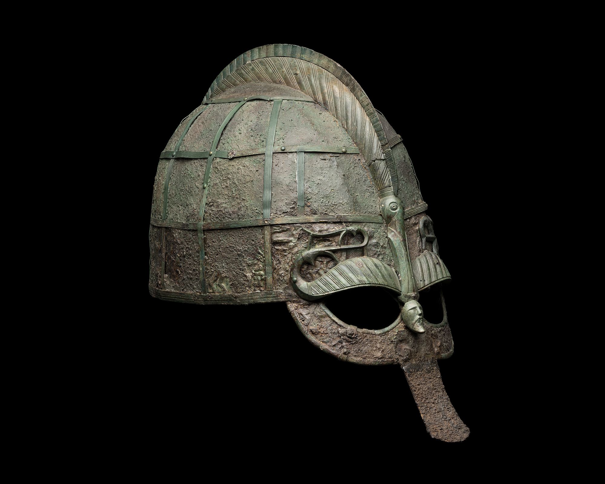
In Scandinavian prehistory, sometimes specifically Swedish prehistory, the Vendel Period, or Vendel Age (; ) appears between the Migration Period and the Viking Age. The name is taken from the rich boat inhumation cemetery at Vendel parish church, Uppland. Unlike the preceding and succeeding eras, the Vendel Period left very few precious metal artifacts or runic inscriptions. Instead, it is extremely rich in animal art on copper-alloy objects. It is also known for '' guldgubbar'', tiny embossed gold foil images, and elaborate helmets with embossed decoration similar to the one found at Sutton Hoo in England. During the period, Swedish expeditions began to explore the waterways of territories which later became Russia, Ukraine, and Belarus. The Elder Futhark writing system was abandoned in favor of the Younger Futhark, virtually simultaneously over the whole of Scandinavia. Some runestones survive, most notably those at Rök and Sparlösa, both from . Other written sourc ... [...More Info...] [...Related Items...] OR: [Wikipedia] [Google] [Baidu] |
Northern Europe
The northern region of Europe has several definitions. A restrictive definition may describe northern Europe as being roughly north of the southern coast of the Baltic Sea, which is about 54th parallel north, 54°N, or may be based on other geographical factors such as climate and ecology. Climate The climate is mainly Oceanic climate (Cfb), Humid continental climate (Dfb), Subarctic climate (Dfc and Dsc) and Tundra (ET). Geography Northern Europe might be defined roughly to include some or all of the following areas: British Isles, Fennoscandia, the peninsula of Jutland, the Baltic region, Baltic plain that lies to the east, and the many islands that lie offshore from mainland northern Europe and the main European continent. In some cases, Greenland is also included, although it is only politically European, comprising part of the Kingdom of Denmark, and not considered to be geographically in Europe. The area is partly mountainous, including the northern volcanic islands ... [...More Info...] [...Related Items...] OR: [Wikipedia] [Google] [Baidu] |
Mälaren
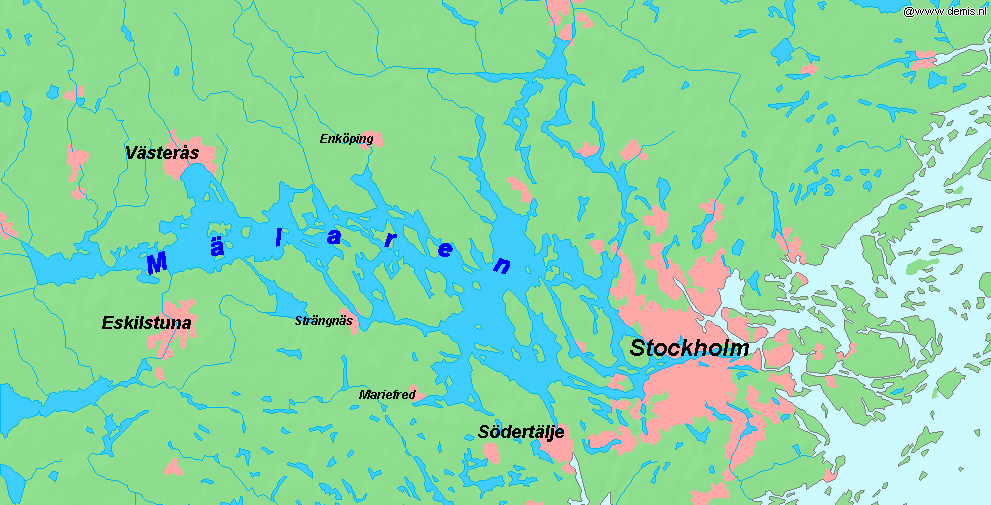
Mälaren ( , , or ), historically referred to as Lake Malar in English, is the third-largest freshwater lake in Sweden (after Vänern and Vättern). Its area is and its greatest depth is 64 m (210 ft). Mälaren spans from east to west. The lake drains, from south-west to north-east, into the Baltic Sea through its natural outlets Norrström and Söderström (as it flows around Stadsholmen island) and through the artificial Södertälje Canal and Hammarbyleden waterway. The easternmost bay of Mälaren, in central Stockholm, is called Riddarfjärden. The lake is located in Svealand and bounded by the provinces of Uppland, Södermanland and Västmanland. The two largest islands in Mälaren are Selaön () and Svartsjölandet (). Mälaren is low-lying and mostly relatively shallow. Being a quite narrow and shallow lake, Mälaren has bridge crossings between Eskilstuna and Västerås with two crossings on the western end at Kvicksund and three separate bridges between St ... [...More Info...] [...Related Items...] OR: [Wikipedia] [Google] [Baidu] |


