|
Grindon, County Durham
Grindon is a village in the borough of Stockton-on-Tees, County Durham, England. The civil parish population at the census 2001 was 2,603 reducing to 2,484 at the 2011 Census. It is situated between Sedgefield and Stockton-on-Tees, near to Thorpe Thewles and Thorpe Larches. The place name of "Grindon" is derived from the word 'dun', which meant hill. Grindon is situated in the Upland Fells, formed of Carboniferous millstone grit. "The alternating strata of harder and softer rocks give a stepped profile to many dale sides and distinctive flat-topped summits to the higher fells." The village formerly had a parish directly named after it; since May 2019 its parish is Grindon and Thorpe Thewles. History In 1831 the parish of Grindon incorporated the townships of Grindon and Whitton. Whitton later moved to the parish of Stillington, two miles west of Grindon. In 1908 the parish boundaries of Grindon grew to include the township of Embleton from the neighbouring parish of S ... [...More Info...] [...Related Items...] OR: [Wikipedia] [Google] [Baidu] |
Grindon And Thorpe Thewles
Grindon may refer to: Places *Grindon, County Durham, England * Grindon, Northumberland, a location in England *Grindon, Sunderland Grindon is a suburb of Sunderland, Tyne and Wear, in the United Kingdom. Located three miles to the west of the city centre along ''Chester Road'', Grindon originated as a Norman-era manor holding and was recreated into a post-war housing estat ..., Tyne and Wear, England * Grindon, Staffordshire, England Other * Leopold Hartley Grindon {{Disambiguation, geo ... [...More Info...] [...Related Items...] OR: [Wikipedia] [Google] [Baidu] |
St Thomas A Becket
Thomas Becket (), also known as Saint Thomas of Canterbury, Thomas of London and later Thomas à Becket (21 December 1119 or 1120 – 29 December 1170), was an English nobleman who served as Lord Chancellor from 1155 to 1162, and then notably as Archbishop of Canterbury from 1162 until his murder in 1170. He is venerated as a saint and martyr by the Catholic Church and the Anglican Communion. He engaged in conflict with Henry II, King of England, over the rights and privileges of the Church and was murdered by followers of the king in Canterbury Cathedral. Soon after his death, he was canonised by Pope Alexander III. Sources The main sources for the life of Becket are a number of biographies written by contemporaries. A few of these documents are by unknown writers, although traditional historiography has given them names. The known biographers are John of Salisbury, Edward Grim, Benedict of Peterborough, William of Canterbury, William fitzStephen, Guernes of Pont- ... [...More Info...] [...Related Items...] OR: [Wikipedia] [Google] [Baidu] |
Northern England
Northern England, also known as the North of England, the North Country, or simply the North, is the northern area of England. It broadly corresponds to the former borders of Angle Northumbria, the Anglo-Scandinavian Kingdom of Jorvik, and the Celt Britonic Yr Hen Ogledd Kingdoms. The common governmental definition of the North is a grouping of three statistical regions: the North East, the North West, and Yorkshire and the Humber. These had a combined population of 14.9 million at the 2011 census, an area of and 17 cities. Northern England is culturally and economically distinct from both the Midlands and the South of England. The area's northern boundary is the border with Scotland, its western the border with Wales, and its eastern the North Sea; there are varying interpretations of where the southern border with the Midlands lies culturally; the Midlands is often also split by closeness to the North and the South. Many Industrial Revolution innovations began ... [...More Info...] [...Related Items...] OR: [Wikipedia] [Google] [Baidu] |
British Empire
The British Empire was composed of the dominions, colonies, protectorates, mandates, and other territories ruled or administered by the United Kingdom and its predecessor states. It began with the overseas possessions and trading posts established by England between the late 16th and early 18th centuries. At its height it was the largest empire in history and, for over a century, was the foremost global power. By 1913, the British Empire held sway over 412 million people, of the world population at the time, and by 1920, it covered , of the Earth's total land area. As a result, its constitutional, legal, linguistic, and cultural legacy is widespread. At the peak of its power, it was described as " the empire on which the sun never sets", as the Sun was always shining on at least one of its territories. During the Age of Discovery in the 15th and 16th centuries, Portugal and Spain pioneered European exploration of the globe, and in the process established ... [...More Info...] [...Related Items...] OR: [Wikipedia] [Google] [Baidu] |
Industrial Revolution
The Industrial Revolution was the transition to new manufacturing processes in Great Britain, continental Europe, and the United States, that occurred during the period from around 1760 to about 1820–1840. This transition included going from hand production methods to machines, new chemical manufacturing and iron production processes, the increasing use of steam power and water power, the development of machine tools and the rise of the mechanized factory system. Output greatly increased, and a result was an unprecedented rise in population and in the rate of population growth. Textiles were the dominant industry of the Industrial Revolution in terms of employment, value of output and capital invested. The textile industry was also the first to use modern production methods. The Industrial Revolution began in Great Britain, and many of the technological and architectural innovations were of British origin. By the mid-18th century, Britain was the world's leadin ... [...More Info...] [...Related Items...] OR: [Wikipedia] [Google] [Baidu] |
Middlesbrough
Middlesbrough ( ) is a town on the southern bank of the River Tees in North Yorkshire, England. It is near the North York Moors national park. It is the namesake and main town of its local borough council area. Until the early 1800s, the area was rural farming land. By 1830, a new industrial town and port started to be developed, driven by the coal and later ironworks. Steel production and ship building began in the late 1800s, remaining associated with the town until post-industrial decline occurred in the late twentieth century. Trade (notably through ports) and digital enterprise sectors contemporarily contribute to the local economy, Teesside University and Middlesbrough College to local education. In 1853, it became a town. The motto ("We shall be" in Latin) was adopted, it reflects ("We have been") of the Bruce clan which were Cleveland's mediaeval lords. The town's coat of arms is three ships representing shipbuilding and maritime trade and an azure (blue) ... [...More Info...] [...Related Items...] OR: [Wikipedia] [Google] [Baidu] |
Teesside
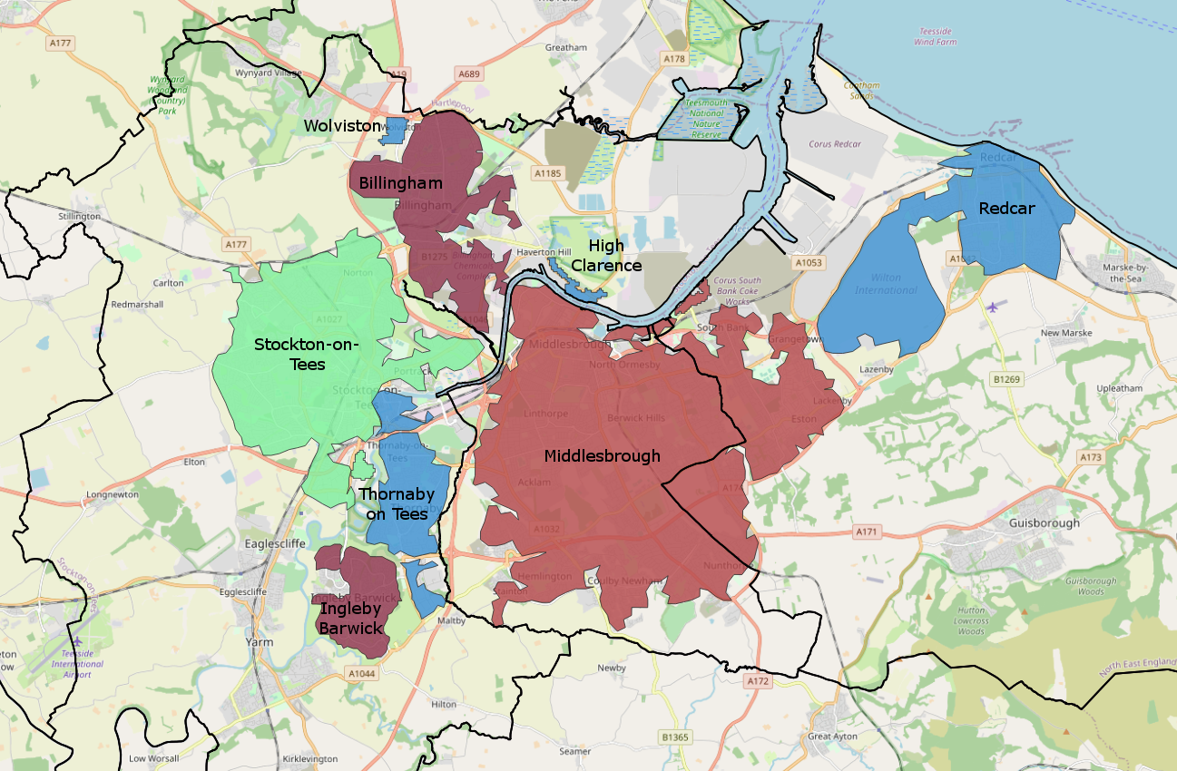
Teesside () is a built-up area around the River Tees in the north of England, split between County Durham and North Yorkshire. The name was initially used as a county borough in the North Riding of Yorkshire. Historically a hub for heavy manufacturing, the number of people employed in this type of work declined from the 1960s onwards, with steel-making and chemical manufacturing (particularly through Imperial Chemical Industries) replaced to some extent by new science businesses and service sector roles. History 1968–1974: County borough Before the county of Cleveland was created, the area (including Stockton-on-Tees) existed as a part of the North Riding of Yorkshire, due to most land being south of the Tees. Teesside was created due to Stockton-on-Tees being linked heavily with Thornaby (which had amalgamated with South Stockton/Mandale to form the Borough of Thornaby), Middlesbrough and Redcar by industry. Compared to the modern Teesside conurbation, the area was sma ... [...More Info...] [...Related Items...] OR: [Wikipedia] [Google] [Baidu] |
Cholera
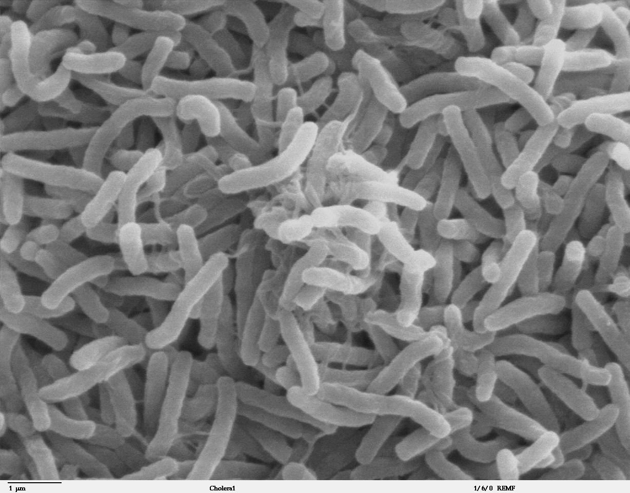
Cholera is an infection of the small intestine by some strains of the bacterium '' Vibrio cholerae''. Symptoms may range from none, to mild, to severe. The classic symptom is large amounts of watery diarrhea that lasts a few days. Vomiting and muscle cramps may also occur. Diarrhea can be so severe that it leads within hours to severe dehydration and electrolyte imbalance. This may result in sunken eyes, cold skin, decreased skin elasticity, and wrinkling of the hands and feet. Dehydration can cause the skin to turn bluish. Symptoms start two hours to five days after exposure. Cholera is caused by a number of types of ''Vibrio cholerae'', with some types producing more severe disease than others. It is spread mostly by unsafe water and unsafe food that has been contaminated with human feces containing the bacteria. Undercooked shellfish is a common source. Humans are the only known host for the bacteria. Risk factors for the disease include poor sanitation, not enou ... [...More Info...] [...Related Items...] OR: [Wikipedia] [Google] [Baidu] |
Holy Trinity Church, Thorpe Thewles
Holy Trinity Church was a now demolished church in the village of Thorpe Thewles, County Durham, England. It was built in 1848–49 to replace an isolated church on a different site which had been dedicated to Thomas à Becket Thomas Becket (), also known as Saint Thomas of Canterbury, Thomas of London and later Thomas à Becket (21 December 1119 or 1120 – 29 December 1170), was an English nobleman who served as Lord Chancellor from 1155 to 1162, and then .... The Thomas à Becket church is now in ruins and is recorded in the National Heritage List for England as a designated Grade I listed building. It is also a scheduled monument. Holy Trinity Church was designed by the Lancaster architects Sharpe and Paley at an estimated cost of £600, and could seat 175 people. It measured by but by the 1880s it was suffering from decay and damp, and was demolished. It was replaced on the same site in 1886–87 by the present church, dedicated to St J ... [...More Info...] [...Related Items...] OR: [Wikipedia] [Google] [Baidu] |
Local Government Boundary Commission For England
The Local Government Boundary Commission for England (LGBCE) is a parliamentary body established by statute to conduct boundary, electoral and structural reviews of local government areas in England. The LGBCE is independent of government and political parties, and is directly accountable to the Speaker's Committee of the House of Commons. History and establishment The Local Democracy, Economic Development and Construction Act 2009, which received royal assent on 12 November 2009, provided for the establishment of the Local Government Boundary Commission for England (LGBCE), and for the transfer to it of all the boundary-related functions of the Boundary Committee for England of the Electoral Commission. The transfer took place in April 2010. Responsibilities and objectives The Local Government Boundary Commission for England is responsible for three types of review: electoral reviews; administrative boundary reviews; and structural reviews. Electoral reviews An electoral ... [...More Info...] [...Related Items...] OR: [Wikipedia] [Google] [Baidu] |


