|
Goslar – Northeim – Osterode
Goslar (; Eastphalian: ''Goslär'') is a historic town in Lower Saxony, Germany. It is the administrative centre of the district of Goslar and is located on the northwestern slopes of the Harz mountain range. The Old Town of Goslar with over 1.500 timber houses and the Mines of Rammelsberg are UNESCO World Heritage Sites for their millennium-long testimony to the history of ore mining and their political importance for the Holy Roman Empire and Hanseatic League. Each year Goslar awards the Kaiserring to an international artist, called the "Nobel Prize" of the art world. Geography Goslar is situated in the middle of the upper half of Germany, about south of Brunswick and about southeast of the state capital, Hanover. The Schalke mountain is the highest elevation within the municipal boundaries at . The lowest point of is near the Oker river. Geographically, Goslar forms the boundary between the Hildesheim Börde which is part of the Northern German Plain, and the Harz ran ... [...More Info...] [...Related Items...] OR: [Wikipedia] [Google] [Baidu] |
Rammelsberg
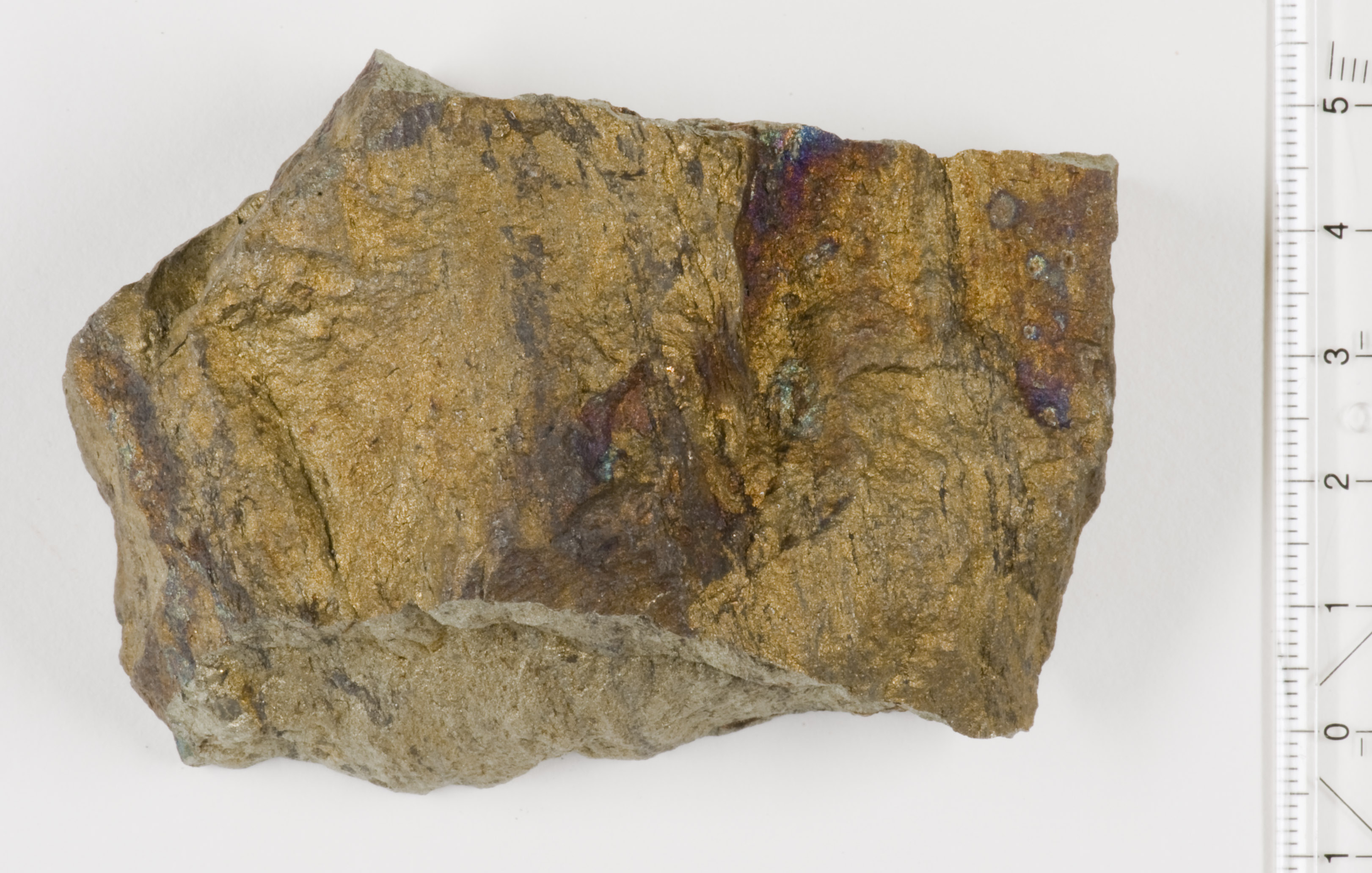
The Rammelsberg is a mountain, high, on the northern edge of the Harz range, south of the historic town of Goslar in the North German state of Lower Saxony. The mountain is the location of an important silver, copper, and lead mine. When it closed in 1988, it had been the only mine still working continuously for over 1,000 years. Because of its long history of mining and testimony to the advancement and exchange of technology over many centuries, the visitor mine of Rammelsberg was inscribed as a UNESCO World Heritage Site in 1992. Name According to legend, the mountain was named after a knight called "Ramm", who was a henchman of Emperor Otto the Great. In 968, whilst out hunting, the knight tied his horse to a tree, in order to pursue some deer through almost impassable terrain. His charger impatiently pawed the ground with its hooves whilst waiting for his master to return and so exposed a vein of silver ore. According to another explanation, the name may be derived from the ... [...More Info...] [...Related Items...] OR: [Wikipedia] [Google] [Baidu] |
Goslarer Kaiserring
Since 1975, the Goslarer Kaiserring award has been given, by the city of Goslar, to a distinguished international artist of modern and contemporary art. The award is for artists whose work has given the contemporary art significant impetus. The prize consists of an aquamarine set in gold, in which the seal of Henry IV, Holy Roman Emperor (1050–1106) is engraved. It is made every year by the goldsmith Hadfried Rinke from Worpswede. Recipients Source: * 1975: Henry Moore * 1976: Max Ernst * 1977: Alexander Calder * 1978: Victor Vasarely * 1979: Joseph Beuys * 1980: Jean Tinguely (acceptance refused) * 1981: Richard Serra * 1982: Max Bill * 1983: Günther Uecker * 1984: Willem de Kooning * 1985: Eduardo Chillida * 1986: Georg Baselitz * 1987: Christo * 1988: Gerhard Richter * 1989: Mario Merz * 1990: Anselm Kiefer * 1991: Nam June Paik * 1992: Rebecca Horn * 1993: Roman Opalka * 1994: Bernd and Hilla Becher * 1995: Cy Twombly * 1996: Dani Karavan * 1997: Franz Gertsch * 19 ... [...More Info...] [...Related Items...] OR: [Wikipedia] [Google] [Baidu] |
Hildesheim Forest
The Hildesheim Forest () is a range of hills up to in the district of Hildesheim in the German state of Lower Saxony. Geography The Hildesheim Forest is located in the Innerste Uplands, part of the Lower Saxon Hills, between the valleys of the Leine to the west, the Innerste to the north and the Lamme to the east. These densely forested hills, which are bordered to the east by the Sauberge and lie a few kilometres west-southwest of the Vorholz, fill an area south of Hildesheim, northwest of Bad Salzdetfurth, north of Sibbesse and southeast of Nordstemmen. Description The Hildesheim Forest, which attain a height of 359 m in the Griesberg, are crossed by numerous waterways, hiking trails and forest tracks, but only by one state road, the L 485, which links Hildesheim via Diekholzen to Sibbesse. In its northwestern part is the Beusterburg, whose circular ramparts are suggestive of a New Stone Age settlement. In the vicinity of the village of Betheln there is ... [...More Info...] [...Related Items...] OR: [Wikipedia] [Google] [Baidu] |
Sugar Beet
A sugar beet is a plant whose root contains a high concentration of sucrose and that is grown commercially for sugar production. In plant breeding, it is known as the Altissima cultivar group of the common beet (''Beta vulgaris''). Together with other beet cultivars, such as beetroot and chard, it belongs to the subspecies ''Beta vulgaris'' subsp. ''vulgaris'' but classified as ''var. saccharifera''. Its closest wild relative is the sea beet (''Beta vulgaris'' subsp. ''maritima''). Sugar beets are grown in climates that are too cold for sugarcane. In 2020, Russia, the United States, Germany, France and Turkey were the world's five largest sugar beet producers. In 2010–2011, Europe, and North America except Arctic territories failed to supply the overall domestic demand for sugar and were all net importers of sugar. The US harvested of sugar beets in 2008. In 2009, sugar beets accounted for 20% of the world's sugar production and nearly 30% by 2013. Sugarcane accounts for most ... [...More Info...] [...Related Items...] OR: [Wikipedia] [Google] [Baidu] |
Agriculture
Agriculture encompasses crop and livestock production, aquaculture, and forestry for food and non-food products. Agriculture was a key factor in the rise of sedentary human civilization, whereby farming of domesticated species created food surpluses that enabled people to live in the cities. While humans started gathering grains at least 105,000 years ago, nascent farmers only began planting them around 11,500 years ago. Sheep, goats, pigs, and cattle were domesticated around 10,000 years ago. Plants were independently cultivated in at least 11 regions of the world. In the 20th century, industrial agriculture based on large-scale monocultures came to dominate agricultural output. , small farms produce about one-third of the world's food, but large farms are prevalent. The largest 1% of farms in the world are greater than and operate more than 70% of the world's farmland. Nearly 40% of agricultural land is found on farms larger than . However, five of every six farm ... [...More Info...] [...Related Items...] OR: [Wikipedia] [Google] [Baidu] |
Clay
Clay is a type of fine-grained natural soil material containing clay minerals (hydrous aluminium phyllosilicates, e.g. kaolinite, ). Most pure clay minerals are white or light-coloured, but natural clays show a variety of colours from impurities, such as a reddish or brownish colour from small amounts of iron oxide. Clays develop plasticity (physics), plasticity when wet but can be hardened through Pottery#Firing, firing. Clay is the longest-known ceramic material. Prehistoric humans discovered the useful properties of clay and used it for making pottery. Some of the earliest pottery shards have been radiocarbon dating, dated to around 14,000 BCE, and Clay tablet, clay tablets were the first known writing medium. Clay is used in many modern industrial processes, such as paper making, cement production, and chemical filtration, filtering. Between one-half and two-thirds of the world's population live or work in buildings made with clay, often baked into brick, as an essenti ... [...More Info...] [...Related Items...] OR: [Wikipedia] [Google] [Baidu] |
Plain
In geography, a plain, commonly known as flatland, is a flat expanse of land that generally does not change much in elevation, and is primarily treeless. Plains occur as lowlands along valleys or at the base of mountains, as coastal plains, and as plateaus or Highland, uplands. Plains are one of the major landforms on earth, being present on all continents and covering more than one-third of the world's land area. Plains in many areas are important for agriculture. There are various types of plains and biomes on them. Description A plain or flatland is a flat expanse of land with a layer of grass that generally does not change much in elevation, and is primarily treeless. Plains occur as lowlands along valleys or at the base of mountains, as coastal plains, and as plateaus or Highland, uplands. Plains are one of the major landforms on earth, where they are present on all continents, and cover more than one-third of the world's land area. In a valley, a plain is enclosed on tw ... [...More Info...] [...Related Items...] OR: [Wikipedia] [Google] [Baidu] |
Central Uplands
The Central UplandsDickinson (1964), p.18 ff. (N.B. In German die ''Mittelgebirge'' (plural) refers to the Central Uplands; das ''Mittelgebirge'' refers to a low mountain range or upland region (''Mittel'' = "medium" and ''-gebirge'' = "range").) is one of the three major natural regions of Germany. It stretches east to west across the country. To the north lies the North German Plain or Northern Lowland; to the south, the Alps and the Alpine Foreland. Formation The German Central Uplands, like the Scandinavian and British mountain ranges and the Urals, belong to the oldest mountains of Europe, even if their present-day appearance has only developed relatively recently. In the Carboniferous, i.e. about 350 million years ago, Variscan mountain ranges were formed in central Europe by the uplifting caused by tectonic plate collision. Immediately after their formation the erosion of the mountains began under the influence of exogenous processes during the Permian period. During ... [...More Info...] [...Related Items...] OR: [Wikipedia] [Google] [Baidu] |
North German Plain
The North German Plain or Northern Lowland () is one of the major geographical regions of Germany. It is the German part of the North European Plain. The region is bounded by the coasts of the North Sea and the Baltic Sea to the north, Germany's Central Uplands (''die Mittelgebirge'') to the south, by the Netherlands to the west and Poland to the east. In the west, the southern boundary of the North German Plain is formed by the Lower Saxon Hills: specifically the ridge of the Teutoburg Forest, the Wiehen Hills, the Weser Hills and the Lower Saxon Börde, which partly separate it from that area of the Plain known as the Westphalian Lowland. Elements of the Rhenish Massif also act a part of the southern boundary of the plain: the Eifel, Bergisches Land and the Sauerland. In the east the North German Plain spreads out beyond the Harz Mountains and Kyffhäuser further to the south as far as the Central Saxon hill country and the foothills of the Ore Mountains. Landscape, soil ... [...More Info...] [...Related Items...] OR: [Wikipedia] [Google] [Baidu] |
Hildesheim Börde
The Hildesheim Börde ( or ''Braunschweig-Hildesheimer Lössbörde'') is a natural region, 272 km2 in area, in the northern part of Hildesheim district, which is known for its especially rich black earth loess soil. Location The '' börde'' landscape is located in the pentagon of land between Hanover - Peine - Brunswick - Salzgitter - Hildesheim and is dominated by arable countryside with no large towns or cities. The natural boundaries of the area are: to the west the Leine, to the north the Burgdorf-Peine Geest, to the south the Innerste Uplands and Hildesheim Forest. To the west is the Calenberg Loess Börde of Calenberg Land. To the east in the direction of Brunswick it transitions gradually into the Magdeburg Börde. These Börde landscapes are part of the Central European loess zone, which lies north of the Central Uplands and stretches from Belgium in the west to Western Ukraine in the east. Based on the type of land surface and drainage situation, the Hildeshei ... [...More Info...] [...Related Items...] OR: [Wikipedia] [Google] [Baidu] |
Oker
The Oker () is a river in Lower Saxony, Germany, that has historically formed an important political boundary. It is a left tributary of the River Aller (Germany), Aller, in length and runs in a generally northerly direction. Origin and meaning of the name The river's name was recorded around 830 as ''Obacra'' and, later, as ''Ovokare'' und ''Ovakara''.H. Blume: ''Oker, Schunter, Wabe.'' In: ''Braunschweigisches Jahrbuch für Landesgeschichte'', vol. 86, 2005, p. 14 sqq. The origin of the name is derived from the root (linguistics), roots ''ov-'' and ''-akara'' meaning “upper” (cf. New High German ''ober-'') and “onward rushing” (rendered in German as “Vorwärtsdrängende”) as distinct from its tributary, the Ecker, whose name means only “onward rushing”. Course The Oker rises at about 910 metres in the Harz National Park in a boggy area on the Bruchberg in the Harz mountains of Central Germany (geography), central Germany. This early section is known ... [...More Info...] [...Related Items...] OR: [Wikipedia] [Google] [Baidu] |
Schalke (Harz)
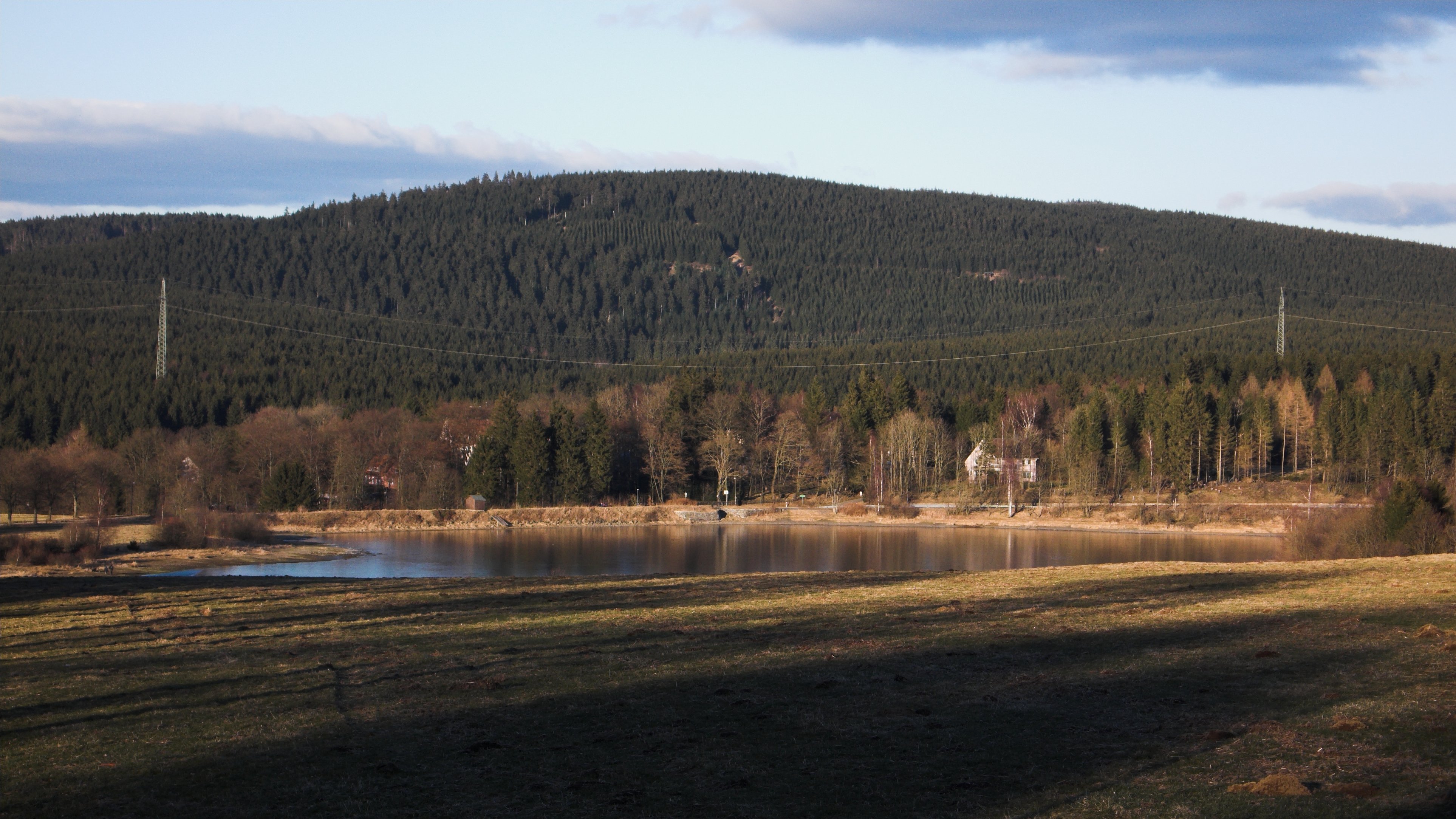
The Schalke is a mountain, , in the Upper Harz in the German state of Lower Saxony. It lies in Goslar district north of Clausthal-Zellerfeld and west of Schulenberg im Oberharz, Schulenberg. From 1959 there was a French listening post on the summit, which was supplemented in 1968 by a 64 m high concrete tower. This tower stood empty from 1993 and was demolished on 11 October 2002; the entire facility being removed in September 2003. Other listening posts in the Harz were located on the Wurmberg (Harz), Wurmberg and the Stöberhai. Towers that still exist include those on the Ravensberg (Harz), Ravensberg and the Bocksberg (Harz), Bocksberg, the latter not far from the Schalke. The observation tower, which was about 10.5 m high, stood about 50 metres southeast of the listening post until 2002 and, following the demolition of the latter, was moved back to its original site on the summit. However it only has good views towards the east and south. The view extends from the ... [...More Info...] [...Related Items...] OR: [Wikipedia] [Google] [Baidu] |


