|
Goshen Township, Auglaize County, Ohio
Goshen Township is one of the fourteen civil township, townships of Auglaize County, Ohio, Auglaize County, Ohio, United States. The 2020 United States Census, 2020 census found 472 people in the township. Geography Located in the southern part of the eastern edge of the county, it borders the following townships: *Wayne Township, Auglaize County, Ohio, Wayne Township - north *Roundhead Township, Hardin County, Ohio, Roundhead Township, Hardin County - east *Stokes Township, Logan County, Ohio, Stokes Township, Logan County - south *Clay Township, Auglaize County, Ohio, Clay Township - southwest *Union Township, Auglaize County, Ohio, Union Township - northwest No municipalities are located in Goshen Township, although the unincorporated area, unincorporated community of New Hampshire, Ohio, New Hampshire lies in the township's center. Goshen Township contains slightly less than eighteen square miles. [...More Info...] [...Related Items...] OR: [Wikipedia] [Google] [Baidu] |
Civil Township
A civil township is a widely used unit of local government in the United States that is subordinate to a County (United States), county, most often in the northern and midwestern parts of the country. The term town is used in New England town, New England, Political subdivisions of New York State#Town, New York, as well as Political subdivisions of Wisconsin#Town, Wisconsin to refer to the equivalent of the civil township in these states; Minnesota uses "town" officially but often uses it and "township" interchangeably. Specific responsibilities and the degree of Wiktionary:autonomy, autonomy vary in each U.S. state, state. Civil townships are distinct from survey townships, but in states that have both, the boundaries often coincide, especially in Indiana, Ohio, and Illinois, and may completely geographically subdivide a county. The United States Census Bureau, U.S. Census Bureau classifies civil townships as minor civil divisions. Currently, there are 20 states with civil townshi ... [...More Info...] [...Related Items...] OR: [Wikipedia] [Google] [Baidu] |
Union Township, Auglaize County, Ohio
Union Township is one of the fourteen townships of Auglaize County, Ohio, United States. The 2020 census found 1,746 people in the township. Geography Located in the northeastern part of the county, it borders the following townships: * Perry Township, Allen County – north * Auglaize Township, Allen County – northeast corner * Wayne Township – east * Goshen Township – southeast * Clay Township – south * Pusheta Township – southwest corner * Duchouquet Township – west The unincorporated communities of Saint Johns and Uniopolis lie in the township's west and southwest respectively. According to the U.S. Census Bureau, the township has an area of . Name and history It is one of twenty-seven Union Townships statewide. The township was formed in 1836, while still part of Allen County. One of its earliest settlers was Hugh T. Rinehart, who immigrated to the township in 1839. His house is still in existence; it has been designated a historic site. Government Th ... [...More Info...] [...Related Items...] OR: [Wikipedia] [Google] [Baidu] |
1836 Establishments In Ohio
Events January–March * January 1 — Hill Street Academy is named Colombo Academy and acquired by the Government, establishing the first public school in Sri Lanka. * January 1 – Queen Maria II of Portugal marries Ferdinand II of Portugal, Prince Ferdinand Augustus Francis Anthony of Saxe-Coburg-Gotha. * January 5 – Former U.S. Representative Davy Crockett of Tennessee arrives in Texas to join the Texan fight for independence from Mexico. * January 12 ** , with Charles Darwin on board, reaches Sydney. ** Will County, Illinois, is formed. * February 8 – London and Greenwich Railway opens its first section, the first railway in London, England. * February 23 – Texas Revolution: The Battle of the Alamo begins, with an American settler army surrounded by the Mexican Army, under Antonio López de Santa Anna, Santa Anna. * February 25 – Samuel Colt receives a United States patent for the Colt Firearms, Colt revolver, the first revolving barrel multishot firearm. * Mar ... [...More Info...] [...Related Items...] OR: [Wikipedia] [Google] [Baidu] |
Townships In Auglaize County, Ohio
A township is a form of human settlement or administrative subdivision. Its exact definition varies among countries. Although the term is occasionally associated with an urban area, this tends to be an exception to the rule. In Australia, Canada, Scotland, and parts of the United States, the term refers to settlements too small or scattered to be considered urban. Australia '' The Australian National Dictionary'' defines a township as "a site reserved for and laid out as a town; such a site at an early stage of its occupation and development; a small town". The term refers purely to the settlement; it does not refer to a unit of government. Townships are governed as part of a larger council (such as that of a shire, district or city) or authority. Canada In Canada, two kinds of township occur in common use: *In Eastern Canada, a township is one form of the subdivision of a county. In Canadian French, this is a . Townships are referred to as "lots" in Prince Edward Island; ... [...More Info...] [...Related Items...] OR: [Wikipedia] [Google] [Baidu] |
Lakeview, Ohio
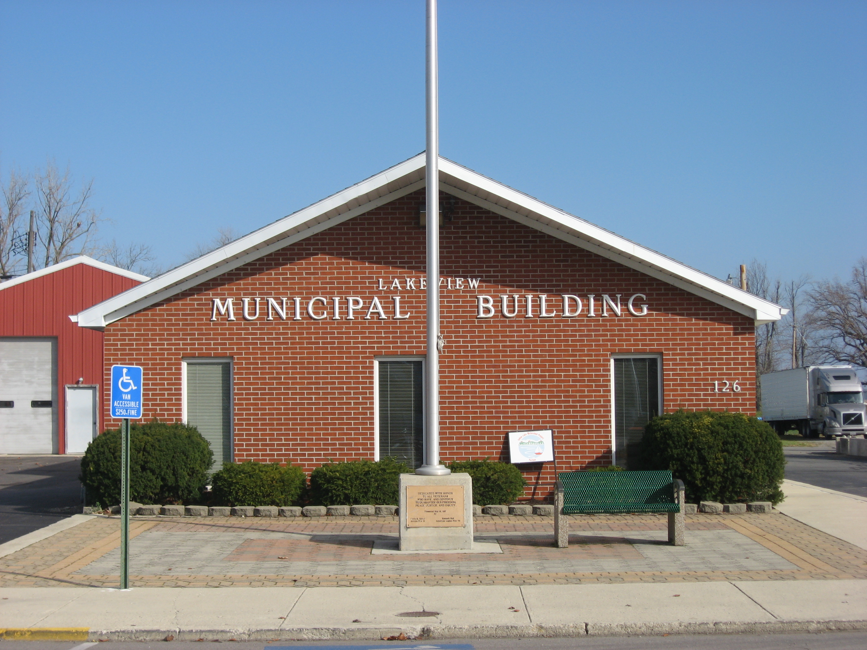
Lakeview is a village in Logan County, Ohio, United States. The population was 1,184 at the 2020 census. A branch of the Logan County District Library serves the Lakeview community. The town was heavily damaged by an EF3 tornado on March 14, 2024. The tornado killed three people and injured 27 others along its track. Geography According to the United States Census Bureau, the village has a total area of , of which, is land and is water. Lakeview takes its name from Indian Lake, a mostly artificial lake nearby. Part of the village's perimeter is bounded by the lakeshore. Demographics 2010 census As of the census of 2010, there were 1,072 people, 446 households, and 272 families living in the village. The population density was . There were 576 housing units at an average density of . The racial makeup of the village was 97.2% White, 0.7% African American, 0.3% Native American, 0.1% Asian, 0.1% Pacific Islander, 0.4% from other races, and 1.2% from two or more race ... [...More Info...] [...Related Items...] OR: [Wikipedia] [Google] [Baidu] |
Waynesfield, Ohio
Waynesfield is a village in Auglaize County, Ohio, United States. The population was 749 at the 2020 census. It is included in the Wapakoneta, Ohio Micropolitan Statistical Area. History Waynesfield was founded on July 1, 1848. Geography According to the United States Census Bureau, the village has a total area of , all land. Demographics 2010 census As of the census of 2010, there were 847 people, 309 households, and 218 families living in the village. The population density was . There were 350 housing units at an average density of . The racial makeup of the village was 97.8% White, 0.6% African American, 0.2% Native American, 0.1% Asian, 0.7% from other races, and 0.6% from two or more races. Hispanic or Latino of any race were 2.1% of the population. There were 309 households, of which 42.1% had children under the age of 18 living with them, 50.8% were married couples living together, 12.3% had a female householder with no husband present, 7.4% had a male househol ... [...More Info...] [...Related Items...] OR: [Wikipedia] [Google] [Baidu] |
Wapakoneta, Ohio
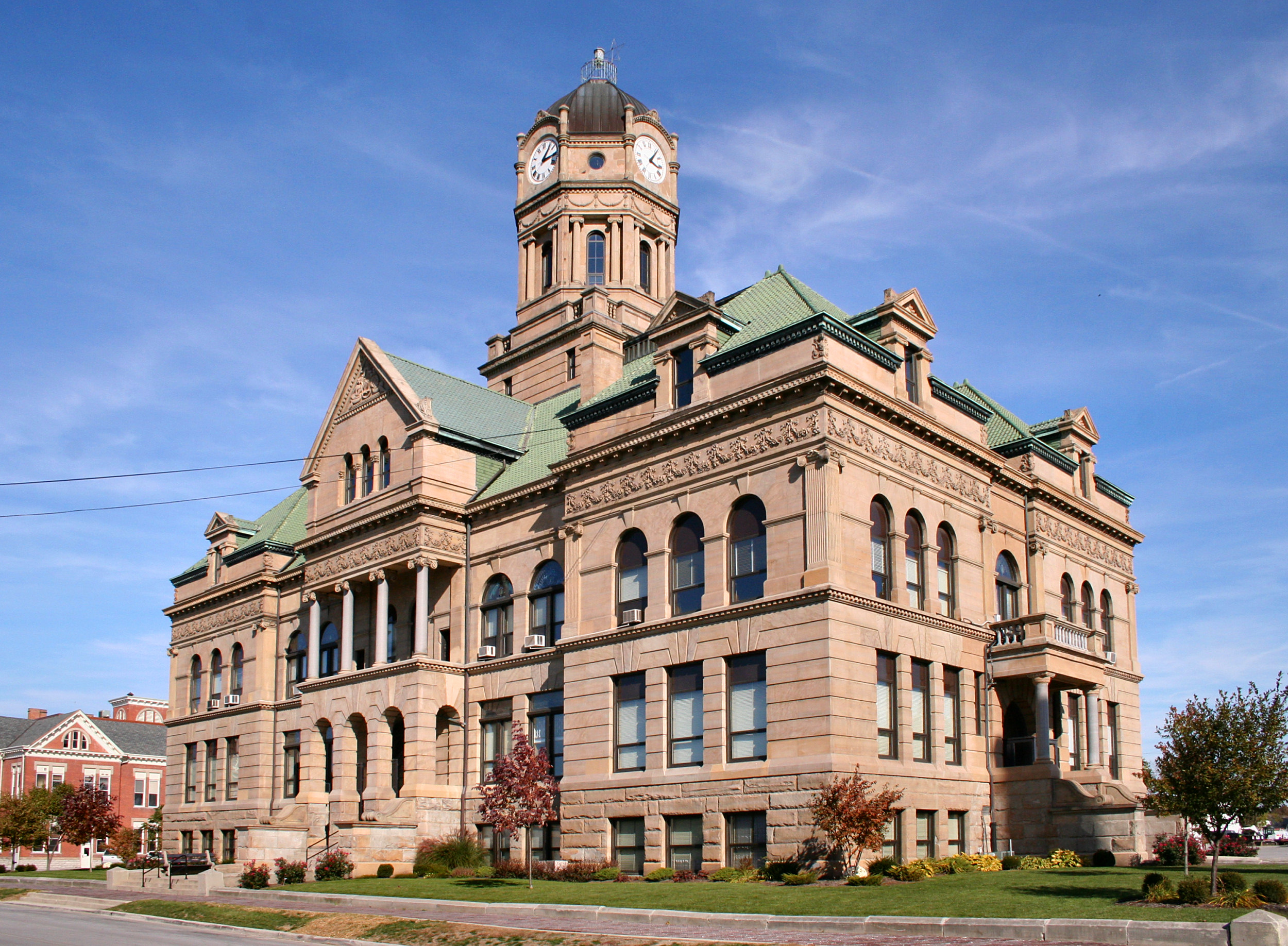
Wapakoneta (, locally , commonly shortened to “Wapak”) is a city in Auglaize County, Ohio, United States, and its county seat. Located along the Auglaize River, the city is about north of Dayton and south of Toledo. The population was 9,957 at the 2020 census. It is the principal city of the Wapakoneta micropolitan area, which is included in the Lima–Van Wert–Celina combined statistical area. Neil Armstrong, the first man on the Moon, grew up in Wapakoneta, which is now the home of the Armstrong Air & Space Museum. History In 1748, the French built a trading post (Fort au Glaize, also known as "Wapakoneta Trading Post" or "AuGlaize Trading Post") about a half-mile northeast of the future site of Wapakoneta. After being re-established in 1760 as "Francis Duchouquet's Trading Post," the British later took over this territory after the French ceded it following defeat in the Seven Years' War. Neither they nor the later Americans (after independence) built a succe ... [...More Info...] [...Related Items...] OR: [Wikipedia] [Google] [Baidu] |
Ohio Revised Code
The ''Ohio Revised Code'' (ORC) contains all current statutes of the Ohio General Assembly of a permanent and general nature, consolidated into provisions, titles, chapters and sections. However, the only official publication of the enactments of the General Assembly is the ''Laws of Ohio''; the ''Ohio Revised Code'' is only a reference. The ''Ohio Revised Code'' is not officially printed, but there are several unofficial but certified (by the Ohio Secretary of State) commercial publications: ''Baldwin's Ohio Revised Code Annotated'' and ''Page's Ohio Revised Code Annotated'' are annotated, while ''Anderson's Ohio Revised Code Unannotated'' is not. ''Baldwin's'' is available online from Westlaw and ''Page's'' is available online from LexisNexis. The state also publishes the full contents of the ORonline Users can request a real-time, certified download of any particular page: a PDF generates with a seal certifying its authenticity. History The ''Ohio Revised Code'' replaced t ... [...More Info...] [...Related Items...] OR: [Wikipedia] [Google] [Baidu] |
Logan County, Ohio
Logan County is a county in the west central portion of the U.S. state of Ohio. As of the 2020 census, the population was 46,150. The county seat is Bellefontaine. The county is named for Benjamin Logan, who fought Native Americans in the area. Logan County comprises the Bellefontaine, Ohio Micropolitan Statistical Area, which is also included in the Columbus-Marion-Zanesville, Ohio Combined Statistical Area. Geography According to the U.S. Census Bureau, the county has an area of , of which is land and (1.8%) is water. Campbell Hill, the highest natural point in Ohio at , is northeast of Bellefontaine. Adjacent counties * Hardin County (north) * Union County (east) * Champaign County (south) * Shelby County (west) * Auglaize County (northwest) Major highways * U.S. Route 33 * U.S. Route 68 * State Route 47 * State Route 117 * State Route 235 * State Route 245 * State Route 273 * State Route 274 * State Route 287 * State Route 292 * St ... [...More Info...] [...Related Items...] OR: [Wikipedia] [Google] [Baidu] |
Allen County, Ohio
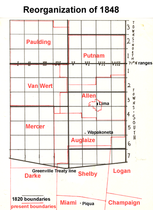
Allen County is a county located in the northwestern part of the U.S. state of Ohio. Its county seat and largest city is Lima. The county was created in 1820 and organized in 1831. The county is named in honor of Colonel John Allen, who was killed leading his men at the Battle of Frenchtown during the War of 1812. Allen County comprises the Lima metropolitan statistical area, and as of the 2020 census, the population was 102,206. Allen County also comprises the entirety of the Lima, OH media market. History Under the terms of the Treaty of Greenville signed in 1795, northwestern Ohio was reserved for Native Americans. Thus the area now comprising Allen County was off-limits to European settlement until the Treaty of Maumee Rapids in 1817. Under the terms of this treaty, the Shawnee tribe was assigned reservations at Wapakonetta and at their "Hog Creek" settlement along the Ottawa River which comprised most of what is the present-day Shawnee Township. The latter treaty ... [...More Info...] [...Related Items...] OR: [Wikipedia] [Google] [Baidu] |
Goshen Township, Ohio (other)
Goshen Township may refer to: Arkansas * Goshen Township, Washington County, Arkansas Illinois * Goshen Township, Stark County, Illinois Iowa * Goshen Township, Muscatine County, Iowa Kansas * Goshen Township, Clay County, Kansas Ohio * Goshen Township, Auglaize County, Ohio * Goshen Township, Belmont County, Ohio * Goshen Township, Champaign County, Ohio * Goshen Township, Clermont County, Ohio *Goshen Township, Hardin County, Ohio *Goshen Township, Mahoning County, Ohio *Goshen Township, Tuscarawas County, Ohio Goshen Township is one of the twenty-two townships of Tuscarawas County, Ohio, United States. The 2020 census found 5,081 people in the township. Geography Located in the east central part of the county, it borders the following townships: * ... Pennsylvania * Goshen Township, Clearfield County, Pennsylvania See also * West Goshen Township, Pennsylvania * East Goshen Township, Chester County, Pennsylvania {{Geodis Township name disambiguation pages [...More Info...] [...Related Items...] OR: [Wikipedia] [Google] [Baidu] |
Virginia Military District
The Virginia Military District was an approximately 4.2 million acre (17,000 km2) area of land in what is now the state of Ohio that was reserved by Virginia to use as payment in lieu of cash for its veterans of the American Revolutionary War. Virginia had historic claims to much of the Northwest Territory, which included Ohio, dating from its colonial charter. Virginia and the other states ceded their claims over western lands to overcome other states' objections to ratifying the Articles of Confederation. In return for ceding its claims in 1784, Virginia was granted this area to provide military bounty land grants. The Ohio district was a surplus reserve, in that military land grants were first made in an area southeast of the Ohio River, in what is now Kentucky. The Ohio land was to be used only after the land southeast of the river was exhausted. Location The land was located in southern Ohio, bordered by the Ohio River on the south, the Little Miami River on the west, ... [...More Info...] [...Related Items...] OR: [Wikipedia] [Google] [Baidu] |


