|
Goldstream
Two different neighbourhoods located in Langford, British Columbia in Greater Victoria on southern Vancouver Island include the name Goldstream. Goldstream Meadows is a neighbourhood in the city of Langford, on the northwest outskirts of Greater Victoria, British Columbia, Canada. The community is located just west of Langford Lake and the Trans-Canada Highway and adjacent to the river of the same name, which was the scene of a small gold rush in the 1860s. At the turn of the century, the Lubbe Hydroelectric Plant was operated near Goldstream and created electricity by running high pressure drinking water through a turbine. A powerline then ran into Victoria and provided electricity to power the streetcars of the day. The plant still exists but is inaccessible to the public. Goldstream Village is located in Langford Proper, considered the downtown heart of the city. The area is only a few square kilometres, located along Goldstream Ave on south side of the city starting ... [...More Info...] [...Related Items...] OR: [Wikipedia] [Google] [Baidu] [Amazon] |
Goldstream Provincial Park
Goldstream Provincial Park is a provincial park in British Columbia, Canada. It is known for the annual fall salmon runs in the Goldstream River, and the large numbers of bald eagles that congregate to feed at that time. The total size of the park is . It is located in the city of Langford. Recreational fishing is only accessible to indigenous cultures, and not local non-indigenous residents. Huge trees stand on the Goldstream River floodplain. Among them are Douglas-fir and western red cedar. They tower over substantial specimens of western hemlock, black cottonwood, bigleaf maple and red alder, which in turn shade western yew. Steep ridges—home to arbutus, western flowering dogwood and lodgepole pine—overlook the floodplain. Many wildflowers are seen during spring and summer. Goldstream Park has several hiking trails, one of which offers access to Mount Finlayson. Goldstream Nature House Goldstream Nature House is a nature centre located in the park and oper ... [...More Info...] [...Related Items...] OR: [Wikipedia] [Google] [Baidu] [Amazon] |
Langford, British Columbia
Langford is a city on southern Vancouver Island in the province of British Columbia, Canada. Langford is one of the 13 component municipalities of Greater Victoria and is within the Capital Regional District. Langford was incorporated in 1992 and has a population of over 40,000 people, the largest municipality in the Western Communities, and third-largest in the Capital Regional District after Saanich and Victoria. Its motto is "Golden in setting, determined in Spirit," containing a reference to the natural beauty of the City of Langford, specifically Goldstream Provincial Park, and a comment on the community's drive to enhance Langford's special character and future. History Langford's history of European settlement dates back to 1851, when Captain Edward Langford established one of the four Hudson's Bay Company farms in the Victoria area. He arrived with his family in 1851 as the first English family to emigrate to the Colony of Vancouver Island. He was the manager of ... [...More Info...] [...Related Items...] OR: [Wikipedia] [Google] [Baidu] [Amazon] |
Goldstream River (Vancouver Island)
The Goldstream River ( Saanich: sʔə́ləq̕ʷtəɬ) is a river northwest of Victoria on southern Vancouver Island, British Columbia, Canada . The river's name derives from a small gold rush in its basin during the 1860s, and was originally Gold Stream. Course The Goldstream River begins at the outlet of Butchart Lake, the first of three reservoirs along the upper reaches of the Goldstream which are within the Greater Victoria Watershed Area. Shortly after exiting Butchart Lake it flows into Lubbe Lake. Shortly after exiting Lubbe Lake the river enters the final and largest of the three lakes, Goldstream Lake. After exiting Goldstream Lake, the river flows southeast until it turns north and enters Goldstream Provincial Park. Just before entering the park, the river receives its first major tributary, Waugh Creek. About halfway through the park, the river tumbles over Goldstream Falls. After the falls it continues north, receiving its final major tributary, Niagara Creek, just ... [...More Info...] [...Related Items...] OR: [Wikipedia] [Google] [Baidu] [Amazon] |
Lubbe Powerhouse
The Goldstream Powerhouse is a decommissioned hydroelectric plant located near Goldstream Provincial Park in Langford, near Victoria, British Columbia. This plant provided electricity to Victoria for 60 years and is one of the little-known and ingenious chapters in the history of Victoria. This plant was one of the first hydro plants of this type on the west coast of North America. The structure is over a century old and is unsafe to inhabit. It is within the boundaries of the watershed lands owned by the CRD and is inaccessible to the public due to its proximity to a drinking water reservoir. Overview In 1897, Esquimalt Waterworks Company (EWWC) and British Columbia Electric Railway (BCER) came to an agreement to generate power by using the water from the high elevation reservoirs to generate electricity. The water would be run through Pelton waterwheels, where the water would then flow into the Japan Gulch Reservoir and subsequently be used for domestic purposes. T ... [...More Info...] [...Related Items...] OR: [Wikipedia] [Google] [Baidu] [Amazon] |
List Of Rivers Of British Columbia
The following is a partial list of rivers of British Columbia, organized by drainage basin, watershed. Some large creeks are included either because of size or historical importance (See Alphabetical List of British Columbia rivers ). Also included are lakes that are "in-line" connecting upper tributaries of listed rivers, or at their heads. Arctic drainage Arctic Ocean via Mackenzie River drainage :''(NB Liard tributaries on Yukon side of border omitted)'' Liard River watershed *Liard River **Petiewewtot River **Fort Nelson River ***Sahtaneh River ****Snake River (Sahtaneh River tributary), Snake River ***Muskwa River ****Prophet River *****Minaker River *****Besa River ****Tetsa River ****Chischa River ****Tuchodi River ***Sikanni Chief River ****Buckinghorse River ***Fontas River **Dunedin River **Beaver River (Liard River tributary), Beaver River **Toad River ***West Toad River ***Racing River (Toad River tributary), Racing River ***Schipa River **Grayling River **Trout River ... [...More Info...] [...Related Items...] OR: [Wikipedia] [Google] [Baidu] [Amazon] |
Greater Victoria
Greater Victoria (also known as the Greater Victoria Region) is located in British Columbia, Canada, on the southern tip of Vancouver Island. It is usually defined as the thirteen municipalities of the Capital Regional District (CRD) on Vancouver Island as well as some adjacent areas and nearby islands. The Capital Regional District administers some aspects of public administration for the whole metro region; other aspects are administered by the individual member municipalities of Greater Victoria. Roughly, Greater Victoria consists of all land and nearby islands east of a line drawn from the southern end of Finlayson Arm to the eastern shore of Sooke Harbour, along with some lands on the northern shore of Sooke Harbour. Many places, buildings, and institutions associated with Victoria such as the University of Victoria, Victoria International Airport, and BC Ferries Swartz Bay ferry terminal, are outside the City of Victoria itself, which has an area of just on the ... [...More Info...] [...Related Items...] OR: [Wikipedia] [Google] [Baidu] [Amazon] |
Provinces And Territories Of Canada
Canada has ten provinces and three territories that are sub-national administrative divisions under the jurisdiction of the Constitution of Canada, Canadian Constitution. In the 1867 Canadian Confederation, three provinces of British North America—New Brunswick, Nova Scotia, and the Province of Canada (which upon Confederation was divided into Ontario and Quebec)—united to form a federation, becoming a fully Independence, independent country over the next century. Over its history, Canada's international borders have changed several times as it has added territories and provinces, making it the List of countries and dependencies by area, world's second-largest country by area. The major difference between a Canadian province and a territory is that provinces receive their power and authority from the ''Constitution Act, 1867'' (formerly called the ''British North America Acts, British North America Act, 1867''), whereas territories are federal territories whose governments a ... [...More Info...] [...Related Items...] OR: [Wikipedia] [Google] [Baidu] [Amazon] |
Unincorporated Settlements In British Columbia
Unincorporated may refer to: * Unincorporated area, land not governed by a local municipality * Unincorporated entity, a type of organization * Unincorporated territories of the United States, territories under U.S. jurisdiction, to which Congress has determined that only select parts of the U.S. Constitution apply * Unincorporated association Unincorporated association refers to a group of people in common law jurisdictions—such as the United Kingdom, Canada, and New Zealand—who organize around a shared purpose without forming a corporation or similar legal entity. Unlike in some ..., also known as voluntary association, groups organized to accomplish a purpose * ''Unincorporated'' (album), a 2001 album by Earl Harvin Trio {{disambig ... [...More Info...] [...Related Items...] OR: [Wikipedia] [Google] [Baidu] [Amazon] |
Leechtown, British Columbia
Leechtown is at the confluence of the Leech River into the Sooke River in southern Vancouver Island, British Columbia. The ghost town, off BC Highway 1 is about by road northwest of Victoria. Geology Leechtown is notable for its geologic placement, which produced the historical gold finds. The Leech River runs along the Leech River Fault, a major regional fault that marks a distinct geological boundary between the Pacific Rim Terrane and the Crescent Terrane (part of Siletzia). The "Leech River Complex" (also "Leech River Formation" and "Leech River Schist") is a well-known assemblage of highly deformed schists underlain by gneiss. The gold is thought to be derived from quartz stringers concentrated in the schists, emplaced by hydrothermal events related to the regional tectonic activity. Name origin The town was named after the river. The Vancouver Island Exploring Expedition, led by Robert Brown, included Lieutenant Peter John Leech of the Royal Engineers. Leech, a forme ... [...More Info...] [...Related Items...] OR: [Wikipedia] [Google] [Baidu] [Amazon] |
Roundabout
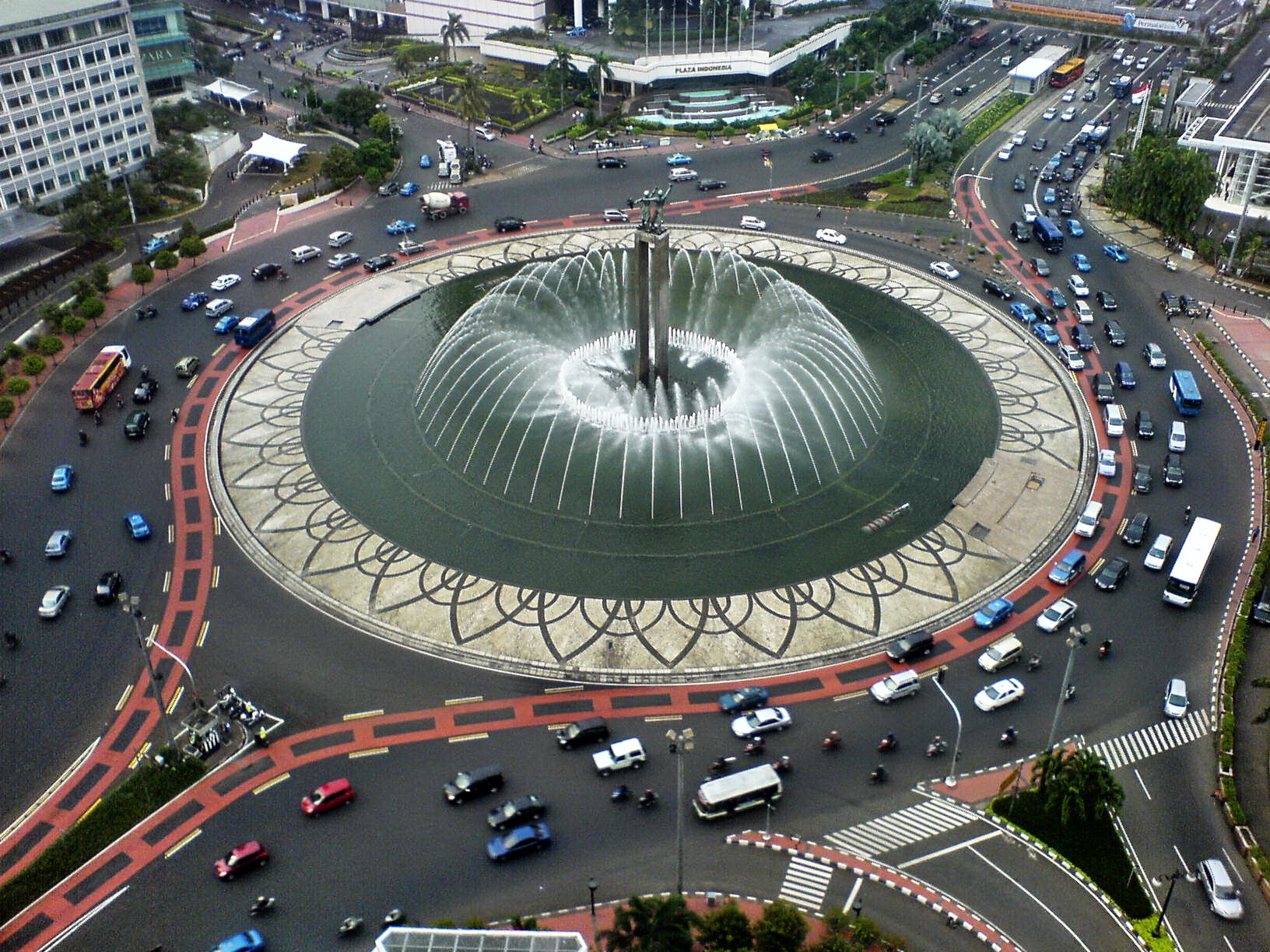
A roundabout, a rotary and a traffic circle are types of circular intersection or junction in which road traffic is permitted to flow in one direction around a central island, and priority is typically given to traffic already in the junction.''The New Shorter Oxford English Dictionary,'' Volume 2, Clarendon Press, Oxford (1993), page 2632 In the United States, engineers use the term modern roundabout to refer to junctions installed after 1960 that incorporate design rules to increase safety. Compared to stop signs, traffic signals, and earlier forms of roundabouts, modern roundabouts reduce the likelihood and severity of collisions greatly by reducing traffic speeds through horizontal deflection and minimising T-bone and head-on collisions. Variations on the basic concept include integration with tram or train lines, two-way flow, higher speeds and many others. For pedestrians, traffic exiting the roundabout comes from one direction, instead of three, simplifying the p ... [...More Info...] [...Related Items...] OR: [Wikipedia] [Google] [Baidu] [Amazon] |
Remembrance Day
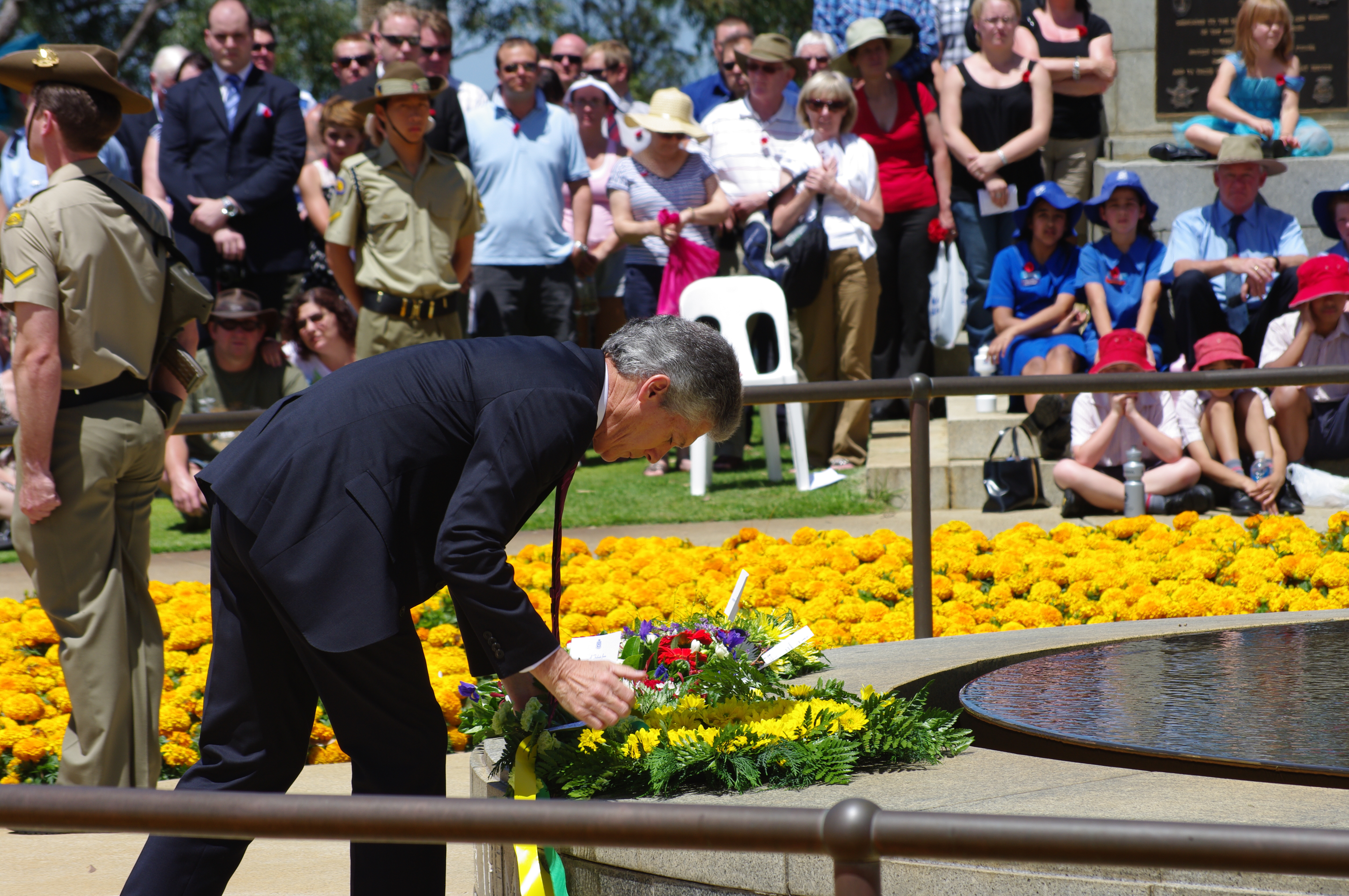
Remembrance Day (also known as Poppy Day owing to the tradition of wearing a remembrance poppy) is a memorial day observed in Commonwealth of Nations, Commonwealth member states since the end of the First World War to honour armed forces members who have died in the line of duty. The day is also marked by war remembrances in several other non-Commonwealth countries. In most countries, Remembrance Day is observed on 11 November to recall the end of First World War hostilities. Hostilities ended "at the 11th hour of the 11th day of the 11th month" of 1918, in accordance with Armistice with Germany (Compiègne), the armistice signed by representatives of Germany and the Entente between 5:12 and 5:20 that morning. ("At the 11th hour" refers to the ''passing'' of the 11th hour, or 11:00 am.) The First World War formally ended with the signing of the Treaty of Versailles on 28 June 1919. The tradition of Remembrance Day evolved out of Armistice Day. The initial Armistice Day ... [...More Info...] [...Related Items...] OR: [Wikipedia] [Google] [Baidu] [Amazon] |


