|
Gitwinksihlkw, British Columbia
Gitwinksihlkw ( , ) formerly Canyon City, is a Nisga'a Village in the Nass River valley of northwestern British Columbia, Canada, near that river's confluence with the Tseax River. An older spelling is Kitwilluchsilt. It is one of four Nisga'a villages. Road access is via the Nisga'a Highway. Gitwinksihlkw means "people of the lizard's habitat", a reference to the presence of ( salamanders) in the area prior to the eruption of Tseax Cone in the 18th century which buried the neighbouring villages of Wii Lax K'abit and Lax̱ Ksiluux. Education The community is served by School District 92 Nisga'a and hosts Gitwinksihlkw Elementary School. The secondary school is in Gitlax̱t'aamiks. See also *Nisga'a Memorial Lava Beds Provincial Park Nisga'a Memorial Lava Bed Provincial Park (Nisga'a: ) is a provincial park in the Nass River valley in northwestern British Columbia, Canada, about 80 kilometres north of Terrace, and near the Nisga'a Villages of Gitlakdamix and Gitwin ... [...More Info...] [...Related Items...] OR: [Wikipedia] [Google] [Baidu] |
British Columbia
British Columbia (commonly abbreviated as BC) is the westernmost Provinces and territories of Canada, province of Canada, situated between the Pacific Ocean and the Rocky Mountains. It has a diverse geography, with rugged landscapes that include rocky coastlines, sandy beaches, forests, lakes, mountains, inland deserts and grassy plains, and borders the province of Alberta to the east and the Yukon and Northwest Territories to the north. With an estimated population of 5.3million as of 2022, it is Canada's Population of Canada by province and territory, third-most populous province. The capital of British Columbia is Victoria, British Columbia, Victoria and its largest city is Vancouver. Vancouver is List of census metropolitan areas and agglomerations in Canada, the third-largest metropolitan area in Canada; the 2021 Canadian census, 2021 census recorded 2.6million people in Metro Vancouver Regional District, Metro Vancouver. The First Nations in Canada, first known human inhabi ... [...More Info...] [...Related Items...] OR: [Wikipedia] [Google] [Baidu] |
Tseax Cone
The Tseax Cone ( ), also called the Tseax River Cone or the Aiyansh Volcano, is a young and active cinder cone and adjacent lava flows associated with the Nass Ranges and the Northern Cordilleran Volcanic Province. It is located east of Crater Creek at outlet of Melita Lake, southeast of Gitlakdamix and north of Terrace, British Columbia, Canada. The volcano is in a valley above and east of the Tseax River, about south of the river's junction with the larger Nass River. The Tseax Cone is one of the most accessible volcanic centres in British Columbia. Geology The Tseax Cone is in the southern part of the Northern Cordilleran Volcanic Province and is therefore part of the Ring of Fire. It has been the site of some of the youngest volcanic eruptions in Canada. It has been active at least twice in the past few hundred years and other remnants of lava flows exist in the area. It is in diameter at its base and rests on the remnants of an earlier and somewhat larger, dissec ... [...More Info...] [...Related Items...] OR: [Wikipedia] [Google] [Baidu] |
Designated Places In British Columbia
A designated place is a type of geographic unit used by Statistics Canada to disseminate census data. It is usually "a small community that does not meet the criteria used to define incorporated municipalities or Statistics Canada population centres (areas with a population of at least 1,000 and no fewer than 400 persons per square kilometre)." Provincial and territorial authorities collaborate with Statistics Canada in the creation of designated places so that data can be published for sub-areas within municipalities. Starting in 2016, Statistics Canada allowed the overlapping of designated places with population centres. In the 2021 Census of Population, British Columbia had 332 designated places, an increase from 326 in 2016. Designated place types in British Columbia include 55 Indian reserves, 13 island trusts, 5 Nisga'a villages The Nisga’a , often formerly spelled Nishga and spelled in the Nisga'a language as (pronounced ), are an Indigenous people of Canada in ... [...More Info...] [...Related Items...] OR: [Wikipedia] [Google] [Baidu] |
Nisga'a Memorial Lava Beds Provincial Park
Nisga'a Memorial Lava Bed Provincial Park (Nisga'a: ) is a provincial park in the Nass River valley in northwestern British Columbia, Canada, about 80 kilometres north of Terrace, and near the Nisga'a Villages of Gitlakdamix and Gitwinksihlkw. The park was established by Order in Council on April 29, 1992, expanded in 1995, included in the Nisga'a Treaty in 2000, and is the first park in the province to be jointly managed by the government and a First Nation. An interpretive centre in a traditional Nisga'a longhouse informs visitors about the Nisga'a legend that accounts for the lava as well as geological causes. The park has waterfalls, pools, cinder cones, tree moulds, lava tubes, spatter cones, a lava-dammed lake, caves and other features created by lava flows. The park aims to protect moose, goats, marmots, bears and many other species of wildlife. The park covers 178.93 square kilometres in area. Volcanic eruption It is believed to be the site of Canada's most recent vo ... [...More Info...] [...Related Items...] OR: [Wikipedia] [Google] [Baidu] |
Gitlakdamix, British Columbia
Gitlax̱t'aamiks , formerly New Aiyansh , is a Nisga'a village about north of Terrace, in the heart of the Nass River valley, Canada. It is one of four Nisga'a villages. Though it is located in British Columbia, it is also considered the "capital of the Nisga'a Nation." The Nisg̱a'a Lisims Government building (), which opened in 2000, is located here. The area is home to 806 people and the Nisga'a Memorial Lava Bed Provincial Park. Gitlax̱t'aamiks is located overlooking a lava flow that erupted in the 18th century. The source for this lava flow was the Tseax Cone. In front of the Nisga'a Elementary Secondary School stands the Unity Totem Pole which, raised in 1977, was the first totem pole raised in the Nass Valley since the late 19th century. Name origin ''Gitlax̱t'aamiks'' means "people of the ponds" in the Nisga'a language. The name New Aiyansh was established in 1974. Though the name Aiyansh was originally at a location 3 miles to the northeast, maps now show both Aiy ... [...More Info...] [...Related Items...] OR: [Wikipedia] [Google] [Baidu] |
School District 92 Nisga'a
School District 92 Nisga'a is a school district in British Columbia, Canada. Situated in the Nass River valley it covers the First Nations area of the Nisga'a people north of Terrace. This includes the communities of Gitlaxt'aamiks (or New Aiyansh), Gitwinksihlkw (or Canyon City), Laxgalts'ap (or Greenville), Gingolx (or Kincolith), and the surrounding settlements. History School District 92 Nisga'a was created January 1, 1975 as the first aboriginal school district in the province. There has been a steady decline in the number of students over the past several years. In September 2010, there were 422 students in Grades K-12. School populations range from 46 students in the smallest elementary school to 241 in the combined elementary/secondary school located in the largest community. There are 44 students designated as having special needs, within the Ministry of Education categories. Half of our students—212 students—receive English Language Development progra ... [...More Info...] [...Related Items...] OR: [Wikipedia] [Google] [Baidu] |
Lax Ksiluux, British Columbia
Lax̱ Ksiluux is the name of a former First Nations community in northwestern British Columbia, Canada. It existed on the south side of the Nass River near a creek known as Ts'oohl Ts'ap. Lax̱ Ksiluux was in existence prior to the eruption of Tseax Cone in the 18th century which buried the community with thick lava flows along with the nearby community of Wii Lax K'abit The Wii ( ) is a home video game console developed and marketed by Nintendo. It was released on November 19, 2006, in North America and in December 2006 for most other regions of the world. It is Nintendo's fifth major home game console, .... See also * Nisga'a Memorial Lava Bed Provincial Park References Nisga'a Nass Country Natural disasters in British Columbia {{Disaster-stub ... [...More Info...] [...Related Items...] OR: [Wikipedia] [Google] [Baidu] |
Wii Lax K'abit, British Columbia
The Wii ( ) is a home video game console developed and marketed by Nintendo. It was released on November 19, 2006, in North America and in December 2006 for most other regions of the world. It is Nintendo's fifth major home game console, following the GameCube and is a seventh-generation console alongside Microsoft's Xbox 360 and Sony's PlayStation 3. In developing the Wii, Nintendo president Satoru Iwata directed the company to avoid competing with Microsoft and Sony on computational graphics and power and instead to target a broader demographic of players through novel gameplay. Game designers Shigeru Miyamoto and Genyo Takeda led the console's development under the codename Revolution. The primary controller for the Wii is the Wii Remote, a wireless controller with both motion sensing and traditional controls which can be used as a pointing device towards the television screen or for gesture recognition. The Wii was Nintendo's first home console to directly sup ... [...More Info...] [...Related Items...] OR: [Wikipedia] [Google] [Baidu] |
Salamander
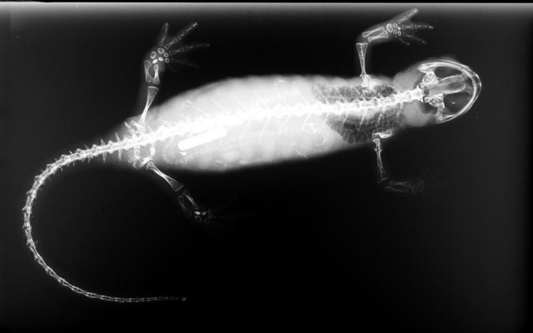
Salamanders are a group of amphibians typically characterized by their lizard-like appearance, with slender bodies, blunt snouts, short limbs projecting at right angles to the body, and the presence of a tail in both larvae and adults. All ten extant salamander families are grouped together under the order Urodela. Salamander diversity is highest in eastern North America, especially in the Appalachian Mountains; most species are found in the Holarctic realm, with some species present in the Neotropical realm. Salamanders rarely have more than four toes on their front legs and five on their rear legs, but some species have fewer digits and others lack hind limbs. Their permeable skin usually makes them reliant on habitats in or near water or other cool, damp places. Some salamander species are fully aquatic throughout their lives, some take to the water intermittently, and others are entirely terrestrial as adults. This group of amphibians is capable of regenerating lost l ... [...More Info...] [...Related Items...] OR: [Wikipedia] [Google] [Baidu] |
Nisga'a
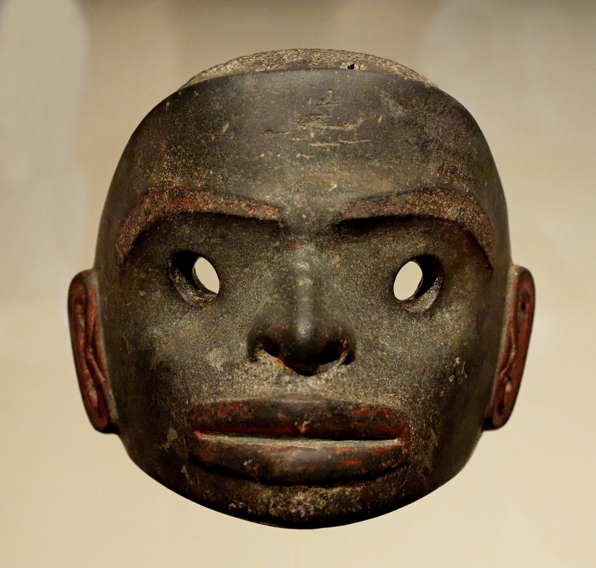
The Nisga’a , often formerly spelled Nishga and spelled in the Nisga'a language as (pronounced ), are an Indigenous people of Canada in British Columbia. They reside in the Nass River valley of northwestern British Columbia. The name is a reduced form of , which is a loan word from Tongass Tlingit, where it means "people of the Nass River". The official languages of Nisg̱a’a are the Nisg̱a’a language and English. Nisga’a culture Society Nisga’a society is organized into four tribes: * Ganhada (G̱anada, Raven) * Gispwudwada (Gisḵ’aast, Killer Whale) * Laxgibuu (Lax̱gibuu, Wolf) * Laxsgiik (Lax̱sgiik, Eagle) Each tribe is further sub-divided into house groups – extended families with same origins. Some houses are grouped together into clans – grouping of Houses with same ancestors. Example: *Lax̱gibuu Tribe (Wolf Tribe) ** Gitwilnaak’il Clan (People Separated but of One) *** House of Duuḵ *** House of K’eex̱kw *** House of Gwingyoo ... [...More Info...] [...Related Items...] OR: [Wikipedia] [Google] [Baidu] |
Nisga'a Highway
Nisga'a Highway, officially designated British Columbia Highway 113, is a highway in the Regional District of Kitimat-Stikine in British Columbia. It starts in Terrace at Highway 16. The route provides paved access to the settlements of the Nisga'a Nation - Gitlaxt'aamiks (New Aiyansh), Gitwinksihlkw (Canyon City), Gingolx (Kincolith), Laxgalts'ap (Greenville), Nass Camp and others. It enters the Nass Country via the valley of Kitsumkalum Lake, which connects from the Skeena and via the Nisga'a Lava Beds Provincial Park. The route heads north from Terrace and once into the Nass River Valley then travels west to Gingolx (Kincolith) for a total of . There is a spur between New Aiyansh and Nass Camp. The 29 kilometre section of the highway between Laxgalts'ap and Gingolx opened on 17 May 2003 at a cost of $34 million (equivalent to 49.74 million in 2022). Before the road, the only ways into Gingolx were via boat or floatplane. The route received a newly designed shield ... [...More Info...] [...Related Items...] OR: [Wikipedia] [Google] [Baidu] |
Nisga’a
The Nisga’a , often formerly spelled Nishga and spelled in the Nisga'a language as (pronounced ), are an Indigenous people of Canada in British Columbia. They reside in the Nass River valley of northwestern British Columbia. The name is a reduced form of , which is a loan word from Tongass Tlingit, where it means "people of the Nass River". The official languages of Nisg̱a’a are the Nisg̱a’a language and English. Nisga’a culture Society Nisga’a society is organized into four tribes: * Ganhada (G̱anada, Raven) * Gispwudwada (Gisḵ’aast, Killer Whale) * Laxgibuu (Lax̱gibuu, Wolf) * Laxsgiik (Lax̱sgiik, Eagle) Each tribe is further sub-divided into house groups – extended families with same origins. Some houses are grouped together into clans – grouping of Houses with same ancestors. Example: *Lax̱gibuu Tribe (Wolf Tribe) ** Gitwilnaak’il Clan (People Separated but of One) *** House of Duuḵ *** House of K’eex̱kw *** House of Gwingyoo Traditi ... [...More Info...] [...Related Items...] OR: [Wikipedia] [Google] [Baidu] |


_(cropped_2).jpg)

