|
Frigidolfo
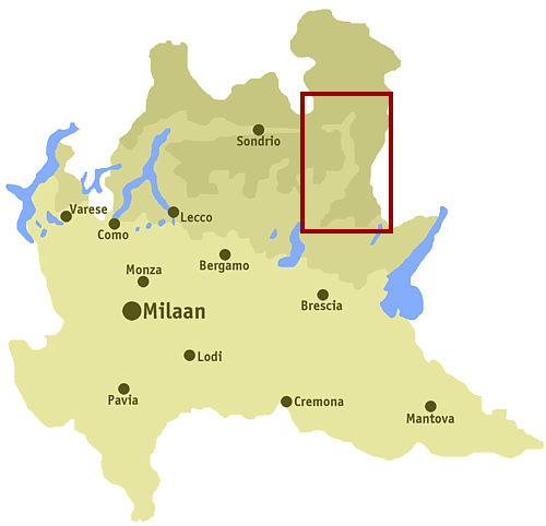
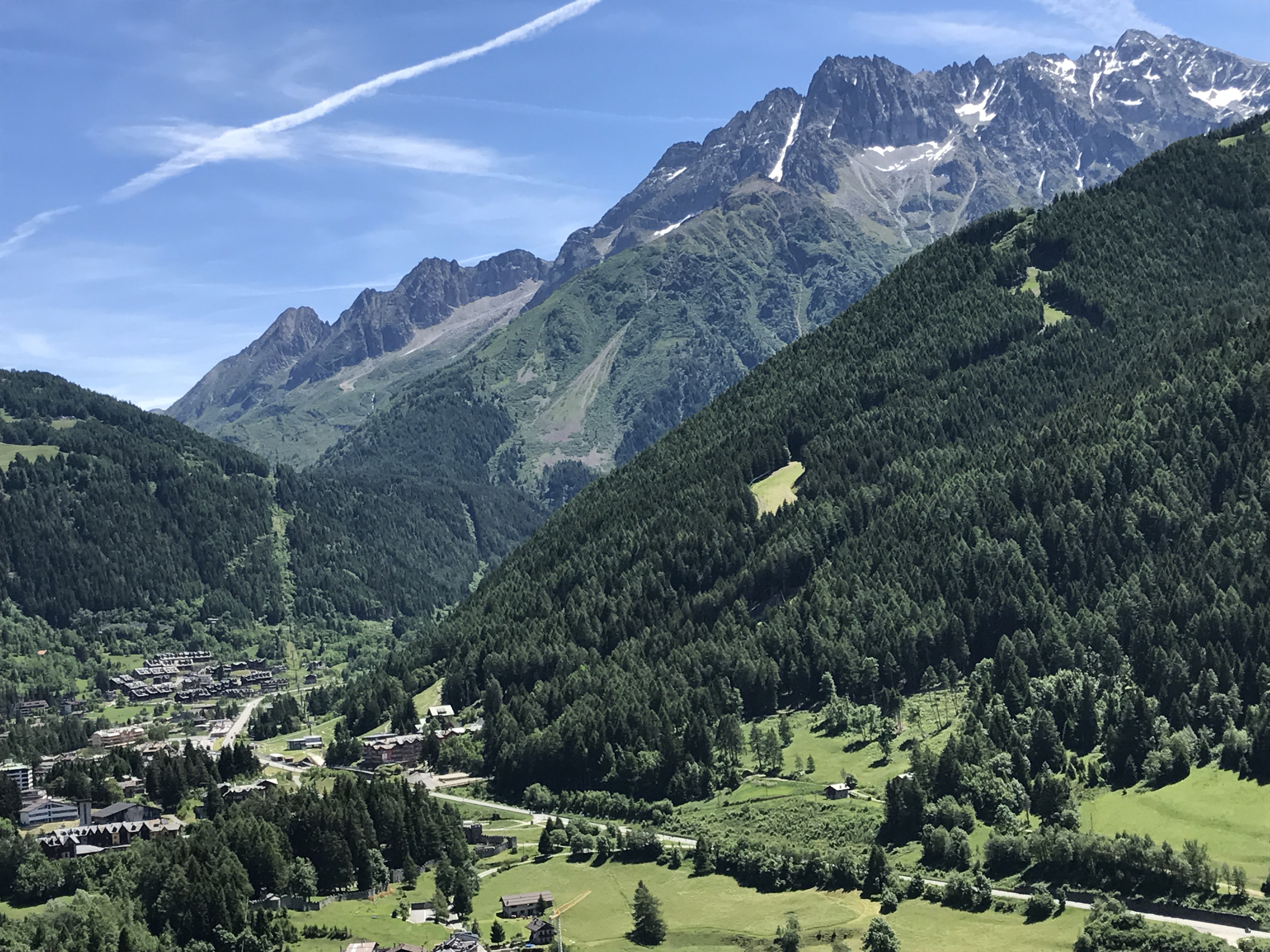
The Frigidolfo (also called Oglio Frigidolfo) is a stream of Val Camonica, in the province of Brescia, about 7 km long. It rises in the Valle delle Messi, near the Gavia Pass on the slopes of the Corno dei Tre Signori (3360 m a.s.l.). Along its path it receives water from the Arcanello. Its confluence with the Narcanello in Ponte di Legno (1300 m a.s.l.) gives rise to the Oglio The Oglio (; Latin ''Ollius'', or ''Olius''; Lombard ''Òi''; Cremonese ''Ùi'') is a left-side tributary of the river Po in Lombardy, Italy. It is long. In the hierarchy of the Po's tributaries, with its of length, it occupies the 2nd pla ... River. References {{coord, 46.25914, 10.50803, format=dms, type:river_region:IT, display=title Rivers of the Province of Brescia ... [...More Info...] [...Related Items...] OR: [Wikipedia] [Google] [Baidu] |
Oglio
The Oglio (; Latin ''Ollius'', or ''Olius''; Lombard ''Òi''; Cremonese ''Ùi'') is a left-side tributary of the river Po in Lombardy, Italy. It is long. In the hierarchy of the Po's tributaries, with its of length, it occupies the 2nd place per length (after the river Adda), while it is the 4th per basin surface (after Tanaro, Adda and Ticino), and the 3rd per average discharge at the mouth (after Ticino and Adda). Overview The Oglio is formed from the confluence of two mountain streams, the Narcanello branch from the Presena Glacier, in the Adamello group and the Frigidolfo branch, in the Corno dei Tre Signori, part of the Stelvio National Park. The streams merge near Pezzo di Ponte di Legno, both the streams have an average discharge of . The Frigidolfo branch, before merging with Narcanello branch, receives the Arcanello branch, which have an average discharge of , which receives a minor branch originating from Lake Ercavallo. The Ogliolo stream, with an average disc ... [...More Info...] [...Related Items...] OR: [Wikipedia] [Google] [Baidu] |
Val Camonica
Val Camonica (also ''Valcamonica'' or Camonica Valley, Eastern Lombard dialect, Eastern Lombard: ''Al Camònega'') is one of the largest valleys of the central Alps, in eastern Lombardy, Italy. It extends about from the Tonale Pass to Corna Trentapassi, in the commune of Pisogne near Lake Iseo. It has an area of about Area of the municipalities, excluding Val di Scalve and 118,323 inhabitants.Sum of Istituto Nazionale di Statistica, ISTAT data of communes at 31 December 2007 The River Oglio runs through its full length, rising at Ponte di Legno and flowing into Lake Iseo between Pisogne and Costa Volpino. Almost all of the valley is included in the administrative territory of the province of Brescia, except for Lovere, Rogno, Costa Volpino and the Val di Scalve, which belong to the province of Bergamo. Since 1979, the Rock Drawings in Valcamonica, rock drawings located along the valley are a UNESCO World Heritage Site, while the entire valley became a UNESCO World Bio ... [...More Info...] [...Related Items...] OR: [Wikipedia] [Google] [Baidu] |
Ponte Di Legno
Ponte di Legno ( Camunian: ) is an Italian ''comune'' of 1,729 inhabitants in Val Camonica, province of Brescia, in Lombardy. Geography Situated at the confluence of the two source rivers of the Oglio, Ponte di Legno is the uppermost comune of Valle Camonica. History The territory of the municipality of Ponte di Legno was part of the ancient Dalaunia (Dalegno), which included also the comune of Temù. On September 27, 1917 the village was bombarded by Austrian cannons and razed to the ground in a short time. Monuments and places of interest Religious architectures The churches of Ponte di Legno are: * Parish of the Holy Trinity, dated 1685, though the wooden door is from 1929. Inside there are works from the workshop of Ramus. * Church St. Appollonio in Plampezzo. It is an ancient church dating from the twelfth century, with frescoes of the thirteenth century of the hand of the painter Johannes from Volpino. Society Demographic trends Colors= id:lightgrey value:gray(0. ... [...More Info...] [...Related Items...] OR: [Wikipedia] [Google] [Baidu] |
Valle Delle Messi
Valle may refer to: * Valle (surname) Geography *"Valle", the cultural and climatic zone of the dry subtropical Interandean Valles of the Andes of Peru, Bolivia, and northwest Argentina *University of Valle, a public university in Cali, Colombia *Bale, Croatia, or Valle, a small town and municipality in Istria county, Croatia * Valle, Ecuador, a town and parish in Cuenca Canton, Azuay Province, Ecuador *Valle Department, a department in southern Honduras *Valle di Cadore, a municipality Belluno, Veneto, Italy * Valle Parish, an administrative unit of Aizkraukle District, Latvia *Valle Hundred, a hundred of Västergötland county, Sweden *Valle, Arizona, United States Norway *Valle, or Valle-Hovin, a neighborhood in the capital city of Oslo *Valle, Bamble, a village in the municipality of Bamble in Vestfold og Telemark county; see Stråholmen *Valle, Møre og Romsdal, a village in the municipality of Ålesund in Møre og Romsdal county *Valle, Norway, a municipality in the Setesd ... [...More Info...] [...Related Items...] OR: [Wikipedia] [Google] [Baidu] |
Metre
The metre (British spelling) or meter (American spelling; see spelling differences) (from the French unit , from the Greek noun , "measure"), symbol m, is the primary unit of length in the International System of Units (SI), though its prefixed forms are also used relatively frequently. The metre was originally defined in 1793 as one ten-millionth of the distance from the equator to the North Pole along a great circle, so the Earth's circumference is approximately km. In 1799, the metre was redefined in terms of a prototype metre bar (the actual bar used was changed in 1889). In 1960, the metre was redefined in terms of a certain number of wavelengths of a certain emission line of krypton-86. The current definition was adopted in 1983 and modified slightly in 2002 to clarify that the metre is a measure of proper length. From 1983 until 2019, the metre was formally defined as the length of the path travelled by light in a vacuum in of a second. After the 2019 redefiniti ... [...More Info...] [...Related Items...] OR: [Wikipedia] [Google] [Baidu] |
Sea Level
Mean sea level (MSL, often shortened to sea level) is an average surface level of one or more among Earth's coastal bodies of water from which heights such as elevation may be measured. The global MSL is a type of vertical datuma standardised geodetic datumthat is used, for example, as a chart datum in cartography and marine navigation, or, in aviation, as the standard sea level at which atmospheric pressure is measured to calibrate altitude and, consequently, aircraft flight levels. A common and relatively straightforward mean sea-level standard is instead the midpoint between a mean low and mean high tide at a particular location. Sea levels can be affected by many factors and are known to have varied greatly over geological time scales. Current sea level rise is mainly caused by human-induced climate change. When temperatures rise, mountain glaciers and the polar ice caps melt, increasing the amount of water in water bodies. Because most of human settlement and in ... [...More Info...] [...Related Items...] OR: [Wikipedia] [Google] [Baidu] |
Stream
A stream is a continuous body of surface water flowing within the bed and banks of a channel. Depending on its location or certain characteristics, a stream may be referred to by a variety of local or regional names. Long large streams are usually called rivers, while smaller, less voluminous and more intermittent streams are known as streamlets, brooks or creeks. The flow of a stream is controlled by three inputs – surface runoff (from precipitation or meltwater), daylighted subterranean water, and surfaced groundwater ( spring water). The surface and subterranean water are highly variable between periods of rainfall. Groundwater, on the other hand, has a relatively constant input and is controlled more by long-term patterns of precipitation. The stream encompasses surface, subsurface and groundwater fluxes that respond to geological, geomorphological, hydrological and biotic controls. Streams are important as conduits in the water cycle, instruments in groundw ... [...More Info...] [...Related Items...] OR: [Wikipedia] [Google] [Baidu] |
Brescia
Brescia (, locally ; lmo, link=no, label= Lombard, Brèsa ; lat, Brixia; vec, Bressa) is a city and ''comune'' in the region of Lombardy, Northern Italy. It is situated at the foot of the Alps, a few kilometers from the lakes Garda and Iseo. With a population of more than 200,000, it is the second largest city in the administrative region and the fourth largest in northwest Italy. The urban area of Brescia extends beyond the administrative city limits and has a population of 672,822, while over 1.5 million people live in its metropolitan area. The city is the administrative capital of the Province of Brescia, one of the largest in Italy, with over 1,200,000 inhabitants. Founded over 3,200 years ago, Brescia (in antiquity Brixia) has been an important regional centre since pre-Roman times. Its old town contains the best-preserved Roman public buildings in northern Italy and numerous monuments, among these the medieval castle, the Old and New cathedral, the Renaissance ' ... [...More Info...] [...Related Items...] OR: [Wikipedia] [Google] [Baidu] |
Gavia Pass
Gavia Pass ( it, Passo di Gavia) (el. 2621 m.) is a high mountain pass in the Italian Alps. It is the tenth highest paved road in the Alps. The pass lies in the Lombardy region and divides the province of Sondrio to the north and the province of Brescia to the south. The road over the pass (SS 300) connects Bormio to the northwest with Ponte di Legno to the south and is single track most on its southern section. Climbing around Gavia Pass There are many peaks to climb around. Directly above the pass on its east side is Corno dei Tre Signori (3360 m) and next to it Monte Gaviola (3025). On the other side of the road raises Monte Gavia (3223 m). By continuing along the road in the direction of Bormio, after less than 3 km, one arrives at the monument from where routes start for the Punta San Matteo (3678 m) group. The group includes Pizo Tresero (3594 m), Punta Pendranzini (3599), Cima Dosegu (3560) and several others. Huts There are several huts around. Rifugio Bon ... [...More Info...] [...Related Items...] OR: [Wikipedia] [Google] [Baidu] |
Corno Dei Tre Signori
Corno dei Tre Signori is a mountain in Lombardy, Italy Italy ( it, Italia ), officially the Italian Republic, ) or the Republic of Italy, is a country in Southern Europe. It is located in the middle of the Mediterranean Sea, and its territory largely coincides with the homonymous geographical .... References Mountains of Lombardy Mountains of the Alps Alpine three-thousanders Ortler Alps {{Lombardy-geo-stub ... [...More Info...] [...Related Items...] OR: [Wikipedia] [Google] [Baidu] |
.jpg)


_nahe_dem_Weiherdamm_in_Wildbergerhütte.jpg)
