|
Fortinho
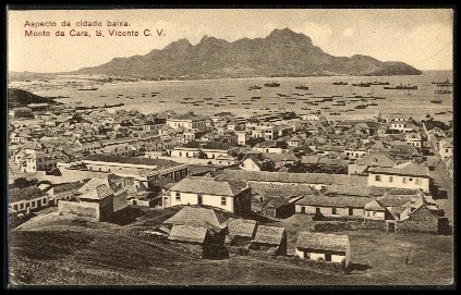
Fortinho or Fortinho/Escola Técnica is a subdivision of the city of Mindelo in the island of São Vicente, Cape Verde. Its population was 92 at the 2010 census. It is situated northwest of the city centre and south of Matiota. It takes its name from the fortress Fortim d'El-Rei Fortim d'El Rei is a fort in Mindelo, in the island of São Vicente, Cape Verde. It is located on a hill north of the city centre, in the neighbourhood Fortinho. It was built in 1852 for the defence of Porto Grande Bay Porto Grande Bay ( pt, .... References {{Mindelo, Cape Verde Mindelo ... [...More Info...] [...Related Items...] OR: [Wikipedia] [Google] [Baidu] |
Mindelo
Mindelo is a port cityCabo Verde, Statistical Yearbook 2015 Instituto Nacional de Estatística, p. 32-33 in the northern part of the island of São Vicente in . Mindelo is also the seat of the parish of Nossa Senhora da Luz, and the municipality of São Vicente. The city is home to ... [...More Info...] [...Related Items...] OR: [Wikipedia] [Google] [Baidu] |
City Center Of Mindelo
The City center of Mindelo or Morada (Portuguese: ''Centro do Mindelo'') is the historic center of the Mindelo in the island of São Vicente, Cape Verde. Its population was 1,553 at the 2010 census. It is the place where the island's first settlement was founded in 1793.Génese e desenvolvimento da cidade do Mindelo: a preservação de uma identidade Fred Yanick Fonseca Delgado, 2016 Many public buildings are situated in the city centre. It lies along the . Adjacent neighbourhoods include |
Matiota
Matiota Instituto Nacional de Estatística, code 2110101, p. 27 is a subdivision of the city of in the island of São Vicente, . It is situated 1.2 km northwest of the city centre, along |
Fortim D'El-Rei
Fortim d'El Rei is a fort in Mindelo, in the island of São Vicente, Cape Verde. It is located on a hill north of the city centre, in the neighbourhood Fortinho. It was built in 1852 for the defence of Porto Grande Bay and the city of Mindelo.Génese e desenvolvimento da cidade do Mindelo: a preservação de uma identidade Fred Yanick Fonseca Delgado, 2016, p. 124 Since 1930, it was only used for civil purposes, and it gradually fell into disrepair. See also * |
Cape Verde
, national_anthem = () , official_languages = Portuguese , national_languages = Cape Verdean Creole , capital = Praia , coordinates = , largest_city = capital , demonym = Cape Verdean or Cabo Verdean , ethnic_groups_year = 2017 , government_type = Unitary semi-presidential republic , leader_title1 = President , leader_name1 = José Maria Neves , leader_title2 = Prime Minister , leader_name2 = Ulisses Correia e Silva , legislature = National Assembly , area_rank = 166th , area_km2 = 4033 , area_sq_mi = 1,557 , percent_water = negligible , population_census = 561,901 , population_census_rank = 172nd , population_census_year = 2021 , population_density_km2 = 123.7 , population_density_sq_mi = 325.0 , population_density_rank = 89th , GDP_PPP ... [...More Info...] [...Related Items...] OR: [Wikipedia] [Google] [Baidu] |
Administrative Divisions Of Cape Verde
The territory of Cape Verde is divided into 22 ''concelhos'' (municipalities), and subdivided into 32 ''freguesias'' (equivalent to civil parish). In Portuguese language usage, there are two words to distinguish the territory and the administrative organ. Administratively, right below the government, there are the ''municípios'' (municipalities), who administrate the ''concelhos''. Therefore, the ''concelhos'' are the first-level administrative subdivision in Cape Verde. Each municipality has an ''Assembleia Municipal'' (municipal assembly, the legislative body) and a ''Câmara Municipal'' (municipal chamber, the executive body). Every four years elections are held for the Assembleia Municipal, the Câmara Municipal and the President of the Câmara Municipal. Where a municipality consists of several ''freguesias'' (civil parishes), a ''Delegação Municipal'' (municipal delegation) is established in the parishes that do not contain the municipal seat. The islands are traditionall ... [...More Info...] [...Related Items...] OR: [Wikipedia] [Google] [Baidu] |
São Vicente, Cape Verde
São Vicente (Portuguese for " Saint Vincent") is one of the Barlavento Islands, the northern group within the Cape Verde archipelago in the Atlantic Ocean, off the West African coast. It is located between the islands of Santo Antão and Santa Luzia, with the Canal de São Vicente separating it from Santo Antão. Geography The island is roughly rectangular in shape with an area of . From east to west it measures and from north to south .Cabo Verde, Statistical Yearbook 2015 Instituto Nacional de Estatística The island, of |
Instituto Nacional De Estatística (Cape Verde)
The Instituto Nacional de Estatística (Portuguese for the ''National Statistics Institute'', abbreviated as INE) is the public statistics institute of Cape Verde. Its current president is Osvaldo Rui Monteiro dos Reis Borges. The population censuses are held every first year of a decade; the most recent was in 2010. Its main office is on 18 Rua da Caixa Económica in the capital city of Praia. History Until 1975, under Portuguese rule, statistics were done by the Provincial Statistics Bureau (''Repartição Provincial de Estatística''), part of the Instituto Nacional de Estatística of Portugal. When Cape Verde became independent, the ''Serviço Nacional de Estatística'' (SNE, Portuguese for the National Statistics Service) was established, part of the Ministry of Economy. Its first president was Edgard Chrysostome Pinto. At the end of 1985, the Directorate-General of Statistics was created. In 1996, the new law of the National Statistics System was approved, and the ''Istituto ... [...More Info...] [...Related Items...] OR: [Wikipedia] [Google] [Baidu] |

