|
Fort Phil Kearny
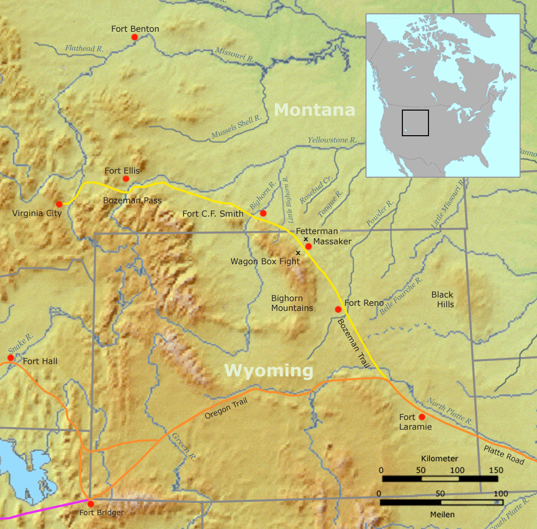
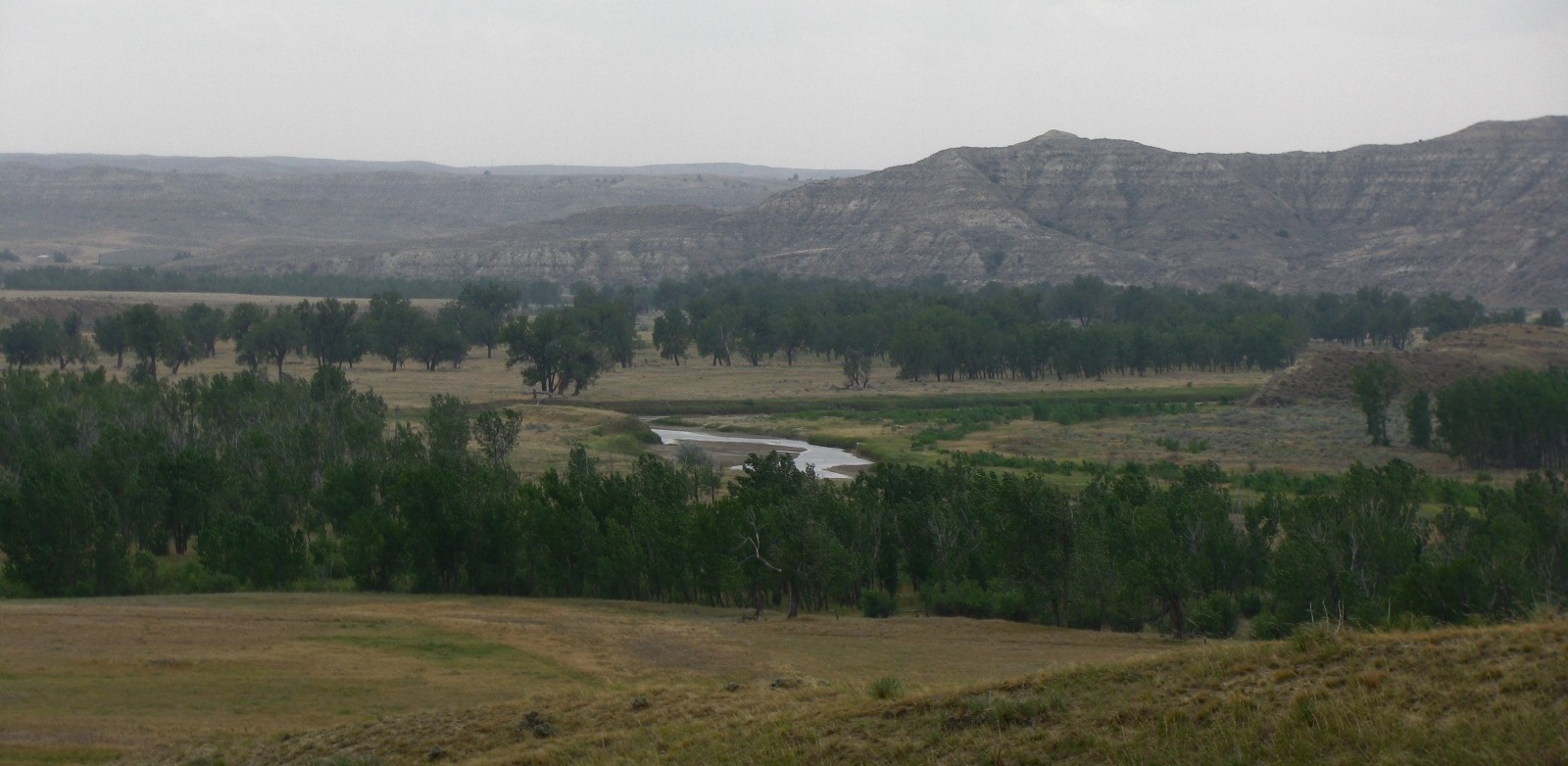
Fort Phil Kearny was an outpost of the United States Army that existed in the late 1860s in present-day northeastern Wyoming along the Bozeman Trail. Construction began in 1866 on Friday, July 13, by Companies A, C, E, and H of the 2nd Battalion, 18th Infantry, under the direction of the regimental commander and Mountain District commander Colonel Henry B. Carrington. The post was named for Major General Philip Kearny (1815–1862), a popular figure in the Civil War. The fort should be distinguished from the similarly named Fort Kearny in Nebraska, which was named for his uncle, Stephen Kearny (1794–1848). Today, the fort and the nearby Fetterman and Wagon Box battle sites are maintained by the State of Wyoming as the Fort Phil Kearny State Historic Site. The fort was located along the east side of the Bighorn Mountains in present-day northern Johnson County, approximately north of Buffalo. Along with Fort Reno and Fort C. F. Smith, the fort was established along the ... [...More Info...] [...Related Items...] OR: [Wikipedia] [Google] [Baidu] |
Buffalo, Wyoming
Buffalo is a city in Johnson County, Wyoming, United States. The city is located almost equidistant between Yellowstone Park and Mount Rushmore. The population was 4,415 at the 2020 census, down from 4,585 at the 2010 census. It is the county seat of Johnson County. The city has experienced an economic boom due to methane production from the coal bed methane extraction method used in the Powder River Basin and surrounding areas. However, with the decline of methane production, Buffalo's population has stabilized since the 2010 Census. Even though energy is a vital part of its economy, agriculture, tourism, and recreation are three other major components. Buffalo is at the foot of the Bighorn Mountains. Demographics 2010 census As of the census of 2010, there were 4,585 people, 2,080 households, and 1,198 families living in the city. The population density was . There were 2,300 housing units at an average density of . The racial makeup of the city was 95.5% White, 0.3% Africa ... [...More Info...] [...Related Items...] OR: [Wikipedia] [Google] [Baidu] |
Fetterman Fight
The Fetterman Fight, also known as the Fetterman Massacre or the Battle of the Hundred-in-the-Hands or the Battle of a Hundred Slain, was a battle during Red Cloud's War on December 21, 1866, between a confederation of the Lakota, Cheyenne, and Arapaho tribes and a detachment of the United States Army, based at Fort Phil Kearny, Wyoming. The U.S. military mission was intended to protect travelers on the Bozeman Trail. A group of ten warriors, including Crazy Horse, acted to lure a detachment of U.S. soldiers into an ambush. All 81 men under the command of Captain William J. Fetterman were then killed by the Native American warriors. At the time, it was the worst military disaster ever suffered by the U.S. Army on the Great Plains. The Lakota alliance emerged victorious and the remaining U.S. forces withdrew from the area. The Fetterman Fight took place on Crow Indian land that was guaranteed to them by a treaty signed with the U.S. government. The Lakota and their allies were o ... [...More Info...] [...Related Items...] OR: [Wikipedia] [Google] [Baidu] |
Red Cloud's War
Red Cloud's War (also referred to as the Bozeman War or the Powder River War) was an armed conflict between an alliance of the Lakota, Northern Cheyenne, and Northern Arapaho peoples against the United States that took place in the Wyoming and Montana territories from 1866 to 1868. The war was fought over control of the western Powder River Country in present north-central Wyoming. In 1863, European Americans had blazed the Bozeman Trail through the heart of the traditional territory of the Cheyenne, Arapaho, and Lakota. It was the shortest and easiest route from Fort Laramie and the Oregon Trail to the Montana gold fields. From 1864 to 1866, the trail was traversed by about 3,500 miners, emigrant settlers and others, who competed with the Indians for the diminishing resources near the trail.Fort Phil Kearney/Bozeman Trail As ... [...More Info...] [...Related Items...] OR: [Wikipedia] [Google] [Baidu] |
2nd Cavalry Regiment (United States)
The 2nd Cavalry Regiment, also known as the 2nd Dragoons, is an active Stryker infantry and cavalry regiment of the United States Army. The Second Cavalry Regiment is a unit of the United States Army Europe and Africa, with its garrison at the Rose Barracks in Vilseck, Germany. It can trace its lineage back to the early part of the 19th century. In addition to its two current names, former names are 2nd Riflemen, 2nd Dragoons, 2nd Constabulary Regiment, 2nd Armored Cavalry, 2nd Cavalry (Light), and 2nd Stryker Cavalry. Previous names and dates Previous designations of the regiment: 2nd Regiment of Dragoons (May 1836 – March 1843, April 1844 – August 1861); 2nd Regiment of Riflemen (March 1843 – April 1844); 2nd US Cavalry Regiment (August 1861 – July 1942); 2nd Cavalry Regiment (Mechanized) (January 1943 – December 1943); 2nd Cavalry Group (Mechanized) (December 1943 – July 1946); 2nd Constabulary Regiment (July 1946 – November 1948); 2nd Armored Cavalr ... [...More Info...] [...Related Items...] OR: [Wikipedia] [Google] [Baidu] |
Board Foot
The board foot or board-foot is a unit of measurement for the volume of lumber in the United States and Canada. It equals the volume of a length of a board, one foot wide and thick. Board foot can be abbreviated as FBM (for "foot, board measure"), BDFT, or BF. A thousand board feet can be abbreviated as MFBM, MBFT, or MBF. Similarly, a million board feet can be abbreviated as MMFBM, MMBFT, or MMBF. Until 1970s in Australia and New Zealand the terms super foot and superficial foot were used with the same meaning. One board foot equals: * 1 ft × 1 ft × 1 in * 12 in × 12 in × 1 in * 144 in3 * 1/12 ft3 * ≈ * ≈ * ≈ or steres * 1/1980 Petrograd Standard of board The board foot is used to measure rough lumber (before drying and planing with no adjustments) or planed/surfaced lumber. An example of planed lumber is softwood 2 × 4 lumber sold by large lumber retailers. The 2 × 4 is actually only , but the dimensions for the lumber when purchased wholesal ... [...More Info...] [...Related Items...] OR: [Wikipedia] [Google] [Baidu] |
Sea Level
Mean sea level (MSL, often shortened to sea level) is an average surface level of one or more among Earth's coastal bodies of water from which heights such as elevation may be measured. The global MSL is a type of vertical datuma standardised geodetic datumthat is used, for example, as a chart datum in cartography and marine navigation, or, in aviation, as the standard sea level at which atmospheric pressure is measured to calibrate altitude and, consequently, aircraft flight levels. A common and relatively straightforward mean sea-level standard is instead the midpoint between a mean low and mean high tide at a particular location. Sea levels can be affected by many factors and are known to have varied greatly over geological time scales. Current sea level rise is mainly caused by human-induced climate change. When temperatures rise, Glacier, mountain glaciers and the Ice sheet, polar ice caps melt, increasing the amount of water in water bodies. Because most of human settlem ... [...More Info...] [...Related Items...] OR: [Wikipedia] [Google] [Baidu] |
Elevation
The elevation of a geographic location is its height above or below a fixed reference point, most commonly a reference geoid, a mathematical model of the Earth's sea level as an equipotential gravitational surface (see Geodetic datum § Vertical datum). The term ''elevation'' is mainly used when referring to points on the Earth's surface, while ''altitude'' or ''geopotential height'' is used for points above the surface, such as an aircraft in flight or a spacecraft in orbit, and '' depth'' is used for points below the surface. Elevation is not to be confused with the distance from the center of the Earth. Due to the equatorial bulge, the summits of Mount Everest and Chimborazo have, respectively, the largest elevation and the largest geocentric distance. Aviation In aviation the term elevation or aerodrome elevation is defined by the ICAO as the highest point of the landing area. It is often measured in feet and can be found in approach charts of the aerodrome. It is n ... [...More Info...] [...Related Items...] OR: [Wikipedia] [Google] [Baidu] |
Montana
Montana () is a state in the Mountain West division of the Western United States. It is bordered by Idaho to the west, North Dakota and South Dakota to the east, Wyoming to the south, and the Canadian provinces of Alberta, British Columbia, and Saskatchewan to the north. It is the fourth-largest state by area, the eighth-least populous state, and the third-least densely populated state. Its state capital is Helena. The western half of Montana contains numerous mountain ranges, while the eastern half is characterized by western prairie terrain and badlands, with smaller mountain ranges found throughout the state. Montana has no official nickname but several unofficial ones, most notably "Big Sky Country", "The Treasure State", "Land of the Shining Mountains", and " The Last Best Place". The economy is primarily based on agriculture, including ranching and cereal grain farming. Other significant economic resources include oil, gas, coal, mining, and lumber. The health ca ... [...More Info...] [...Related Items...] OR: [Wikipedia] [Google] [Baidu] |
Oregon Trail
The Oregon Trail was a east–west, large-wheeled wagon route and Westward Expansion Trails, emigrant trail in the United States that connected the Missouri River to valleys in Oregon. The eastern part of the Oregon Trail spanned part of what is now the state of Kansas and nearly all of what are now the states of Nebraska and Wyoming. The western half of the trail spanned most of the current states of Idaho and Oregon. The Oregon Trail was laid by fur traders and trappers from about 1811 to 1840 and was only passable on foot or on horseback. By 1836, when the first migrant wagon train was organized in Independence, Missouri, a wagon trail had been cleared to Fort Hall, Idaho. Wagon trails were cleared increasingly farther west and eventually reached all the way to the Willamette Valley in Oregon, at which point what came to be called the Oregon Trail was complete, even as almost annual improvements were made in the form of bridges, cutoffs, ferries, and roads, which made the t ... [...More Info...] [...Related Items...] OR: [Wikipedia] [Google] [Baidu] |
Indian Wars
The American Indian Wars, also known as the American Frontier Wars, and the Indian Wars, were fought by European governments and colonists in North America, and later by the United States and Canadian governments and American and Canadian settlers, against various American Indian and First Nation tribes. These conflicts occurred in North America from the time of the earliest colonial settlements in the 17th century until the early 20th century. The various wars resulted from a wide variety of factors, the most common being the desire of settlers and governments for lands that the Indian tribes considered their own. The European powers and their colonies also enlisted allied Indian tribes to help them conduct warfare against each other's colonial settlements. After the American Revolution, many conflicts were local to specific states or regions and frequently involved disputes over land use; some entailed cycles of violent reprisal. As settlers spread westward across North America ... [...More Info...] [...Related Items...] OR: [Wikipedia] [Google] [Baidu] |
Powder River Country
The Powder River Country is the Powder River Basin area of the Great Plains in northeastern Wyoming, United States. The area is loosely defined as that between the Bighorn Mountains and the Black Hills, in the upper drainage areas of the Powder, Tongue, and Little Bighorn rivers. During the late 1860s, the area was the scene of Red Cloud's War, fought between the Lakota peoples and the United States. The Lakota victory in the war resulted in the continuation of their control of the area for the next decade. After control of the area fell to the U.S. government in the 1870s following the end of the Great Sioux War of 1876–77, the area was opened to white settlement for homesteading. In 1892, the area was the scene of the Johnson County War. In the early 20th century, the discovery of oil in the area led to the development of the area's oil fields. Coal Coal is a combustible black or brownish-black sedimentary rock, formed as rock strata called coal seams. Coal is ... [...More Info...] [...Related Items...] OR: [Wikipedia] [Google] [Baidu] |
Fort C
A fortification is a military construction or building designed for the defense of territories in warfare, and is also used to establish rule in a region during peacetime. The term is derived from Latin ''fortis'' ("strong") and ''facere'' ("to make"). From very early history to modern times, defensive walls have often been necessary for cities to survive in an ever-changing world of invasion and conquest. Some settlements in the Indus Valley civilization were the first small cities to be fortified. In ancient Greece, large stone walls had been built in Mycenaean Greece, such as the ancient site of Mycenae (famous for the huge stone blocks of its 'cyclopean' walls). A Greek '' phrourion'' was a fortified collection of buildings used as a military garrison, and is the equivalent of the Roman castellum or English fortress. These constructions mainly served the purpose of a watch tower, to guard certain roads, passes, and borders. Though smaller than a real fortress, they acted ... [...More Info...] [...Related Items...] OR: [Wikipedia] [Google] [Baidu] |


