|
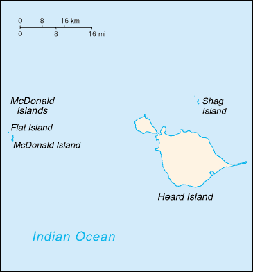
Flat Island (other)
Flat Island may refer to: * Flat Island (Hong Kong) * Flat Island (Spratly) in the South China Sea * Flat Island (Falkland Islands) in the south Atlantic Ocean * Flat Island Wildlife Sanctuary, in the Andaman Islands * Flat Island, a former separate island now merged by recent volcanic activity with McDonald Island, in the southern Indian Ocean * Flat Island, one of the Engineer Islands in southeast Papua New Guinea * Île Plate, also known as Flat Island, a small island off the north coast of Mauritius * Sandy Point, Newfoundland and Labrador See also * Flat Islands (other) * Flat Isles The Northumberland Islands are a scattered island chain off the eastern coast of Queensland, Australia. Geography and history The Northumberland Islands are to the south-east of the city of Mackay roughly between the latitudes 21°S and 22� ... * Flat Islet, Queensland {{geodab ... [...More Info...] [...Related Items...] OR: [Wikipedia] [Google] [Baidu] |
Flat Island (Hong Kong)
Flat Island or Ngan Chau () is an island located near the north shore of Sai Kung Peninsula of Hong Kong. It is at the mouth of in Hoi Ha Wan Hoi Ha Wan () or Jone's Cove is a bay at the north of Sai Kung Peninsula. It is part of Hoi Ha Wan Marine Park, a marine park in Hong Kong. The village of Hoi Ha is located on the innermost shore of Hoi Ha Wan. The location has a high biolog ... and the boundary of Hoi Ha Wan Marine Park (). See also * Ngan Chau for other islands with the same Chinese name. External links Map of Hoi Ha Wan Marine Park showing Flat Island(.pdf document) Uninhabited islands of Hong Kong Tai Po District Islands of Hong Kong {{HongKong-geo-stub ... [...More Info...] [...Related Items...] OR: [Wikipedia] [Google] [Baidu] |
Flat Island (Spratly)
Flat Island, also known as Patag Island ( fil, Pulo ng Patag; Mandarin ; vi, Đảo Bình Nguyên), is the second smallest of the natural Spratly Islands. It has an area of , and is about north of Philippine-occupied Nanshan Island, both of which are located on the expansive but otherwise submerged Flat Island Bank in the NE of Dangerous Ground. It is the sixth largest of the Philippine-occupied Spratly islands and is administered by the Philippines as part of Kalayaan, Palawan. The island is also claimed by the People's Republic of China, the Republic of China (Taiwan), and Vietnam. Environment The island is a low, flat, sandy cay, , and is subject to erosion. It changes its shape seasonally. The sand build up depends largely on the direction of prevailing winds and waves; it has taken an elongated shape for some years, the shape of a crescent moon for a few years, and the shape of a letter "S". Like Lankiam Cay, it is barren of any vegetation. No underground water source h ... [...More Info...] [...Related Items...] OR: [Wikipedia] [Google] [Baidu] |
Flat Island (Falkland Islands)
Flat Jason is one of the Jason Islands in the north west Falkland Islands. In Spanish, it is considered one of "Islas las Llaves" (eastern, Seal Rocks and North Fur Island),; such a distinction does not exist in English English usually refers to: * English language * English people English may also refer to: Peoples, culture, and language * ''English'', an adjective for something of, from, or related to England ** English national ide ... between the two groups of the islands. References Jason Islands {{Falklands-geo-stub ... [...More Info...] [...Related Items...] OR: [Wikipedia] [Google] [Baidu] |
Flat Island Wildlife Sanctuary
Flat Island is an island of the Andaman Islands. It belongs to the North and Middle Andaman administrative district, part of the Indian union territory of Andaman and Nicobar Islands. the island is lying north from Port Blair. Geography The island is situated west of Great Andaman near the shores of Yadita village. And also this island wild life will be protected by the government and the flat island is also known as 2nd wild life sanctuary in the country Administration Politically, Flat Island is part of Rangat Tehsil A tehsil (, also known as tahsil, taluka, or taluk) is a local unit of administrative division in some countries of South Asia. It is a subdistrict of the area within a district including the designated populated place that serves as its administ .... Fauna The island is the location of a wildlife sanctuary, although there is no station on the island. References * North and Middle Andaman district Tourist attractions in the Andaman and Nicoba ... [...More Info...] [...Related Items...] OR: [Wikipedia] [Google] [Baidu] |
McDonald Islands (volcano)
The McDonald Islands () are an uninhabited archipelago in the southern Indian Ocean in the vicinity of Heard Island (). Together with Heard Island, they make up the Australian external Territory of Heard Island and McDonald Islands. The McDonald Islands are the emergent peaks of submarine volcanoes and are Australian external territory. Prior to 1992, there had not been an eruption in the previous 75,000 years. Morphology The McDonald Islands comprise three islands: McDonald Island, Flat Island (which later merged with McDonald Island) and Meyer Rock. The islands are mostly composed of phonolitic low-silica pumice, dikes and lava domes, and sit atop a submarine plateau, the Kerguelen Plateau. They are located about 75 km from Heard Island. McDonald Island is the largest of the islands, at around in area. It has been the main focus of volcanic activity in recent times. Prior to 1996, McDonald Island had been a flat green island whose pumice beaches provided a great nest ... [...More Info...] [...Related Items...] OR: [Wikipedia] [Google] [Baidu] |
Engineer Islands
The Engineer Islands are an archipelago in the Solomon Sea belonging to Papua New-Guinea. Geography The Engineer Islands belong to Milne Bay Province, and are one of the groups forming the Louisiade Archipelago. They are located on the western edge of Louisiade archipelago, east of Basilaki and south of Normanby . The islands form an unusual group consisting of high islands, low coral islands, atolls and underwater reefs, which are located in a radius of 24 km to 14 km away. The three largest islands lie on the southwestern part of the group. They are: Tubetube (Slade Island), Naruaruari (Skelton Island ) and Kwaraiwa (Watts island), each about 3.5 km long and about 0.75 km wide. The islands are hilly with elevations of up to 150 m (at Slade Island). The eastern boundary of the Engineer group is marked by a crescent-shaped reef, on which the four low islands Hummock, Haszard, Button and Flat are located. In the center of the archipelago there is a reef with ... [...More Info...] [...Related Items...] OR: [Wikipedia] [Google] [Baidu] |
Île Plate
Île Plate, also known as Flat Island, is a small island in the Indian Ocean off the north coast of Mauritius. Geography Île Plate is located north of Cap Malheureux, the main island's northernmost point. It is part of the administrative area of Rivière du Rempart District. The small nature reserve of Coin de Mire lies between the two islands. As its name suggests, Île Plate is low-lying, apart from a bluff, and is in danger of possible submersion due to the historical rise in the sea-level. It covers an area of . Two small islets, Îlot Gabriel and Pigeon Rock, lie close to the shore of Île Plate. The three sites are national protected areas (Pigeon Rock as part of Islets National Park). Île Plate is uninhabited, though there is a small army base on the island. Flora and fauna A census conducted in 2007/2008 by the University of Mauritius classified 121 species of vascular plants, many of which are non-native. Among the indigenous plants present, the Latania loddige ... [...More Info...] [...Related Items...] OR: [Wikipedia] [Google] [Baidu] |
Sandy Point, Newfoundland And Labrador
Sandy Point or Flat Island (as described by some provincial maps) was formerly a peninsula but is now an island on the west coast of Newfoundland which is gradually being transformed into a hidden island as a result of ocean storm-induced coastal erosion. Its former connecting isthmus is known as "The Gap" by locals after a severe winter storm during the 1960s breached the land bridge and created a gap. The island of Sandy Point was first coined a "hidden island" due to the extreme difficulty in spotting the barrier island on the horizon when approaching inner Bay St. George from the Gulf of St Lawrence by ship. This may have also served beneficial to "pirate" vessels looking to temporarily mask or hide from the regular trade route along the Gulf of St. Laurence River at the time on the lee side of Sandy Point where an anchorage was available, away from the prevailing winds. The fur trade was quite lucrative during this period, so it is somewhat conceivable that inner Bay St. Geo ... [...More Info...] [...Related Items...] OR: [Wikipedia] [Google] [Baidu] |
Flat Islands (other)
Flat Islands may refer to: * Flat Islands (Antarctica) * Flat Islands, Bonavista Bay, Newfoundland and Labrador * Flat Islands, Placentia Bay, Newfoundland and Labrador See also * Flat Island (other) * Flat Isles The Northumberland Islands are a scattered island chain off the eastern coast of Queensland, Australia. Geography and history The Northumberland Islands are to the south-east of the city of Mackay roughly between the latitudes 21°S and 22 ... * Flat Islet, Queensland {{geodab ... [...More Info...] [...Related Items...] OR: [Wikipedia] [Google] [Baidu] |
Flat Isles
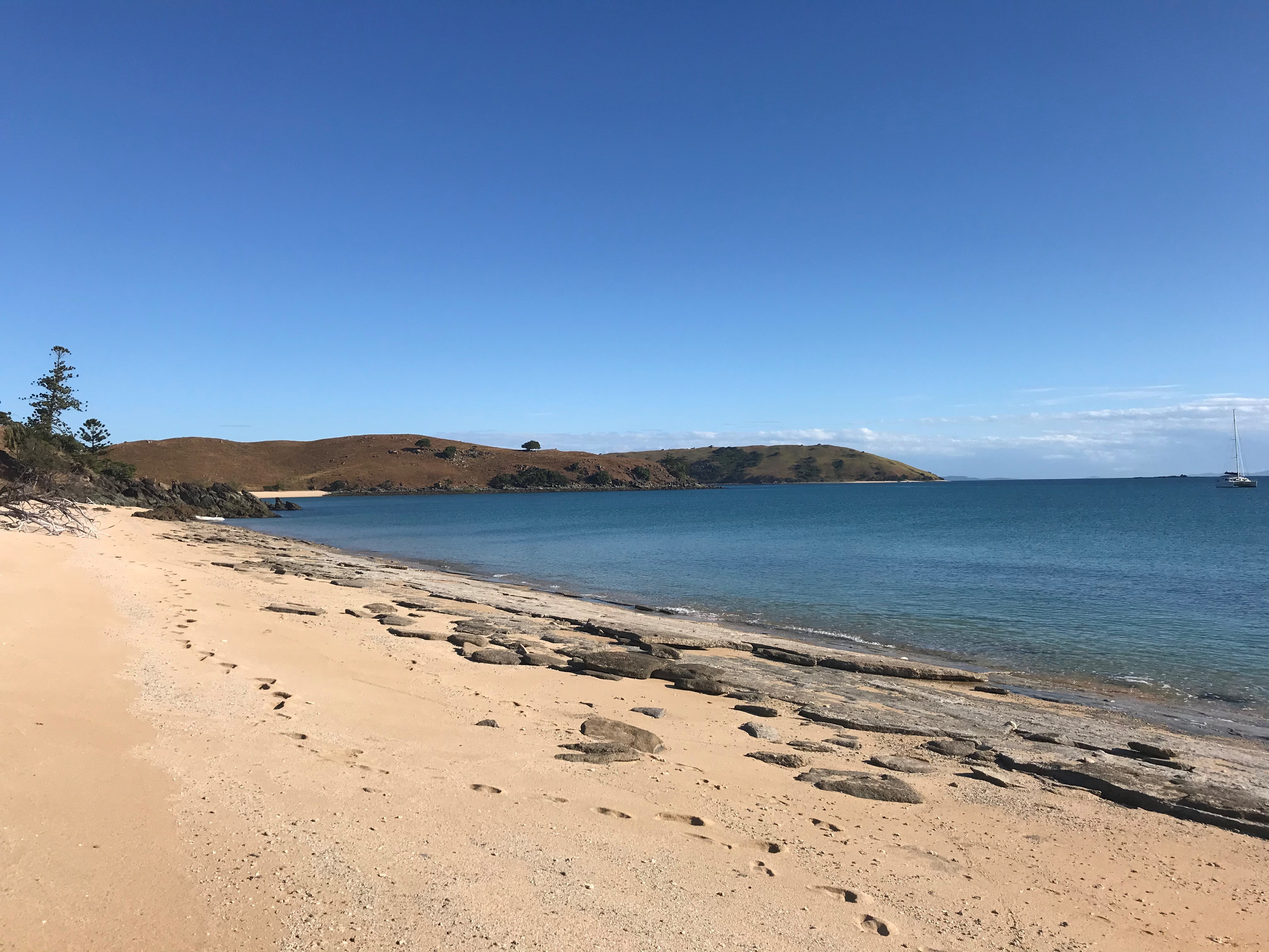
The Northumberland Islands are a scattered island chain off the eastern coast of Queensland, Australia. Geography and history The Northumberland Islands are to the south-east of the city of Mackay roughly between the latitudes 21°S and 22°S. All islands are of the continental type. The island group was named by James Cook during his historic voyage along Australia's eastern seaboard in 1770, after the First Duke of Northumberland, Hugh Percy. Both Cook and Matthew Flinders make note of the island group in their journals, Cook describing them as such: In 1855, a botany expedition led by naturalist Frederick Strange visited the islands on his ship ''Vision''. Four of the expedition were killed by Aboriginal people at Middle Percy Island. Those killed were Frederick Strange and his assistant Richard Spinks, William Spurling (ship's mate) and Andrew Gittings (ship's cook and steward). Captain Chimmo of the Royal Navy vessel , sailed to the island and conducted an investi ... [...More Info...] [...Related Items...] OR: [Wikipedia] [Google] [Baidu] |


