|
Fürth
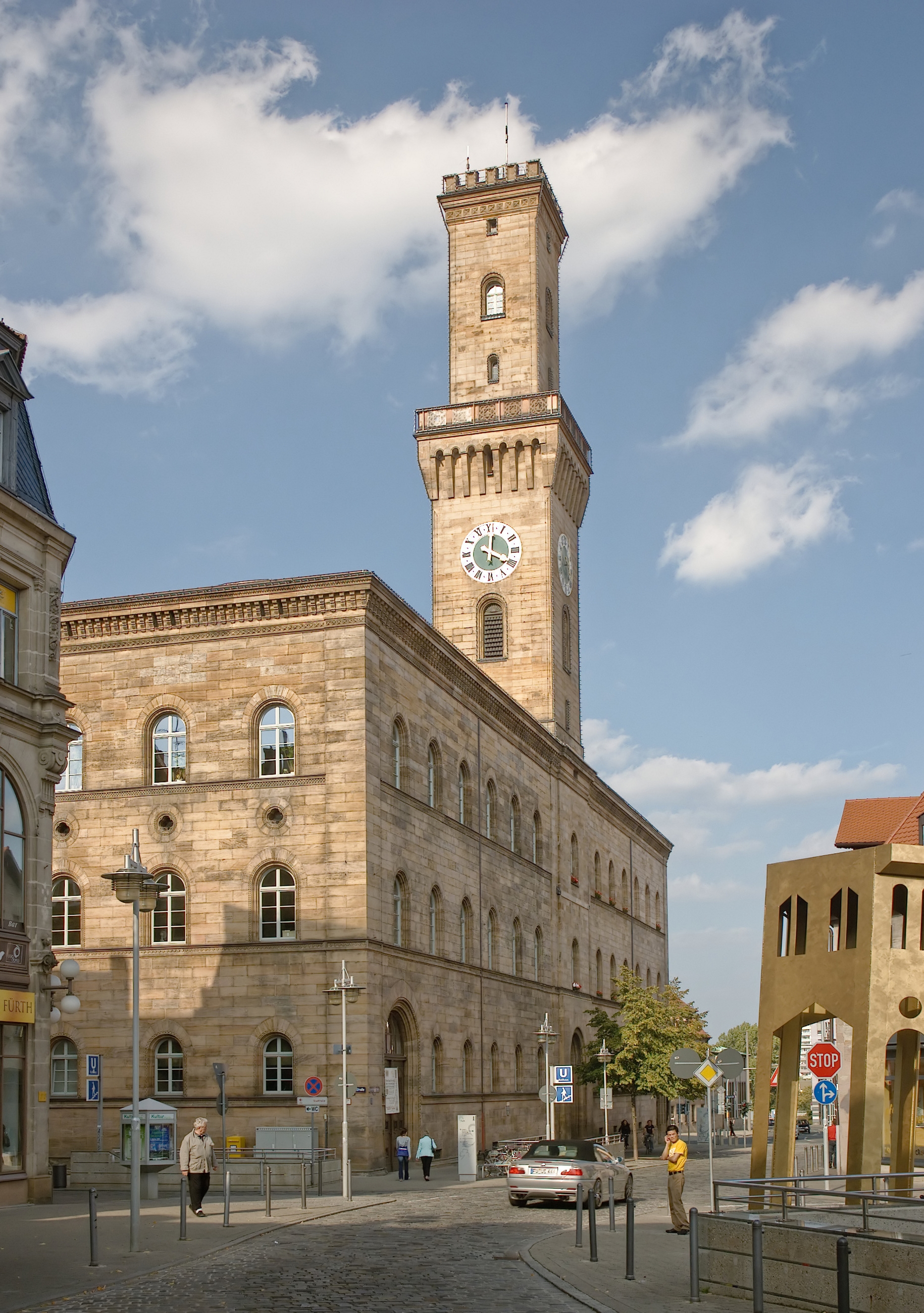
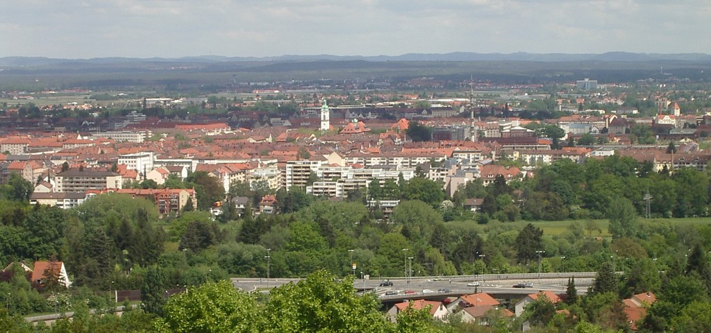
Fürth (; East Franconian German, East Franconian: ; ) is a List of cities and towns in Germany, city in northern Bavaria, Germany, in the administrative division (''Regierungsbezirk'') of Middle Franconia. It is the Franconia#Towns and cities, second-largest city in Franconia and now contiguous with the larger city of Nuremberg, the centres of the two cities being only apart. The city forms a continuous conurbation with the neighbouring cities of Nuremberg, Erlangen and Schwabach, which is the heart of an urban area region with around 1.4 million inhabitants, while the larger Nuremberg Metropolitan Region has a population of approximately 3.6 million. Fürth celebrated its thousand-year anniversary in 2007, its first mention being on 1 November 1007. Geography The historic centre of the town is to the east and south of the rivers Rednitz and Pegnitz River, Pegnitz, which join to form the Regnitz to the northwest of the Old Town. To the west of the town, on the far side ... [...More Info...] [...Related Items...] OR: [Wikipedia] [Google] [Baidu] |
Battle Of Fürth
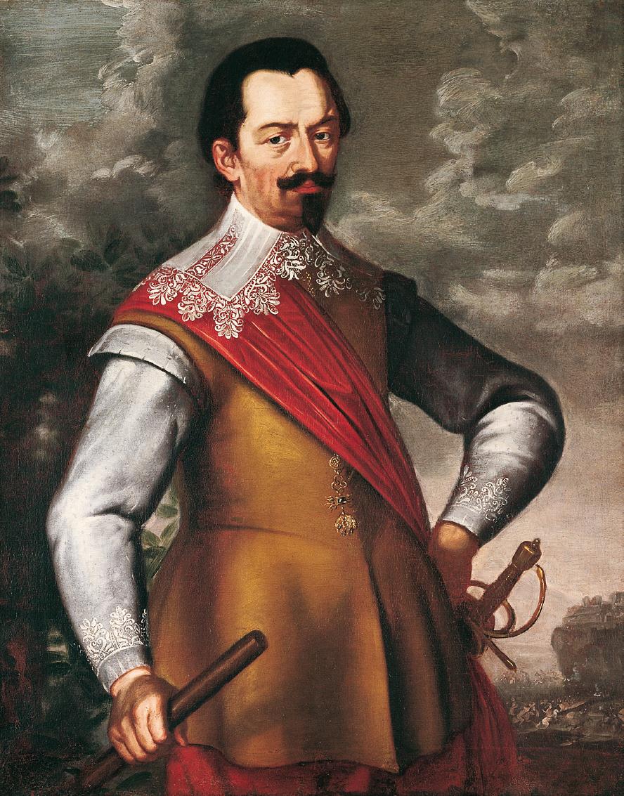
The Battle of Fürth was fought on 3 September 1632 between the Catholic forces of Holy Roman Emperor Ferdinand II and the Protestant forces of King Gustavus II Adolphus of Sweden during the period of Swedish intervention in the Thirty Years War. The tactical victory by the Catholic forces allowed the Imperial army to quickly advance into Saxony, while the Swedish forces were forced into retreat. Regional background Fürth was a market town, whose marketing license had been suspended under Holy Roman Emperor Heinrich III, losing the privilege and all that went with it, to nearby Nürnberg (English: Nuremberg) shortly after its founding. This situation changed after Heinrich's death, and in 1062 Fürth was once again permitted to have its own market. However, Fürth could not readily compete with Nuremberg, which had steadily grown and prospered in the ensuing years. In the following centuries, the City of Nuremberg became the most important town in the region, even making ... [...More Info...] [...Related Items...] OR: [Wikipedia] [Google] [Baidu] |
Cadolzburg
Cadolzburg (outdated also ''Kadolzburg'' , colloquially pronounced "Kalschbuʳch" or "Sporch" in the local dialect) is a municipality in the Middle Franconian Fürth (district), district of Fürth, in Bavaria, Germany. It is situated west of Fürth. Its name derives from its central castle, first being mentioned in the year 1157. Geography The topography varies significantly in its height. Neighborhood Neighboring Municipalities are: (beginning in the north then going clockwise) * Veitsbronn * Seukendorf * Fürth * Zirndorf * Ammerndorf * Großhabersdorf * Langenzenn, Langenzen Districts Cadolzburg consists of the city itself and 15 farther districts: History Middle Ages The place was first mentioned in 1157 when the reeve of Kadolzburg, Helmericus de Kadoldesburc, agreed on a territorial exchange between the Bishopric of Würzburg, diocese of Würzburg the Heilsbronn Abbey. So the name derives from ''Burg des Kadold'' meaning "Kadold's castle". If the castle had ... [...More Info...] [...Related Items...] OR: [Wikipedia] [Google] [Baidu] |
Erlangen
Erlangen (; , ) is a Middle Franconian city in Bavaria, Germany. It is the seat of the administrative district Erlangen-Höchstadt (former administrative district Erlangen), and with 119,810 inhabitants (as of 30 September 2024), it is the smallest of the eight major cities () in Bavaria. The number of inhabitants exceeded the threshold of 100,000 in 1974, making Erlangen a major city according to the statistical definition officially used in Germany. Together with Nuremberg, Fürth, and Schwabach, Erlangen forms one of the three metropolises in Bavaria. With the surrounding area, these cities form the Nuremberg Metropolitan Region, European Metropolitan Region of Nuremberg, one of 11 metropolitan areas in Germany. The cities of Nuremberg, Fürth, and Erlangen also form a triangle on a map, which represents the heartland of the Nuremberg conurbation. An element of the city that goes back a long way in history, but is still noticeable, is the settlement of Huguenots after the Revo ... [...More Info...] [...Related Items...] OR: [Wikipedia] [Google] [Baidu] |
Franconia
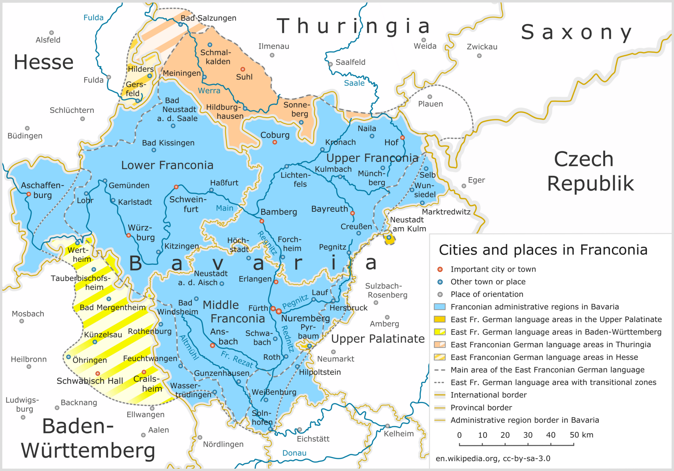
Franconia ( ; ; ) is a geographical region of Germany, characterised by its culture and East Franconian dialect (). Franconia is made up of the three (governmental districts) of Lower Franconia, Lower, Middle Franconia, Middle and Upper Franconia in Bavaria, the adjacent, East Franconian, Franconian-speaking South Thuringia, south of the Thuringian Forest—which constitutes the language boundary between Franconian and Thuringian—and the eastern parts of Heilbronn-Franconia in Baden-Württemberg. Those parts of the Vogtland lying in Saxony (largest city: Plauen) are sometimes regarded as Franconian as well, because the Vogtlandian dialects are mostly East Franconian. The inhabitants of Saxon Vogtland, however, mostly do not consider themselves Franconian. On the other hand, the inhabitants of the Hessian dialect, Hessian-speaking parts of Lower Franconia west of the Spessart (largest city: Aschaffenburg) do consider themselves Franconian, although not speaking the dialect. He ... [...More Info...] [...Related Items...] OR: [Wikipedia] [Google] [Baidu] |
Stein, Bavaria
Stein (; East Franconian: ''Schdah'') is a town in the district of Fürth, in Bavaria, Germany. It is situated 7 km south of Fürth, and 7 km southwest of Nuremberg (centre). Geography Stein is located in the metropolitan area Nürnberg/Fürth/Erlangen in Middle Franconia, Bavaria and is a part of the district of Fürth. It adjoins to Nuremberg in the north-west and lies on the left bank of the river Rednitz. Neighboring municipalities are Nuremberg, Rohr, Roßtal, Zirndorf and Oberasbach. Stein is divided into 11 districts: History Stein has first been mentioned in a document dating back to 1296. The origin of the settlement is linked to the first ''Rednitzbrücke'', a bridge which first crossed the river Rednitz. It was referred to as “Steinbruke” and probably caused the town's naming. In 1498, the two famous sculptors Veit Stoss and Adam Kraft were appointed as counselors for construction works on the bridge. Between the 15th and the 17th century ... [...More Info...] [...Related Items...] OR: [Wikipedia] [Google] [Baidu] |
Zirndorf
Zirndorf () is a town, which is part of the district of Fürth. It is located in northern Bavaria, Germany in the Regierungsbezirk of Middle Franconia. Neighbouring municipalities The following towns and municipalities share borders with Zirndorf; they are listed in clockwise order, starting in the north: * Fürth * Oberasbach * Stein * Roßtal * Ammerndorf * Cadolzburg History The first mention of the town occurs in a document dated 9 September 1297. The town was virtually destroyed during the Thirty Years' War, though the brewing industry established in the late seventeenth century helped in its recovery. In the mid-nineteenth century, the toy industry contributed to the town’s industrial development, and remains important today. Pinder Barracks In 1935 the city of Zirndorf applied to the German Reich Administration to have a caserne built here. The application was approved, with the condition of Reichsmarschall Hermann Göring, that construction must be in the Fra ... [...More Info...] [...Related Items...] OR: [Wikipedia] [Google] [Baidu] |
Nuremberg
Nuremberg (, ; ; in the local East Franconian dialect: ''Nämberch'' ) is the Franconia#Towns and cities, largest city in Franconia, the List of cities in Bavaria by population, second-largest city in the States of Germany, German state of Bavaria, and its 544,414 (2023) inhabitants make it the List of cities in Germany by population, 14th-largest city in Germany. Nuremberg sits on the Pegnitz (river), Pegnitz, which carries the name Regnitz from its confluence with the Rednitz in Fürth onwards (), and on the Rhine–Main–Danube Canal, that connects the North Sea to the Black Sea. Lying in the Bavarian Regierungsbezirk, administrative region of Middle Franconia, it is the largest city and unofficial capital of the entire cultural region of Franconia. The city is surrounded on three sides by the , a large forest, and in the north lies (''garlic land''), an extensive vegetable growing area and cultural landscape. The city forms a continuous conurbation with the neighbouring ... [...More Info...] [...Related Items...] OR: [Wikipedia] [Google] [Baidu] |
Oberasbach
Oberasbach is a municipality in the district of Fürth, in Bavaria, Germany. It is situated 6 km southwest of Fürth, and 10 km west of Nuremberg (centre). Stadtrat The local council has 24 members. The election in 2020 showed the following results: * 9 seats (CSU) * 4 seats (The Greens) * 3 seats (Free voters) * 3 seats (SPD) * 2 seats (BI Oberasbach) * 1 seat (AfD) * 1 seat (FDP) * 1 seat (The Left) Twin towns Oberasbach is twinned with: * Niederwürschnitz, Germany * Oława, Poland * Riolo Terme Riolo Terme ( or ) is a ''comune'' (municipality) in the Province of Ravenna in the Italian region Emilia-Romagna, located about southeast of Bologna and about southwest of Ravenna. The main attraction of the town are the termal baths. History U ..., Italy Personalities * Steffen Weinhold, (born 1986), handball player * Deniz Aytekin, (born 1978), football referee * Maurice Müller, (born 1992), soccer player See also * References Fürth (district) ... [...More Info...] [...Related Items...] OR: [Wikipedia] [Google] [Baidu] |
Bavaria
Bavaria, officially the Free State of Bavaria, is a States of Germany, state in the southeast of Germany. With an area of , it is the list of German states by area, largest German state by land area, comprising approximately 1/5 of the total land area of Germany, and with over 13.08 million inhabitants, it is the list of German states by population, second most populous German state, behind only North Rhine-Westphalia; however, due to its large land area, its population density is list of German states by population density, below the German average. Major cities include Munich (its capital and List of cities in Bavaria by population, largest city, which is also the list of cities in Germany by population, third largest city in Germany), Nuremberg, and Augsburg. The history of Bavaria includes its earliest settlement by Iron Age Celts, Celtic tribes, followed by the conquests of the Roman Empire in the 1st century BC, when the territory was incorporated into the provinces of Ra ... [...More Info...] [...Related Items...] OR: [Wikipedia] [Google] [Baidu] |
Vach
Vach is a district in the city of Fürth, Germany. Originally a separate town, it was incorporated into Fürth in 1972. It is first mentioned in documents concerning Gundekar II of Eichstätt in 1059. As of 1961, Vach has an area of 8.208 km². The village is located between the Rhine–Main–Danube Canal and the Regnitz, into which the Zenn and, further north, the Michaelbach flows. The flood plain of Regnitz and Zenn is listed as a landscape conservation area. The village has a population of 2815 and 712 inhabited houses as of 1987. Transportation The station " Vach Bahnhof" is a regular stop on the railway line between Fürth and Erlangen, but it is located approx.2km away from the district Vach in the district of Stadeln. Vach is also reachable by the motorway A73; from the north by the slip road "Eltersdorf" and from the south by the slip road "Ronhof". Sights The church, rectory and the "Kantorat" form an attractive ensemble of monuments. The church with its western ... [...More Info...] [...Related Items...] OR: [Wikipedia] [Google] [Baidu] |
Pegnitz River
The Pegnitz () is a river in Franconia in the German state of Bavaria. The Pegnitz has its source in the town of the same name at an altitude of and meets the Rednitz at in Fürth to form the Regnitz river. Shortly after the source, the Pegnitz unites with the long Fichtenohe while keeping the name of the shorter tributary. Some therefore consider the Fichtenohe as the upper course of the river Pegnitz. The source of the Fichtenohe is in Lindenhardt Forest ( Landkreis Bayreuth) north of the town of Pegnitz. The Pegnitz is about long, with Fichtenohe . The river is inhabited by numerous ducks, coots, swans, and gulls. Tributaries * Fichtenohe (left tributary) * Flembach (left tributary) * Hirschbach (left tributary) * Högenbach (left tributary from the Pommelsbrunn direction) * Happurger Bach (left tributary) * Sittenbach (right tributary) * Hammerbach (left tributary) * Sandbach (left tributary) * Schnaittach (right tributary) * Röttenbach (right tributary) * Bit ... [...More Info...] [...Related Items...] OR: [Wikipedia] [Google] [Baidu] |
Nuremberg Metropolitan Region
The Nuremberg Metropolitan Region comprises 3.5 million people on 21,800 square kilometers. With a gross domestic product of 134 billion euros and about 1.9 million employees, this metropolitan region is one of the strongest economic areas in Germany. The major cities are Nuremberg, Fürth, Erlangen, Bayreuth and Bamberg. Geographic The Nuremberg Metropolitan Region encloses geographically the administrative region of Middle Franconia, whole Upper Franconia, two territorial authorities of Lower Franconia and about half of the Upper Palatinate. Cities and rural district of the region The region includes the cities Ansbach, Amberg, Bamberg, Bayreuth, Coburg, Erlangen, Fürth, Hof, Nuremberg, Schwabach and Weiden in der Oberpfalz as well as the rural districts of Amberg-Sulzbach, Ansbach, Bamberg, Bayreuth, Coburg, Erlangen-Höchstadt, Forchheim, Fürth, Haßberge, Hof, Kitzingen, Kronach, Kulmbach, Lichtenfels, Neumarkt, Neustadt (Aisch)-Bad Windsheim, Neustadt an der Wa ... [...More Info...] [...Related Items...] OR: [Wikipedia] [Google] [Baidu] |
