|
Fudai, Iwate
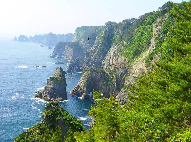
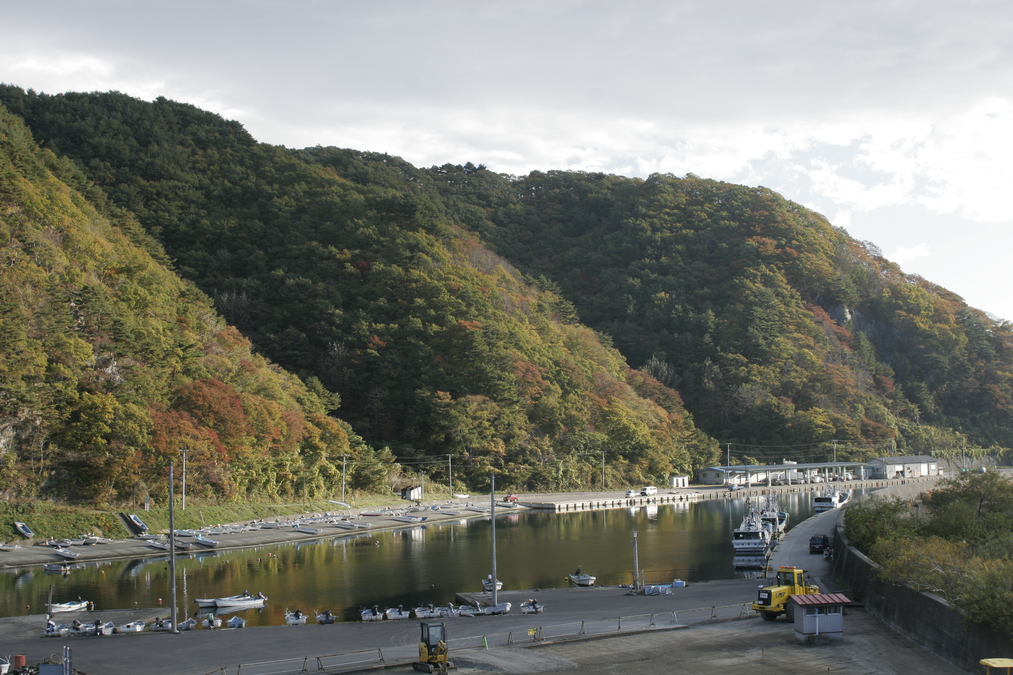
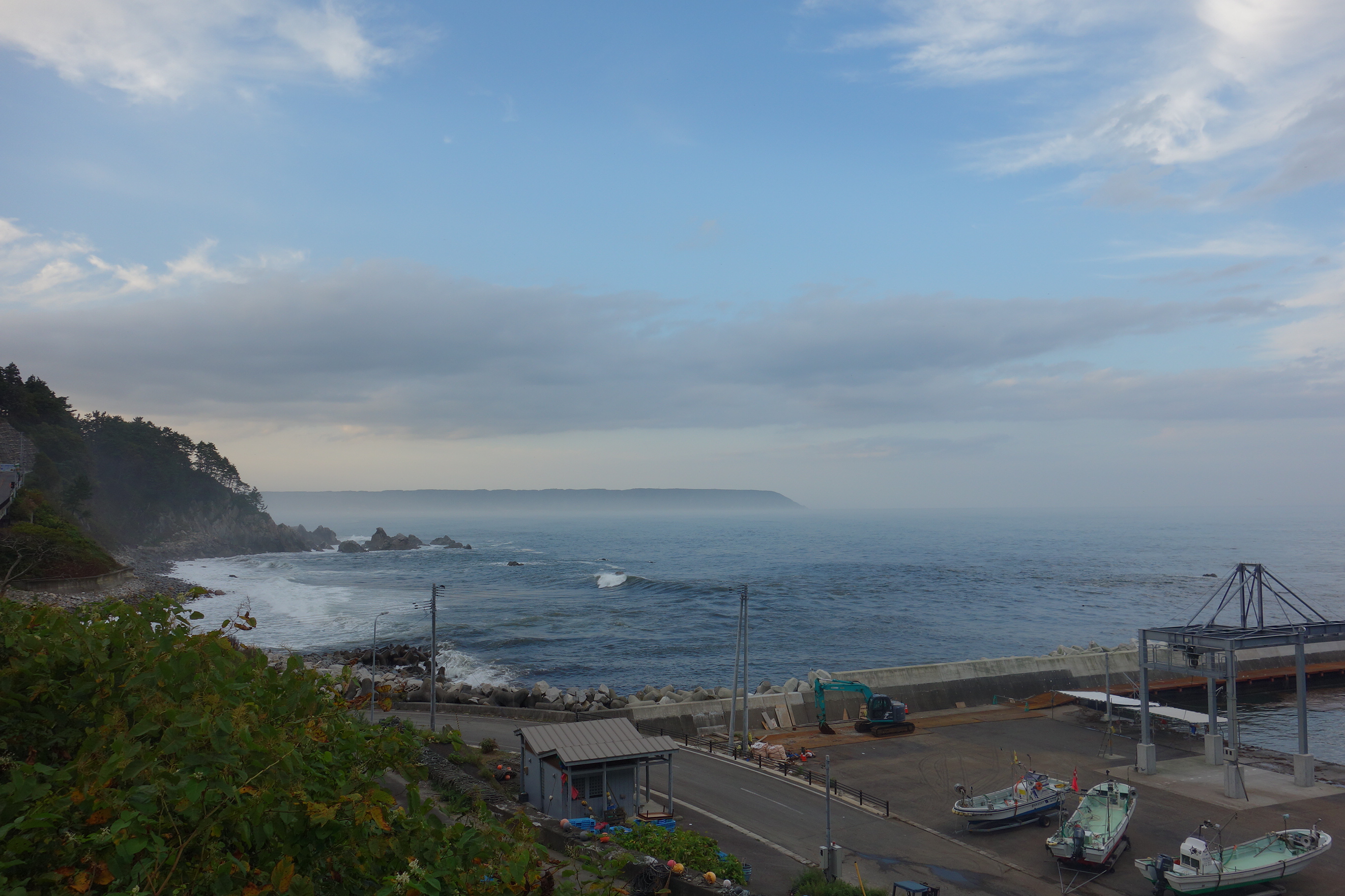
is a village located in Iwate Prefecture, Japan. , the village had an estimated population of 2,607, and a population density of 37.4 persons per km2 in 1,126 households. The total area of the village is . Geography Fudai is a coastal mountainous community situated on the Sanriku Coast ria along the Pacific Ocean in northern Iwate. The southern part of the village, an area called , included a part of the Rikuchu Kaigan National Park, which is now part of the Sanriku Fukkō National Park. It features an observation point to view scenic seaside cliffs. Neighboring municipalities Iwate Prefecture * Noda *Iwaizumi * Tanohata Climate Fudai has a cold humid climate (Köppen climate classification ''Cfa'') characterized by mild summers and cold winters. The average annual temperature in Fudai is 10.1 °C. The average annual rainfall is 1201 mm with September as the wettest month and February as the driest month. The temperatures are highest on average in August, at aro ... [...More Info...] [...Related Items...] OR: [Wikipedia] [Google] [Baidu] |
Villages Of Japan
A is a local administrative unit in Japan. It is a local public body along with , , and . Geographically, a village's extent is contained within a prefecture. It is larger than an actual settlement, being in actuality a subdivision of a rural , which are subdivided into towns and villages with no overlap and no uncovered area. As a result of mergers and elevation to higher statuses, the number of villages in Japan is decreasing. Currently, 13 prefectures no longer have any villages: Tochigi (since March 20, 2006), Fukui (since March 3, 2006), Ishikawa (since March 1, 2005), Shizuoka (since July 1, 2005), Hyōgo (since April 1, 1999), Mie (since November 1, 2005), Shiga (since January 1, 2005), Hiroshima (since November 5, 2004), Yamaguchi (since March 20, 2006), Ehime (since January 16, 2005), Kagawa (since April 1, 1999), Nagasaki (since October 1, 2005), and Saga (since March 20, 2006). The six villages in the Northern Territories dispute and Atarashiki-mur ... [...More Info...] [...Related Items...] OR: [Wikipedia] [Google] [Baidu] |
Population Density
Population density (in agriculture: Stock (other), standing stock or plant density) is a measurement of population per unit land area. It is mostly applied to humans, but sometimes to other living organisms too. It is a key geographical term.Matt RosenberPopulation Density Geography.about.com. March 2, 2011. Retrieved on December 10, 2011. In simple terms, population density refers to the number of people living in an area per square kilometre, or other unit of land area. Biological population densities Population density is population divided by total land area, sometimes including seas and oceans, as appropriate. Low densities may cause an extinction vortex and further reduce fertility. This is called the Allee effect after the scientist who identified it. Examples of the causes of reduced fertility in low population densities are * Increased problems with locating sexual mates * Increased inbreeding Human densities Population density is the number of people pe ... [...More Info...] [...Related Items...] OR: [Wikipedia] [Google] [Baidu] |
Remote Work
Remote work, also called work from home (WFH), work from anywhere, telework, remote job, mobile work, and distance work is an employment arrangement in which employees do not commute to a central place of work, such as an office building, warehouse, or retail store. Instead, work can be accomplished in the home, such as in a study, a small office/home office and/or a telecentre. A company in which all workers perform remote work is known as a distributed company. History In the early 1970s, technology was developed that linked satellite offices to downtown mainframes through dumb terminals using telephone lines as a network bridge. The terms "telecommuting" and "telework" were coined by Jack Nilles in 1973. In 1979, five IBM employees were allowed to work from home as an experiment. By 1983, the experiment was expanded to 2,000 people. By the early 1980s, branch offices and home workers were able to connect to organizational mainframes using personal computers and termi ... [...More Info...] [...Related Items...] OR: [Wikipedia] [Google] [Baidu] |
Digital Transformation
Digital transformation is the adoption of digital technology by an organization to digitize non-digital products, services or operations. The goal for its implementation is to increase value through innovation, invention, customer experience or efficiency. History Digitization is the process of converting analog information into digital form using an analog-to-digital converter, such as in an image scanner or for digital audio recordings. As usage of the internet has increased since the 1990s, the usage of digitization has also increased. Digital transformation, however, is broader than just the digitization of existing processes. Digital transformation entails considering how products, processes and organizations can be changed through the use of new, digital technologies. A 2019 review proposes a definition of digital transformation as "a process that aims to improve an entity by triggering significant changes to its properties through combinations of information, computing ... [...More Info...] [...Related Items...] OR: [Wikipedia] [Google] [Baidu] |
Second Kishida Cabinet
The Second Kishida Cabinet is the 101st Cabinet of Japan and was formed by Fumio Kishida, leader of the Liberal Democratic Party and Prime Minister of Japan. The government is a coalition between the Liberal Democratic Party and the Komeito and controls both the upper and lower houses of the National Diet. It is the successor to Kishida's previous cabinet. Background After Fumio Kishida called for a general election and won a supermajority on 31 October 2021, he was re-elected as the prime minister at a special session of the National Diet on 10 November 2021. As his first cabinet only served 37 days, the shortest term in history, Kishida reappointed nearly all of the ministers from the previous cabinet following re-election. On 10 August 2022, the cabinet was reshuffled. 7 MPs with ties to the Unification Church were dismissed following the assassination of former Prime Minister Shinzo Abe and increasing media scrutiny of LDP officials' close ties with the church. On ... [...More Info...] [...Related Items...] OR: [Wikipedia] [Google] [Baidu] |
Japan Meteorological Agency
The , abbreviated JMA, is an agency of the Ministry of Land, Infrastructure, Transport and Tourism. It is charged with gathering and providing results for the public in Japan that are obtained from data based on daily scientific observation and research into natural phenomena in the fields of meteorology, hydrology, seismology and volcanology, among other related scientific fields. Its headquarters is located in Minato, Tokyo. JMA is responsible for gathering and reporting weather data and forecasts for the general public, as well as providing aviation and marine weather. JMA other responsibilities include issuing warnings for volcanic eruptions, and the nationwide issuance of earthquake warnings of the Earthquake Early Warning (EEW) system. JMA is also designated one of the Regional Specialized Meteorological Centers of the World Meteorological Organization (WMO). It is responsible for forecasting, naming, and distributing warnings for tropical cyclones in the No ... [...More Info...] [...Related Items...] OR: [Wikipedia] [Google] [Baidu] |
Humid Subtropical Climate
A humid subtropical climate is a zone of climate characterized by hot and humid summers, and cool to mild winters. These climates normally lie on the southeast side of all continents (except Antarctica), generally between latitudes 25° and 40° and are located poleward from adjacent tropical climates. It is also known as warm temperate climate in some climate classifications. Under the Köppen climate classification, ''Cfa'' and ''Cwa'' climates are either described as humid subtropical climates or warm temperate climates. This climate features mean temperature in the coldest month between (or ) and and mean temperature in the warmest month or higher. However, while some climatologists have opted to describe this climate type as a "humid subtropical climate", Köppen himself never used this term. The humid subtropical climate classification was officially created under the Trewartha climate classification. In this classification, climates are termed humid subtropical when ... [...More Info...] [...Related Items...] OR: [Wikipedia] [Google] [Baidu] |
Tanohata, Iwate
is a village located in Iwate Prefecture, Japan. , the village had an estimated population of 3,244, and a population density of 21 persons per km² in 1,398 households. The total area of the village is . Geography Tanohata is a coastal mountainous community situated on the rocky ria Sanriku Coast along the Pacific coast of Iwate. Parts of the village are within the borders of the Sanriku Fukkō National Park. Neighboring municipalities Iwate Prefecture *Iwaizumi * Fudai Climate Tanohata has a cold humid climate (Köppen climate classification ''Cfa'') characterized by mild summers and cold winters. The average annual temperature in Tanohata is 10.1 °C. The average annual rainfall is 1201 mm with September as the wettest month and February as the driest month. The temperatures are highest on average in August, at around 22.6 °C, and lowest in January, at around -1.1 °C. Demographics Per Japanese census data, the population of Tanohata peaked at around t ... [...More Info...] [...Related Items...] OR: [Wikipedia] [Google] [Baidu] |
Iwaizumi, Iwate
is a town located in Iwate Prefecture, Japan. , the town had an estimated population of 8,987, and a population density of 9.1 persons per km² in 4366 households. The total area of the town is . Geography Iwaizumi is in the Kitakami Mountains of northeast Iwate prefecture, east of the prefectural capital of Morioka. It has a small coastline on the Pacific Ocean to the east. The area has numerous limestone caves, including the Ryūsendō. Neighboring municipalities Iwate Prefecture * Morioka * Kuji * Miyako * Fudai * Tanohata * Kuzumaki * Noda Climate Iwaizumi has a humid climate (Köppen climate classification ''Cfa'') characterized by mild summers and cold winters with heavy snowfall. The average annual temperature in Iwaizumi is 9.5 °C. The average annual rainfall is 1283 mm with September as the wettest month and February as the driest month. The temperatures are highest on average in August, at around 22.3 °C, and lowest in January, at around −2. ... [...More Info...] [...Related Items...] OR: [Wikipedia] [Google] [Baidu] |
Noda, Iwate
is a village located in Iwate Prefecture, Japan. , the village had an estimated population of 4,201, and a population density of 52 persons per km² in 1660 households. The total area of the village is . Geography Noda is located in far northeastern Iwate Prefecture, bordered by the Pacific Ocean to the east. The western portion of the village is within the Kitakami Mountains. Parts of the coastline of Noda are within the borders of the Sanriku Fukkō National Park. Neighboring municipalities Iwate Prefecture *Kuji * Iwaizumi * Fudai Climate Noda has a cold oceanic climate (Köppen climate classification ''Cfb'') characterized by mild summers and cold winters with heavy snowfall. The average annual temperature in Noda is 8.7 °C. The average annual rainfall is 1273 mm with September as the wettest month and February as the driest month. The temperatures are highest on average in August, at around 21.4 °C, and lowest in January, at around -2.9 °C. Demogra ... [...More Info...] [...Related Items...] OR: [Wikipedia] [Google] [Baidu] |
Sanriku Fukkō National Park
(''lit''. "Sanriku Reconstruction National Park") is a national park extending along the Sanriku Coast of Japan from Hachinohe in Aomori Prefecture through Iwate Prefecture to Kesennuma in Miyagi Prefecture. The national park was created on 24 May 2013 and covers a land area of History On 2 May 1955 the was created in the Tōhoku region of Honshū in northern Japan. The park extended for 180 kilometers from north to south along the coastline of the Pacific Ocean from northern Miyagi prefecture to northern Iwate prefecture. It had a land area of . On 24 May 2013 the park was incorporated into Sanriku Fukkō National Park. This was in the aftermath of the 2011 Tōhoku earthquake and tsunami. It also includes the former Tanesashi Kaigan Hashikamidake Prefectural Natural Park. On 31 March 2015, the Ministry of the Environment extended the park to include the former Minami Sanriku Kinkasan Quasi-National Park. Subsequently, the park will be extended to include Kesennuma Prefec ... [...More Info...] [...Related Items...] OR: [Wikipedia] [Google] [Baidu] |


