|
Francistown
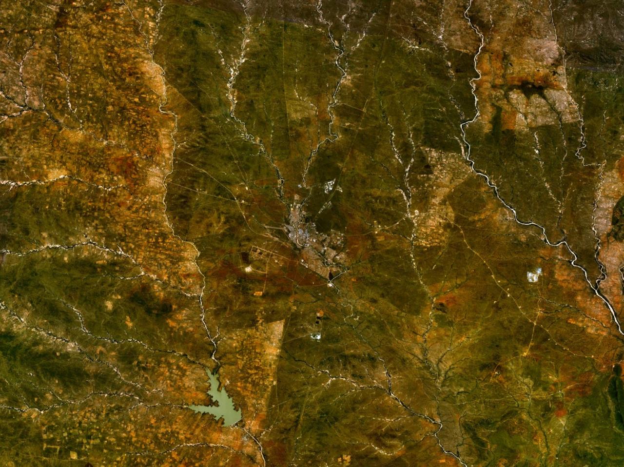
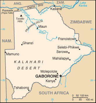
Francistown is the second-largest city in Botswana, with a population of about 103,417 inhabitants and 147,122 inhabitants in its agglomeration at the 2022 census. It is located in eastern Botswana, about north-northeast from the capital, Gaborone. Francistown is located at the confluence of the Tati and Ntshe rivers, and near the Shashe River (tributary to the Limpopo) and from the international border with Zimbabwe. Francistown was the centre of Southern Africa's first gold rush and is still surrounded by old and abandoned mines. The City of Francistown is an administrative district, separated from North-East District. It is administered by Francistown City Council. The main language spoken and used in and around Francistown is Kalanga. Other languages used in the area are isiNdebele, ChiShona as well as SeTswana. Francistown is the only city in Botswana with an English name. There are no English-language named towns and only a couple of villages with English names. ... [...More Info...] [...Related Items...] OR: [Wikipedia] [Google] [Baidu] |
Phillip Gaonwe Matante International Airport
Phillip Gaonwe Matante International Airport , also known as Francistown International Airport, serves Francistown, Botswana. The public airport, which caters to both commercial and national military's aircraft, is on the western edge of the city. The airport was named after Philip Matante. Facilities The new terminal building opened in 2011 and the old terminal at the eastern end of the airport was transferred to the Botswana Defence Force. There are no jet bridges, thus passengers must walk from the terminal to designated parking areas on the Tarmacadam, tarmac in front of the terminal. A new control tower was built next to the new terminal. The passenger terminal has an arrival and departure hall. A small retail area hosts car rental companies, an ATM and a post office. Other tenants include Customs and Excise, Immigration, Meteorological Service Office, Air BP Fuels, and Air Botswana Offices. Airline and destinations Francistown handles domestic and regional (within Afr ... [...More Info...] [...Related Items...] OR: [Wikipedia] [Google] [Baidu] |
Obed Itani Chilume Stadium
Obed Itani Chilume Stadium (previously known as Francistown Sports Complex) is a multi-use stadium in Francistown, Botswana. It is used mostly for football Football is a family of team sports that involve, to varying degrees, kick (football), kicking a football (ball), ball to score a goal (sports), goal. Unqualified, football (word), the word ''football'' generally means the form of football t ... matches and usually hosts the home matches of Francistown-based TAFIC F.C. The stadium can accommodate 26,000 spectators, making it the largest stadium in the country. It was officially opened in 2015, five years behind schedule. Due to delays, the stadium could not be completed in time for the 2010 World Cup as initially planned. Originally called the Francistown Sports Complex, it was renamed as Obed Itani Chilume Stadium in October 2019. The stadium also hosts athletics meets for local high schools, as well as national trials and competitions. References External links ... [...More Info...] [...Related Items...] OR: [Wikipedia] [Google] [Baidu] |
Botswana
Botswana, officially the Republic of Botswana, is a landlocked country in Southern Africa. Botswana is topographically flat, with approximately 70 percent of its territory part of the Kalahari Desert. It is bordered by South Africa to the south and southeast, Namibia to the west and north, Zambia to the north, and Zimbabwe to the northeast. With a population of slightly over 2.4 million people and a comparable land area to France, Botswana is one of the List of countries and dependencies by population density, most sparsely populated countries in the world. It is essentially the nation-state of the Tswana people, who constitute nearly 80 percent of the population. The Tswana ethnic group are descended mainly from Bantu peoples, Bantu-speaking peoples who Bantu expansion, migrated into southern Africa, including modern Botswana, in several waves before AD 600. In 1885, the British Empire, British colonised the area and declared a protectorate named Bechuanaland. As part of the ... [...More Info...] [...Related Items...] OR: [Wikipedia] [Google] [Baidu] |
North-East District (Botswana)
The North-East District is one of the administrative districts of Botswana. Its capital is Francistown. In 2011, North-East had a population of 60,264 people. The district is predominantly occupied by Kalanga-speaking people, the BaKalanga. The district is administered by a district administration and district council, which are responsible for local administration. In the north and east, the district borders the Matabeleland South Province of Zimbabwe, and the border in the east is predominantly along the Ramokgwebana River. In the south and west, the district borders the Central District along the Shashe River. Geography Most parts of Botswana have tableland slopes sliding from east to west. It is predominantly savannah, with tall grasses, bushes, and trees. The region has an average elevation of around above sea level. The annual precipitation is around , most of which is received during the summer season from November to May. There are conflicts between agricultural exp ... [...More Info...] [...Related Items...] OR: [Wikipedia] [Google] [Baidu] |
Shashe River
The Shashe River (or Shashi River) is a major left-bank tributary of the Limpopo River in Zimbabwe. It rises northwest of Francistown, Botswana and flows into the Limpopo River where Botswana, Zimbabwe and South Africa meet. The confluence is at the site of the Greater Mapungubwe Transfrontier Conservation Area. Hydrology The Shashe is a highly ephemeral river, with flow generally restricted to a few days of the year. The river contributes 12.2% of the mean annual[...More Info...] [...Related Items...] OR: [Wikipedia] [Google] [Baidu] |
Gaborone
Gaborone ( , , ) is the Capital city, capital and List of cities in Botswana, largest city of Botswana, with a population of 246,325 based on the 2022 census, about 10% of the total population of Botswana. Its metropolitan area is home to 534,842 inhabitants at the 2022 census. Gaborone is situated between Kgale Hill and Oodi Hill, near the confluence of the Notwane River and Segoditshane River in the southeastern corner of Botswana, within from the South African border. The city is served by the Sir Seretse Khama International Airport. It is an administrative district in its own right, but is the capital of the surrounding South-East District (Botswana), South-East District. Locals often refer to the city as ''GC or Motse-Mshate''. The city of Gaborone is named after Chief Gaborone of the Tlokwa people, who once controlled land nearby. Because it was not affiliated with any specific indigenous group and was close to fresh water, the city was New town, planned to be the capi ... [...More Info...] [...Related Items...] OR: [Wikipedia] [Google] [Baidu] |
Telephone Numbers In Botswana
Fixed line numbers in Botswana are seven digits long in a closed telephone numbering plan, with the geographical area being indicated by the first two or three digits, meaning that there are no area codes. The country was allocated its own country code by the International Telecommunication Union, +267, in the late 1960s. Calling formats * xx xxxxx or xxx xxxxx – calling within Botswana * +267 xx xxxxx or +267 xxx xxxxx – calling from outside Botswana The NSN length is seven digits for fixed lines, and eight digits for VoIP and mobile ranges. Until the 1990s, calls to Botswana could be made from South Africa using the regional code 0192. Department of Posts and Telecommunications, 1991, page 21 General allocations Fixed allocations in Botswana< ...
|
Tati Goldfields
The Tati Goldfields are a mineral-rich band in Botswana and Zimbabwe in southern Africa. The band runs approximately long by wide, and crosses the Tati River. It is the southernmost of the gold-bearing bands in the Archaen greenstone ( schist) belts of Zimbabwe. It is estimated that between 1866 and 1963 over 200,000 ounces of gold were produced from mines in the Tati Goldfields. History The area along the Tati River was pit mined by the Bakalanga before the arrival of Europeans. It may have been one of the sources of wealth for the Great Zimbabwe empire (c. 1200 to 1450). In 1866, Karl Mauch discovered the Tati goldfield, making it the first one discovered by Europeans in southern Africa. This led to the first South African gold rush. Geology The gold mineralization occurs in quartz veins, intruded into the volcano-sedimentary rocks of the Tati greenstone belt. Other economic minerals occur including nickel and copper. The major formation is the Selkirk Formation which ... [...More Info...] [...Related Items...] OR: [Wikipedia] [Google] [Baidu] |
Botswana Democratic Party
The Botswana Democratic Party (Abbreviation, abbr. BDP, colloquially known as Domkrag) is a centre-right politics, centre-right political party in Botswana. From the country's 1965 Bechuanaland general election, inaugural election in 1965 until the 2024 Botswana general election, 2024 general election the party governed the country without interruption for 58 years. At the time of its defeat, the BDP was the longest continuous ruling party in the democratic world. The party was founded in February 1962 as the Bechuanaland Democratic Party while the country was a Bechuanaland, British protectorate. It adopted its current name following Botswana's independence in 1966. In its beginnings, it was led by Seretse Khama, the country's first president and his successor Quett Masire. Subsequent presidents of Botswana, Festus Mogae, Ian Khama and Mokgweetsi Masisi, have chaired the party. The party won an overwhelming majority in the first elections under universal suffrage in 1965 Bechuanal ... [...More Info...] [...Related Items...] OR: [Wikipedia] [Google] [Baidu] |
List Of Cities In Botswana
The following is a list of cities and towns or villages in Botswana with population of over 1,000 citizens in the year 2022. Capitals of the administrative divisions (cities, towns or districts) are shown in boldface. References [...More Info...] [...Related Items...] OR: [Wikipedia] [Google] [Baidu] |
Tati River
The Tati River is a river in northeast Botswana, a tributary of the Shashe River, which in turn is a tributary of the Limpopo River. The river flows through Francistown, where it is joined by the Ntshe (or Inchwe) River from the left. History About 1865 a hunter came across traces of old gold diggings near the Tati. He invited Karl Mauch to accompany him on his next trip, and in 1866 Mauch announced that he had found the Tati goldfields extending about which started the first gold rush in Southern Africa the following year. In 1869 the Englishman Daniel Francis came to hunt for gold on the river, before heading south to the Kimberley diamond fields in 1870. The gold was hard to extract, and the gold rush subsided. Francis returned in 1880 and obtained mining rights from King Lobengula. Mining activity revived in the 1880s and 1890s, and Francistown was established in 1897 when the railway arrived. The town was named after Francis, who owned most of the land in the area. Use Th ... [...More Info...] [...Related Items...] OR: [Wikipedia] [Google] [Baidu] |
Gold Rush
A gold rush or gold fever is a discovery of gold—sometimes accompanied by other precious metals and rare-earth minerals—that brings an onrush of miners seeking their fortune. Major gold rushes took place in the 19th century in Australia, Greece, New Zealand, Brazil, Chile, South Africa, the United States, and Canada while smaller gold rushes took place elsewhere. In the 19th century, the wealth that resulted was distributed widely because of reduced migration costs and low barriers to entry. While gold mining itself proved unprofitable for most diggers and mine owners, some people made large fortunes, and merchants and transportation facilities made large profits. The resulting increase in the world's gold supply stimulated global trade and investment. Historians have written extensively about the mass migration, trade, colonization, and environmental history associated with gold rushes. Gold rushes were typically marked by a general buoyant feeling of a "free-for-al ... [...More Info...] [...Related Items...] OR: [Wikipedia] [Google] [Baidu] |


