|
Flå
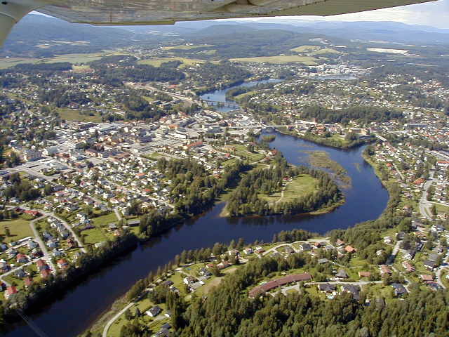
Flå is a municipality in Buskerud county, Norway. The administrative centre of the municipality is the village of Flå. The municipality of Flå was established when it was separated from the municipality of Nes on 1 January 1905. The municipality lies at the most southeasterly point in the valley and traditional region of Hallingdal. General information Name The Old Norse form of the name was ''Flóða sokn'' (''sokn'' means parish). This is the plural genitive case of ''flœð'' meaning "flood" (probably because flooding has been a problem for many farms in the river valley). Prior to 1921, the name was written ''"Flaa"''. Coat-of-arms The coat-of-arms is from modern times. They were granted on 1 March 1985. The arms show a black bear on a gray/silver background. This was chosen because there used to be many bears in the Vassfaret area. Prior to 1985, the municipality used a logo with a bear walking through the area. History Ancient routes went to Vestlandet throu ... [...More Info...] [...Related Items...] OR: [Wikipedia] [Google] [Baidu] |
List Of Municipalities Of Norway
Municipalities in Norway are the basic unit of local government. Norway is divided into 15 administrative regions, called Counties of Norway, counties. These counties are subdivided into 357 municipality, municipalities (as of 2024). The capital city Oslo is both a county and a municipality. Municipalities are responsible for primary education (through 10th grade), outpatient Health care, health services, old age, senior citizen services, welfare spending, welfare and other Social work, social services, zoning, economic development, and municipal roads and utilities. The municipality is governed by a Municipal council (Norway), municipal council of Direct election, directly elected representatives. The mayor is Indirect election, indirectly elected by a vote of the municipal council. Law enforcement and Church of Norway, church services are provided at a national level in Norway. Municipalities are undergoing continuous change by dividing, consolidating, and adjusting boundaries. ... [...More Info...] [...Related Items...] OR: [Wikipedia] [Google] [Baidu] |
Buskerud
Buskerud () is a Counties of Norway, county and a current electoral district in Norway, bordering Akershus, Oslo, Innlandet, Vestland, Telemark and Vestfold. The region extends from the Oslofjord and Drammensfjorden in the southeast to Hardangervidda mountain range in the northwest. The county administration was in modern times located in Drammen. Buskerud was merged with Akershus and Østfold into the newly created Viken (county), Viken County on 1 January 2020. On 23 February 2022, the Viken County Council voted in a 49 against 38 decision to submit an application to the Norwegian government for a county demerger. Due to this, Buskerud (except the area forming the defunct municipalities of Røyken and Hurum) was re-established in 2024. Etymology The county was named after the old manor Buskerud Manor, Buskerud () (Biskopsrøysa) located on the west side of the Drammenselva, Drammen River in Åmot, Buskerud, Åmot, Modum municipality. The first element is the genitive case of ', ... [...More Info...] [...Related Items...] OR: [Wikipedia] [Google] [Baidu] |
Vassfaret
Vassfaret is a forested mountain valley in southern Norway. The valley is located on the border of the municipalities of Flå, Nesbyen, and Ringerike in Buskerud county and Sør-Aurdal Municipality in Innlandet county. The valley lies between the Hallingdal and Hedalen valleys in the traditional district of Valdres. The steep forest and mountain slopes on both sides of the valley have peaks reaching up to above sea level at Sørbølfjellet in Flå municipality in the furthest southwest part of Vassfaret. The area was one heavily inhabited by bears. Protected area The valley includes several nature conservation areas: * Vassfaret and Vidalen conservation area (''Vassfaret/Vidalen landskapsvernområde'') covering * Inner Vassfaret conservation area (''Indre Vassfaret landskapsvernområde''), covering * There are also 9 small nature reserves, a total of with very strict protection rules. History Vassfaret is characterized by low alpine coniferous forests, heather, and bo ... [...More Info...] [...Related Items...] OR: [Wikipedia] [Google] [Baidu] |
Hallingdal
Hallingdal () is a valley as well as a traditional district located in the traditional and electoral district Buskerud county in Norway. It consists of six municipalities: Flå, Nes, Gol, Hemsedal, Ål and Hol. Hallingdal is one of the major valleys of eastern Norway, on an area of 5,830 square kilometers. Hallingdal lies in the northern part of the county of Buskerud. The valley stretches from Gulsvik by Lake Krøderen to the border with Hordaland and Sogn og Fjordane. Central to the geography is relatively flat mountain area which lies above sea level. The valley is V-shaped and is drained by the Hallingdal River which originates in the western parts of Hardangervidda and flows eastwards later southwards through Hallingdal. Etymology The Old Norse form of the name was ''Haddingjadalr''. The first recorded case beginning with ''Hall-'' is from 1443. The first element seems to be the genitive case of the name of the people '' Haddingjar'' or of the male name ''Hadd ... [...More Info...] [...Related Items...] OR: [Wikipedia] [Google] [Baidu] |
Ringerike (municipality)
Ringerike is a Municipalities of Norway, municipality in Buskerud Counties of Norway, county, Norway. It is part of the Districts of Norway, traditional region of Ringerike (traditional district), Ringerike. The administrative centre of the municipality is the List of cities in Norway, town of Hønefoss. The municipality of Ringerike was created on 1 January 1964 after the merger of the town of Hønefoss and the rural municipalities of Hole, Norway, Hole, Norderhov, Tyristrand, and Ã…dal. However, the area of Hole was removed from the municipality of Ringerike on 1 January 1977 to become a separate municipality once again. The historic area of Ringerike included not just the modern municipality of Ringerike but also Hole and Krødsherad, Modum, and Sigdal. General information Etymology The Old Norse language, Norse form of this name was ''HringarÃki''. The first element is (probably) the genitive plural of ''hringir'', the name of an old Germanic peoples, Germanic tribe. The la ... [...More Info...] [...Related Items...] OR: [Wikipedia] [Google] [Baidu] |
Nes, Buskerud
Nesbyen is a Municipalities of Norway, municipality in Buskerud Counties of Norway, county, Norway. It is part of the Districts of Norway, traditional region of Hallingdal. The administrative centre of the municipality is the village of Nesbyen. The parish of ''Næs'' was established as a municipality on 1 January 1838 (see formannskapsdistrikt). The area of FlÃ¥ was separated from Nes on 1 January 1905 to become a separate municipality. General information Name The municipality (originally the parish) is named after the old ''Nes'' farm (Old Norse: ''Nes''—now the village of Nesbyen), since the first church was built there. The name is identical with the word ''nes'' which means ''headland''. Prior to 1889, the name was spelled ''"Næs"''. Coat-of-arms The Coat of arms, coat-of-arms is from modern times. They were granted on 29 June 1979. The arms show a yellow-gold triangle pointing to the left on a red background. This represents a sandy peninsula or headlands (yel ... [...More Info...] [...Related Items...] OR: [Wikipedia] [Google] [Baidu] |
Sør-Aurdal
Sør-Aurdal is a List of municipalities of Norway, municipality in Innlandet county, Norway. It is located in the Traditional districts of Norway, traditional district of Valdres. The administrative centre of the municipality is the village of Bagn. Other villages in the municipality include Begna, Norway, Begna, Hedalen, and Begnadalen. The municipality is the 101st largest by area out of the 356 municipalities in Norway. Sør-Aurdal is the 233rd most populous municipality in Norway with a population of 2,866. The municipality's population density is and its population has decreased by 8.9% over the previous 10-year period. General information The prestegjeld, parish of ''Søndre Aurdal'' was established as a municipality on 1 January 1838 (see formannskapsdistrikt law). On 1 January 1894, the new Etnedal Municipality was established by merging the eastern valley area of ''Nordre Etnedal'' (population: 362) from the neighboring Nord-Aurdal, Nordre Aurdal municipality and the ... [...More Info...] [...Related Items...] OR: [Wikipedia] [Google] [Baidu] |
Western Norway
Western Norway (; ) is the Regions of Norway, region along the Atlantic coast of southern Norway. It consists of the Counties of Norway, counties Rogaland, Vestland, and Møre og Romsdal. The region has no official or political-administrative function. The region has a population of approximately 1.4 million people. The largest city is Bergen and the second-largest is Stavanger. Historically the regions of Agder, Vest-Telemark, Hallingdal, Valdres, and northern parts of Gudbrandsdal have been included in Western Norway. Western Norway, as well as other parts of historical regions of Norway, shares a common history with Denmark-Norway, Denmark, the Faroe Islands and Iceland and to a lesser extent the Netherlands and Britain. For example, the Icelandic horse is a close relative of the Fjord horse and both the Faroese language, Faroese and Icelandic languages are based on the Old West Norse. In early Norsemen, Norse times, people from Western Norway became settlers at the West ... [...More Info...] [...Related Items...] OR: [Wikipedia] [Google] [Baidu] |
Krødsherad
Krødsherad (''Krødsherad kommune'') is a Municipalities of Norway, municipality in Buskerud Counties of Norway, county, Norway. The administrative centre of the municipality is the village of Noresund. The municipality of Krødsherad was established when it was separated from the municipality of Sigdal on 1 January 1901. General information Name The Old Norse form of the name was ''Krœðisherað''. The first element is the genitive case of the name of the lake Krøderen (lake), Krøderen, the last element is ''herað'' meaning "district". Prior to 1918, the name was spelled ''Krødsherred''. Coat-of-arms The Coat of arms, coat-of-arms is from modern times. They were granted on 11 September 1981. The arms are supposedly canting arms. In older times, the name, ''Krødsherad'', was commonly misunderstood as the word ''kross'' meaning "cross" or the area where two valleys crossed. Thus the saltire cross was taken as a symbol in the arms. New insights, however, derive the name f ... [...More Info...] [...Related Items...] OR: [Wikipedia] [Google] [Baidu] |
Districts Of Norway
The country of Norway is historically divided into a number of districts. Many districts have deep historical roots, and only partially coincide with today's administrative units of counties of Norway, counties and municipalities of Norway, municipalities. The districts are defined by geographical features, often valleys, mountain ranges, fjords, plains, or coastlines, or combinations of the above. Many such regions were petty kingdoms up to the early Viking Age. Regional identity A high percentage of Norwegians identify themselves more by the district they live in or come from, than the formal administrative unit(s) whose jurisdiction they fall under. A significant reason for this is that the districts, through their strong geographical limits, have historically delineated the region(s) within which one could travel without too much trouble or expenditure of time and money (on foot or skis, by horse/ox-drawn cart or sleigh or dog sled, or by one's own small Watercraft rowing, ro ... [...More Info...] [...Related Items...] OR: [Wikipedia] [Google] [Baidu] |
Odda
Odda () is a list of former municipalities of Norway, former municipality in the old Hordaland counties of Norway, county, Norway. The municipality existed from 1913 until its dissolution in 2020 when it was merged into Ullensvang Municipality in Vestland county. It was located in southeastern Hordaland county, surrounding the southern end of the Sørfjorden (Hardanger), Sørfjorden. The administrative centre was the Odda (town), town of Odda, which was also the main commercial and economic centre of the entire Hardanger region. Other villages in the municipality included Botnen, Hordaland, Botnen, Eitrheim, Horda, Norway, Håra, Røldal, Seljestad, Hordaland, Seljestad, Skare, and Tyssedal. Prior to its dissolution in 2020, the municipality was the 42nd largest by area out of the 422 municipalities in Norway. Odda is the 150th most populous municipality in Norway with a population of 7,025. The municipality's population density is and its population has decreased by 1.8% over ... [...More Info...] [...Related Items...] OR: [Wikipedia] [Google] [Baidu] |


