|
First English Civil War, 1645
1645 was the fourth year of the First English Civil War. By the beginning of 1645 the war was going badly for Charles I and the campaigns of 1645 did not see a recovery in his prospects. New-model ordinance For the present, Charles's cause was crumbling, more from internal weakness than from the blows of the enemy. Fresh negotiations for peace which opened on 29 January 1645 at Uxbridge (by the name of which place, they are known to history) occupied the attention of the Scots and their Presbyterian friends. The rise of Independency, and of Cromwell, was a further distraction. The Lords and Commons were seriously at variance over the new army, and the Self-denying Ordinance. But in February, a fresh mutiny in Waller's command struck alarm into the hearts of the disputants. The "treaty" of Uxbridge came to the same end as the treaty of Oxford in 1643, and a settlement as to army reform was achieved on 15 February. Though it was only on 25 March that the second and modified form o ... [...More Info...] [...Related Items...] OR: [Wikipedia] [Google] [Baidu] |
First English Civil War
The First English Civil War took place in England and Wales from 1642 to 1646, and forms part of the 1639 to 1653 Wars of the Three Kingdoms. They include the Bishops' Wars, the Irish Confederate Wars, the Second English Civil War, the Anglo-Scottish war (1650–1652) and the 1649 to 1653 Cromwellian conquest of Ireland. Historians estimate that between 15% to 20% of all adult males in England and Wales served in the military between 1639 to 1653, while around 4% of the total population died from war-related causes. This compares to a figure of 2.23% for World War I, which illustrates the impact of the conflict on society in general and the bitterness it engendered. Conflict over the role of Parliament and religious practice dated from the accession of James VI and I in 1603. These tensions culminated in the imposition of Personal Rule in 1629 by his son, Charles I, who finally recalled Parliament in April and November 1640. He did so hoping to obtain funding that ... [...More Info...] [...Related Items...] OR: [Wikipedia] [Google] [Baidu] |
Beeston Castle
Beeston Castle is a former Royal castle in Beeston, Cheshire, England (), perched on a rocky sandstone crag above the Cheshire Plain. It was built in the 1220s by Ranulf de Blondeville, 6th Earl of Chester (1170–1232), on his return from the Crusades. In 1237, Henry III took over the ownership of Beeston, and it was kept in good repair until the 16th century, when it was considered to be of no further military use, although it was pressed into service again in 1643, during the English Civil War. The castle was slighted (partly demolished) in 1646, in accordance with Cromwell's destruction order, to prevent its further use as a bastion. During the 18th century, parts of the site were used as a quarry. The castle is a Scheduled Ancient Monument owned and managed by English Heritage. The walls of the outer bailey and the gatehouse and curtain walls of the inner bailey are recorded separately in the National Heritage List for England as designated Grade I listed buildings ... [...More Info...] [...Related Items...] OR: [Wikipedia] [Google] [Baidu] |
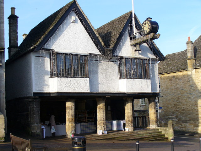
Burford
Burford () is a town on the River Windrush, in the Cotswold hills, in the West Oxfordshire district of Oxfordshire, England. It is often referred to as the 'gateway' to the Cotswolds. Burford is located west of Oxford and southeast of Cheltenham, about from the Gloucestershire boundary. The toponym derives from the Old English words ''burh'' meaning fortified town or hilltown and ''ford'', the crossing of a river. The 2011 Census recorded the population of Burford parish as 1,422. Economic and social history The town began in the middle Saxon period with the founding of a village near the site of the modern priory building. This settlement continued in use until just after the Norman conquest of England when the new town of Burford was built. On the site of the old village a hospital was founded which remained open until the Dissolution of the Monasteries by King Henry VIII. The modern priory building was constructed some 40 years later, in around 1580. The town centre's ... [...More Info...] [...Related Items...] OR: [Wikipedia] [Google] [Baidu] |
Faringdon
Faringdon is a historic market town in the Vale of White Horse, Oxfordshire, England, south-west of Oxford, north-west of Wantage and east-north-east of Swindon. It extends to the River Thames in the north; the highest ground is on the Ridgeway in the south. Faringdon was Berkshire's westernmost town until the 1974 boundary changes transferred its administration to Oxfordshire. The civil parish is formally known as ''Great Faringdon'', to distinguish it from Little Faringdon in West Oxfordshire. The 2011 Census gave a population of 7,121; it was estimated at 7,992 in 2019. On 1 February 2004, Faringdon became the first place in south-east England to be awarded Fairtrade Town status. History The toponym "Faringdon" means "hill covered in fern". Claims, for example by P. J. Goodrich, that King Edward the Elder (reigned 899–924) died in Faringdon are unfounded. The town was granted a weekly market in 1218, and as a result came to be called Chipping Faringdon. A week ... [...More Info...] [...Related Items...] OR: [Wikipedia] [Google] [Baidu] |
Blandford
Blandford Forum ( ), commonly Blandford, is a market town in Dorset, England, sited by the River Stour about northwest of Poole. It was the administrative headquarters of North Dorset District until April 2019, when this was abolished and its area incorporated into the new Dorset unitary authority. Blandford is notable for its Georgian architecture, the result of rebuilding after the majority of the town was destroyed by a fire in 1731. The rebuilding work was assisted by an Act of Parliament and a donation by George II, and the rebuilt town centre—to designs by local architects John and William Bastard—has survived to the present day largely intact. Blandford Camp, a military base, is sited on the hills north-east of the town. It is the base of the Royal Corps of Signals, the communications wing of the British Army, and the site of the Royal Signals Museum. Dorset County Council estimates that in 2013 the town's civil parish had a population of 10,610. The t ... [...More Info...] [...Related Items...] OR: [Wikipedia] [Google] [Baidu] |
Faringdon House
Faringdon House is a Grade I listed 14,510 square feet house in Faringdon, Oxfordshire, England. It was built in about 1770–1785 for the Poet Laureate Sir Henry James Pye. It became the country home of Lord Berners, who inherited it in 1918. He moved to Faringdon House in 1931, along with his companion, Robert Heber-Percy, nearly 30 years his junior and known as the Mad Boy. In 1942, Heber-Percy married Jennifer Ross, the only child of Sir Geoffrey Fry, 1st Baronet, and they had a daughter, Victoria, although the '' ménage à trois'' lasted only two years before Jennifer and their daughter moved to her parents' home, Oare House Oare House is a Grade I listed country house in Oare, Wiltshire, England. The house was built in 1740 for a London wine merchant, Henry Deacon. It was largely remodelled in the early 1920s by the architect Clough Williams-Ellis, for Sir Geoff ... in Wiltshire. Berners was notorious for his eccentricity, dyeing pigeons at Faringdon in vibrant co ... [...More Info...] [...Related Items...] OR: [Wikipedia] [Google] [Baidu] |
Bampton-in-the-Bush
Bampton, also called Bampton-in-the-Bush, is a settlement and civil parish in the Thames Valley about southwest of Witney in Oxfordshire. The parish includes the hamlet of Weald. The 2011 Census recorded the parish's population as 2,564. Bampton is variously referred to as both a town and a village. The Domesday Book recorded that it was a market town by 1086. It continued as such until the 1890s. It has both a town hall and a village hall. Geography The core of the village is on gravel terraces formed of Summertown-Radley or flood plain terrace deposits. It is just east of Shill Brook, which flows south to join the River Thames, and just north of a smaller stream that flows west to join Shill Brook. The A4095 road passes through the village. The civil parish measures about north – south and about east – west. It is bounded to the south by the River Thames, to the east by Aston Ditch, and to the west and north by ditches and field boundaries. A small part of the airf ... [...More Info...] [...Related Items...] OR: [Wikipedia] [Google] [Baidu] |
Witney
Witney is a market town on the River Windrush in West Oxfordshire in the county of Oxfordshire, England. It is west of Oxford. The place-name "Witney" is derived from the Old English for "Witta's island". The earliest known record of it is as ''Wyttannige'' in a Saxon charter of 969. The Domesday Book of 1086 records it as ''Witenie''. Notable buildings The Church of England parish church of St Mary the Virgin was originally Norman. The north porch and north aisle were added in this style late in the 12th century, and survived a major rebuilding in about 1243. In this rebuilding the present chancel, transepts, tower and spire were added and the nave was remodelled, all in the Early English style. In the 14th century a number of side chapels and some of the present windows were added in the Decorated style. In the 15th century the south transept was extended and the present west window of the nave were added in the Perpendicular style. The tower has a peal of eigh ... [...More Info...] [...Related Items...] OR: [Wikipedia] [Google] [Baidu] |
Bletchingdon
Bletchingdon (also known as Bletchington) is a village and civil parish north of Kidlington and southwest of Bicester in Oxfordshire, England. Bletchingdon parish includes the hamlet of Enslow just over west of the village. The 2011 Census recorded the parish's population as 910. Toponym The earliest known document to mention Bletchingdon is in the Domesday Book of 1086, which records it as ''Blecesdone''. A charter written about 1130 records it as ''Blechesdune''. The '' Feet of fines'' records it as ''Blechesdon'' in 1197. A document called the ''Placitorum abbreviato'' records it as ''Blechindon'' in 1279. It is derived from the Old English ''Blecces dūn'' meaning "Blecca's hill". In recent centuries "Bletchington" has been an alternative spelling. In the 19th and 20th centuries Bletchington railway station at Enslow was spelt with a "t". A local business based on the site of the former station trades as "Smiths of Bletchington". Etymologically this is misleading, ... [...More Info...] [...Related Items...] OR: [Wikipedia] [Google] [Baidu] |
Islip, Oxfordshire
Islip is a village and civil parish on the River Ray, just above its confluence with the River Cherwell in Oxfordshire, England. It is about east of Kidlington and about north of Oxford. The 2011 Census recorded the parish's population as 652. Archaeology The remains of a Romano-British villa have been found about southwest of the village. Parish church Edward the Confessor (born ''circa'' 1004, died 1066) was born in Islip and tradition holds that he was baptised in a church here. Parts of the present church date from about 1200. The chancel was rebuilt in 1780 and the church was restored in 1861. The church is Islip's only Grade I Listed Building. The belltower has a ring of eight bells. Since 1987 the Church of England parish has been part of the Ray Valley Benefice. A chapel associated with Edward the Confessor existed north of the church. The chapel was damaged in April 1645 in a military engagement in the English Civil War, and in the 1780s it was demolished. The ... [...More Info...] [...Related Items...] OR: [Wikipedia] [Google] [Baidu] |
Watlington, Oxfordshire
Watlington is a small market town and Civil parishes in England, civil parish about south of Thame in Oxfordshire, near the county's eastern edge and less than from its border with Buckinghamshire. The parish includes the Hamlet (place), hamlets of Christmas Common, Greenfield and Howe Hill, all of which are in the Chiltern Hills. The United Kingdom Census 2011, 2011 Census recorded the parish's population as 2,727. History The Watlington area is likely to have been settled at an early date, encouraged by the proximity of the Icknield Way. The Toponymy, toponym means "settlement of Waeclingas, Waecel's people" and indicates occupation from around the 6th century. A 9th-century charter by Æthelred, Ealdorman of Mercia, Æthelred of Mercia records eight 'manses' or major dwellings in Watlington. The Domesday Book of 1086 referred to the town as ''Watelintone'' or ''Watelintune''. Medieval documents indicate that the modern street plan was in existence in the 14th century, as ' ... [...More Info...] [...Related Items...] OR: [Wikipedia] [Google] [Baidu] |
Battle Of Inverlochy (1645)
The Battle of Inverlochy occurred on 2 February 1645 during the Wars of the Three Kingdoms when a Royalist force of Highlanders and Confederate Irish troops under the overall command of James Graham, 1st Marquess of Montrose, routed and largely destroyed the pursuing forces of Archibald Campbell, 1st Marquess of Argyll, who had been encamped under the walls of Inverlochy Castle. After being researched, the area was designated as a battlefield by Historic Scotland in 2011. Background After the Covenanter-controlled Scottish Committee of Estates decided to intervene on the English Civil War on the Parliamentarian side, the Royalist party sought to find ways of tying down Covenanter forces in Scotland to prevent them being employed in England. King Charles I had already given a commission to Montrose, a disaffected former signatory of the Covenant, to organise Royalist opposition in Scotland. The project was given impetus when Confederate Ireland, at the instigation of ... [...More Info...] [...Related Items...] OR: [Wikipedia] [Google] [Baidu] |
