|
Fagatogo, American Samoa
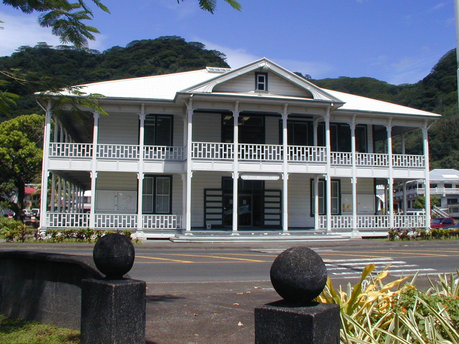
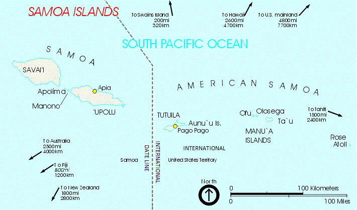
Fagatogo () is the downtown area of Pago Pago (the territorial capital of American Samoa).Grabowski, John F. (1992). ''U.S. Territories and Possessions (State Report Series)''. Chelsea House Pub. Page 51. . Located in the low grounds at the foot of Matafao Peak, it was the location of the first American settlement on Tutuila Island. It includes the sub-village of Malaloa. Today, Fagatogo is the government, commercial, financial, and shipping center of Tutuila.Enright, John (2001). ''A Walking Tour of Historic Fagatogo: Tutuila, American Samoa''. American Samoa Historic Preservation Office. It is also the administrative capital of American Samoa. It is the location of the American Samoa Fono (legislature), and is listed in the Constitution of American Samoa as the territory's official seat of government. Its population (as of April 1, 2010) is 1,737. Fagatogo contains the Pago Pago port, the Pago Pago bus station and market, and the Co-Cathedral of St. Joseph the Worker of the Ro ... [...More Info...] [...Related Items...] OR: [Wikipedia] [Google] [Baidu] |
Samoan Language
Samoan ( or , ) is a Polynesian languages, Polynesian language spoken by Samoans of the Samoan Islands. Administratively, the islands are split between the sovereign country of Samoa and the Unincorporated territories of the United States, United States territory of American Samoa. It is an official language, alongside English language, English, in both jurisdictions. It is widely spoken across the Pacific region, heavily so in New Zealand and in Australia and the United States. Among the Polynesian languages, Samoan is the most widely spoken by number of native speakers. Samoan is spoken by approximately 260,000 people in the archipelago and with many Samoans living in diaspora in a number of countries, the total number of speakers worldwide was estimated at 510,000 in 2015. It is the third-most widely spoken language in New Zealand, where 2.2% of the population, 101,900 people, were able to speak it as of 2018. The language is notable for the phonology, phonological differenc ... [...More Info...] [...Related Items...] OR: [Wikipedia] [Google] [Baidu] |
Utulei
Utulei or Utulei is a village in Maoputasi County, American Samoa, Maoputasi County, in the Eastern District, American Samoa, Eastern District of Tutuila, the main island of American Samoa. Utulei is traditionally considered to be a section of Fagatogo village, the legislative capital of American Samoa, and is located on the southwest edge of Pago Pago Harbor. Utulei is the site of many local landmarks: The A. P. Lutali Executive Office Building, which is next to the Feleti Barstow Public Library, Feleti Barstow Library; paved roads that wind up to a former cablecar terminal on Solo Hill; the governor's mansion, which sits on Mauga o Alii, overlooking the entrance to Goat's Island, and the lieutenant governor's residence directly downhill from it; the Governor H. Rex Lee Auditorium, Lee Auditorium, built in 1962; American Samoa's television studios, known as the Michael J. Kirwan Educational Television Center; and the Rainmaker Hotel (a portion of which is now known as Sadie's Hote ... [...More Info...] [...Related Items...] OR: [Wikipedia] [Google] [Baidu] |
American Naval Base, Samoan Islands
American(s) may refer to: * American, something of, from, or related to the United States of America, commonly known as the "United States" or "America" ** Americans, citizens and nationals of the United States of America ** American ancestry, people who self-identify their ancestry as "American" ** American English, the set of varieties of the English language native to the United States ** Native Americans in the United States, indigenous peoples of the United States * American, something of, from, or related to the Americas, also known as "America" ** Indigenous peoples of the Americas * American (word), for analysis and history of the meanings in various contexts Organizations * American Airlines, U.S.-based airline headquartered in Fort Worth, Texas * American Athletic Conference, an American college athletic conference * American Recordings (record label), a record label that was previously known as Def American * American University, in Washington, D.C. Sports teams S ... [...More Info...] [...Related Items...] OR: [Wikipedia] [Google] [Baidu] |
In Faga Togo, Tutuila, Samoa LOC 15669922472
IN, In or in may refer to: Dans * India (country code IN) * Indiana, United States (postal code IN) * Ingolstadt, Germany (license plate code IN) * In, Russia, a town in the Jewish Autonomous Oblast Businesses and organizations * Independent Network, a UK-based political association * Indiana Northeastern Railroad (Association of American Railroads reporting mark) * Indian Navy, a part of the India military * Infantry, the branch of a military force that fights on foot * IN Groupe, the producer of French official documents * MAT Macedonian Airlines (IATA designator IN) * Nam Air (IATA designator IN) * Office of Intelligence and Counterintelligence, sometimes abbreviated IN Science and technology * .in, the internet top-level domain of India * Inch (in), a unit of length * Indium, symbol In, a chemical element * Intelligent Network, a telecommunication network standard * Intra-nasal ( insufflation), a method of administrating some medications and vaccines * Integrase, a re ... [...More Info...] [...Related Items...] OR: [Wikipedia] [Google] [Baidu] |
Mangrove Tree
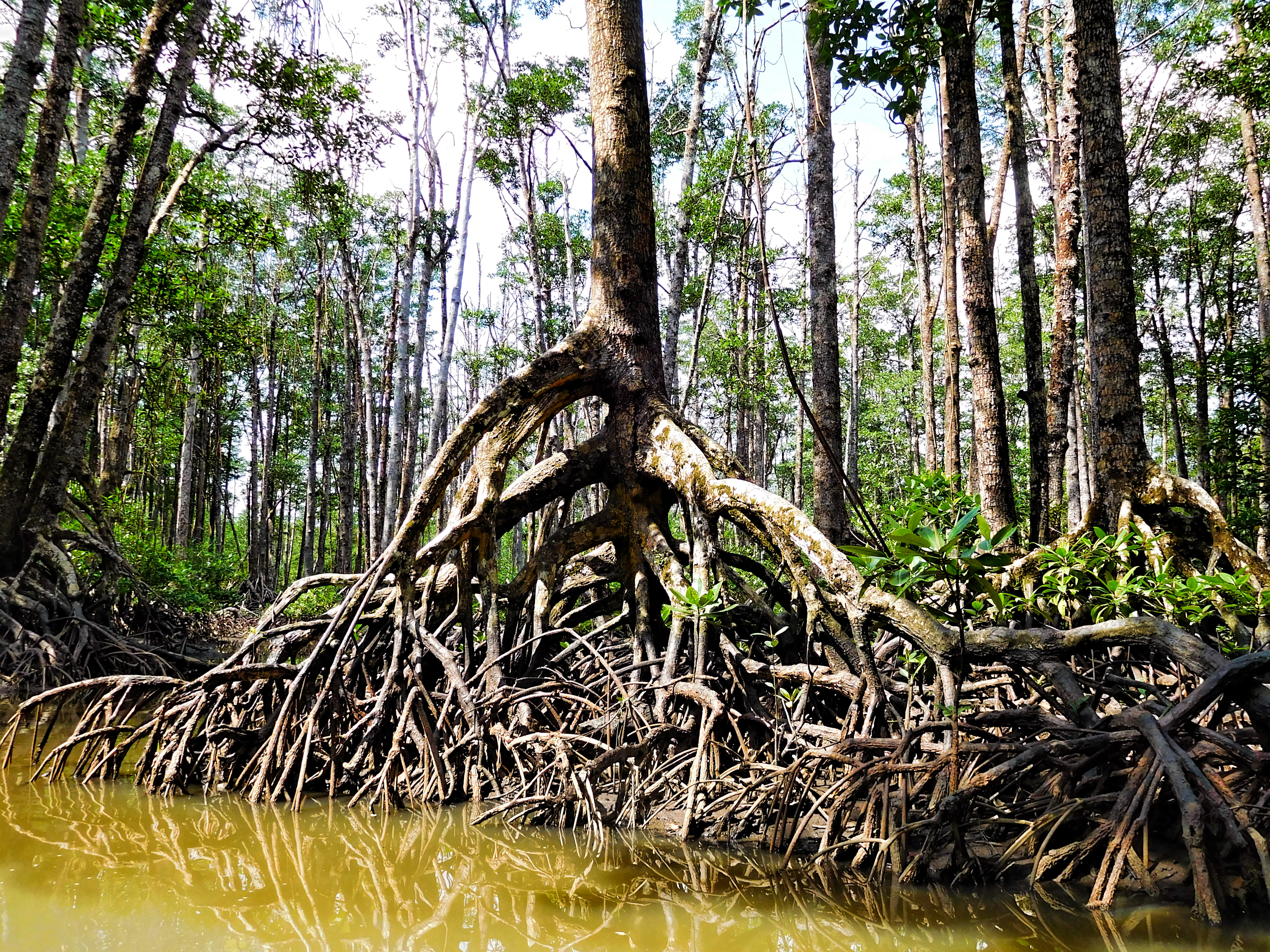
A mangrove is a shrub or tree that grows mainly in coastal saline or brackish water. Mangroves grow in an equatorial climate, typically along coastlines and tidal rivers. They have particular adaptations to take in extra oxygen and remove salt, allowing them to tolerate conditions that kill most plants. The term is also used for tropical coastal vegetation consisting of such species. Mangroves are taxonomically diverse due to convergent evolution in several plant families. They occur worldwide in the tropics and subtropics and even some temperate coastal areas, mainly between latitudes 30° N and 30° S, with the greatest mangrove area within 5° of the equator. Mangrove plant families first appeared during the Late Cretaceous to Paleocene epochs and became widely distributed in part due to the movement of tectonic plates. The oldest known fossils of mangrove palm date to 75 million years ago. Mangroves are salt-tolerant (halophytic) and are adapted to live in hars ... [...More Info...] [...Related Items...] OR: [Wikipedia] [Google] [Baidu] |
Mangrove Swamp
Mangrove forests, also called mangrove swamps, mangrove thickets or mangals, are productive wetlands that occur in coastal intertidal zones. Mangrove forests grow mainly at tropical and subtropical latitudes because mangrove trees cannot withstand freezing temperatures. There are about 80 different species of mangroves, all of which grow in areas with low-oxygen soil, where slow-moving waters allow fine sediments to accumulate.What is a mangrove forest? National Ocean Service, NOAA. Updated: 25 March 2021. Retrieved: 4 October 2021. Many mangrove forests can be recognised by their dense tangle of prop roots that make the trees appear to be standing on stilts above the water. This tangle of roots allows the trees to handle the daily rise and fall of tides, as most mangroves get flooded at least twice per day. The r ... [...More Info...] [...Related Items...] OR: [Wikipedia] [Google] [Baidu] |
United States
The United States of America (USA), also known as the United States (U.S.) or America, is a country primarily located in North America. It is a federal republic of 50 U.S. state, states and a federal capital district, Washington, D.C. The 48 contiguous states border Canada to the north and Mexico to the south, with the semi-exclave of Alaska in the northwest and the archipelago of Hawaii in the Pacific Ocean. The United States asserts sovereignty over five Territories of the United States, major island territories and United States Minor Outlying Islands, various uninhabited islands in Oceania and the Caribbean. It is a megadiverse country, with the world's List of countries and dependencies by area, third-largest land area and List of countries and dependencies by population, third-largest population, exceeding 340 million. Its three Metropolitan statistical areas by population, largest metropolitan areas are New York metropolitan area, New York, Greater Los Angeles, Los Angel ... [...More Info...] [...Related Items...] OR: [Wikipedia] [Google] [Baidu] |
Pago Pago Harbor
Pago Pago Harbor on Tutuila Island in American Samoa is one of the world's largest natural harbors. The capital, Pago Pago, is located on the inner reaches of the harbor, close to its northwesternmost point. It has the highest annual rainfall of any harbor in the world. It is also considered one of the best and deepest deepwater harbors in the South Pacific Ocean or in Oceania as a whole. Pago Pago Bay is over deep and long. As part of the Pago Volcano caldera, the harbor is 50% landlocked. Villages along the harbor include several communities in the Greater Pago Pago Area, including Utulei, Fagatogo, Malaloa, Pago Pago proper, Satala, Anua and Atuʻu. The legislature and High Court are located in Fagatogo, while the executive offices are located in Utulei. Pago Pago Harbor is surrounded and sheltered by mountains such as Mount ʻAlava, Mount Matafao and Rainmaker Mountain (Mount Pioa). The entrance to Pago Pago Bay is marked by two mountains: Mount Peiva in the ea ... [...More Info...] [...Related Items...] OR: [Wikipedia] [Google] [Baidu] |
Rainmaker Mountain
Rainmaker Mountain (also known as Mount Pioa and Mount Peiva) is the name of a mountain located near Pago Pago, American Samoa on Tutuila Island. Rainmaker Mountain traps rain clouds and gives Pago Pago the highest annual rainfall of any harbor. The average annual rainfall on the mountain is around . It has a three-pronged summit. Rainmaker Mountain and its base were designated a National Natural Landmark in 1972 due to the slopes’ tropical vegetation. Rainmaker Mountain is one of several giant volcanic mountains that created Tutuila Island. It dominates the scene from nearly every point in Pago Pago Harbor. It comprises three mountain peaks: North Pioa, South Pioa, and Sinapioa. The peaks range in elevation from to . The designated landmark area occurs above the contour line. Several endemic species are present only here and on Matafao Peak, the highest point on Tutuila. Rainmaker Mountain, famous in Samoan legend and lore, is also geologically important as an example of a ... [...More Info...] [...Related Items...] OR: [Wikipedia] [Google] [Baidu] |


