|
Eifionydd
Eifionydd () is an area in north-west Wales covering the south-eastern part of the Llŷn Peninsula from Porthmadog to just east of Pwllheli. The Afon Erch forms its western border. It now lies in Gwynedd. The commote of Eifionydd formed the northern half of the former minor kingdom of Dunoding within the Kingdom of Gwynedd. It traditionally took its name from Eifion, son of Dunod (who gave his name to the cantref) and grandson of Cunedda Wledig. The chief centre of the commote was at Criccieth, although there may have been an earlier royal residence at Dolbenmaen. Although it is not currently a unit of local government, the name is still in common use for the region. It includes the villages of Chwilog, Abererch, Llanaelhaearn, Pencaenewydd, Llangybi, Llanystumdwy, Llanarmon, Rhoslan, Pentrefelin, Penmorfa, Garndolbenmaen, Bryncir and Pantglas. R. Williams Parry's poem ''Eifionydd'' contrasts rural Eifionydd with the bustling slate quarries of Dyffryn Nantlle ... [...More Info...] [...Related Items...] OR: [Wikipedia] [Google] [Baidu] |
Criccieth
Criccieth ( cy, Criccieth ) is a town and community on the Llŷn Peninsula in the Eifionydd area of Gwynedd in Wales. The town lies west of Porthmadog, east of Pwllheli and south of Caernarfon. It had a population of 1,826 in 2001, reducing to 1,753 at the 2011 census. The town is a seaside resort, popular with families. Attractions include the ruins of '' Criccieth Castle'', which have extensive views over the town and surrounding countryside. Nearby on ''Ffordd Castell'' (Castle Way) is '' Cadwalader's Ice Cream Parlour'', opened in 1927, whilst ''Stryd Fawr'' (High Street) has several bistro-style restaurants. In the centre lies ''Y Maes'' ("The Field", or town square), part of the original medieval town common.Eira and James Gleasure, ''Criccieth : A Heritage Walk'', 2003Cymdeithas Hanes Eifionydd, Wales, 28 pages The town is noted for its fairs, held on 23 May and 29 June every year, when large numbers of people visit the fairground and the market which spreads through ... [...More Info...] [...Related Items...] OR: [Wikipedia] [Google] [Baidu] |
Porthmadog
Porthmadog (; ), originally Portmadoc until 1974 and locally as "Port", is a Welsh coastal town and community in the Eifionydd area of Gwynedd and the historic county of Caernarfonshire. It lies east of Criccieth, south-west of Blaenau Ffestiniog, north of Dolgellau and south of Caernarfon. The community population of 4,185 in the 2011 census was put at 4,134 in 2019. It grew in the 19th century as a port for local slate, but as the trade declined, it continued as a shopping and tourism centre, being close to Snowdonia National Park and the Ffestiniog Railway. The 1987 National Eisteddfod was held there. It includes nearby Borth-y-Gest, Morfa Bychan and Tremadog. History Porthmadog came about after William Madocks built a sea wall, the ''Cob'', in 1808–1811 to reclaim much of Traeth Mawr from the sea for farming use. Diversion of the Afon Glaslyn caused it to scour out a new natural harbour deep enough for small ocean-going sailing ships,John Dobson and Roy W ... [...More Info...] [...Related Items...] OR: [Wikipedia] [Google] [Baidu] |
Kingdom Of Gwynedd
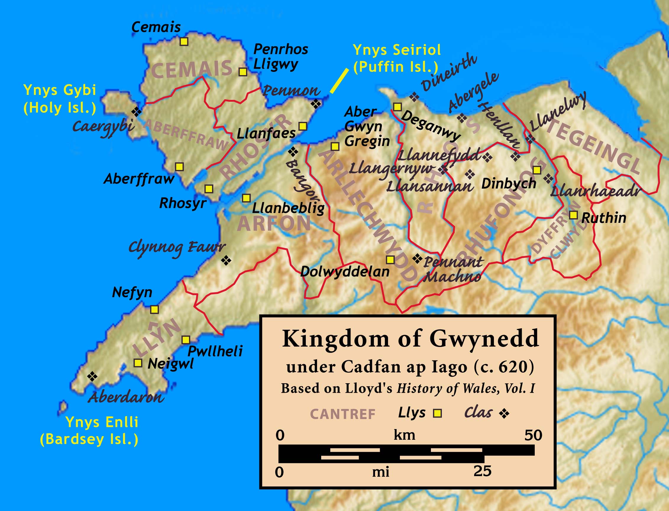
The Kingdom of Gwynedd (Medieval Latin: ; Middle Welsh: ) was a Welsh kingdom and a Roman Empire successor state that emerged in sub-Roman Britain in the 5th century during the Anglo-Saxon settlement of Britain. Based in northwest Wales, the rulers of Gwynedd repeatedly rose to dominance and were acclaimed as " King of the Britons" before losing their power in civil wars or invasions. The kingdom of Gruffydd ap Llywelynthe King of Wales from 1055 to 1063was shattered by a Saxon invasion in 1063 just prior to the Norman invasion of Wales, but the House of Aberffraw restored by Gruffudd ap Cynan slowly recovered and Llywelyn the Great of Gwynedd was able to proclaim the Principality of Wales at the Aberdyfi gathering of Welsh princes in 1216. In 1277, the Treaty of Aberconwy between Edward I of England and Llewelyn's grandson Llywelyn ap Gruffudd granted peace between the two but would also guarantee that Welsh self-rule would end upon Llewelyn's death, and so it represen ... [...More Info...] [...Related Items...] OR: [Wikipedia] [Google] [Baidu] |
Chwilog
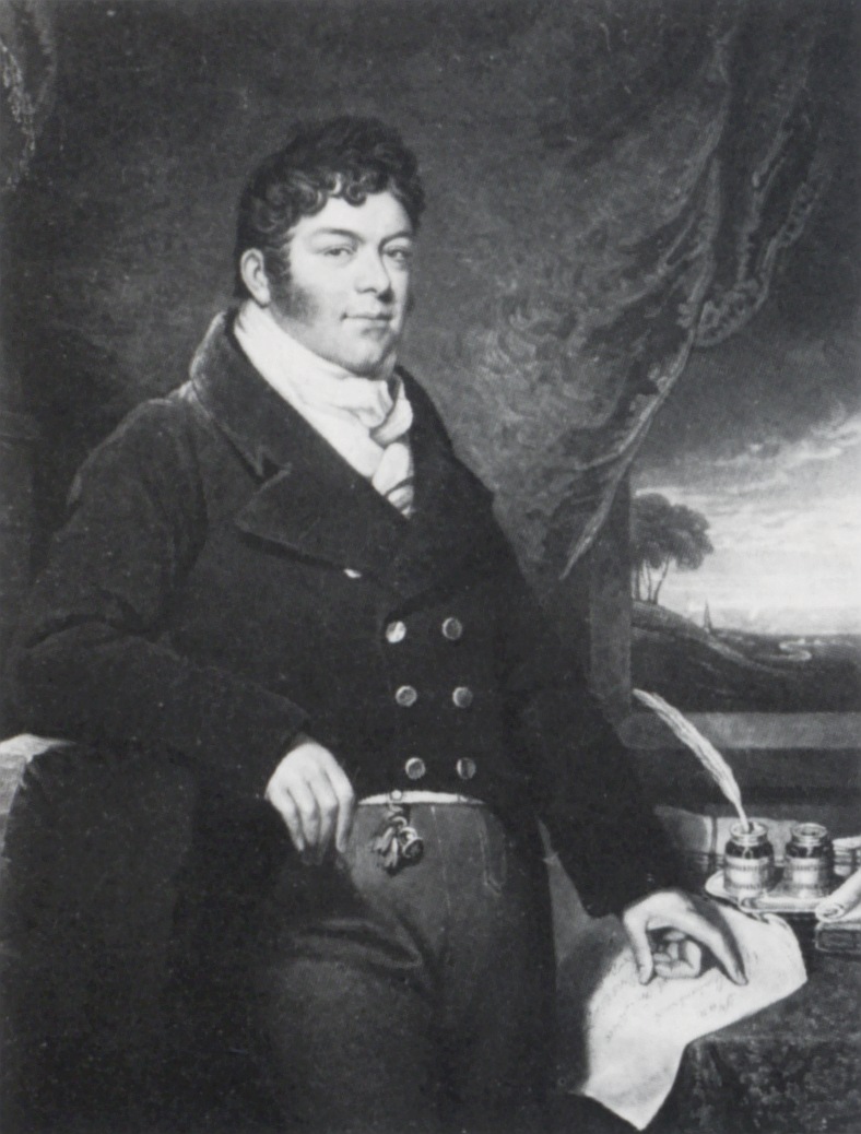
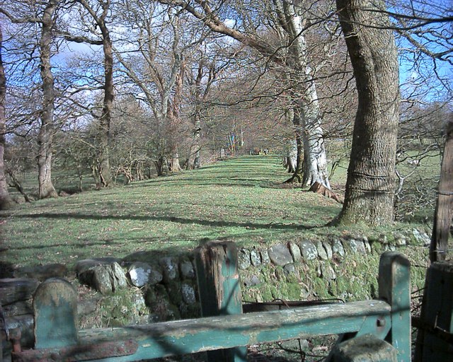
Chwilog is a village in Eifionydd on the Llŷn Peninsula in the Welsh county of Gwynedd. It forms part of the community of Llanystumdwy. The name means 'abounding in beetles' and was perhaps transferred from an earlier name of the river (or a part of it). It had a population of 640 as of the 2011 UK census, with 78% born in Wales. Village The village is fairly linear, built up around the B4354 which used to be a turnpike/toll road crossing the peninsula to Porthdinllaen. The Afon Wen or its original name Afon Carrog flows through the lower part of the village on its way to the sea at Afonwen, less than away. Y Lôn Goed Nearby is Y Lôn Goed, a tree-lined path, first nicknamed by the local population, then made well known due to its reference in "Eifionydd" a poem by R. Williams Parry. It was originally named 'Ffordd Maughan' (Maughan Way) after John Maughan, land commissioner for Sir Thomas Mostyn (1817-1828). It is a wide tree-lined avenue created in the 18th century f ... [...More Info...] [...Related Items...] OR: [Wikipedia] [Google] [Baidu] |
Llŷn Peninsula
The Llŷn Peninsula ( cy, Penrhyn Llŷn or , ) extends into the Irish Sea from North West Wales, south west of the Isle of Anglesey. It is part of the historic county of Caernarfonshire, and historic region and local authority area of Gwynedd. Much of the eastern part of the peninsula, around Criccieth, may be regarded as part of Eifionydd rather than Llŷn, although the boundary is somewhat vague. The area of Llŷn is about , and its population is at least 20,000. Historically, the peninsula was travelled by pilgrims en route to Bardsey Island (Welsh: ''Ynys Enlli''), and its relative isolation has helped to conserve the Welsh language and culture, for which the locality is now famous. This perceived remoteness from urban life has lent the area an unspoilt image which has made Llŷn a popular destination for both tourists and holiday home owners. Holiday homes remain contentious among locals, many of whom are priced out of the housing market by incomers. From the 1970s to the 199 ... [...More Info...] [...Related Items...] OR: [Wikipedia] [Google] [Baidu] |
Llanarmon Eifionydd
Llanarmon ''(English: Garmon's Church)'' is a small village and former civil parish in the old commote of Eifionydd and Cantref Dunoding in the Welsh county of Gwynedd. The parish was abolished in 1934 and incorporated into Llanystumdwy. The village lies north east of Pwllheli and is close to the village of Llangybi, a holy well and the mountain of Carn Pentrych. A well-preserved 15th-century manor house at Penarth-fawr is maintained by Cadw, and another ancient monument ''Plas Du'' ''( Welsh: Black Place)'' is a well-preserved, substantial sub-medieval gentry house. retrieved 13 January 2010 It also has important historical associations; it was known as the centre of the Roman ... [...More Info...] [...Related Items...] OR: [Wikipedia] [Google] [Baidu] |
Dolbenmaen
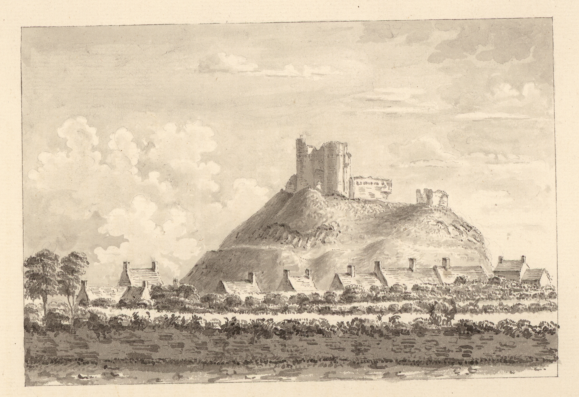
Dolbenmaen () is a village and community in the Welsh county of Gwynedd, located in Eifionydd, of which it was the administrative centre until 1239. The community includes the villages of Bryncir (), Cenin, Garndolbenmaen, (the largest settlement) Golan, Llanfihangel-y-Pennant, Penmorfa (), Pentrefelin, Wern, Glan-dwyfach, and the hamlet of Prenteg. It has a population of 1,300, increasing slightly to 1,343 at the 2011 Census. The summit of Moel Hebog is shared between Beddgelert and Dolbenmaen. It is a sparsely populated area and covers nearly 100 square kilometres. A castle motte is located to the south of the village which is thought to have been the residence of Llywelyn the Great until the 1230s, when the court moved to a motte and bailey castle at Criccieth. The castle guarded a ford on the Afon Dwyfor which may have been on the Pen Llystyn (Tremadog) to Segontium Roman road. The parish church of St Mary's is a grade II* listed building. South of Pentrefelin is St Cyn ... [...More Info...] [...Related Items...] OR: [Wikipedia] [Google] [Baidu] |
Llangybi Eifionydd
Llangybi ''(English: Cybi's Church)'' is a village and former civil parish in the Eifionydd area of the Welsh county of Gwynedd, near Llanarmon. The parish was abolished in 1934 and divided between Llanystumdwy and Llannor. St Cybi's church is a grade II* building. As well as various menhirs, tumuli and stone circles in the countryside around, the village is particularly noted for a holy well, Ffynnon Gybi ''(English English usually refers to: * English language * English people English may also refer to: Peoples, culture, and language * ''English'', an adjective for something of, from, or related to England ** English national ide ...: St Cybi's Well)''. According to local tradition the girls who wished to know their lover's intentions would spread their pocket-handkerchiefs on the water of the well, and, if the water pushed the handkerchiefs to the south they knew that everything was right and that their lovers were honest and honourable in ... [...More Info...] [...Related Items...] OR: [Wikipedia] [Google] [Baidu] |
Beddgelert
Beddgelert () is a village and community in the Snowdonia area of Gwynedd, Wales. The population of the community taken at the 2011 census was 455, and includes Nantmor and Nant Gwynant. It is reputed to be named after the legendary hound Gelert. The community is large and sparsely populated and covers 86 square kilometres. Location The village stands in a valley at the confluence of the River Glaslyn and the River Colwyn. Just above the confluence of the rivers, in the centre of the village, is an old stone bridge with two arches. The River Gwynant also exists in the area, coinciding with the River Colwyn under what locals know as ‘Pont Bren’, creating the River Glaslyn. Many of the houses and hotels are built of local dark stone. To the west is Moel Hebog and its neighbours to the north and a series of hills rising to the top of Snowdon. A lane of the A4085 between Caernarfon (13 miles north) and Porthmadog (8 miles south) runs through the village. The outdoor ... [...More Info...] [...Related Items...] OR: [Wikipedia] [Google] [Baidu] |
Dunoding
Dunoding was an early sub-kingdom within the Kingdom of Gwynedd in north-west Wales that existed between the 5th and 10th centuries. According to tradition, it was named after Dunod, a son of the founding father of Gwynedd - Cunedda Wledig - who drove the Irish settlers from the area in c.460. The territory existed as a subordinate realm within Gwynedd until the line of rulers descended from Dunod expired in c.925. Following the end of the House of Dunod, it was split into the cantrefi of Eifionydd and Ardudwy and fully incorporated into Gwynedd. After the defeat of the kingdom of Gwynedd in 1283 and its annexation to England, the two cantrefi became parts of the counties of Caernarfonshire and Meirionnydd respectively. It is now part of the modern county of Gwynedd within a devolved Wales Wales ( cy, Cymru ) is a country that is part of the United Kingdom. It is bordered by England to the east, the Irish Sea to the north and west, the Celtic Sea to the south west ... [...More Info...] [...Related Items...] OR: [Wikipedia] [Google] [Baidu] |
Llanystumdwy
Llanystumdwy is a predominantly Welsh-speaking village, community and electoral ward on the Llŷn Peninsula in Wales. It lies in the traditional county of Caernarfonshire but is currently administered as part of the unitary authority of Gwynedd. It is not regarded as being part of Llŷn, but as belonging instead to the ancient commote of Eifionydd on the Cardigan Bay coast, where it has its own beach. The community includes the villages of Chwilog, Afon Wen, Llanarmon, and Llangybi, plus the hamlets of Rhoslan and Pencaenewydd. Description The village lies between Criccieth and Pwllheli at the point where the A497 crosses the Afon Dwyfor. It had a population of 1,949 in 2001 and 2,080 in 2011. David Lloyd George, the last Liberal Party leader to be British Prime Minister, was brought up in Llanystumdwy and lived there until he was 16. His grave in the village was designed by Clough Williams-Ellis, creator of the Italianate village of Portmeirion, across Cardigan Bay, w ... [...More Info...] [...Related Items...] OR: [Wikipedia] [Google] [Baidu] |


.jpg)
.jpg)

