|
Eckington, Worcestershire
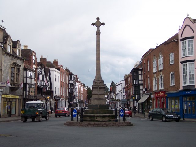
Eckington is a small village near to the southern border of the English county of Worcestershire, according to the 2001 census it had a population of 1,202. The village is surrounded by the River Avon and often experiences flooding on its entry roads. It is situated at the north-west side of Bredon Hill, an outcrop of the Cotswolds. The nearest towns to Eckington and also situated along the River Avon are Pershore which is north and Evesham north east. The historic town of Tewkesbury is situated south west on the River Severn which river also runs through the nearest city of Worcester ( from Eckington). Eckington is renowned for Eckington Bridge, which is the subject of a poem by Arthur Quiller-Couch, its village cross and its Norman-period church. It has a thriving first school, the Eckington Church of England First School, a scout hut with surrounding recreation grounds, home to village's football and cricket teams, and a well used village hall. Eckington has a village ... [...More Info...] [...Related Items...] OR: [Wikipedia] [Google] [Baidu] |
Wychavon
Wychavon is a local government district in Worcestershire, England, with a population size of 132,500 according to the 2021 census. Its council is based in the town of Pershore, and the other towns in the district are Droitwich Spa and Evesham. The district extends from the southeast corner of Worcestershire north and west. It borders all the other districts of Worcestershire, as well as the counties of Gloucestershire and Warwickshire. The district was created under the Local Government Act 1972, on 1 April 1974. It was a merger of the boroughs of Droitwich and Evesham along with Evesham Rural District and most of Droitwich Rural District and most of Pershore Rural District. The district's name, which was invented in 1973, contains two elements. "Wych" recalls the Saxon Kingdom of Hwicca, and "Avon" is for the River Avon. Wychavon District Council was a joint 'Council of the Year 2007', along with High Peak Borough Council. It was also featured as the 'Best Council to work ... [...More Info...] [...Related Items...] OR: [Wikipedia] [Google] [Baidu] |
River Severn
, name_etymology = , image = SevernFromCastleCB.JPG , image_size = 288 , image_caption = The river seen from Shrewsbury Castle , map = RiverSevernMap.jpg , map_size = 288 , map_caption = Tributaries (light blue) and major settlements on and near the Severn (bold blue) , pushpin_map = , pushpin_map_size = 288 , pushpin_map_caption= , subdivision_type1 = Country , subdivision_name1 = England and Wales , subdivision_type2 = , subdivision_name2 = , subdivision_type3 = Region , subdivision_name3 = Mid Wales, West Midlands, South West , subdivision_type4 = Counties , subdivision_name4 = Powys, Shropshire, Worcestershire, Gloucestershire , subdivision_type5 = Cities , subdivision_name5 = Shrewsbury, Worcester, Gloucester, Bristol , length = , width_min = , width_avg = , width_max = , depth_min = , depth_avg = ... [...More Info...] [...Related Items...] OR: [Wikipedia] [Google] [Baidu] |
Pilgrim Fathers
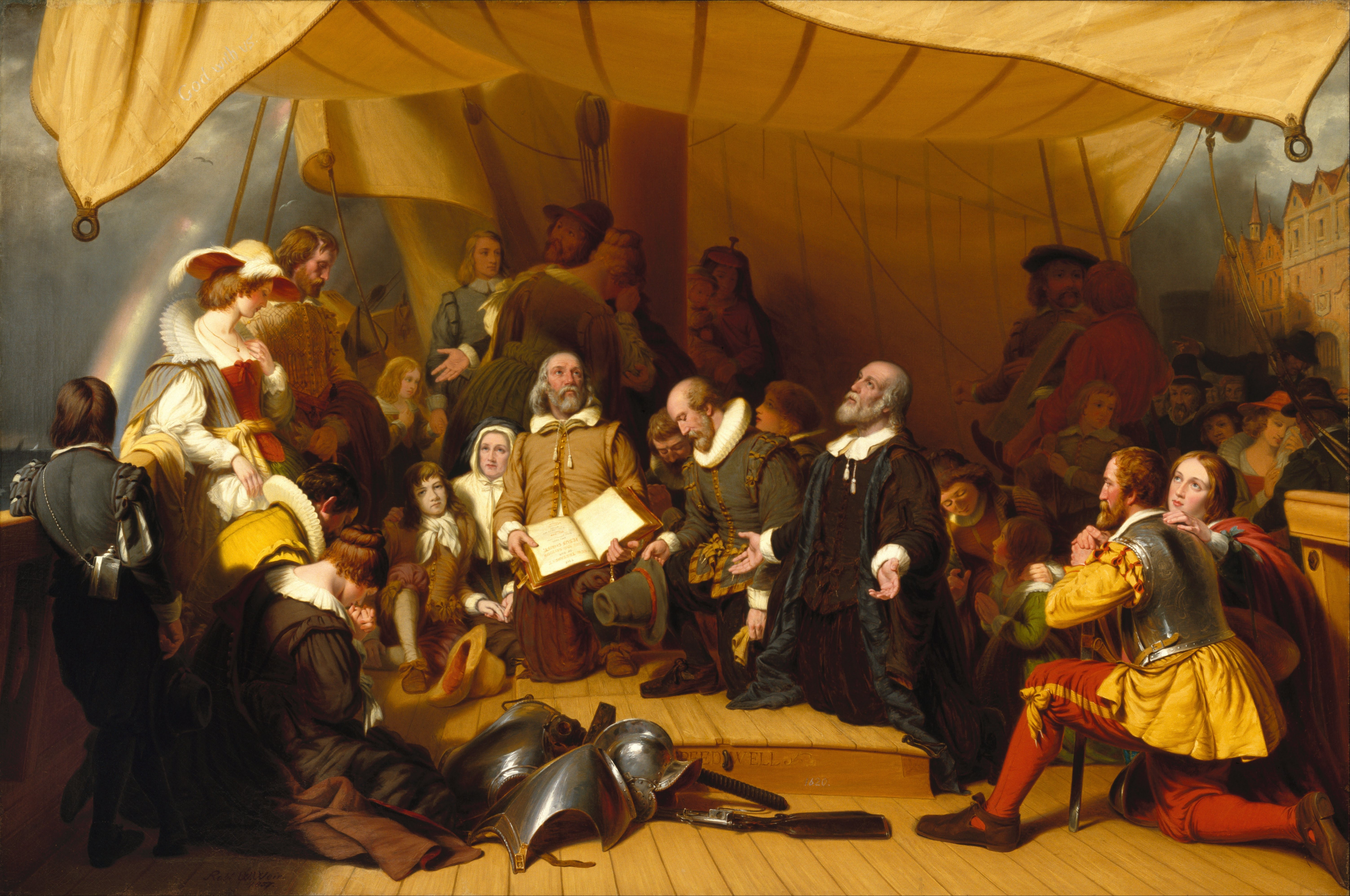
The Pilgrims, also known as the Pilgrim Fathers, were the English settlers who came to North America on the ''Mayflower'' and established the Plymouth Colony in what is today Plymouth, Massachusetts, named after the final departure port of Plymouth, Devon. Their leadership came from the religious congregations of Brownists, or Separatist Puritans, who had fled religious persecution in England for the tolerance of 17th-century Holland in the Netherlands. They held many of the same Puritan Calvinist religious beliefs but, unlike most other Puritans, they maintained that their congregations should separate from the English state church, which led to them being labeled Separatists (the word "Pilgrims" was not used to refer to them until several centuries later). After several years living in exile in Holland, they eventually determined to establish a new settlement in the New World and arranged with investors to fund them. They established Plymouth Colony in 1620, where they erecte ... [...More Info...] [...Related Items...] OR: [Wikipedia] [Google] [Baidu] |
Birmingham And Gloucester Railway
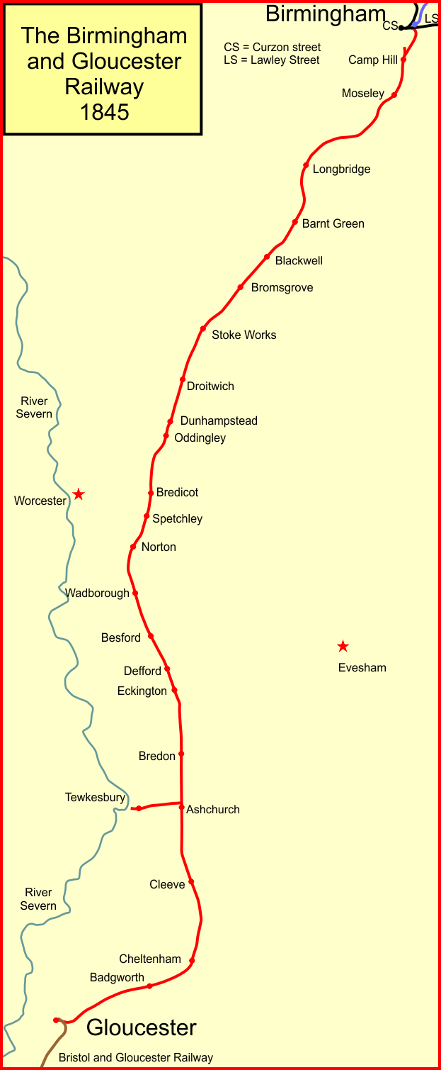
The Birmingham and Gloucester Railway (B&GR) was the first name of the railway linking the cities in its name and of the company which pioneered and developed it; the line opened in stages in 1840, using a terminus at Camp Hill in Birmingham. It linked with the Bristol and Gloucester Railway in Gloucester, but at first that company's line was broad gauge, and Gloucester was a point of the necessary but inconvenient transhipment of goods and passengers onto gauge that became the national standard. Nearly all of the original main line remains active as a "trunk" route, also known as an arterial route or line. Its main line incorporated the Lickey Incline of track climbing a 1-in-37 (2.7%) gradient, northbound (and descending in the other). The climb was a challenge or impediment for many of the heaviest loads and weaker engines during the era of steam traction. Having attracted its own patronage, capital and accomplished fully functional transformation and employment of land, ... [...More Info...] [...Related Items...] OR: [Wikipedia] [Google] [Baidu] |
Eckington Railway Station
Eckington railway station was a railway station to serve Eckington in Worcestershire Worcestershire ( , ; written abbreviation: Worcs) is a county in the West Midlands of England. The area that is now Worcestershire was absorbed into the unified Kingdom of England in 927, at which time it was constituted as a county (see H .... The station was opened by the Birmingham and Gloucester Railway in 1840. The buildings were ''"erected in the Gothic style, very much like those on some of the Scotch railways recently opened to the public."'' Whishaw, F., (1840) ''The Railways of Great Britain and Ireland: Practically described and illustrated'' London: Simpkin, Marshall and Co. The station closed to passengers on 4 January 1965. References Further reading * Former Midland Railway stations Railway stations in Great Britain opened in 1840 Railway stations in Great Britain closed in 1965 Disused railway stations in Worcestershire Beeching closures in England [...More Info...] [...Related Items...] OR: [Wikipedia] [Google] [Baidu] |
Arthur Quiller-Couch
Sir Arthur Thomas Quiller-Couch (; 21 November 186312 May 1944) was a British writer who published using the pseudonym Q. Although a prolific novelist, he is remembered mainly for the monumental publication '' The Oxford Book of English Verse 1250–1900'' (later extended to 1918) and for his literary criticism. He influenced many who never met him, including American writer Helene Hanff, author of ''84, Charing Cross Road'' and its sequel, ''Q's Legacy''. His ''Oxford Book of English Verse'' was a favourite of John Mortimer fictional character Horace Rumpole. Life Arthur Quiller-Couch was born in the town of Bodmin, Cornwall. He was the son of DrThomas Quiller Couch (d.1884), who was a noted physician, folklorist and historian who married Mary Ford and lived at 63, Fore Street, Bodmin, until his death in 1884. Thomas was the product of the union of two ancient local families, the Quiller family and the Couch family. Arthur was the third in a line of intellectuals from the C ... [...More Info...] [...Related Items...] OR: [Wikipedia] [Google] [Baidu] |
Eckington Bridge
Eckington Bridge is a stone bridge over the River Avon in Eckington in the English county of Worcestershire. It is a Grade II* listed building and has been scheduled as an ancient monument. The first bridge at the site was built in 1440, replacing an earlier ferry, but this fell into disrepair and was replaced by the current stone bridge in the 1720s. It consists of six arches built of red sandstone with the piers being protected by cutwaters. On the northern side of the bridge, slightly downstream, is a World War II pillbox. During 2011 and 2012 repairs were undertaken by Worcestershire County Council at a cost of £240,000. Next to the bridge is Eckington Wharf, which is no longer used commercially but provides public moorings, a canoe launching slipway and picnic area. The bridge is the subject of a poem by Arthur Quiller-Couch Sir Arthur Thomas Quiller-Couch (; 21 November 186312 May 1944) was a British writer who published using the pseudonym Q. Although a prol ... [...More Info...] [...Related Items...] OR: [Wikipedia] [Google] [Baidu] |
Worcester, England
Worcester ( ) is a cathedral city in Worcestershire, England, of which it is the county town. It is south-west of Birmingham, north-west of London, north of Gloucester and north-east of Hereford. The population was 103,872 in the 2021 Census. The River Severn flanks the western side of the city centre. It is overlooked by Worcester Cathedral. Worcester is the home of Royal Worcester Porcelain, composer Edward Elgar, Lea & Perrins, makers of traditional Worcestershire sauce, the University of Worcester, and '' Berrow's Worcester Journal'', claimed as the world's oldest newspaper. The Battle of Worcester in 1651 was the final battle of the English Civil War, during which Oliver Cromwell's New Model Army defeated King Charles II's Royalists. History Early history The trade route past Worcester, later part of the Roman Ryknild Street, dates from Neolithic times. It commanded a ford crossing over the River Severn, which was tidal below Worcester, and fortified by the ... [...More Info...] [...Related Items...] OR: [Wikipedia] [Google] [Baidu] |
Tewkesbury
Tewkesbury ( ) is a medieval market town and civil parish in the north of Gloucestershire, England. The town has significant history in the Wars of the Roses and grew since the building of Tewkesbury Abbey. It stands at the confluence of the River Severn and the River Avon, and thus became an important trading point, which continued as railways and later M5 and M50 motorway connections were established. The town gives its name to the Borough of Tewkesbury, due to the earlier governance by the Abbey, yet the town is the second largest settlement in the Borough. The town lies on border with Worcestershire, identified largely by the Carrant Brook (a tributary of the River Avon). The name Tewkesbury is thought to come from Theoc, the name of a Saxon who founded a hermitage there in the 7th century, and in the Old English language was called '. Toulmin Smith L., ed. 1909, ''The Itinerary of John Leland'', London, IV, 150 An erroneous derivation from Theotokos (the Greek title of ... [...More Info...] [...Related Items...] OR: [Wikipedia] [Google] [Baidu] |
Worcestershire
Worcestershire ( , ; written abbreviation: Worcs) is a county in the West Midlands of England. The area that is now Worcestershire was absorbed into the unified Kingdom of England in 927, at which time it was constituted as a county (see History of Worcestershire). Over the centuries the county borders have been modified, but it was not until 1844 that substantial changes were made. Worcestershire was abolished as part of local government reforms in 1974, with its northern area becoming part of the West Midlands and the rest part of the county of Hereford and Worcester. In 1998 the county of Hereford and Worcester was abolished and Worcestershire was reconstituted, again without the West Midlands area. Location The county borders Herefordshire to the west, Shropshire to the north-west, Staffordshire only just to the north, West Midlands to the north and north-east, Warwickshire to the east and Gloucestershire to the south. The western border with Herefordshire includ ... [...More Info...] [...Related Items...] OR: [Wikipedia] [Google] [Baidu] |
Evesham, Worcestershire
Evesham () is a market town and parish in the Wychavon district of Worcestershire, in the West Midlands region of England. It is located roughly equidistant between Worcester, Cheltenham and Stratford-upon-Avon. It lies within the Vale of Evesham, an area comprising the flood plain of the River Avon, which has been renowned for market gardening. The town centre, situated within a meander of the river, is subjected regularly to flooding. The 2007 floods were the most severe in recorded history. The town was founded around an 8th-century abbey, one of the largest in Europe, which was destroyed during the Dissolution of the Monasteries, with only Abbot Lichfield's Bell Tower remaining. During the 13th century, one of the two main battles of England's Second Barons' War took place near the town, marking the victory of Prince Edward, who later became King Edward I; this was the Battle of Evesham. History Evesham is derived from the Old English ''homme'' or ''ham'', and ... [...More Info...] [...Related Items...] OR: [Wikipedia] [Google] [Baidu] |
.jpg)


