|
Ewloe
Ewloe (; cy, Ewlo, ) is a village and electoral ward in the community of Hawarden in Flintshire, Wales. It is situated close to the Flintshire/Cheshire sector of the Wales-England border. The A55 expressway passes through Ewloe and its most notable landmark is Ewloe Castle. The Ewloe electoral ward had a population at the 2011 Census of 5,420. The urban area of the village is contiguous with Hawarden, Buckley and Shotton. The Office for National Statistics deems Ewloe to form part of the Buckley built-up area, which covers much of Deeside. Economy Ewloe grew rapidly during the late 1990s and early 2000s and is now the home of the internet based Moneysupermarket.com and construction company Redrow. HSBC Bank along with many other firms can be found in Ewloe. Flintshire County Council has one of its main offices at Ty Dewy Sant on St David's Park, a building which had previously been occupied by Unilever and before them by the former Alyn and Deeside District Council. T ... [...More Info...] [...Related Items...] OR: [Wikipedia] [Google] [Baidu] |
Ewloe Castle
Ewloe Castle ( cy, Castell Ewlo) is a native Welsh castle built by the Kingdom of Gwynedd near the town of Ewloe in Flintshire, Wales. The castle, which was one of the last fortifications to be built by the native Princes of Wales, was abandoned at the beginning of the invasion of Wales by Edward I in 1277. Its construction, using locally quarried sandstone, appears to have continued piecemeal over many years and may have not been completed. On taking the castle, the English Crown gave it little military value and allowed it to fall into ruin. Ewloe was sited on high ground within Tegeingl, a cantref in the lands of North-east Wales (Welsh ''Perfeddwlad''). Standing near the Chester road, it maintained a strategic position near the Wales–England border. The castle is located on a steeply-sloped promontory within a forested valley. It overlooks the junction of two streams with higher ground to the south. Layout Ewloe Castle combines features from both motte-and-bailey and ... [...More Info...] [...Related Items...] OR: [Wikipedia] [Google] [Baidu] |
A55 Road
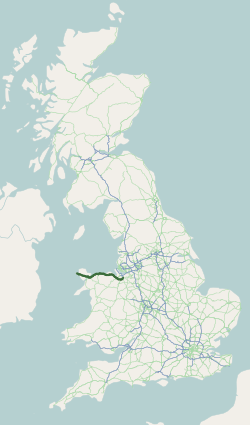
The A55, also known as the North Wales Expressway ( cy, Gwibffordd Gogledd Cymru) is a major road in Wales and England, connecting Cheshire and north Wales. The vast majority of its length from Chester to Holyhead is a dual carriageway primary route, with the exception of the Britannia Bridge over the Menai Strait and several short sections where there are gaps in between the two carriageways. All junctions are grade separated apart from a roundabout east of Penmaenmawr and another nearby in Llanfairfechan. Initially, the road ran from Chester to Bangor. In 2001, it was extended across Anglesey to the ferry port of Holyhead parallel to the A5. The road improvements have been part funded with European money, under the Trans-European Networks programme, as the route is designated part of Euroroute E22 (Holyhead – Leeds – Amsterdam – Hamburg – Malmö – Riga – Moscow – Perm – Ekaterinburg – Ishim). Route The Chester southerly bypass The A55 ... [...More Info...] [...Related Items...] OR: [Wikipedia] [Google] [Baidu] |
Hawarden
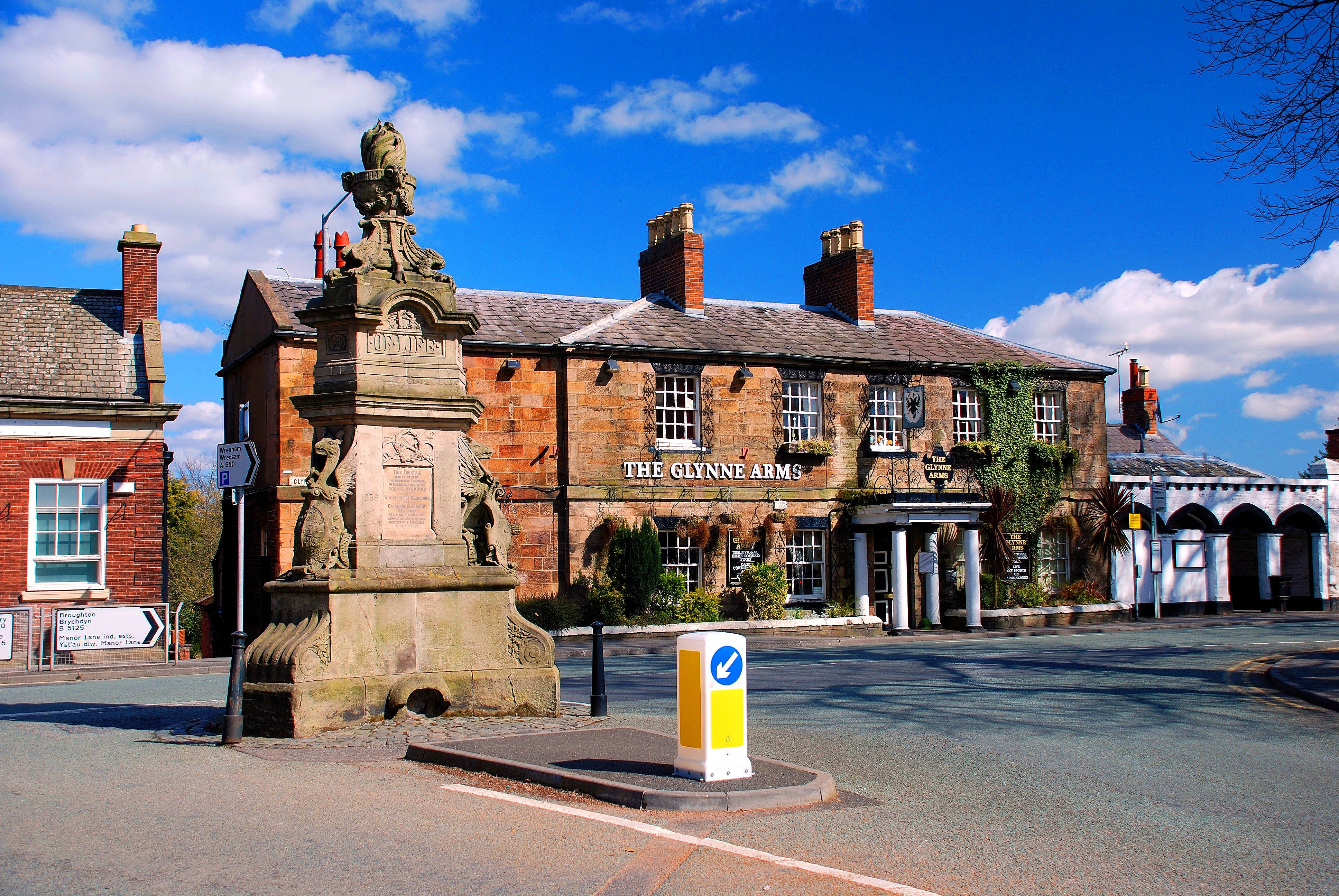
Hawarden (; cy, Penarlâg) is a village, community and electoral ward in Flintshire, Wales. It is part of the Deeside conurbation on the Wales-England border and is home to Hawarden Castle. In the 2011 census the ward of the same name had a population of 1,887, whereas the community of the same name, which also includes Ewloe (which also has a castle) Mancot and Aston had a population of 13,920. The scenic wooded Hawarden Park abuts the clustered settlement in the south. Hawarden Bridge consists of distribution and industrial business premises beyond Shotton/ Queensferry and the Dee. The west of the main street is called The Highway, its start marked by the crossroads with a fountain in the middle, near which are public houses, some with restaurants. The large village is west and north-west of England and is from Chester. In 2014 it was named in ''The Sunday Times'' annual Best Places To Live List. The highest temperature in Wales was recorded in Hawarden on ... [...More Info...] [...Related Items...] OR: [Wikipedia] [Google] [Baidu] |
Flintshire County Council
Flintshire County Council is the unitary local authority for the county of Flintshire, one of the principal areas of Wales. It is based at County Hall in Mold. Elections take place every five years. The last election was on 5 May 2022. History Flintshire County Council was first created in 1889 under the Local Government Act 1888, which established elected county councils to take over the administrative functions of the quarter sessions. That county council and the administrative county of Flintshire were abolished in 1974, when the area merged with neighbouring Denbighshire to become the new county of Clwyd. Flintshire was unusual in retaining exclaves right up until the 1974 reforms. The contiguous part of the county was split to become three of the six districts of Clwyd: Alyn and Deeside, Delyn, and Rhuddlan. The county's exclaves of Maelor Rural District and the parish of Marford and Hoseley both went to the Wrexham Maelor district. Under the Local Government (Wales ... [...More Info...] [...Related Items...] OR: [Wikipedia] [Google] [Baidu] |
Buckley, Flintshire
Buckley ( cy, Bwcle ) is a town and community (Wales), community in Flintshire, north-east Wales, from the county town of Mold, Flintshire, Mold and contiguous with the villages of Ewloe, Alltami and Mynydd Isa. It is on the A549 road, with the larger A55 road passing nearby. Buckley is the second-largest town in Flintshire in terms of population. At the United Kingdom Census 2011, 2011 Census, its community had a population of 15,665. When the contiguous Argoed, Flintshire, Argoed community is included, Buckley has a population of 21,502. A prominent nearby landmark is the Hanson Cement kiln just south of the town. Etymology Buckley's name appears as ''Bocleghe'' in 1198 and ''Bokkeley'' in 1294. It may mean "clearing of the bucks", from Old English ''bucc lēah''; however, the preponderance of an O vowel in historical forms suggests that the first element could instead be a personal name, ''Bocca''. Another contender is ''bōca'', meaning "beeches", but the fact that beech ... [...More Info...] [...Related Items...] OR: [Wikipedia] [Google] [Baidu] |
Deeside Deeside ( cy, Glannau Dyfrdwy) is the name given to a predominantly industrial conurbation of towns and villages in |

