|
Err, Pyrénées-Orientales
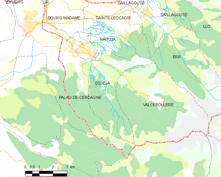
Err (; , ) is a commune in the Pyrénées-Orientales department in southern France. Toponymy The onomastics of the town name, first attested as ''Ezerre'' in 839 AD amongst many later forms, is ultimately mysterious. Linguists generally agree it dates before the dominance of Celtic languages and Latin in ancient Gaul (a dominant hypothesis being a Basque-related Pre-Indo-European name; also see Old European hydronymy). Compare the etymology of similarly-sounding nearby Ur. Geography Err is located in the canton of Les Pyrénées catalanes and in the arrondissement of Prades. Err station has rail connections to Villefranche-de-Conflent and Latour-de-Carol. Population Sport The commune contains the winter sports resort of Err-Puigmal, on the Puigmal mountain. See also *Communes of the Pyrénées-Orientales department The Pyrénées-Orientales departments of France, department is composed of 226 communes of France, communes. Most of the territory (except fo ... [...More Info...] [...Related Items...] OR: [Wikipedia] [Google] [Baidu] |
Communes Of France
A () is a level of administrative divisions of France, administrative division in the France, French Republic. French are analogous to civil townships and incorporated municipality, municipalities in Canada and the United States; ' in Germany; ' in Italy; ' in Spain; or civil parishes in the United Kingdom. are based on historical geographic communities or villages and are vested with significant powers to manage the populations and land of the geographic area covered. The are the fourth-level administrative divisions of France. vary widely in size and area, from large sprawling cities with millions of inhabitants like Paris, to small hamlet (place), hamlets with only a handful of inhabitants. typically are based on pre-existing villages and facilitate local governance. All have names, but not all named geographic areas or groups of people residing together are ( or ), the difference residing in the lack of administrative powers. Except for the Municipal arrondissem ... [...More Info...] [...Related Items...] OR: [Wikipedia] [Google] [Baidu] |
Arrondissement Of Prades
The arrondissement of Prades is an arrondissement of France in the Pyrénées-Orientales department (Northern Catalonia) in the Occitanie region. It has 123 communes. Its population is 60,536 (2021), and its area is . Composition The communes of the arrondissement of Prades, and their INSEE codes, are: # Les Angles (66004) # Angoustrine-Villeneuve-des-Escaldes (66005) # Ansignan (66006) # Arboussols (66007) # Ayguatébia-Talau (66010) # Baillestavy (66013) # Bélesta (66019) # Bolquère (66020) # Boule-d'Amont (66022) # Bouleternère (66023) # Bourg-Madame (66025) # La Cabanasse (66027) # Campôme (66034) # Campoussy (66035) # Canaveilles (66036) # Caramany (66039) # Casefabre (66040) # Casteil (66043) # Catllar (66045) # Caudiès-de-Conflent (66047) # Caudiès-de-Fenouillèdes (66046) # Clara-Villerach (66051) # Codalet (66052) # Conat (66054) # Corbère (66055) # Corbère-les-Cabanes (66056) # Corneilla-de-Conflent (66057) # Corneilla-la-Rivière (6 ... [...More Info...] [...Related Items...] OR: [Wikipedia] [Google] [Baidu] |
Puigmal
The Peak of Puigmal (), also called Puigmal d'Err, is a mountain in the Pyrenees, in the Spanish- French border, within the limits of the municipality of Queralbs and the commune of Err. Its summit is above sea level, one of the highest peaks in the eastern Pyrenees.Institut Cartogràfic de Catalunya Puigmal d'Err is near the west end of a fine ridge over 2500m high for 16 km. The west half is composed of friable metasediments (s) which break down to form smooth slopes, and so give easy walking. The east half is of tougher and forms spiky alpine scenery with sharp crests and some difficult places. ... [...More Info...] [...Related Items...] OR: [Wikipedia] [Google] [Baidu] |
Err-Puigmal
Err-Puigmal or Puigmal is a winter sports resort in the Pyrenees massif located at the western end of the Pyrénées-Orientales department, in the Occitania region of France. The resort is about from the Spanish border. It takes its name from the summit that dominates it, the Puigmal which, at above sea level, is the second highest peak of the Cerdanya after Pic Carlit at . The resort, located at an altitude of , is one of the highest in the French Pyrenees. It is managed by the municipality of Err. History Developed from 1970, the resort was created in the heart of the large Puigmal forest, below the mountain ridge that forms part of the Franco-Spanish border. A joint syndicate for the management of the resort, the Syndicat du Puigmal, was created, in which the commune of Err and the department participated. The commune of Sainte-Léocadie joined in 1984, but in a limited way. After the withdrawal of the department in 1992, the union changed its status and became an intercomm ... [...More Info...] [...Related Items...] OR: [Wikipedia] [Google] [Baidu] |
Winter Sports Resort
A ski resort is a resort developed for skiing, snowboarding, and other winter sports. In Europe, most ski resorts are towns or villages in or adjacent to a ski area–a mountainous area with pistes (ski trails) and a ski lift system. In North America, it is more common for ski areas to exist well away from towns, so ski resorts usually are destination resorts, often purpose-built and self-contained, where skiing is the main activity. Ski resort Ski resorts are located in both hemispheres, on all continents except Antarctica. They typically are located on mountains, as they require a large slope. They also need to receive sufficient snow (at least in combination with artificial snowmaking, unless the resort uses dry ski slopes). High concentrations of ski resorts are located in the Alps, Scandinavia, western and eastern North America, and Japan. There are also ski resorts in the Andes, scattered across central Asia, and in Australia and New Zealand. Extreme locations of non ... [...More Info...] [...Related Items...] OR: [Wikipedia] [Google] [Baidu] |
Spain
Spain, or the Kingdom of Spain, is a country in Southern Europe, Southern and Western Europe with territories in North Africa. Featuring the Punta de Tarifa, southernmost point of continental Europe, it is the largest country in Southern Europe and the fourth-most populous European Union member state. Spanning across the majority of the Iberian Peninsula, its territory also includes the Canary Islands, in the Eastern Atlantic Ocean, the Balearic Islands, in the Western Mediterranean Sea, and the Autonomous communities of Spain#Autonomous cities, autonomous cities of Ceuta and Melilla, in mainland Africa. Peninsular Spain is bordered to the north by France, Andorra, and the Bay of Biscay; to the east and south by the Mediterranean Sea and Gibraltar; and to the west by Portugal and the Atlantic Ocean. Spain's capital and List of largest cities in Spain, largest city is Madrid, and other major List of metropolitan areas in Spain, urban areas include Barcelona, Valencia, Seville, ... [...More Info...] [...Related Items...] OR: [Wikipedia] [Google] [Baidu] |
Queralbs
Queralbs () is a municipality in the ''comarca'' of the Ripollès in the province of Girona, Catalonia, Spain. It is situated in the Pyrenees to the north of Ribes de Freser, near the peaks of Puigmal (2909 m), Infern (2896 m) and Noufonts (2864 m). Tourism and hydroelectricity are the bases of the local economy. The Virgin of Nuria shrine is situated in the municipality, to the north of the village in Vall de Núria: it houses a romanesque mural image of ''la Mare de Déu de Núria''. The shrine is reached by Vall de Núria Rack Railway from Ribes de Freser, which also serves the village. There is also a local road to Ribes de Freser (), which serves the ski resort. The first historical mention of Queralbs is in the consecration act of the church of the Urgell Diocese in 836—thus the town's motto, ''poble mil·lenari'' (millennial town)—and its Romanesque church, dedicated to Saint James, dates to the late tenth century. Earthquakes Queralbs is located ... [...More Info...] [...Related Items...] OR: [Wikipedia] [Google] [Baidu] |
Valcebollère
Valcebollère (; ) is a commune in the Pyrénées-Orientales department in southern France. Geography Valcebollère is located in the canton of Les Pyrénées catalanes and in the arrondissement of Prades. Population See also *Communes of the Pyrénées-Orientales department The Pyrénées-Orientales departments of France, department is composed of 226 communes of France, communes. Most of the territory (except for the district of Fenolheda) formed a part of the Principality of Catalonia until 1659, and Catalan lan ... References Communes of Pyrénées-Orientales {{PyrénéesOrientales-geo-stub ... [...More Info...] [...Related Items...] OR: [Wikipedia] [Google] [Baidu] |
Osséja
Osséja (; ) is a commune in the Pyrénées-Orientales department in southern France. In 1972 it absorbed the former commune Valcebollère. '''' n° 0131, 6 June 1972, p. 5668. Geography Osséja is located in the and in the[...More Info...] [...Related Items...] OR: [Wikipedia] [Google] [Baidu] |
Saillagouse
Saillagouse (; ) is a commune in the Pyrénées-Orientales department in southern France. The inhabitants are called ''Saillagousains''. Geography Saillagouse is in the canton of Les Pyrénées catalanes and in the arrondissement of Prades. Saillagouse station has rail connections to Villefranche-de-Conflent and Latour-de-Carol. Population See also *Communes of the Pyrénées-Orientales department The Pyrénées-Orientales departments of France, department is composed of 226 communes of France, communes. Most of the territory (except for the district of Fenolheda) formed a part of the Principality of Catalonia until 1659, and Catalan lan ... References External links Saillagouse site Communes of Pyrénées-Orientales {{PyrénéesOrientales-geo-stub ... [...More Info...] [...Related Items...] OR: [Wikipedia] [Google] [Baidu] |
Sainte-Léocadie
Sainte-Léocadie (; , named after the catholic saint Leocadia) is a Communes of France, commune in the Pyrénées-Orientales Departments of France, department in southern France. Geography Sainte-Léocadie is located in the canton of Les Pyrénées catalanes and in the arrondissement of Prades. Sainte-Léocadie station has rail connections to Villefranche-de-Conflent and Latour-de-Carol. Climate Population See also *Communes of the Pyrénées-Orientales department References Communes of Pyrénées-Orientales Pyrénées-Orientales communes articles needing translation from French Wikipedia {{PyrénéesOrientales-geo-stub ... [...More Info...] [...Related Items...] OR: [Wikipedia] [Google] [Baidu] |
Map Commune FR Insee Code 66067
A map is a symbolic depiction of interrelationships, commonly spatial, between things within a space. A map may be annotated with text and graphics. Like any graphic, a map may be fixed to paper or other durable media, or may be displayed on a transitory medium such as a computer screen. Some maps change interactively. Although maps are commonly used to depict geography, geographic elements, they may represent any space, real or fictional. The subject being mapped may be two-dimensional such as Earth's surface, three-dimensional such as Earth's interior, or from an abstract space of any dimension. Maps of geographic territory have a very long tradition and have existed from ancient times. The word "map" comes from the , wherein ''mappa'' meant 'napkin' or 'cloth' and ''mundi'' 'of the world'. Thus, "map" became a shortened term referring to a flat representation of Earth's surface. History Maps have been one of the most important human inventions for millennia, allowin ... [...More Info...] [...Related Items...] OR: [Wikipedia] [Google] [Baidu] |


