|
Eem
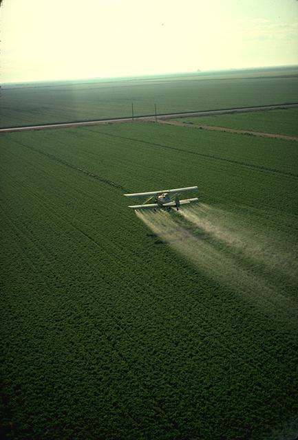
The Eem (; formerly the Amer) is a river in the central Netherlands with a length of approximately . The river is fed by the Vallei Canal and a number of Veluwe creeks, the most important of which are the Heiligenberger Beek, the Barneveldse Beek and the Lunterse Beek, all of which come together in Amersfoort. The river then runs through the Eem Valley to the east of Soest, Baarn and Eemnes before emptying into the Eemmeer. The Eem is responsible for the largest portion of the drainage of the Gelder Valley. The polders of the Eem are valuable scenic landscapes. Because of land subsidence as a result of drainage, the primate lies higher than the surrounding land. When water levels drop in the summer, water is pumped from the Nederrijn to the Eem through the Vallei Canal. Because of agricultural pollution carried by the Eem towards the Eemmeer, the biological richness of this lake is less than that of the other lakes which surround Flevoland. The Eem gives its name to the ... [...More Info...] [...Related Items...] OR: [Wikipedia] [Google] [Baidu] |
Eemnes
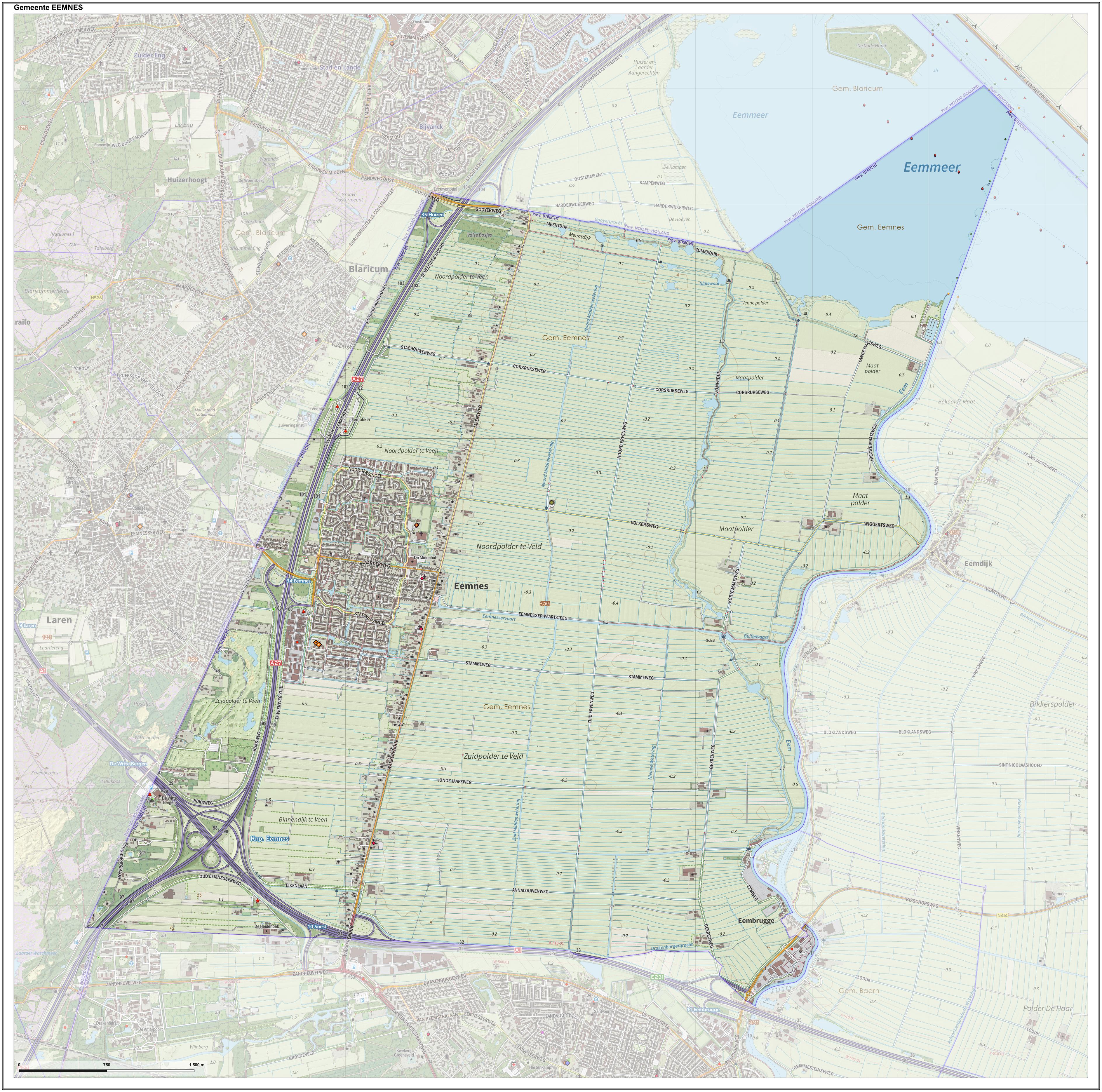
Eemnes () is a municipality and a village in the Netherlands, in the province of Utrecht. The town of Eemnes Eemnes formerly consisted of two villages, Eemnes-Binnen ("Inner Eemnes") and Eemnes-Buiten ("Outer Eemnes"). These names referred to the location of the villages with respect to the dyke of the river Eem. Eemnes-Buiten received city rights in 1345; Eemnes-Binnen was granted city rights in 1439. ''Dutch topographic map of the municipality of Eemnes, June 2015'' Pools Until 1932, when the Afsluitdijk sealed off the Zuiderzee from the North Sea, the weak dykes in this part of the country would occasionally break during storms. This resulted in the formation of pools, which in Dutch are called "''waaien''" or "''wielen''". Because they could be tens of meters in diameter and several metres deep, landowners often did not make the effort of filling them up. Because they symbolize man's battle against the sea and are relatively rare, provincial authorities designated the ... [...More Info...] [...Related Items...] OR: [Wikipedia] [Google] [Baidu] |
Eemian
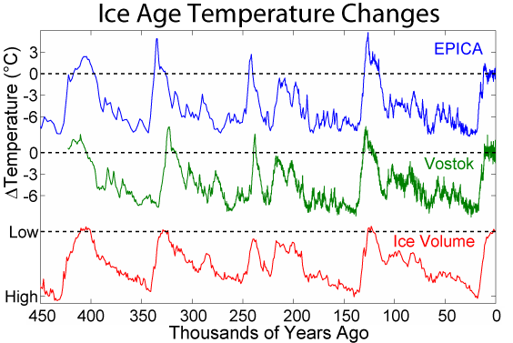
The Last Interglacial, also known as the Eemian, was the interglacial period which began about 130,000 years ago at the end of the Penultimate Glacial Period and ended about 115,000 years ago at the beginning of the Last Glacial Period. It corresponds to Marine Isotope Stage 5e. It was the second-to-latest interglacial period of the current Ice Age, the most recent being the Holocene which extends to the present day (having followed the last glacial period). During the Last Interglacial, the proportion of in the atmosphere was about 280 parts per million. The Last Interglacial was one of the warmest periods of the last 800,000 years, with temperatures comparable to and at times warmer (by up to on average 2 degrees Celsius) than the contemporary Holocene interglacial, with the maximum sea level being up to 6 to 9 metres higher than at present, with global ice volume likely also being smaller than the Holocene interglacial. The Last Interglacial is known as the Eemian in nort ... [...More Info...] [...Related Items...] OR: [Wikipedia] [Google] [Baidu] |
Amersfoort
Amersfoort () is a Cities of the Netherlands, city and List of municipalities of the Netherlands, municipality in the Provinces of the Netherlands, province of Utrecht (province), Utrecht, Netherlands. As of 31 January 2023, the municipality had a population of 160,902, making it the second-largest of the province and fifteenth-largest of the country. Amersfoort is also one of the largest Dutch railway junctions with its three stations—Amersfoort Centraal railway station, Amersfoort Centraal, Amersfoort Schothorst railway station, Schothorst and Amersfoort Vathorst railway station, Vathorst—due to its location on two of the Netherlands' main east to west and north to south railway lines. The city was used during the 1928 Summer Olympics as a venue for the Modern pentathlon at the 1928 Summer Olympics, modern pentathlon events. Amersfoort marked its 750th anniversary as a city in 2009. History Hunter-gatherer, Hunter gatherers set up camps in the Amersfoort region in the Mes ... [...More Info...] [...Related Items...] OR: [Wikipedia] [Google] [Baidu] |
Eemmeer
The Eemmeer () is a lake situated in the middle of the Netherlands between the provinces of Flevoland, Utrecht (province), Utrecht, and North Holland. It measures and contains one small island, the Dode Hond (''Dead Dog''). The Eemmeer is one in a series of peripheral lakes used to Geohydrology, geohydrologically detach the low-lying polders of Flevoland from higher old mainland. The Eemmeer is connected to the peripheral lakes Gooimeer in the west, at the point where both lakes are crossed by the highway A27 bridge, and the Nijkerkernauw in the east. It is also connected to the lakes at the southern side of Markermeer near Amsterdam. The feeders of this lake system are the IJssel, River IJssel (Rhine branch) and drains towards the North Sea. References Lakes of the Netherlands Landforms of Flevoland Landforms of North Holland Landforms of Utrecht (province) Blaricum Zeewolde {{Flevoland-geo-stub ... [...More Info...] [...Related Items...] OR: [Wikipedia] [Google] [Baidu] |
Interglacial
An interglacial period (or alternatively interglacial, interglaciation) is a geological interval of warmer global average temperature lasting thousands of years that separates consecutive glacial periods within an ice age. The current Holocene interglacial began at the end of the Pleistocene, about 11,700 years ago. Pleistocene During the 2.5 million years of the Pleistocene, numerous glacials, or significant advances of continental ice sheets, in North America and Europe, occurred at intervals of approximately 40,000 to 100,000 years. The long glacial periods were separated by more temperate and shorter interglacials. During interglacials, such as the present one, the climate warms and the tundra recedes polewards following the ice sheets. Forests return to areas that once supported tundra vegetation. Interglacials are identified on land or in shallow epicontinental seas by their paleontology. Floral and faunal remains of species pointing to temperate climate and indicating a ... [...More Info...] [...Related Items...] OR: [Wikipedia] [Google] [Baidu] |
Baarn
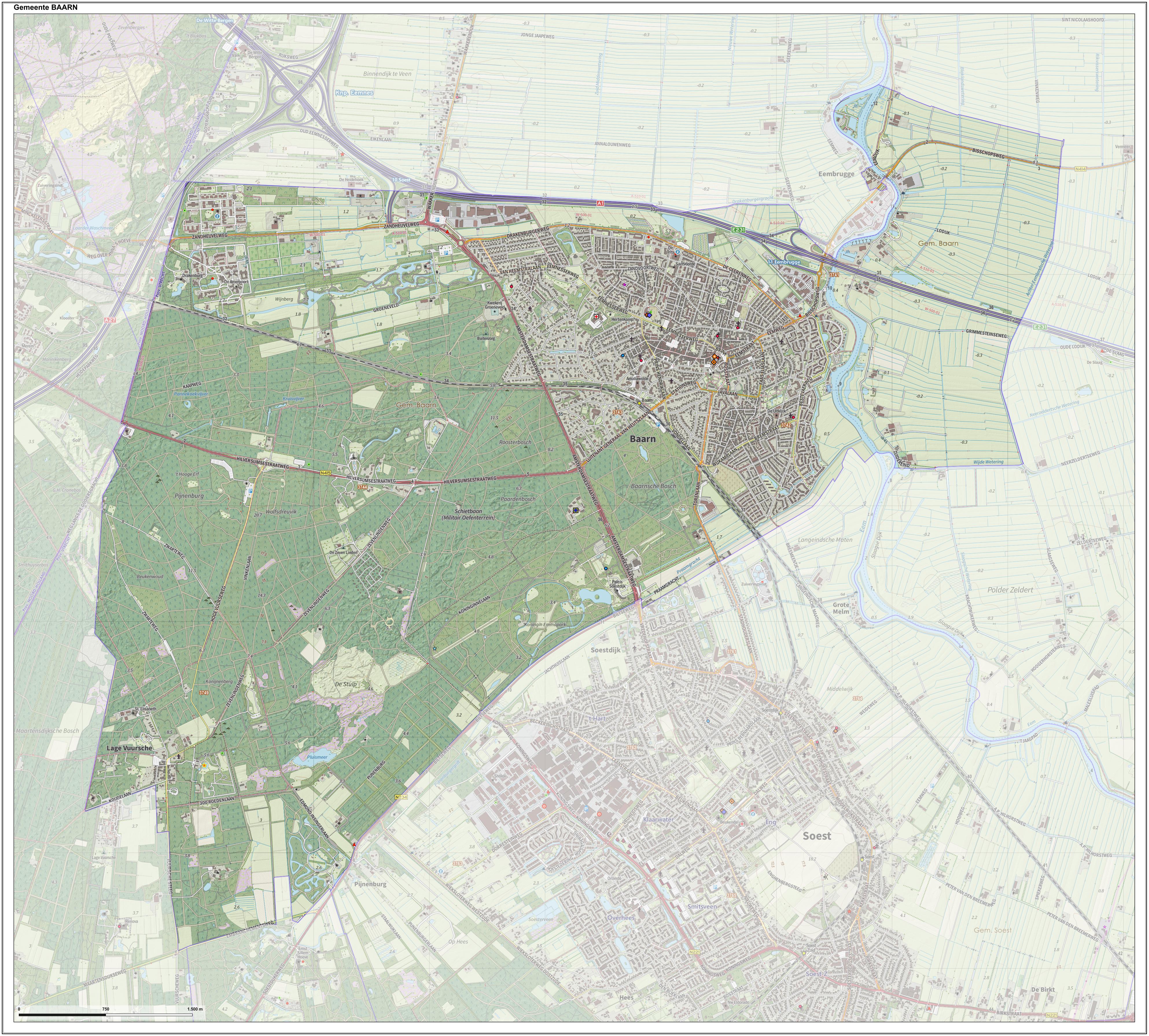
Baarn () is a municipality and a town in the Netherlands, near Hilversum in the province of Utrecht (province), Utrecht. The municipality of Baarn The municipality of Baarn consists of the following towns: Baarn, Eembrugge, Lage Vuursche. The town of Baarn Baarn, the main town of the municipality, received City rights in the Netherlands, city rights in 1391. The town lies about 8 km east of Hilversum. In 2001, the town of Baarn had a population of 22,871. The urban area of the town was , and consisted of 10,076 residences.Statistics Netherlands (CBS), ''Bevolkingskernen in Nederland 2001'' . Statistics are for the continuous built-up area. The royal family owns several houses around Baarn. The Soestdijk Palace in Baarn was the home of Emma of the Netherlands, Queen Emma, Juliana of the Netherlands, Queen Juliana and Juliana's husband prince Prince Bernhard of the Netherlands, Bernard. Crown prince Willem-Alexander, Prince of Orange, Willem Alexander and his brothers a ... [...More Info...] [...Related Items...] OR: [Wikipedia] [Google] [Baidu] |
Utrecht (province)
Utrecht (), officially the Province of Utrecht (), is a Provinces of the Netherlands, province of the Netherlands. It is located in the centre of the country, bordering the Eemmeer in the north-east, the province of Gelderland in the east and south-east, the province of South Holland in the west and south-west and the province of North Holland in the north-west and north. The province of Utrecht has a population of about 1,388,000 as of January 2023. With a land area of approximately , it is the second smallest province in the country. Apart from its Utrecht, eponymous capital, major cities and towns in the province are Amersfoort, Houten, IJsselstein, Nieuwegein, Veenendaal and Zeist. The busiest railway station in the Netherlands, Utrecht Centraal railway station, Utrecht Centraal, is located in the province of Utrecht. History The Archdiocese of Utrecht (695–1580), Bishopric of Utrecht was established in 695 when Saint Willibrord was consecrated bishop of the Frisians a ... [...More Info...] [...Related Items...] OR: [Wikipedia] [Google] [Baidu] |
Soest, Netherlands
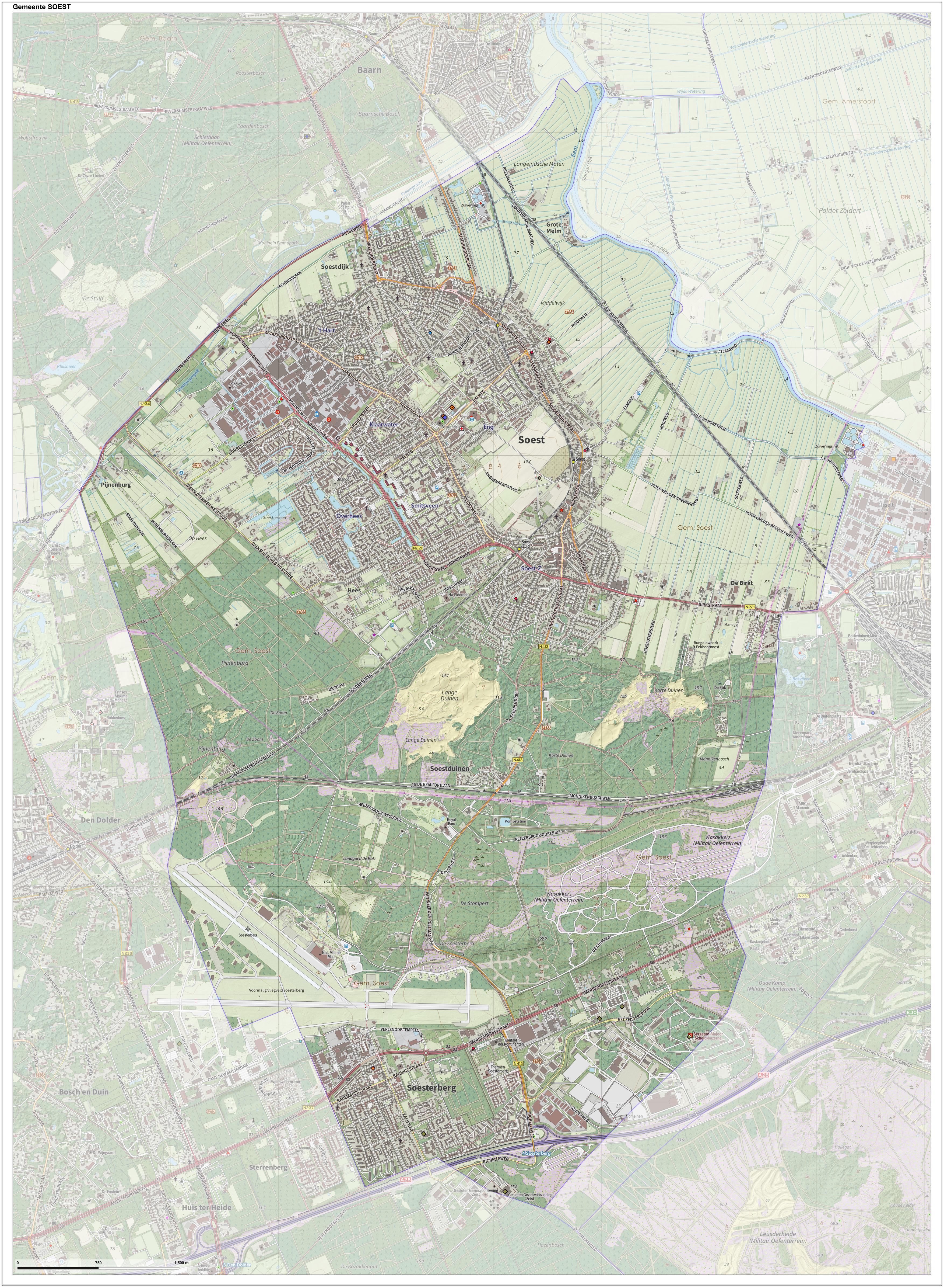
Soest () is a Municipalities of the Netherlands, municipality and town in the central Netherlands, in the province of Utrecht (province), Utrecht. It is about west of Amersfoort. Population centres The town of Soest The oldest documents mentioning Soest (then written as ''Zoys'') date from 1029. Its oldest church (the ''Oude Kerk'', meaning ''Old Church''), which is still in use today, dates from the fifteenth century. Traces of earlier habitation are found though. The area of "Hees", now at the outskirts of Soest may date in to the Early Middle Ages, and prehistory, prehistoric burial mounds in the Soesterduinen point to early habitation in this area. Agricultural activity is still visible as there is much Farmland (farming), farmland within Soest. The biggest area is in the center of the town, on a hill, and are called 'de Engh'. A small street is ''het Kerkpad'' (literally, the Church Path). The Soesterduinen (sand dunes), is a popular area for recreation. Numerous chu ... [...More Info...] [...Related Items...] OR: [Wikipedia] [Google] [Baidu] |
Nederrijn
300px, Course of the Nederrijn The Nederrijn (; "Lower Rhine"; distinct from the Lower Rhine or further upstream) is the Dutch part of the Rhine from the confluence at the town of Angeren of the cut-off Rhine bend of Oude Rijn (Gelderland) and the Pannerdens Kanaal (which was dug to form the new connection between the Waal and Nederrijn branches). The city of Arnhem lies on the right (north) bank of the Nederrijn, just past the point where the IJssel branches off. The Nederrijn flows on to the city of Wijk bij Duurstede, from where it continues as the Lek. The once-important but now small Kromme Rijn branch (in Roman times part of the Limes Germanicus and border river of the Roman Empire) carries the name "Rhine" towards the city of Utrecht. From the city of Utrecht, the Kromme Rijn forks into the Vecht to the north, and into the Oude Rijn (Utrecht and South Holland) to the west. The first part is channelised and known as the Leidse Rijn (Leiden Rhine). After the rail ... [...More Info...] [...Related Items...] OR: [Wikipedia] [Google] [Baidu] |
Flevoland
Flevoland () is the twelfth and newest province of the Netherlands, established in 1986, when the southern and eastern Flevopolders, together with the Noordoostpolder, were merged into one provincial entity. It is in the centre of the country in the former Zuiderzee, which was turned into the freshwater IJsselmeer by the closure of the Afsluitdijk in 1932. Almost all of the land belonging to Flevoland was reclaimed in the 1950s and 1960s while splitting the Markermeer and Bordering lakes from the IJsselmeer. As to dry land, it is the smallest province of the Netherlands at , but not gross land as that includes much of the waters of the fresh water lakes (meres) mentioned. The province had a population of about 445,000 as of January 2023 and consists of six municipalities. Its capital is Lelystad and its most populous city is Almere, which forms part of the Randstad and has grown to become the seventh largest city of the country. Flevoland is bordered in the extreme nort ... [...More Info...] [...Related Items...] OR: [Wikipedia] [Google] [Baidu] |
Agricultural Pollution
Agricultural pollution refers to biotic and abiotic byproducts of farming practices that result in contamination or degradation of the environment and surrounding ecosystems, and/or cause injury to humans and their economic interests. The pollution may come from a variety of sources, ranging from point source water pollution (from a single discharge point) to more diffuse, landscape-level causes, also known as non-point source pollution and air pollution. Once in the environment these pollutants can have both direct effects in surrounding ecosystems, i.e. killing local wildlife or contaminating drinking water, and downstream effects such as dead zones caused by agricultural runoff is concentrated in large water bodies. Management practices, or ignorance of them, play a crucial role in the amount and impact of these pollutants. Management techniques range from animal management and housing to the spread of pesticides and fertilizers in global agricultural practices, which ... [...More Info...] [...Related Items...] OR: [Wikipedia] [Google] [Baidu] |
Latin
Latin ( or ) is a classical language belonging to the Italic languages, Italic branch of the Indo-European languages. Latin was originally spoken by the Latins (Italic tribe), Latins in Latium (now known as Lazio), the lower Tiber area around Rome, Italy. Through the expansion of the Roman Republic, it became the dominant language in the Italian Peninsula and subsequently throughout the Roman Empire. It has greatly influenced many languages, Latin influence in English, including English, having contributed List of Latin words with English derivatives, many words to the English lexicon, particularly after the Christianity in Anglo-Saxon England, Christianization of the Anglo-Saxons and the Norman Conquest. Latin Root (linguistics), roots appear frequently in the technical vocabulary used by fields such as theology, List of Latin and Greek words commonly used in systematic names, the sciences, List of medical roots, suffixes and prefixes, medicine, and List of Latin legal terms ... [...More Info...] [...Related Items...] OR: [Wikipedia] [Google] [Baidu] |
