|
Edgewood, New Mexico
Edgewood is a town in Santa Fe County, New Mexico, United States. Through annexations, its town boundaries now extend into Bernalillo and Torrance Counties. Although in Santa Fe County, Edgewood is geographically closer to Albuquerque than to the city of Santa Fe. The town's population grew 97% between 2000 and 2010, from 1,893 to 3,735. History Homesteaders moving into the American West created the initial settlements that grew into what is now the town of Edgewood. Taking advantage of the federal Homestead Acts, pioneer families obtained land claims and began farming and ranching in the Edgewood area during the late 19th and early 20th centuries. Edgewood was founded by a group of southern Santa Fe County residents and landowners. After the incorporation of the town in 1999, large areas of land were annexed. Efforts by the town government to avoid annexing properties whose owners did not wish to be brought within the town boundaries resulted in a checkerboard pattern o ... [...More Info...] [...Related Items...] OR: [Wikipedia] [Google] [Baidu] |
Town
A town is a type of a human settlement, generally larger than a village but smaller than a city. The criteria for distinguishing a town vary globally, often depending on factors such as population size, economic character, administrative status, or historical significance. In some regions, towns are formally defined by legal charters or government designations, while in others, the term is used informally. Towns typically feature centralized services, infrastructure, and governance, such as municipal authorities, and serve as hubs for commerce, education, and cultural activities within their regions. The concept of a town varies culturally and legally. For example, in the United Kingdom, a town may historically derive its status from a market town designation or City status in the United Kingdom, royal charter, while in the United States, the term is often loosely applied to incorporated municipality, municipalities. In some countries, such as Australia and Canada, distinction ... [...More Info...] [...Related Items...] OR: [Wikipedia] [Google] [Baidu] |
Interstate 40 In New Mexico
Interstate 40 (I-40), a major east–west route of the Interstate Highway System, runs east–west through Albuquerque in the US state of New Mexico. It is the direct replacement for the historic U.S. Highway 66 (US 66). Route description Arizona to Albuquerque As I-40 enters New Mexico in a northeasterly direction, it begins following the basin of the intermittent Puerco River ( Rio Puerco of the West, as opposed to the Rio Puerco of the East that it crosses near Albuquerque), roughly tracing the southern edge of the contiguous part of the Navajo Reservation in the state. The freeway enters Gallup later, paralleling the Burlington Northern Santa Fe Railway's southern transcontinental mainline. Leaving Gallup, the now more easterly I-40 passes to the north of Fort Wingate and part of the fragmented Cibola National Forest before crossing the North American continental divide via Campbell Pass at an elevation of , with the stratovolcano Mount Taylor ... [...More Info...] [...Related Items...] OR: [Wikipedia] [Google] [Baidu] |
Bernalillo Public Schools
Bernalillo Public Schools is a school district with its headquarter in Bernalillo, New Mexico. History As of 1970, Hispanic and Latino people are the majority ethnic group in the area. Prior to 1969 the school board had five members. To encourage elections of members of non-Hispanic groups, in 1969 the number of board members increased to seven. The two new board members included an American Indian and a non-Hispanic white person. Bernalillo High School alumnus Matthew Montaño became the superintendent in 2021. Service area It service area includes most of Bernalillo as well as Algodones, Cochiti, Cochiti Lake, La Madera, Peña Blanca, Placitas, Pueblo of Sandia Village, San Felipe Pueblo, Santo Domingo Pueblo, and most of Santa Ana Pueblo. Schools ; High schools * Bernalillo High School Bernalillo High School is a public high school in Bernalillo, New Mexico, United States. The school is a part of the Bernalillo Public Schools district and is the only high schoo ... [...More Info...] [...Related Items...] OR: [Wikipedia] [Google] [Baidu] |
Albuquerque Public Schools
Albuquerque Public Schools (APS) is a school district based in Albuquerque, New Mexico. Founded in 1891, APS is the largest of 89 public school districts in the state of New Mexico. In 2022 it had a total of 143 schools with some 70,000 students, making it one of the largest school districts in the United States. APS operates 88 elementary, 5 K-8, 28 middle, 20 high, 31 charter, and alternative schools. They also own the radio station KANW and co-own the TV stations KNME-TV and KNMD-TV along with the University of New Mexico. APS serves a majority of Bernalillo County. Exceptions include Barton, the county's portion of Manzano Springs, and a section of Sedillo. APS also includes a portion of Sandoval County, where it serves Corrales. History Albuquerque Public Schools was founded in 1891, shortly after the New Mexico Territorial Legislature passed a new public education law authorizing municipalities to establish school boards and sell municipal bonds for school con ... [...More Info...] [...Related Items...] OR: [Wikipedia] [Google] [Baidu] |
Moriarty-Edgewood School District
Moriarty-Edgewood School District (MESD), also known as Moriarty Municipal Schools,Text list/ref> is a school district headquartered in unincorporated Torrance County, New Mexico, near Moriarty.Compare to: History Its year of establishment was 1907. Stanley was formerly in the Santa Fe School District, which operated a school in Stanley, which in 1962 had 150 students. In 1962 that district's school board approved a plan to have the district moved to Moriarty Municipal Schools. In the period 1999-2013 the number of students in the district declined to 60% of its previous total, with declines increasing in size post-2008. In 2013 three members of the board of education had voted to close two schools, while one member voted against. In 2014 the New Mexico Public Education Department declined the Moriarty-Edgewood plan to close the schools, so the district sued the state agency. Service area Much of the district is in Torrance County. Within Torrance County it includes Moriart ... [...More Info...] [...Related Items...] OR: [Wikipedia] [Google] [Baidu] |
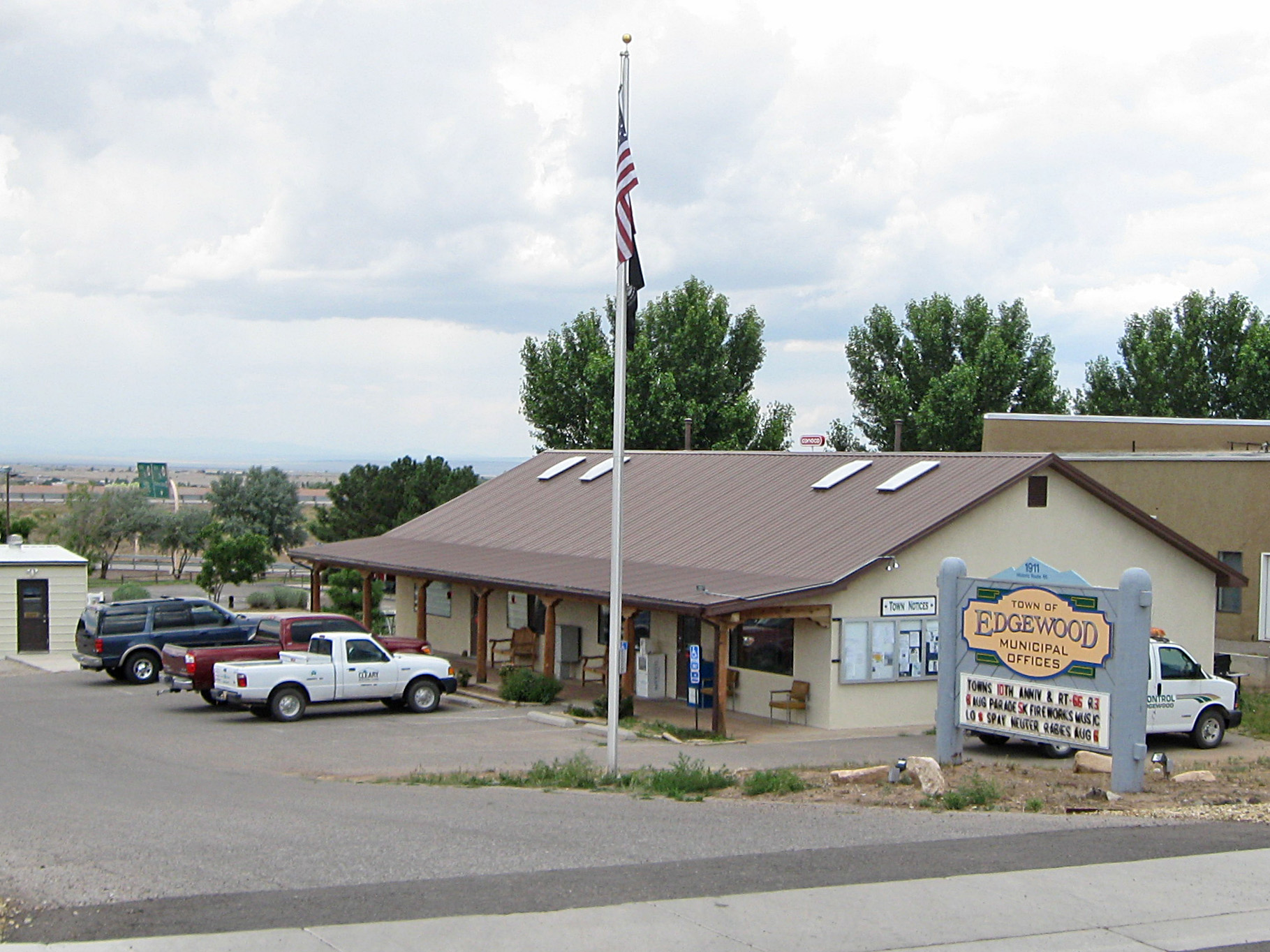
Edgewood New Mexico Municipal Offices
Edgewood may refer to: Places Canada * Edgewood, British Columbia, a settlement United States Cities and towns * Edgewood, California, a census-designated place * Edgewood, Florida, a city * Edgewood, Illinois, a village in Effingham County * Edgewood, Boone County, Illinois, an unincorporated community * Edgewood, Indiana, a town * Edgewood, Iowa, a city * Edgewood, Kentucky, a home rule–class city * Edgewood, Maryland, an unincorporated community and census-designated place * Edgewood, Minnesota, an unincorporated community * Edgewood, Missouri, an unincorporated community * Edgewood, Nevada, an abandoned townsite * Edgewood, New Mexico, a town * Edgewood, New York, a hamlet * Edgewood, Ohio, a census-designated place * Edgewood, Allegheny County, Pennsylvania, a borough * Edgewood, Northumberland County, Pennsylvania, a census-designated place * Edgewood, Texas, a city * Edgewood, Washington, a city * Edgewood, West Virginia, an unincorporated community Neighborhoods * ... [...More Info...] [...Related Items...] OR: [Wikipedia] [Google] [Baidu] |
Poverty Line
The poverty threshold, poverty limit, poverty line, or breadline is the minimum level of income deemed adequate in a particular country. The poverty line is usually calculated by estimating the total cost of one year's worth of necessities for the average adult.Poverty Lines – Martin Ravallion, in The New Palgrave Dictionary of Economics, 2nd Edition, London: Palgrave Macmillan The cost of housing, such as the renting, rent for an apartment, usually makes up the largest proportion of this estimate, so economists track the real estate market and other housing cost indicators as a major influence on the poverty line. Individual factors are often used to account for various circumstances, such as whether one is a parent, elderly, a child, married, etc. The poverty threshold may be adjusted annually. In practice, like the definition of poverty, the official or common understanding of the poverty line is significantly higher in developed country, developed countries than in developi ... [...More Info...] [...Related Items...] OR: [Wikipedia] [Google] [Baidu] |
Per Capita Income
Per capita income (PCI) or average income measures the average income earned per person in a given area (city, region, country, etc.) in a specified year. In many countries, per capita income is determined using regular population surveys, such as the American Community Survey. This allows the calculation of per capita income for both the country as a whole and specific regions or demographic groups. However, comparing per capita income across different countries is often difficult, since methodologies, definitions and data quality can vary greatly. Since the 1990s, the OECD has conducted regular surveys among its 38 member countries using a standardized methodology and set of questions. Per capita income is often used to measure a sector's average income and compare the wealth of different populations. Per capita income is also often used to measure a country's standard of living. When used to compare income levels of different countries, it is usually expressed using a commonly ... [...More Info...] [...Related Items...] OR: [Wikipedia] [Google] [Baidu] |
Census
A census (from Latin ''censere'', 'to assess') is the procedure of systematically acquiring, recording, and calculating population information about the members of a given Statistical population, population, usually displayed in the form of statistics. This term is used mostly in connection with Population and housing censuses by country, national population and housing censuses; other common censuses include Census of agriculture, censuses of agriculture, traditional culture, business, supplies, and traffic censuses. The United Nations (UN) defines the essential features of population and housing censuses as "individual enumeration, universality within a defined territory, simultaneity and defined periodicity", and recommends that population censuses be taken at least every ten years. UN recommendations also cover census topics to be collected, official definitions, classifications, and other useful information to coordinate international practices. The United Nations, UN's Food ... [...More Info...] [...Related Items...] OR: [Wikipedia] [Google] [Baidu] |
Sandia Park, New Mexico
Sandia Park is a census-designated place in Bernalillo County, New Mexico, United States. Its population was 237 as of the 2010 census and 265 as of the 2020 census. Sandia Park has a post office with ZIP code 87047. Tinkertown Museum is an attraction in the area. Demographics Education It is zoned to Albuquerque Public Schools Albuquerque Public Schools (APS) is a school district based in Albuquerque, New Mexico. Founded in 1891, APS is the largest of 89 public school districts in the state of New Mexico. In 2022 it had a total of 143 schools with some 70,000 student .... References Census-designated places in New Mexico Census-designated places in Bernalillo County, New Mexico {{NewMexico-geo-stub ... [...More Info...] [...Related Items...] OR: [Wikipedia] [Google] [Baidu] |


