|
Eastern Division, Fiji
The Eastern Division () is one of Fiji's four Local government in Fiji, divisions. It consists of Kadavu Province, Lau Province, Lomaiviti Province and Rotuma. The capital of the division is Levuka, on the Ovalau (Fiji), Ovalau island. Other islands in the division include Kadavu, Gau Island, Gau, Koro Island, Koro, Nairai, Moala Island, Moala, Matuku Island, Matuku, Vatu Vara, Naitaba, Mago Island, Mago, Cicia, Tuvuca, Lakeba, Vanua Vatu, Oneata, Vuaqava, Kabara, Fiji, Kabara, Moce, and Fulaga. The division is the largest by area (including the sea), but has the smallest land area. The division has sea borders with Central Division, Fiji, Central, Northern Division, Fiji, Northern and Western Division, Fiji, Western Divisions. References External links Divisions of Fiji / Statoids Divisions of Fiji, Eastern {{Fiji-geo-stub ... [...More Info...] [...Related Items...] OR: [Wikipedia] [Google] [Baidu] [Amazon] |
Levuka
Levuka () is a Local government in Fiji, town on the eastern coast of the Fijian island of Ovalau (Fiji), Ovalau, in Lomaiviti Province, in the Eastern Division, Fiji, Eastern Division of Fiji. Prior to 1877, it was the capital of Fiji. At the census in 2007, the last to date, Levuka town had a population of 1,131 (plus 3,266 living in the peri-urban area as defined by the Bureau of Statistics), about half of Ovalau's 8,360 inhabitants. It is the economic hub and the largest of 24 settlements on the island. Having been nominated decades prior, Levuka was designated a UNESCO World Heritage Site in June 2013, in recognition of the port town's exceptional testimony to the late colonial port towns in the Pacific. History The modern town of Levuka was founded around 1820 by European settlers and traders as the first modern town in the Fiji Islands, and became an important port and trading post. A disparate band of settlers made up Levuka's population – traders, missionaries, shipwr ... [...More Info...] [...Related Items...] OR: [Wikipedia] [Google] [Baidu] [Amazon] |
Mago Island
Mago Island (pronounced ) is a volcanic island that lies in the northwest sector of Fiji's northern Lau Group of islands. One of the largest private islands in the southwestern Pacific Ocean, the island has an area of . The island is privately owned by actor and director Mel Gibson. Mago is located 166 statute miles ENE of the Fiji capital of Suva and SW of the tiny island of Namalata, near Vanua Balavu, where descendants of original Mago inhabitants still reside. Mago Island is relatively undeveloped at present and inhabited only by a few caretakers of Indo-Fijian descent. History During the 1860s, a cotton plantation established by the Ryder brothers of Australia flourished there. In 1884 there was a well-established sugar cane plantation plus a sugar mill on the island. The Mill was shut down in 1895 and it was dismantled and used to enlarge the Penang Mill in Ra.w:Colonial Sugar Refining Company (Fiji), Colonial Sugar Refining Company (Fiji) The Ryders were succeeded by t ... [...More Info...] [...Related Items...] OR: [Wikipedia] [Google] [Baidu] [Amazon] |
Northern Division, Fiji
The Northern Division is one of four Divisions into which Fiji's fourteen Provinces are grouped for local government purposes. The administrative centre of the Division, where main governmental departments are located, is Labasa. The Northern Division covers three Provinces: Macuata, Cakaudrove, and Bua, and includes the entire island of Vanua Levu. This is based on the decisions of the traditional Fijian Provinces, as well as administrative considerations. Excluding the Lau Islands, which form part of the Eastern Division, the Northern Division is coextensive with the Tovata Confederacy. Notable Fijian leaders from the Northern Division include Ratu Sir Penaia Ganilau, the first President of the Fijian republic (1987–1993). Prime Minister Sitiveni Rabuka is also from the Northern Division. Ratu Wiliame Katonivere, the current President of Fiji The president of Fiji is the List of heads of state of Fiji, head of state of the Fiji, Republic of Fiji. The presid ... [...More Info...] [...Related Items...] OR: [Wikipedia] [Google] [Baidu] [Amazon] |
Central Division, Fiji
The Central Division () is one of Fiji's four divisions. It consists of five provinces - Naitasiri, Namosi, Rewa, Serua and Tailevu. The capital of the division is Suva, which is also the capital of Fiji. The division includes the eastern part of the largest island in Fiji, Viti Levu Viti Levu (pronounced ; ) is the largest island in Fiji. It is the site of the country's capital and largest city, Suva, and home to a large majority of Fiji's population. Geology Fiji lies in a plate tectonics, tectonically complex area betwe ..., with a few outlying islands, including Beqa. It has a land border with the Western Division on Viti Levu, and sea borders with the Northern Division and Eastern Division. The Central Division includes most of the Kubuna Confederacy and part of the Burebasaga Confederacy, two of the three hierarchies to which Fiji's chiefs all belong. The nonconformity between the boundaries of the divisions and confederacies does not affect administra ... [...More Info...] [...Related Items...] OR: [Wikipedia] [Google] [Baidu] [Amazon] |
Fulaga
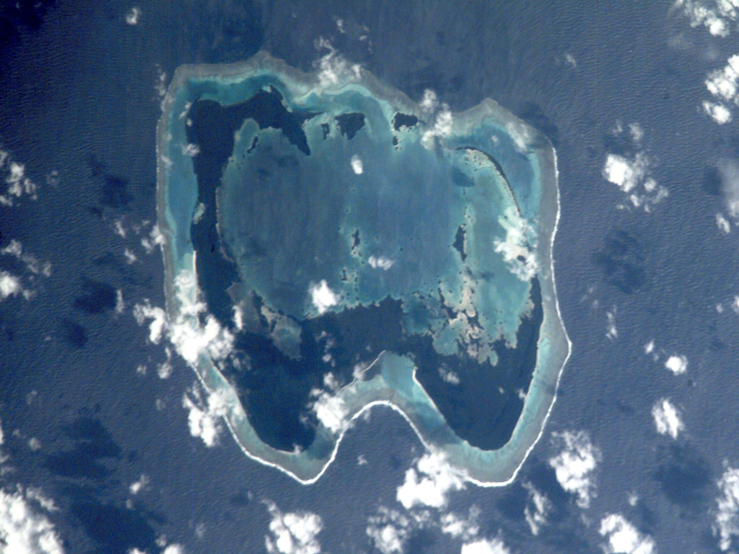
Fulaga (pronounced ) (proper name: Vulaga) is a crescent-shaped reef-limestone island in Fiji's Southern Lau Group. The spectacular lagoon and the fact that the island is a ''Pritchardia thurstonii ''Pritchardia thurstonii'' is a species of flowering plant in the family Arecaceae. It is native to Fiji, in particular the Lau Islands, and the island of ʻEua in Tonga. It is vulnerable and threatened by habitat loss. It is sometimes known as ...'' habitat contribute to its national significance as outlined in Fiji's Biodiversity Strategy and Action Plan. Geography Situated at 19.17° South and 178.65° West, it covers an area of 18.5 square kilometres. It has a maximum elevation of 79 metres. The limestone belongs to the Koroqara Limestone (Tokalau Limestone Group) and is probably Late Miocene in age. In form it is a basin which has been breached in the north, flooding the interior, which has many islets and rocks. The island thus has this unique, beautiful lagoonNew Zealand ... [...More Info...] [...Related Items...] OR: [Wikipedia] [Google] [Baidu] [Amazon] |
Kabara, Fiji
Kabara (pronounced ) is an island of Fiji, a member of the Lau archipelago. With a land area of , its population of around 660 live in four villages. The islanders are noted for their craftsmanship in the area of wood carving. Vesi wood (Intsia bijuga), which grows natively on Kabara, is the traditional material, but deforestation has stripped the island, leaving only 8% of the island covered with Vesi trees . A program of reforestation has been started, but as Vesi trees take 70–80 years to mature, carvers are being encouraged to use as little Vesi wood as possible. Sandalwood, known locally as ''yasi'' is being promoted as an alternative. Unlike Vesi, sandalwood takes only 30–40 years to mature. The Fiji Village news service reported on 28 March 2006 that the World Wide Fund for Nature had donated thirteen 5000-gallon The gallon is a unit of volume in British imperial units and United States customary units. The imperial gallon (imp gal) is defined as , and is or ... [...More Info...] [...Related Items...] OR: [Wikipedia] [Google] [Baidu] [Amazon] |
Vuaqava
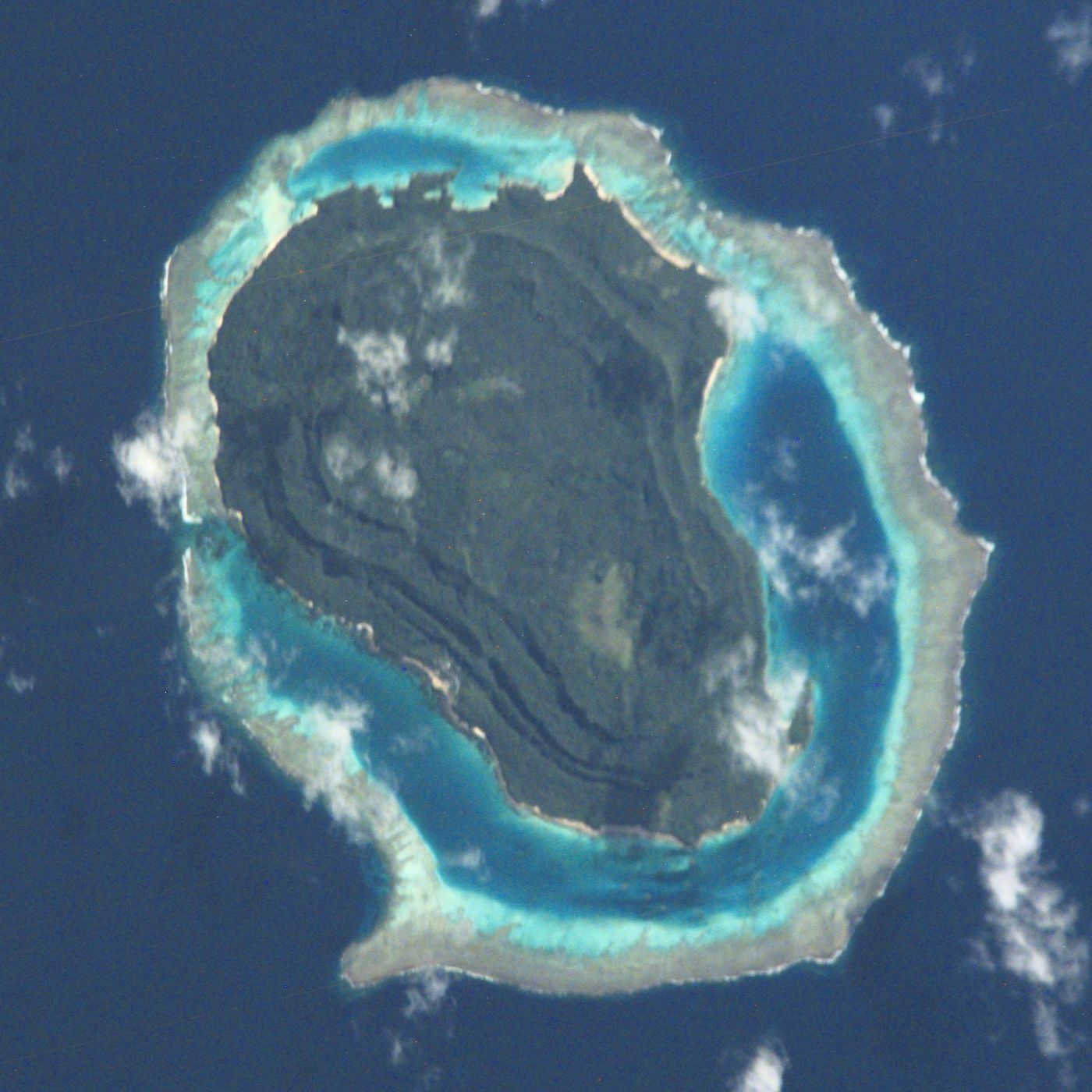
Vuaqava (pronounced ) is an outlier to Kabara, 5 kilometers to the SSW, in Fiji's Southern Lau Group. It occupies an area of 8.1 km2. This limestone island has a maximum altitude of 107 meters. The island is uninhabited but visited by fishermen. The limestone belongs to the Koroqara Limestone (Tokalau Limestone Group) and is probably Late Miocene in age. It is mostly fragmental in nature but true reef occurs along much of the south coast. The interior basin is occupied by the largest lake in Fiji, area 121 ha. There is an emerged notch 1 m above lake level. See also * Desert island * List of islands This is a list of the lists of islands in the world grouped by country, by continent, by body of water A body of water or waterbody is any significant accumulation of water on the surface of Earth or another planet. The term most often refer ... Uninhabited islands of Fiji Lau Islands {{Fiji-geo-stub ... [...More Info...] [...Related Items...] OR: [Wikipedia] [Google] [Baidu] [Amazon] |
Vanua Vatu
Vanua Vatu is an island in Fiji. It is located in the Eastern Division, 240 km east of the capital Suva Suva (, ) is the Capital city, capital and the most populous city of Fiji. It is the home of the country's largest metropolitan area and serves as its major port. The city is located on the southeast coast of the island of Viti Levu, in Rew .... The area is 4.2 square kilometers. References Lau Islands Islands of Fiji {{Fiji-geo-stub ... [...More Info...] [...Related Items...] OR: [Wikipedia] [Google] [Baidu] [Amazon] |
Lakeba
Lakeba (pronounced ) is an island in Fiji’s Southern Lau Islands, Lau Archipelago; the provincial capital of Lau is located here. The island is the List of islands of Fiji, tenth largest in Fiji, with a land area of nearly 60 square kilometers.Steadman (2006) It is fertile and well watered, and encircled by a 29-kilometer road. Its closest neighbors are Aiwa (Fiji), Aiwa and Nayau. Separated by deep sea from the latter but only by shallow waters from the former, when sea levels were lower during Glacial period, glacial episodes Lakeba and Aiwa formed one large island. It has a population of around 2,100 in eight villages, the most important of which is the capital Tubou which lies in the island's south. Near Tubou is the village of Levuka (Lakeba), Levuka; not to be confused with Levuka, its namesake – Fiji's old capital – Levuka on Lakeba is home to a fishing tribe whose ancestors came from Bau (island), Bau Island. Another significant village is Nasaqalau, located ... [...More Info...] [...Related Items...] OR: [Wikipedia] [Google] [Baidu] [Amazon] |
Tuvuca
Tuvuca (pronounced ) is a small island off Vanua Balavu in Fiji's Lau archipelago. It is a densely wooded and inhabited island and rises above sea level at the highest point. There is only one village on the island, which has a population of around 180 people. There is a primary school. Tuvuca has untapped deposits of phosphate. Chiefly titles Tuvuca is part of the Tikina of Lomaloma and the chiefly title of this island is held by the Tui Tuvuca, which is generally held in personal union A personal union is a combination of two or more monarchical states that have the same monarch while their boundaries, laws, and interests remain distinct. A real union, by contrast, involves the constituent states being to some extent in ... by the reigning Turaga na Rasau.Ai Vola Ni Kawa Bula The Village Chief of Tuvuca holds the title of Ramasi, it was this chiefs ancestors who gave the title to the Rasau of Lomaloma because he brought peace to Tuvuca and stopped a long-standing fe ... [...More Info...] [...Related Items...] OR: [Wikipedia] [Google] [Baidu] [Amazon] |


