|
Dr. Guillermo Mann Base
Doctor Guillermo Mann Base (formerly Camp Shirreff) is a Chilean Antarctic research base. It is located on the east side of Cape Shirreff on Ioannes Paulus II Peninsula on Livingston Island in the South Shetland Islands off the Antarctic peninsula. It is adjacent to the Shirreff Base that is administrated by the United States. The base is named after the Chilean zoologist, naturalist and ecologist Guillermo Mann, who participated in 1947 on the first Chilean Antarctic Expedition. This base should not to be confused with the old Doctor Guillermo Mann or Spring-INACH Base from 1973 that is located in the Spring Point, Hughes Bay. Today that base is not operational. See also * List of Antarctic research stations * List of Antarctic field camps Many Antarctic research stations support satellite field camps which are, in general, seasonal camps. The type of field camp can vary – some are permanent structures used during the annual Antarctic summer, whereas others are little ... [...More Info...] [...Related Items...] OR: [Wikipedia] [Google] [Baidu] |
Research Stations In Antarctica
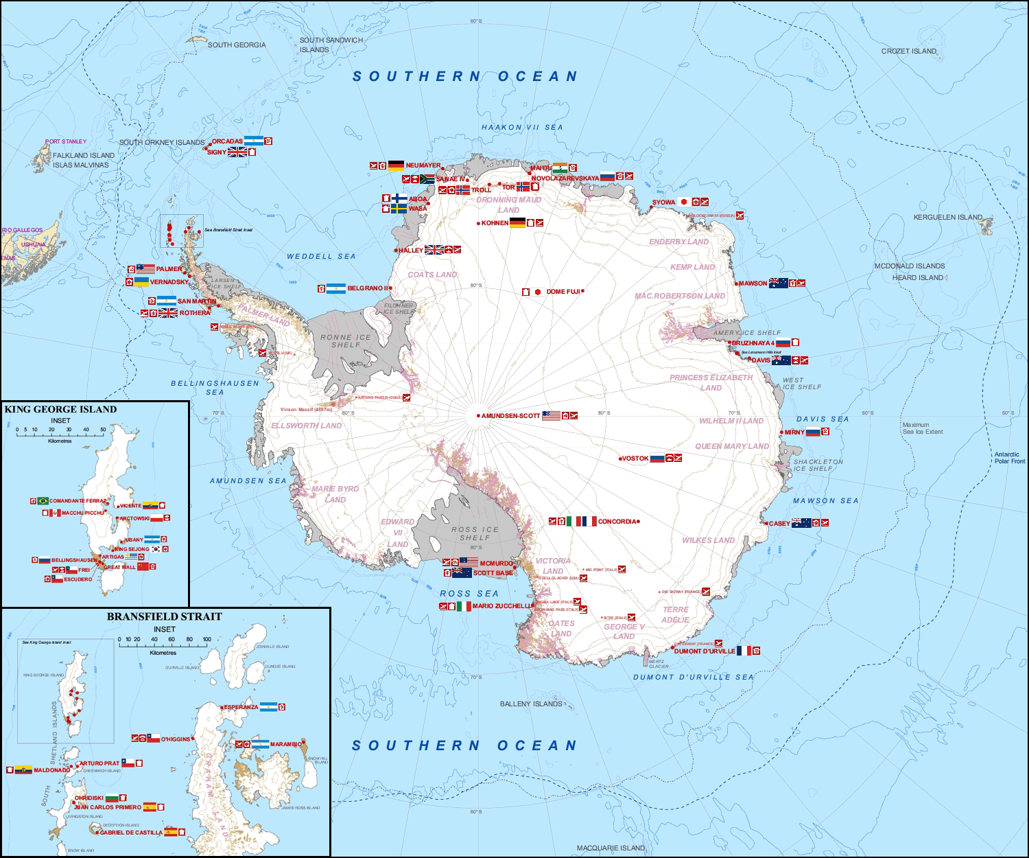
Multiple governments have set up permanent research stations in Antarctica and these bases are widely distributed. Unlike the drifting ice stations set up in the Arctic, the research stations of the Antarctic are constructed either on rock or on ice that is (for practical purposes) fixed in place. Many of the stations are demographics of Antarctica, staffed throughout the year. A total of 42 countries (as of October 2006), all signatories to the Antarctic Treaty System, Antarctic Treaty, operate seasonal (summer) and year-round research stations on the continent. The population of people performing and supporting scientific research on the continent and nearby islands varies from approximately 4,000 during the summer season to 1,000 during winter (June). In addition to these permanent stations, approximately Antarctic field camps, 30 field camps are established each summer to support specific projects. History First bases During the Heroic Age of Antarctic Exploration in t ... [...More Info...] [...Related Items...] OR: [Wikipedia] [Google] [Baidu] |
Cape Shirreff
Cape Shirreff is a prominent cape at the north end of the rocky peninsula which separates Hero Bay and Barclay Bay on the north coast of Livingston Island, in the South Shetland Islands of Antarctica. The cape was named by Edward Bransfield in 1820 after Captain William H. Shirreff, the British commanding officer in the Pacific at that time. The seasonal scientific field station Doctor Guillermo Mann Base has been operated by Chile since 1991 and the Shirreff Base by the USA since 1996. Description Situated on a small, ice-free peninsula forming the northern extremity of Ioannes Paulus II Peninsula, which is protected by the Convention on the Conservation of Antarctic Marine Living Resources Ecosystem Monitoring Programme and requires a permit to enter. It is 24 km north-east of Essex Point, 34 km west-south-west of Williams Point and 21 km north-west of Siddins Point. Lying also 809 km south-south-east of Cape Horn, Cape Shirreff is the locality in th ... [...More Info...] [...Related Items...] OR: [Wikipedia] [Google] [Baidu] |
Chilean Antarctic Territory
The Chilean Antarctic Territory or Chilean Antarctica (Spanish: ''Territorio Chileno Antártico'', ''Antártica Chilena'') is the territory in Antarctica claimed by Chile. The Chilean Antarctic Territory ranges from 53° West to 90° West and from the South Pole to the 60° South parallel, partially overlapping the Argentine and British Antarctic claims. It is administered by the Cabo de Hornos municipality in the South American mainland. The territory claimed by Chile covers the South Shetland Islands, Antarctic Peninsula, called ''"O'Higgins Land"'' ''("Tierra de O'Higgins" in Spanish)'' in Chile, and adjacent islands, the Alexander Island, Charcot Island, and part of the Ellsworth Land, among others. It has an area of 1,250,257.6 km2. Its boundaries are defined by Decree 1747, issued on November 6, 1940, and published on June 21, 1955, the Ministry of Foreign Affairs established: Within Chilean territorial organization Antártica is the name of the commune that ad ... [...More Info...] [...Related Items...] OR: [Wikipedia] [Google] [Baidu] |
Antarctic Field Camps
Many Antarctic research stations support satellite field camps which are, in general, seasonal camps. The type of field camp can vary – some are permanent structures used during the annual Antarctic summer, whereas others are little more than tents used to support short term activities. Field camps are used for many things, from logistics (Sky Blu) to dedicated scientific research (WAIS Divide Field Camp). List of field camps See also *Research stations in Antarctica *Demographics of Antarctica *List of Antarctic expeditions This list of Antarctic expeditions is a chronological list of expeditions involving Antarctica. Although the existence of a southern continent had been hypothesized as early as the writings of Ptolemy in the 1st century AD, the South Pole was no ... * Transport in Antarctica References External links COMNAP Antarctic Facilities() COMNAP Antarctic Facilities Map() Antarctic Digital Database Map ViewerSCAR {{Polar exploration Field ... [...More Info...] [...Related Items...] OR: [Wikipedia] [Google] [Baidu] |
Hughes Bay
Hughes Bay is a bay lying between Cape Sterneck and Cape Murray along the west coast of the Antarctic Peninsula. It is wide and lies south of Chavdar Peninsula and north of Pefaur (Ventimiglia) Peninsula, indenting the Danco Coast on the west side of Graham Land for . History The name has appeared on maps for over 100 years, and commemorates Edward Hughes, master of the ''Sprightly'', a sealing vessel owned by the London whaling company Samuel Enderby & Sons, which explored in this area in 1824–25. Hughes Bay may have been site of the first landing on the Antarctic mainland, by sealers from the U.S. sealing vessel ''Cecilia'' under Captain John Davis on February 7, 1821. SCAR |
Spring Point, Antarctica
Spring Point is a point forming the south side of the entrance to Brialmont Cove, on the west coast of Graham Land in Antarctica. Discovered in 1898 by the Belgian Antarctic Expedition The Belgian Antarctic Expedition of 1897–1899 was the first expedition to winter in the Antarctic region. Led by Adrien de Gerlache de Gomery aboard the RV ''Belgica'', it was the first Belgian Antarctic expedition and is considered the firs ... under Gerlache. He named it for Professor Walthère-Victor Spring chemist of the Université de Liège, a member of the Académie Royale de Belgique and of the Commission de la Belgica. References {{GrahamLand-geo-stub Danco Coast ... [...More Info...] [...Related Items...] OR: [Wikipedia] [Google] [Baidu] |
First Chilean Antarctic Expedition
The First Chilean Antarctic Expedition (1947–1948) was an expedition to Antarctica mounted by the Chilean government and military to enforce its territorial claims against British challenges, namely Operation Tabarin. Among other accomplishments the expedition established Base General Bernardo O'Higgins Riquelme on February 18, 1948. Chilean President Gabriel González Videla personally inaugurated the base, thereby becoming the first head of state to set foot on the continent. The inactive research station González Videla Antarctic Base is named in his honor. The O'Higgins Base is still operated by the Chilean Army The Chilean Army ( es, Ejército de Chile) is the land arm of the Military of Chile. This 80,000-person army (9,200 of which are conscripts) is organized into six divisions, a special operations brigade and an air brigade. In recent years, and a ..., one of the Antarctic bases with the longest times of continuous operation. The expedition was led by Commodore ... [...More Info...] [...Related Items...] OR: [Wikipedia] [Google] [Baidu] |
United States
The United States of America (U.S.A. or USA), commonly known as the United States (U.S. or US) or America, is a country primarily located in North America. It consists of 50 states, a federal district, five major unincorporated territories, nine Minor Outlying Islands, and 326 Indian reservations. The United States is also in free association with three Pacific Island sovereign states: the Federated States of Micronesia, the Marshall Islands, and the Republic of Palau. It is the world's third-largest country by both land and total area. It shares land borders with Canada to its north and with Mexico to its south and has maritime borders with the Bahamas, Cuba, Russia, and other nations. With a population of over 333 million, it is the most populous country in the Americas and the third most populous in the world. The national capital of the United States is Washington, D.C. and its most populous city and principal financial center is New York City. Paleo-Americ ... [...More Info...] [...Related Items...] OR: [Wikipedia] [Google] [Baidu] |
Shirreff Base
Shirreff Base (official name Cape Shirreff Field Station) SCAR is a seasonal field station in the Southern Ocean operated by the and opened in 1996. It is situated on the east side of on |
Antarctic
The Antarctic ( or , American English also or ; commonly ) is a polar region around Earth's South Pole, opposite the Arctic region around the North Pole. The Antarctic comprises the continent of Antarctica, the Kerguelen Plateau and other island territories located on the Antarctic Plate or south of the Antarctic Convergence. The Antarctic region includes the ice shelves, waters, and all the island territories in the Southern Ocean situated south of the Antarctic Convergence, a zone approximately wide varying in latitude seasonally. The region covers some 20 percent of the Southern Hemisphere, of which 5.5 percent (14 million km2) is the surface area of the Antarctica continent itself. All of the land and ice shelves south of 60°S latitude are administered under the Antarctic Treaty System. Biogeographically, the Antarctic realm is one of eight biogeographic realms of Earth's land surface. Geography As defined by the Antarctic Treaty System, the Antarctic r ... [...More Info...] [...Related Items...] OR: [Wikipedia] [Google] [Baidu] |
Antarctica
Antarctica () is Earth's southernmost and least-populated continent. Situated almost entirely south of the Antarctic Circle and surrounded by the Southern Ocean, it contains the geographic South Pole. Antarctica is the fifth-largest continent, being about 40% larger than Europe, and has an area of . Most of Antarctica is covered by the Antarctic ice sheet, with an average thickness of . Antarctica is, on average, the coldest, driest, and windiest of the continents, and it has the highest average elevation. It is mainly a polar desert, with annual precipitation of over along the coast and far less inland. About 70% of the world's freshwater reserves are frozen in Antarctica, which, if melted, would raise global sea levels by almost . Antarctica holds the record for the lowest measured temperature on Earth, . The coastal regions can reach temperatures over in summer. Native species of animals include mites, nematodes, penguins, seals and tardigrades. Where vegetation o ... [...More Info...] [...Related Items...] OR: [Wikipedia] [Google] [Baidu] |
Chile
Chile, officially the Republic of Chile, is a country in the western part of South America. It is the southernmost country in the world, and the closest to Antarctica, occupying a long and narrow strip of land between the Andes to the east and the Pacific Ocean to the west. Chile covers an area of , with a population of 17.5 million as of 2017. It shares land borders with Peru to the north, Bolivia to the north-east, Argentina to the east, and the Drake Passage in the far south. Chile also controls the Pacific islands of Juan Fernández, Isla Salas y Gómez, Desventuradas, and Easter Island in Oceania. It also claims about of Antarctica under the Chilean Antarctic Territory. The country's capital and largest city is Santiago, and its national language is Spanish. Spain conquered and colonized the region in the mid-16th century, replacing Inca rule, but failing to conquer the independent Mapuche who inhabited what is now south-central Chile. In 1818, after declaring in ... [...More Info...] [...Related Items...] OR: [Wikipedia] [Google] [Baidu] |


