|
Dom Hut
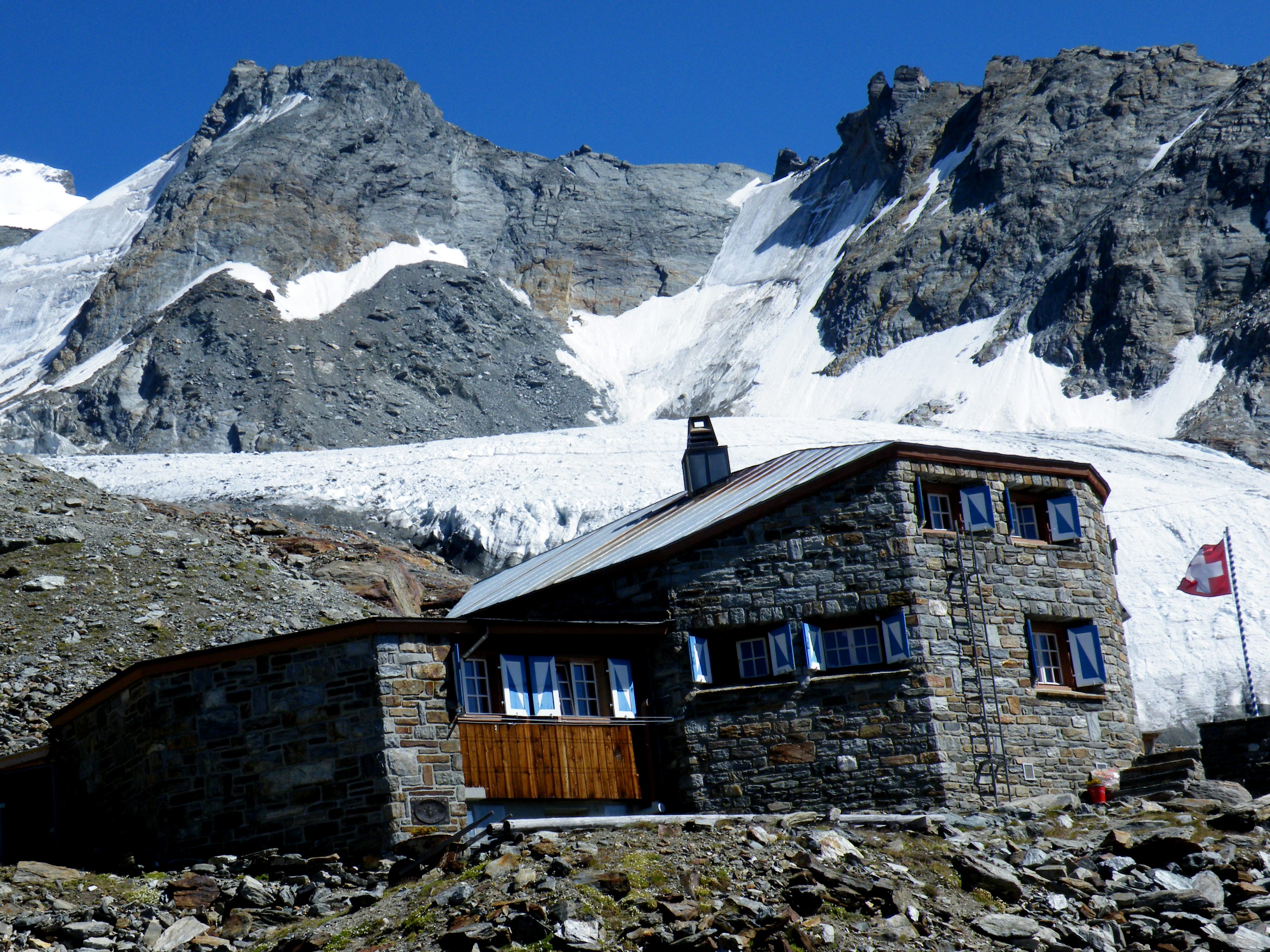
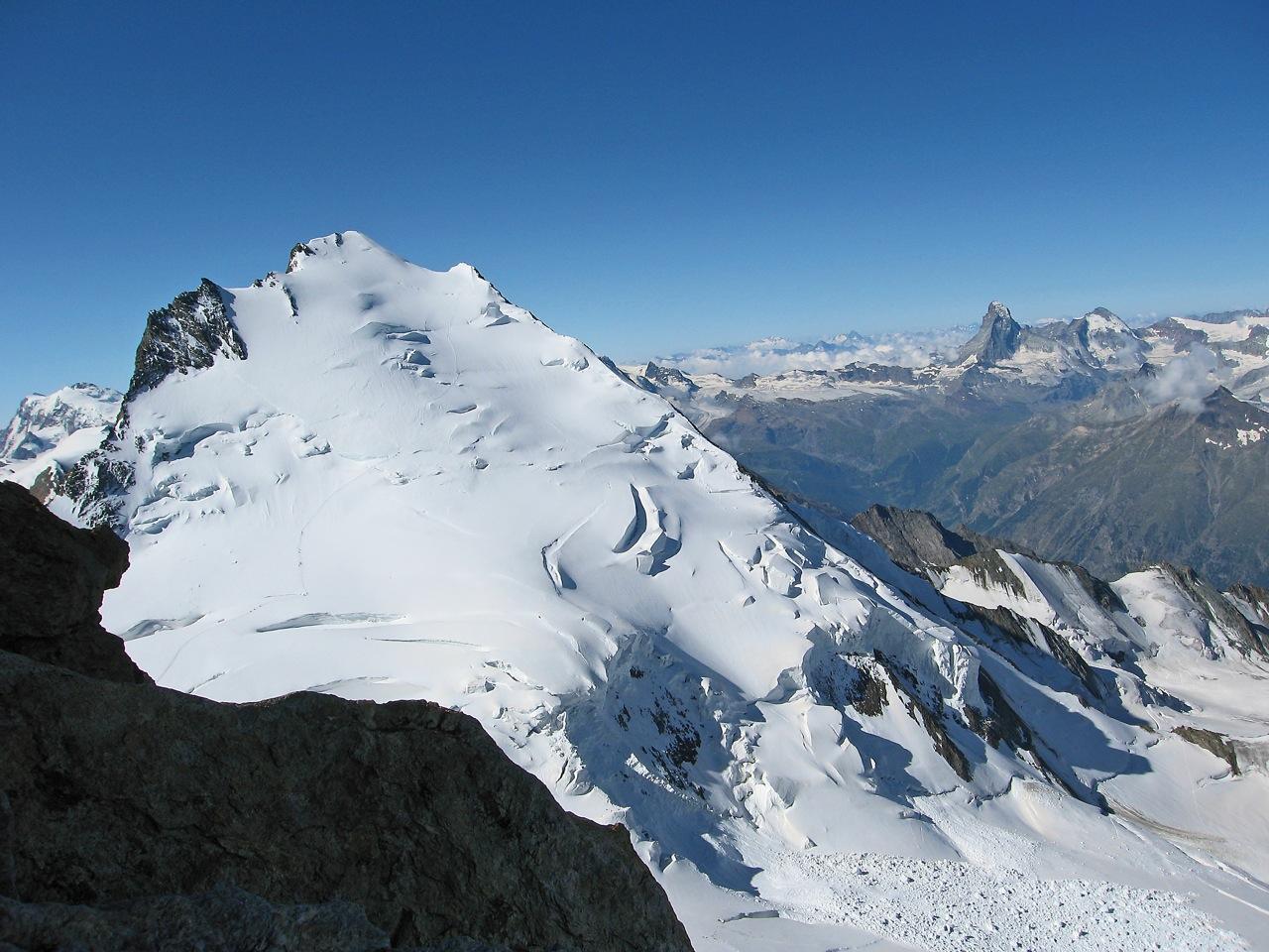
The Dom Hut (german: Domhütte) is a mountain hut of the Swiss Alpine Club The Swiss Alpine Club (german: Schweizer Alpen-Club, french: Club Alpin Suisse, it, Club Alpino Svizzero, rm, Club Alpin Svizzer) is the largest mountaineering club in Switzerland. It was founded in 1863 in Olten and it is now composed of 111 s ..., located above Randa, Switzerland, Randa in the canton of Valais. The hut lies on the western sloped of the Dom (mountain), Dom, at a height of 2,940 m above sea level, near the bottom of the Festigletscher glacier in the Pennine Alps. The Dom Hut is mainly used as the starting point of the normal route of the Dom. A trail leads to the hut from Randa, crossing the Europaweg near the Europa Hut, and climbs further to the Festigletscher (3,200 m). References *Swisstopo topographic maps External links Official website (German) Mountain huts in Switzerland Mountain huts in the Alps {{Valais-geo-stub ... [...More Info...] [...Related Items...] OR: [Wikipedia] [Google] [Baidu] |
Mountain Hut
A mountain hut is a building located high in the mountains, generally accessible only by foot, intended to provide food and shelter to mountaineers, climbers and hikers. Mountain huts are usually operated by an Alpine Club or some organization dedicated to hiking or mountain recreation. They are known by many names, including alpine hut, mountain shelter, mountain refuge, mountain lodge, and mountain hostel. It may also be called a refuge hut, although these occur in lowland areas (e.g. lowland forests) too. Mountain huts can provide a range of services, starting with shelter and simple sleeping berths. Some, particularly in remote areas, are not staffed, but others have staff which prepare meals and drinks and can provide other services, including providing lectures and selling clothing and small items. Mountain huts usually allow anybody to access their facilities, although some require reservations. While shelters have long existed in mountains, modern hut systems date back ... [...More Info...] [...Related Items...] OR: [Wikipedia] [Google] [Baidu] |
Swiss Alpine Club
The Swiss Alpine Club (german: Schweizer Alpen-Club, french: Club Alpin Suisse, it, Club Alpino Svizzero, rm, Club Alpin Svizzer) is the largest mountaineering club in Switzerland. It was founded in 1863 in Olten and it is now composed of 111 sections with 160,000 members (2020). These include the Association of British Members of the Swiss Alpine Club. History The Swiss Alpine Club was the first Alpine club founded in continental Europe after the foundation of the Alpine Club (1857) in London. One of the founders and the first president of the Club was Dr. Melchior Ulrich; other members were Gottlieb Samuel Studer and Dr. Simler. The inaugural meeting was held in Olten. With the increasing number of climbers, steps had to be taken to make the approach to the mountains a little less complicated and exhausting. Until mountain huts were built, there had been no choice for the climbers other than sleeping in the highest chalets or in a Bivouac shelter under some overhanging ro ... [...More Info...] [...Related Items...] OR: [Wikipedia] [Google] [Baidu] |
Randa, Switzerland
Randa is a municipality in the district of Visp in the canton of Valais in Switzerland. It is located between the Weisshorn and the Dom in the Matter Valley. The village is accessible by road and rail, and it has a campsite which offers a taxi service to Zermatt, a car-free town. The Glacier Express train line also connects Randa to Zermatt. History Randa is first mentioned in 1305 as ''Randa''. In 1819, the village was almost totally destroyed by the blast from a huge avalanche that fell nearby. In 1991, a portion of the village was flooded following a large rockslide from a cliff above the town. Randa is a two-hour hike from the Charles Kuonen Suspension Bridge, the world's longest simple suspension bridge for pedestrians. It was opened in 2017 as part of the ''Europaweg'', the scenic hiking route between Grächen and Zermatt. Geography Randa has an area, , of . Of this area, 8.0% is used for agricultural purposes, while 9.9% is forested. Of the rest of the land, 0.6% ... [...More Info...] [...Related Items...] OR: [Wikipedia] [Google] [Baidu] |
Valais
Valais ( , , ; frp, Valês; german: Wallis ), more formally the Canton of Valais,; german: Kanton Wallis; in other official Swiss languages outside Valais: it, (Canton) Vallese ; rm, (Chantun) Vallais. is one of the cantons of Switzerland, 26 cantons forming the Switzerland, Swiss Confederation. It is composed of thirteen districts and its capital and largest city is Sion, Switzerland, Sion. The flag of the canton is made of thirteen stars representing the districts, on a white-red background. Valais is situated in the southwestern part of Switzerland, the country. It borders the cantons of Canton of Vaud, Vaud and Canton of Bern, Bern to the north, the cantons of Canton of Uri, Uri and Ticino to the east, as well as Italy to the south and France to the west. It is one of the three large southern Alps, Alpine cantons, along with Ticino and the Grisons, which encompass a vast diversity of ecosystems. It is a bilingual canton, French language, French and German language, German ... [...More Info...] [...Related Items...] OR: [Wikipedia] [Google] [Baidu] |
Dom (mountain)
The Dom is a mountain of the Pennine Alps, located between Randa and Saas-Fee in the canton of Valais in Switzerland. With a height of , it is the seventh highest summit in the Alps, overall. Based on prominence, it can be regarded as the third highest mountain in the Alps, and the second highest in Switzerland, after Monte Rosa. The Dom is the main summit of the Mischabel group (German: ''Mischabelhörner''), which is the highest massif lying entirely in Switzerland. The Dom is noteworthy for its 'normal route' of ascent having the greatest vertical height gain of all the alpine 4000 metre peaks, and none of that route's 3,100 metres of height can be achieved using mechanical means. Although ''Dom'' is a German cognate for 'dome', it can also mean 'cathedral' and the mountain is named after Canon Berchtold of Sitten cathedral, the first person to survey the vicinity. The former name ''Mischabel'' comes from an ancient German dialect term for ''pitchfork'', as the highest p ... [...More Info...] [...Related Items...] OR: [Wikipedia] [Google] [Baidu] |
Pennine Alps
The Pennine Alps (german: Walliser Alpen, french: Alpes valaisannes, it, Alpi Pennine, la, Alpes Poeninae), also known as the Valais Alps, are a mountain range in the western part of the Alps. They are located in Switzerland (Valais) and Italy (Piedmont and the Aosta Valley). The Pennine Alps are amongst the three highest major subranges of the Alps, together with the Bernese Alps and the Mont Blanc massif. Geography The Italian side is drained by the rivers Dora Baltea, Sesia and Toce, tributaries of the Po. The Swiss side is drained by the Rhône. The Great St Bernard Tunnel, under the Great St Bernard Pass, leads from Martigny, Switzerland to Aosta. Morphology The main chain ( watershed between the Mediterranean Sea and the Adriatic Sea) runs from west to east on the border between Italy (south) and Switzerland (north). From Mont Vélan, the first high summit east of St Bernard Pass, the chain rarely goes below 3000 metres and contains many four-thousanders such as Mat ... [...More Info...] [...Related Items...] OR: [Wikipedia] [Google] [Baidu] |
Europa Hut
The Europa Hut (German: ''Europahütte'') is a mountain hut located in the Mattertal above Randa in the Mischabel range at 2,265 m, owned by the Swiss Alpine Club. It lies on the Grächen-Zermatt high trail, called ''Europaweg'' (also part of the Monte Rosa Tour). From the hut a trail leads to the Dom Hut, on the normal route to the Dom Dom or DOM may refer to: People and fictional characters * Dom (given name), including fictional characters * Dom (surname) * Dom La Nena (born 1989), stage name of Brazilian-born cellist, singer and songwriter Dominique Pinto * Dom people, an et .... The Europaweg is badly affected by unstable terrain; the entire path is prone to rockfalls and sections are sometimes closed. The section between the Europahütte and Zermatt reopened on 4 July 2010 with the construction of a 230-metre suspension bridge over the Grabengufer ravine, but this has since been closed due to the risk of falling rocks. A new bridge has now replaced the old one and is o ... [...More Info...] [...Related Items...] OR: [Wikipedia] [Google] [Baidu] |
Swisstopo
Swisstopo is the official name for the Swiss Federal Office of Topography (in German language, German: ''Bundesamt für Landestopografie''; French language, French: ''Office fédéral de topographie''; Italian language, Italian: ''Ufficio federale di topografia''; Romansh language, Romansh: ''Uffizi federal da topografia''), Switzerland's national mapping agency. The current name was made official in 2002. It had been in use as the domain name for the institute's homepage, swisstopo.ch, since 1997. Maps The main class of products produced by Swisstopo are topographical maps on seven different Scale (map), scales. Swiss maps have been praised for their accuracy and quality. Regular maps * 1:25.000. This is the most detailed map, useful for many purposes. Those are popular with tourists, especially for famous areas like Zermatt and St. Moritz. These maps cost CHF 13.50 each (2004). 208 maps on this scale are published at regular intervals. The first map published on this scale ... [...More Info...] [...Related Items...] OR: [Wikipedia] [Google] [Baidu] |
Mountain Huts In Switzerland
A mountain is an elevated portion of the Earth's crust, generally with steep sides that show significant exposed bedrock. Although definitions vary, a mountain may differ from a plateau in having a limited summit area, and is usually higher than a hill, typically rising at least 300 metres (1,000 feet) above the surrounding land. A few mountains are isolated summits, but most occur in mountain ranges. Mountains are formed through tectonic forces, erosion, or volcanism, which act on time scales of up to tens of millions of years. Once mountain building ceases, mountains are slowly leveled through the action of weathering, through slumping and other forms of mass wasting, as well as through erosion by rivers and glaciers. High elevations on mountains produce colder climates than at sea level at similar latitude. These colder climates strongly affect the ecosystems of mountains: different elevations have different plants and animals. Because of the less hospitable terrain and ... [...More Info...] [...Related Items...] OR: [Wikipedia] [Google] [Baidu] |


