|
Djado
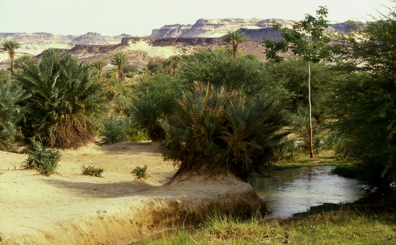
Djado is a ghost town in Bilma Department, Bilma in Niger. The settlement lies on the Djado Plateau, plateau with the same name. The settlement likely wasn't called Djado during its existence. The site is quite remote. No excavation has been done, so the real name of the settlement is unknown. Geography The former Djado is located in an oasis, in the northeastern part of Ténéré Desert, Ténéré desert. Ténéré desert is considered part of the Sahara. It is located on the southeastern end of the Djado Plateau, Djado plateau. For the administration, there's also a modern-day commune called Djado. The modern-day commune also comprises the Menfueni plateau and the Thchigai plateau. Modern-day Djado is the northernmost and easternmost commune in Niger. To the north, it borders Algeria and Libya, to the east, it lies on the border to Tchad. Neighboing communes in Niger are Dirkou to the south, Fachi to the southeast, and Iferouane, Iférouane to the west. There are three v ... [...More Info...] [...Related Items...] OR: [Wikipedia] [Google] [Baidu] |
Djado Plateau
The Djado Plateau lies in the Sahara, in northeastern Niger. It is known for its cave art (often of large mammals long since absent from the area), but is now largely uninhabited, with abandoned towns and forts still standing and visible. As of 2011, the commune of Djado had a total population of 1,495 people. World Heritage Status This site was added to the UNESCO World Heritage Tentative List on May 26, 2006, in the Cultural category due to its universal cultural significance. Djado City The ruined city and ksar of Djado lies on the southern end of the plateau at of elevation within a small oasis of brackish water. Long ago abandoned by the Kanuri people who may have been the original founders. Before the abandonment of Djado city, the area was well known for its salt and date production. Now, the salt mines in Djado are rarely used, however there are date palms of the area that are tended by Toubou The Toubou or Tubu (from Old Tebu, meaning "rock people") are an ethn ... [...More Info...] [...Related Items...] OR: [Wikipedia] [Google] [Baidu] |
Niger
) , official_languages = , languages_type = National languagesRépublique du Niger, "Loi n° 2001-037 du 31 décembre 2001 fixant les modalités de promotion et de développement des langues nationales." L'aménagement linguistique dans le monde (accessed 21 September 2016) , languages = , religion_ref = , religion_year = 2012 , religion = , demonym = Nigerien , capital = Niamey , coordinates = , largest_city = Niamey , government_type = Unitary state, Unitary Semi-presidential s ... [...More Info...] [...Related Items...] OR: [Wikipedia] [Google] [Baidu] |
Niger Djado
) , official_languages = , languages_type = National languagesRépublique du Niger, "Loi n° 2001-037 du 31 décembre 2001 fixant les modalités de promotion et de développement des langues nationales." L'aménagement linguistique dans le monde (accessed 21 September 2016) , languages = , religion_ref = , religion_year = 2012 , religion = , demonym = Nigerien , capital = , coordinates ... [...More Info...] [...Related Items...] OR: [Wikipedia] [Google] [Baidu] |
Ténéré Desert
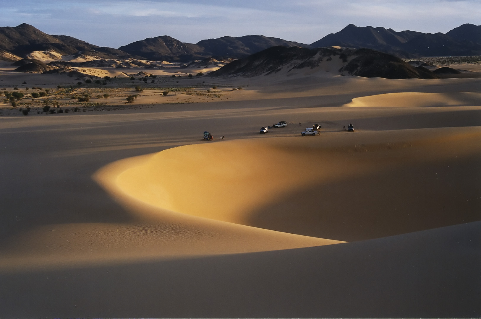
The Ténéré (Tuareg: Tenere, literally: "desert") is a desert region in the south central Sahara. It comprises a vast plain of sand stretching from northeastern Niger into western Chad, occupying an area of over . The Ténéré's boundaries are said to be the Aïr Mountains in the west, the Hoggar Mountains in the north, the Djado Plateau in the northeast, the Tibesti Mountains in the east, and the basin of Lake Chad in the south. The central part of the desert, the Erg du Bilma, is centred at approximately . It is the locus of the Neolithic Tenerian culture. Name The name ''Ténéré'' comes from the Tuareg language, meaning "desert", in much the same way that the Arabic word for "desert", '' Sahara'', came to be applied to the region as a whole. Climate The Ténéré has a hot desert climate (Köppen climate classification ''BWh''), typical of the large Sahara Desert. The climate is hyper-arid, extremely hot, sunny and dry year-round and there is virtually no plant life. ... [...More Info...] [...Related Items...] OR: [Wikipedia] [Google] [Baidu] |
Bilma Department
Bilma is a department of the Agadez Region in Niger. Its capital lies at the city of Bilma. As of 2012, the department had a total population of 17,935 people. Communes *Bilma *Dirkou *Djado Djado is a ghost town in Bilma Department, Bilma in Niger. The settlement lies on the Djado Plateau, plateau with the same name. The settlement likely wasn't called Djado during its existence. The site is quite remote. No excavation has been done ... * Fachi References Departments of Niger Agadez Region {{Niger-geo-stub ... [...More Info...] [...Related Items...] OR: [Wikipedia] [Google] [Baidu] |
Ghost Town
Ghost Town(s) or Ghosttown may refer to: * Ghost town, a town that has been abandoned Film and television * ''Ghost Town'' (1936 film), an American Western film by Harry L. Fraser * ''Ghost Town'' (1956 film), an American Western film by Allen H. Miner * ''Ghost Town'' (1988 film), an American horror film by Richard McCarthy (as Richard Governor) * ''Ghost Town'' (2008 film), an American fantasy comedy film by David Koepp * ''Ghost Town'', a 2008 TV film featuring Billy Drago * '' Derek Acorah's Ghost Towns'', a 2005–2006 British paranormal reality television series * "Ghost Town" (''CSI: Crime Scene Investigation''), a 2009 TV episode Literature * ''Ghost Town'' (''Lucky Luke'') or ''La Ville fantôme'', a 1965 ''Lucky Luke'' comic *''Ghost Town'', a Beacon Street Girls novel by Annie Bryant *''Ghost Town'', a 1998 novel by Robert Coover *''Ghosttown'', a 2007 novel by Douglas Anne Munson Music * Ghost Town (band), an American electronic band * ''Ghost Town'', a 1 ... [...More Info...] [...Related Items...] OR: [Wikipedia] [Google] [Baidu] |
Malaria
Malaria is a mosquito-borne infectious disease that affects humans and other animals. Malaria causes symptoms that typically include fever, tiredness, vomiting, and headaches. In severe cases, it can cause jaundice, seizures, coma, or death. Symptoms usually begin ten to fifteen days after being bitten by an infected mosquito. If not properly treated, people may have recurrences of the disease months later. In those who have recently survived an infection, reinfection usually causes milder symptoms. This partial resistance disappears over months to years if the person has no continuing exposure to malaria. Malaria is caused by single-celled microorganisms of the ''Plasmodium'' group. It is spread exclusively through bites of infected ''Anopheles'' mosquitoes. The mosquito bite introduces the parasites from the mosquito's saliva into a person's blood. The parasites travel to the liver where they mature and reproduce. Five species of ''Plasmodium'' can infect and be spread by h ... [...More Info...] [...Related Items...] OR: [Wikipedia] [Google] [Baidu] |
Bilma
Bilma is an oasis town and commune in north east Niger with, as of the 2012 census, a total population of 4,016 people. It lies protected from the desert dunes under the Kaouar Cliffs and is the largest town along the Kaouar escarpment. It is known for its gardens, for salt and natron production through evaporation ponds, date cultivation, and as the destination of one of the last Saharan caravan routes (the Azalai, from Agadez). Population Its population is mostly Kanuri, with smaller Toubou, Tuareg, and Hausa populations, the last being a reminder of Bilma's role as a key stop in the Trans Saharan trade. Administration and economy Bilma is the administrative seat of the Bilma Department, covering some of north eastern Niger. While it continues to produce salt in large ''natron'' salt pans, and this salt is still sold for livestock use throughout west Africa, tourism (based out of Agadez and the Aïr Mountains some to the west) is of growing importance. Climate ... [...More Info...] [...Related Items...] OR: [Wikipedia] [Google] [Baidu] |
Touareg
The Tuareg people (; also spelled Twareg or Touareg; endonym: ''Imuhaɣ/Imušaɣ/Imašeɣăn/Imajeɣăn'') are a large Berbers, Berber ethnic group that principally inhabit the Sahara in a vast area stretching from far southwestern Libya to southern Algeria, Niger, Mali, and Burkina Faso. Traditionally nomadic pastoralism, pastoralists, small groups of Tuareg are also found in northern Nigeria. The Tuareg speak Tuareg languages, languages of the same name (also known as ''Tamasheq''), which belong to the Berber languages, Berber branch of the Afroasiatic family. The Tuaregs have been called the "blue people" for the indigo dye coloured clothes they traditionally wear and which stains their skin. They are a semi-nomadic people who practice Islam, and are descended from the indigenous Berber communities of Northern Africa, which have been described as a mosaic of local North Africa, Northern African (Taforalt), Middle Eastern, Genetic history of Europe, European (Early European F ... [...More Info...] [...Related Items...] OR: [Wikipedia] [Google] [Baidu] |
Salt
Salt is a mineral composed primarily of sodium chloride (NaCl), a chemical compound belonging to the larger class of salts; salt in the form of a natural crystalline mineral is known as rock salt or halite. Salt is present in vast quantities in seawater. The open ocean has about of solids per liter of sea water, a salinity of 3.5%. Salt is essential for life in general, and saltiness is one of the basic human tastes. Salt is one of the oldest and most ubiquitous food seasonings, and is known to uniformly improve the taste perception of food, including otherwise unpalatable food. Salting, brining, and pickling are also ancient and important methods of food preservation. Some of the earliest evidence of salt processing dates to around 6,000 BC, when people living in the area of present-day Romania boiled spring water to extract salts; a salt-works in China dates to approximately the same period. Salt was also prized by the ancient Hebrews, Greeks, Romans, By ... [...More Info...] [...Related Items...] OR: [Wikipedia] [Google] [Baidu] |
Toubou People
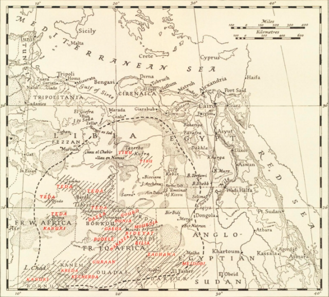
The Toubou or Tubu (from Old Tebu, meaning "rock people") are an ethnic group native to the Tibesti Mountains that inhabit the central Sahara in northern Chad, southern Libya and northeastern Niger. They live either as herders and nomads or as farmers near oases. Their society is clan-based, with each clan having certain oases, pastures and wells. The Toubou are generally divided into two closely related groups: the Teda (or Téda, Toda) and the Dazagara (or Dazzaga, Dazagada, Daza). They are believed to share a common origin and speak the Tebu languages, which are from the Saharan branch of the Nilo-Saharan language family. Tebu is divided further into two closely related languages, called '' Tedaga'' (Téda Toubou) and '' Dazaga'' (Dazaga Gouran). Of the two groups, the Daza, found to the south of the Teda, are more numerous. The Toubou people are also referred to as the Tabu, Tebu, Tebou, Tibu, Tibbu, Toda, Todga, Todaga, Tubu, Tuda, Tudaga, or Gorane people. The Daza ... [...More Info...] [...Related Items...] OR: [Wikipedia] [Google] [Baidu] |


