|
Dean Channel
Dean Channel is the upper end of one of the longest inlets of the British Columbia Coast, from its head at the mouth of the Kimsquit River. The Dean River, one of the main rivers of the Coast Mountains, enters Dean Channel about below the head of the inlet, at the community of Kimsquit. History Dean Channel was named by Captain Vancouver in 1793 after Rev. James King, Dean of Raphoe, Ireland. The channel was surveyed by Captain Richards in 1861 of HMS ''Hecate''. It is located within the Central Coast region. Branches Ending at the mouth of Cousins Inlet, which is the harbour for the abandoned town of Ocean Falls, the fjord's name changes to Fisher Channel down the west side of King Island. Below Fisher Channel's length the fjord merges with Burke Channel, which is a arm of the Dean/Fisher Channel on the east side of King Island, the name of the fjord changes to Fitz Hugh Sound, which is considerably wider than the upper part of the fjord at about in width and is it ... [...More Info...] [...Related Items...] OR: [Wikipedia] [Google] [Baidu] |
Fjord
In physical geography, a fjord or fiord () is a long, narrow inlet with steep sides or cliffs, created by a glacier. Fjords exist on the coasts of Alaska, Antarctica, British Columbia, Chile, Denmark, Germany, Greenland, the Faroe Islands, Iceland, Ireland, Kamchatka, the Kerguelen Islands, Labrador, Newfoundland, New Zealand, Norway, Novaya Zemlya, Nunavut, Quebec, the Patagonia region of Argentina and Chile, Russia, South Georgia Island, Tasmania, United Kingdom, and Washington state. Norway's coastline is estimated to be long with its nearly 1,200 fjords, but only long excluding the fjords. Formation A true fjord is formed when a glacier cuts a U-shaped valley by ice segregation and abrasion of the surrounding bedrock. According to the standard model, glaciers formed in pre-glacial valleys with a gently sloping valley floor. The work of the glacier then left an overdeepened U-shaped valley that ends abruptly at a valley or trough end. Such valleys are fjo ... [...More Info...] [...Related Items...] OR: [Wikipedia] [Google] [Baidu] |
Queen Charlotte Strait
, image = Canadian pilot, near Port Hardy BC.jpg , alt = , caption = A pilot boat plies Queen Charlotte Strait near Port Hardy , image_bathymetry = Locmap-QCS-Hecate-Dixon.png , alt_bathymetry = , caption_bathymetry = Queen Charlotte Strait is located southeast of Queen Charlotte Sound , location = British Columbia , group = , coordinates = , type = Strait , etymology = , part_of = , inflow = , rivers = , outflow = , oceans = Pacific Ocean , catchment = , basin_countries = , agency = , designation = , date-built = , engineer = , date-flooded = , length = , width = , area = , depth = , max-depth = , volume = , residence_time = , salinity ... [...More Info...] [...Related Items...] OR: [Wikipedia] [Google] [Baidu] |
Heiltsuk
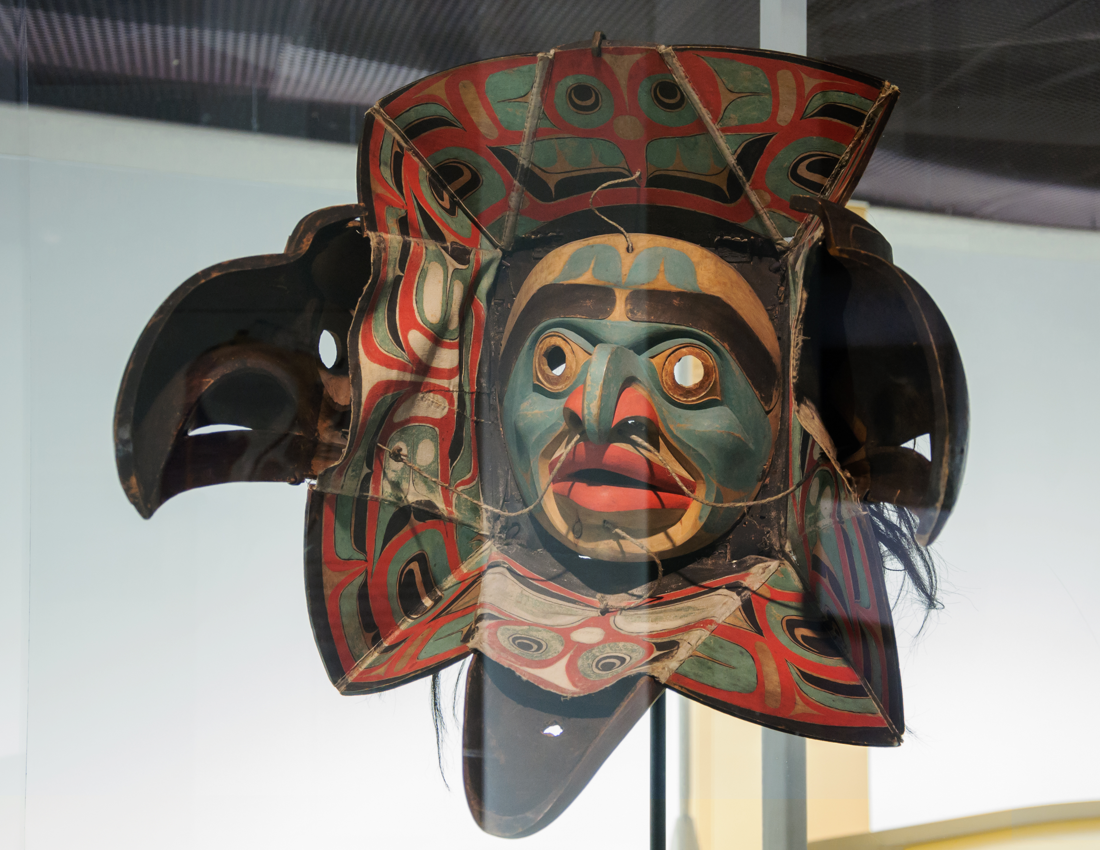
The Heiltsuk or Haíɫzaqv , sometimes historically referred to as ''Bella Bella'', are an Indigenous people of the Central Coast region in British Columbia, centred on the island community of Bella Bella. The government of the Heiltsuk people is the Heiltsuk Nation, though the term is also used to describe the community. Its largest community is Bella Bella. They should not be confused with the Salish-speaking Nuxalk (Nuxalkmc) peoples ("People of Bella Coola Valley (Nuxalk)"), who were formerly usually called Bella Coola, an Anglicization of the Heiltsuk term Bíbḷxvḷá (singular: Bḷ́xvḷá, meaning: "stranger"). History Ancestors of the Heiltsuk (Haíɫzaqv) have been in the Central Coast region of British Columbia since at least 7190 BCE. The Heiltsuk (Haíɫzaqv) are the main descendants of Haíɫzaqvḷa(Heiltsuk)-speaking people and identify as being from one or more of five tribal groups: W̓úyalitx̌v (Wuyalitxv) (Seaward Tribe or Seaward Division; ou ... [...More Info...] [...Related Items...] OR: [Wikipedia] [Google] [Baidu] |
Nuxalk
The Nuxalk people ( Nuxalk: ''Nuxalkmc''; pronounced )'','' also referred to as the Bella Coola, Bellacoola or Bilchula, are an Indigenous First Nation of the Pacific Northwest Coast, centred in the area in and around Bella Coola, British Columbia. Their language is also called Nuxalk. Their on-reserve tribal government is the Nuxalk Nation. Name and tribes/groups The name "Bella Coola", often used in academic writing, is not preferred by the Nuxalk; it is a derivation of the neighbouring Wakashan-speaking coastal Heiltsuk people's name for the Nuxalk as ''bəlxwəlá'' or ''bḷ́xʷlá'', meaning "stranger" (rendered plxwla in Nuxalk orthography). Within the Nuxalk language, "Nuxalkmc" is the term for the people, and "ItNuxalkmc" is the term for the language, and these terms are increasingly being used in English locally. The Nuxalk peoples, known today collectively as Nuxalkmc, are made up of lineages representing several ancestral villages within their territory. From ... [...More Info...] [...Related Items...] OR: [Wikipedia] [Google] [Baidu] |
Alexander Mackenzie (explorer)
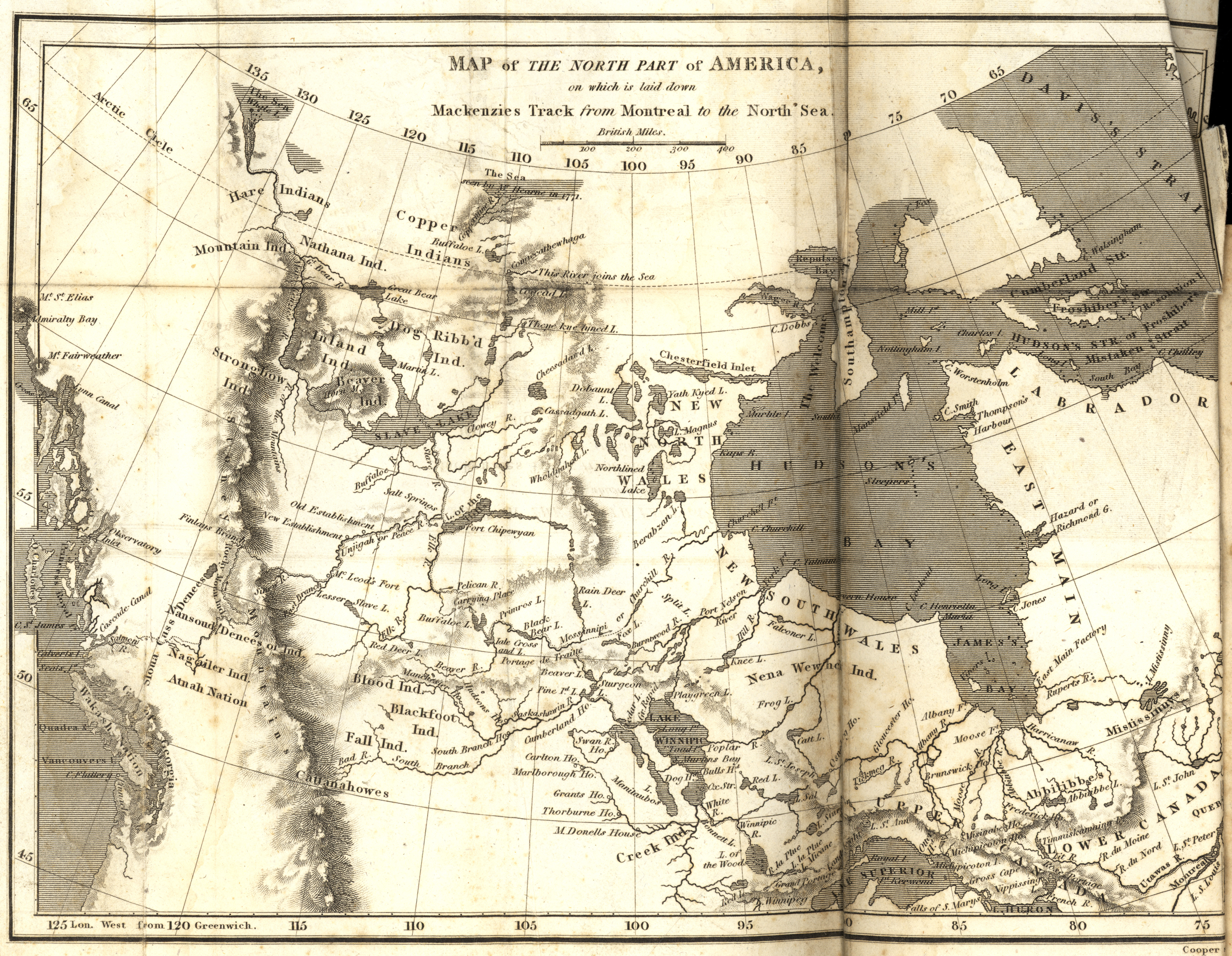
Sir Alexander Mackenzie (or MacKenzie, gd, Alasdair MacCoinnich; – 12 March 1820) was a Scottish explorer known for accomplishing the first crossing of America north of Mexico in 1793. The Mackenzie River is named after him. Early life Mackenzie was born in House in Stornoway in Lewis. He was the third of the four children born to Kenneth 'Corc' Mackenzie (1731–1780) and his wife Isabella MacIver, from another prominent mercantile family in Stornoway. When only 14 years old, Mackenzie's father served as an ensign to protect Stornoway during the Jacobite rising of 1745. He later became a merchant and held the tack of Melbost; his grandfather being a younger brother of Murdoch Mackenzie, 6th Laird of Fairburn. Educated at the same school as Colin Mackenzie, the army officer and first Surveyor General of India, he sailed to New York City with his father to join an uncle, John Mackenzie, in 1774, after his mother died in Scotland. In 1776, during the American War of I ... [...More Info...] [...Related Items...] OR: [Wikipedia] [Google] [Baidu] |
Fur Trade
The fur trade is a worldwide industry dealing in the acquisition and sale of animal fur. Since the establishment of a world fur market in the early modern period, furs of boreal ecosystem, boreal, polar and cold temperate mammalian animals have been the most valued. Historically the trade stimulated the exploration and colonization of Siberia, northern North America, and the South Shetland Islands, South Shetland and South Sandwich Islands. Today the importance of the fur trade has diminished; it is based on pelts produced at fur farms and regulated fur-bearer trapping, but has become controversial. Animal rights organizations oppose the fur trade, citing that animals are brutally killed and sometimes skinned alive. Fur has been replaced in some clothing by synthetic fiber, synthetic imitations, for example, as in ruffs on hoods of parkas. Continental fur trade Russian fur trade Before the European colonization of the Americas, Russia was a major supplier of fur pelts to W ... [...More Info...] [...Related Items...] OR: [Wikipedia] [Google] [Baidu] |
North Bentinck Arm
North Bentinck Arm is a short inlet about in length in the Central Coast region of British Columbia, Canada. It is an arm of Burke Channel and is linked via that waterway and Labouchere Channel to Dean Channel, which is one of the largest inlets of the BC Coast. North Bentinck Arm is historically significant as the location where North West Company explorer Alexander MacKenzie reached the waters of the Pacific Ocean overland from Lake Athabasca via the Peace and Fraser Rivers, on 20 July 1793. Needing to find an open area to make an astronomical sighting, using the moons of the planet Jupiter to determine his longitude, he went by canoe with four Nuxalk natives the next day to Dean Channel, stopping at a site now part of Sir Alexander Mackenzie Provincial Park. A boulder on the shoreline there is marked with "Alexander MacKenzie, from Canada by land 22d July 1793". By only a few weeks MacKenzie missed meeting James Johnstone, one of Captain George Vancouver's men, who also vi ... [...More Info...] [...Related Items...] OR: [Wikipedia] [Google] [Baidu] |
Scoresby Sound
Scoresby Sound (Danish: ''Scoresby Sund'', Greenlandic: ''Kangertittivaq'') is a large fjord system of the Greenland Sea on the eastern coast of Greenland. It has a tree-like structure, with a main body approximately Scoresby Sund Encyclopædia Britannica on-line long that branches into a system of s covering an area of about . The longest of the fjords extends 340–350 km (210-216 mi) inland from the coastline. The depth is 400–600 m (1,310-1,970 ft) in the main basin, but depths increase to up to in some fjords. It is one of the largest and longest fjord systems in the world.Archaeology, p. 7 On the northern side of the mouth of the Scoresby ... [...More Info...] [...Related Items...] OR: [Wikipedia] [Google] [Baidu] |
Greenland
Greenland ( kl, Kalaallit Nunaat, ; da, Grønland, ) is an island country in North America that is part of the Kingdom of Denmark. It is located between the Arctic and Atlantic oceans, east of the Canadian Arctic Archipelago. Greenland is the world's largest island. It is one of three constituent countries that form the Kingdom of Denmark, along with Denmark and the Faroe Islands; the citizens of these countries are all citizens of Denmark and the European Union. Greenland's capital is Nuuk. Though a part of the continent of North America, Greenland has been politically and culturally associated with Europe (specifically Norway and Denmark, the colonial powers) for more than a millennium, beginning in 986.The Fate of Greenland's Vikings , by Dale Mackenzie Brown, ''Archaeological Institute of Am ... [...More Info...] [...Related Items...] OR: [Wikipedia] [Google] [Baidu] |
Sognefjord
The Sognefjord or Sognefjorden (, en, Sogn Fjord), nicknamed the King of the Fjords ( no, Fjordenes konge), is the largest and deepest fjord in Norway. Located in Vestland county in Western Norway, it stretches inland from the ocean to the small village of Skjolden in the municipality of Luster. The fjord gives its name to the surrounding district of Sogn. The name is related to Norwegian word ''súg-'' "to suck", presumably from the surge or suction of the tidal currents at the mouth of the fjord. Geography The fjord runs through many municipalities: Solund, Gulen, Hyllestad, Høyanger, Vik, Sogndal, Lærdal, Aurland, Årdal, and Luster. The fjord reaches a maximum depth of below sea level, and the greatest depths are found in the central parts of the fjord near Høyanger. Sognefjord is more than deep for about of its length, from Rutledal to Hermansverk. Near its mouth, the bottom rises abruptly to a sill about below sea level. The seabed in Sognefjord is covered b ... [...More Info...] [...Related Items...] OR: [Wikipedia] [Google] [Baidu] |
Norway
Norway, officially the Kingdom of Norway, is a Nordic countries, Nordic country in Northern Europe, the mainland territory of which comprises the western and northernmost portion of the Scandinavian Peninsula. The remote Arctic island of Jan Mayen and the archipelago of Svalbard also form part of Norway. Bouvet Island, located in the Subantarctic, is a Dependencies of Norway, dependency of Norway; it also Territorial claims in Antarctica, lays claims to the Antarctic territories of Peter I Island and Queen Maud Land. The capital and largest city in Norway is Oslo. Norway has a total area of and had a population of 5,425,270 in January 2022. The country shares a long eastern border with Sweden at a length of List of countries and territories by land borders, . It is bordered by Finland and Russia to the northeast and the Skagerrak strait to the south, on the other side of which are Denmark and the United Kingdom. Norway has an extensive coastline, facing the North Atlanti ... [...More Info...] [...Related Items...] OR: [Wikipedia] [Google] [Baidu] |
Hardangerfjord
The Hardangerfjord ( en, Hardanger Fjord) is the fifth longest fjord in the world, and the second longest fjord in Norway. It is located in Vestland county in the Hardanger region. The fjord stretches from the Atlantic Ocean into the mountainous interior of Norway along the Hardangervidda plateau. The innermost point of the fjord reaches the town of Odda. Location The Hardangerfjord starts at the Atlantic Ocean about south of the city of Bergen. Here the fjord heads in a northeasterly direction between the island of Bømlo and the mainland. It passes by the larger islands of Stord, Tysnesøya, and Varaldsøy on the north/west side and the Folgefonna peninsula on the south/east side. Once it is surrounded by the mainland, it begins to branch off into smaller fjords that reach inwards towards the grand Hardangervidda mountain plateau. The longest branch of the Hardangerfjord is Sørfjorden which cuts south about from the main fjord. Its maximum depth is more than ... [...More Info...] [...Related Items...] OR: [Wikipedia] [Google] [Baidu] |
.jpg)


