|
Dunøysundet
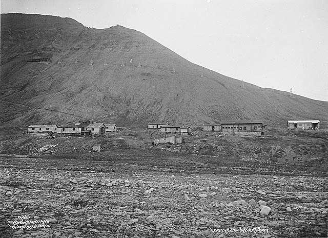
Dunøysundet is a bay in the Norwegian archipelago of Svalbard. It is located near many other bays such as Nottinghambukta and is located relatively close to Longyearbyen. Most of the islands to the west of it are located within the Dunøyane Bird Sanctuary. Dunøysundet has a tundra In physical geography, a tundra () is a type of biome where tree growth is hindered by frigid temperatures and short growing seasons. There are three regions and associated types of tundra: #Arctic, Arctic, Alpine tundra, Alpine, and #Antarctic ... climate, with temperatures rarely exceeding 45 Fahrenheit. It is located well above the Arctic Circle, although it is warmed by sea currents. References Bays of Svalbard {{svalbard-geo-stub ... [...More Info...] [...Related Items...] OR: [Wikipedia] [Google] [Baidu] |
Dunøyane Bird Sanctuary
Dunøyane Bird Sanctuary () is a bird reserve in Svalbard, Norway, established in 1973. It includes islands west of Dunøysundet in Wedel Jarlsberg Land. The protected area covers a total of around 11.9 km2. The island group of Dunøyane is a nesting site for barnacle goose, common eider and Arctic tern. References Bird sanctuaries in Svalbard Protected areas established in 1973 1973 establishments in Norway Ramsar sites in Norway {{Norway-protected-area-stub ... [...More Info...] [...Related Items...] OR: [Wikipedia] [Google] [Baidu] |
Svalbard
Svalbard ( , ), previously known as Spitsbergen or Spitzbergen, is a Norway, Norwegian archipelago that lies at the convergence of the Arctic Ocean with the Atlantic Ocean. North of continental Europe, mainland Europe, it lies about midway between the northern coast of Norway and the North Pole. The islands of the group range from 74th parallel north, 74° to 81st parallel north, 81° north latitude, and from 10th meridian east, 10° to 35th meridian east, 35° east longitude. The largest island is Spitsbergen (37,673 km2), followed in size by Nordaustlandet (14,443 km2), (5,073 km2), and Barentsøya (1,288 km2). Bear Island (Norway), Bjørnøya or Bear Island (178 km2) is the most southerly island in the territory, situated some 147 km south of Spitsbergen. Other small islands in the group include Hopen (Svalbard), Hopen to the southeast of Edgeøya, Kongsøya and Svenskøya in the east, and Kvitøya to the northeast. The largest settlement is Longyearbyen, situated in Isfjor ... [...More Info...] [...Related Items...] OR: [Wikipedia] [Google] [Baidu] |
Nottinghambukta
Nottinghambukta is a bay in Wedel Jarlsberg Land at the western coast of Spitsbergen, Svalbard. It is located south of the coastal plain of Elveflya, and inside of Dunøyane Dunøyane is a group of islands north of Hornsund, outside Wedel Jarlsberg Land at the western coast of Spitsbergen, Svalbard. The island group is a nesting site for barnacle goose, common eider and Arctic tern. Hunters used to collect Down feat .... References Bays of Spitsbergen {{Spitsbergen-geo-stub ... [...More Info...] [...Related Items...] OR: [Wikipedia] [Google] [Baidu] |
Longyearbyen
Longyearbyen (, , "Longyear Town") is the world's northernmost settlements, northernmost settlement with a population greater than 1,000, and the capital and the largest inhabited area of Svalbard. It stretches along the foot of the left bank (geography), bank of the Longyear Valley and on the shore of Adventfjorden, the short estuary leading into Isfjorden (Svalbard), Isfjorden on the west coast of Spitsbergen, the island's broadest inlet. As of 2002, Longyearbyen Community Council became an official municipalities of Norway, Norwegian municipality. It is the seat of the Governor of Svalbard. As of 2024, the town's mayor is Leif Terje Aunevik. Known as Longyear City until 1926, the town was established by and named after American John Munro Longyear, whose Arctic Coal Company started coal-mining there in 1906. Store Norske Spitsbergen Kulkompani (SNSK) took over the mining operations in 1916, and still conducts mining. The German ''Kriegsmarine'' almost completely Operation Zit ... [...More Info...] [...Related Items...] OR: [Wikipedia] [Google] [Baidu] |
Tundra
In physical geography, a tundra () is a type of biome where tree growth is hindered by frigid temperatures and short growing seasons. There are three regions and associated types of tundra: #Arctic, Arctic, Alpine tundra, Alpine, and #Antarctic, Antarctic. Tundra vegetation is composed of dwarf shrubs, Cyperaceae, sedges, Poaceae, grasses, mosses, and lichens. Scattered trees grow in some tundra regions. The ecotone (or ecological boundary region) between the tundra and the forest is known as the tree line or timberline. The tundra soil is rich in nitrogen and phosphorus. The soil also contains large amounts of biomass and decomposed biomass that has been stored as methane and carbon dioxide in the permafrost, making the tundra soil a carbon sink. As global warming heats the ecosystem and causes soil thawing, the permafrost carbon cycle accelerates and releases much of these soil-contained greenhouse gases into the atmosphere, creating Climate change feedback, a feedback cycle t ... [...More Info...] [...Related Items...] OR: [Wikipedia] [Google] [Baidu] |


