|
Dulaankhaan, Selenge
Dulaankhaan ( mn, Дулаанхаан) is an urban-type settlement in the Shaamar sum (district) of Selenge Province in northern Mongolia. It is 35 km SE from Shaamar sum center, 50 km S (via Shaamar) from Selenge Province capital Sükhbaatar city. Dulaankhaan is 60 km N from Darkhan city (Darkhan-Uul Province center). Dulankhaan population was 1,997 (1994). Dulaankhaan has a station on the Trans-Mongolian Railway , map_name = , map_state = collapsed , embedded = The Trans-Mongolian Railway follows an ancient tea-caravan route from China to Russia and connects Ulan-Ude, on the Trans–Baikal ( Trans–Siberian) railway in R .... References External links Official website Populated places in Mongolia Selenge Province {{Mongolia-geo-stub ... [...More Info...] [...Related Items...] OR: [Wikipedia] [Google] [Baidu] |
Shaamar, Selenge
Shaamar ( mn, Шаамар) is a sum (district) of Selenge Province in northern Mongolia. The Dulaankhaan urban-type settlement is 35 km S from Shaamar sum center. In 2008, its population was 4,158.Selenge Aimag Statistical Office. Selenge Aimag Sums Review 2000-2008 The sum center settlement of Shaamar is divided into two parts, about 8 miles apart. Upper Shaamar is located on a flat part of a hill and lower Shaamar on the banks of the Selenge River. Lower Shaamar has access to the railway station and water from the river. Shaamar was established as a negdel (agricultural cooperative ... [...More Info...] [...Related Items...] OR: [Wikipedia] [Google] [Baidu] |
Sums Of Mongolia
A district ( mn, сум, , , ; "arrow"), is a second level administrative subdivision of Mongolia. The 21 Provinces of Mongolia are divided into 331 districts.Montsame News Agency. ''Mongolia''. 2006, Foreign Service office of Montsame News Agency, , p. 46 On average, each district administers a territory of with about 5,000 inhabitants, primarily nomadic herders. Its total revenue is 120 million Tögrög, 90% of which comes from national subsidies. Each district is again subdivided into ''bags'' (brigades; sometimes spelled ''baghs''). Most bags are of an entirely virtual nature. Their purpose is to sort the families of nomads in the district into groups, without a permanent human settlement. Officially, and occasionally on maps, many district seats (sum centers) bear a name different from that of the district. However, in practice the district seat (sum center) is most often referred to under the name of the district, to the point of the official name of the district sea ... [...More Info...] [...Related Items...] OR: [Wikipedia] [Google] [Baidu] |
Selenge Province
Selenge ( mn, Сэлэнгэ) is one of the 21 aimags (provinces) of Mongolia Mongolia; Mongolian script: , , ; lit. "Mongol Nation" or "State of Mongolia" () is a landlocked country in East Asia, bordered by Russia to the north and China to the south. It covers an area of , with a population of just 3.3 millio ..., located in the north of the country. The name is derived from the Selenge river. The capital is Sükhbaatar. The province of Darkhan-Uul, and its capital Darkhan, is located as an enclave inside Selenge. Administrative subdivisions * The aimag capital Sükhbaatar. References Provinces of Mongolia States and territories established in 1934 1934 establishments in Mongolia {{Mongolia-geo-stub ... [...More Info...] [...Related Items...] OR: [Wikipedia] [Google] [Baidu] |
Mongolia
Mongolia; Mongolian script: , , ; lit. "Mongol Nation" or "State of Mongolia" () is a landlocked country in East Asia, bordered by Russia to the north and China to the south. It covers an area of , with a population of just 3.3 million, making it the world's most sparsely populated sovereign nation. Mongolia is the world's largest landlocked country that does not border a closed sea, and much of its area is covered by grassy steppe, with mountains to the north and west and the Gobi Desert to the south. Ulaanbaatar, the capital and largest city, is home to roughly half of the country's population. The territory of modern-day Mongolia has been ruled by various nomadic empires, including the Xiongnu, the Xianbei, the Rouran, the First Turkic Khaganate, and others. In 1206, Genghis Khan founded the Mongol Empire, which became the largest contiguous land empire in history. His grandson Kublai Khan conquered China proper and established the Yuan dynasty. After the c ... [...More Info...] [...Related Items...] OR: [Wikipedia] [Google] [Baidu] |
Sükhbaatar (city)
Sükhbaatar ( mn, Сүхбаатар, , russian: Сухэ-Батор) is the capital of Selenge Province in northern Mongolia, on the Orkhon river. As of late 2007, the city population is 19,224.Official site of the Selenge aimag (version 2008) History  The city was founded in 1940 and named after the Mongolian revolutionary leader .
Transport Sükhbaatar is the northernmost |
Darkhan (city)
Darkhan ( mn, Дархан, ; "blacksmith") is the Second-largest city in Mongolia and the capital of Darkhan-Uul Aimag (Darkhan-Uul Province). It has a population of 121,428 in 2013. History On October 17, 1961, the city of Darkhan was built with extensive economic assistance from the Comecon. As its name implies, the city was originally conceived to be a manufacturing site for Mongolia's northern territory. Polish specialists built a woodworking plant, brickworks and a lime factory in Darkhan. Hungarians built a meat factory, opened in 1974. The city remains a mostly industrial centre and is the home of some 82% of Darkhan-Uul Province's population. As with most urban Mongols, some 86% of the city's population live in residential apartments, with the remaining population living in yurts (gers) on the outskirts of the city. Geography and structures With an elevation of , Darkhan is the capital of the Darkhan-Uul Province. It is a city with notable Soviet influence, it can b ... [...More Info...] [...Related Items...] OR: [Wikipedia] [Google] [Baidu] |
Darkhan-Uul Province
Darkhan-Uul ( mn, Дархан-Уул, literally ''Blacksmith Mountain'') is one of the 21 aimags (provinces) of Mongolia. It is located in the north of the country. History The city Darkhan was founded on October 17, 1961, as a second industrial center to reduce the migration pressure on the capital Ulaanbaatar. To do so, the existing sum (district) of the same name was dissolved, and its territory managed by the city authorities. The Darkhan-Uul aimag with its four sum was carved out of the Selenge aimag in 1994. Economy Darkhan is the second largest industrial center of Mongolia. Darkhan Metallurgical Plant is one of the largest. There is also ThermoPower Plant in Darkhan that has capacity of 48 MW/h. The aimag basically serves to support the city. Transport Darkhan is the point where the side line to Erdenet forks off the main line of the Trans-Mongolian Railway , map_name = , map_state = collapsed , embedded = The Trans-Mongolian Ra ... [...More Info...] [...Related Items...] OR: [Wikipedia] [Google] [Baidu] |
Trans-Mongolian Railway
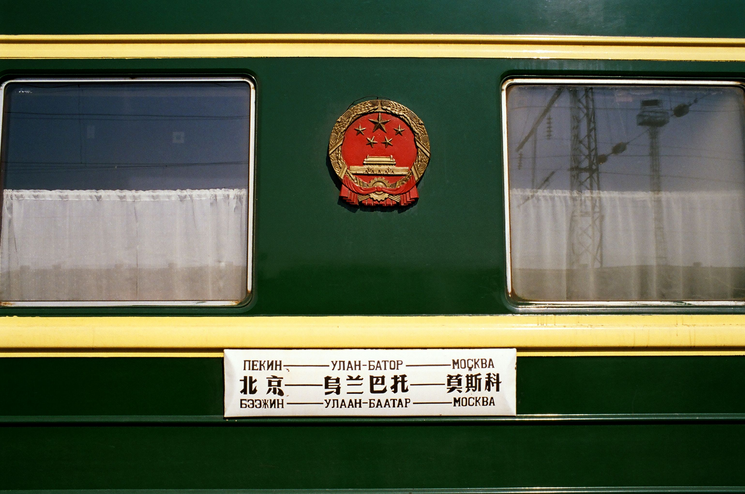
, map_name = , map_state = collapsed , embedded = The Trans-Mongolian Railway follows an ancient tea-caravan route from China to Russia and connects Ulan-Ude, on the Trans–Baikal ( Trans–Siberian) railway in Russia, with the Chinese city of Jining, by way of Ulaanbaatar in Mongolia. Other important stops are Sükhbaatar, Darkhan, Choir, and Zamyn-Üüd/ Erenhot ( border crossing and gauge-changing station). The line was built between 1949 and 1961. In most of Mongolia, it is single track, and in China double track. The gauge is in Russia and Mongolia and in China. There are important branches leading to Erdenet and Baganuur. History Railway development came late to Mongolia. Construction of the Trans-Mongolian line began in 1947, reaching Ulan Bator from the north in 1950 and the Chinese border in 1955. Before that the only railways in Mongolia had been a line (opened in 1938) connecting the coal mines at Nalaikh to the capi ... [...More Info...] [...Related Items...] OR: [Wikipedia] [Google] [Baidu] |
Populated Places In Mongolia
Population typically refers to the number of people in a single area, whether it be a city or town, region, country, continent, or the world. Governments typically quantify the size of the resident population within their jurisdiction using a census, a process of collecting, analysing, compiling, and publishing data regarding a population. Perspectives of various disciplines Social sciences In sociology and population geography, population refers to a group of human beings with some predefined criterion in common, such as location, race, ethnicity, nationality, or religion. Demography is a social science which entails the statistical study of populations. Ecology In ecology, a population is a group of organisms of the same species who inhabit the same particular geographical area and are capable of interbreeding. The area of a sexual population is the area where inter-breeding is possible between any pair within the area and more probable than cross-breeding with ... [...More Info...] [...Related Items...] OR: [Wikipedia] [Google] [Baidu] |


