|
Doggerland
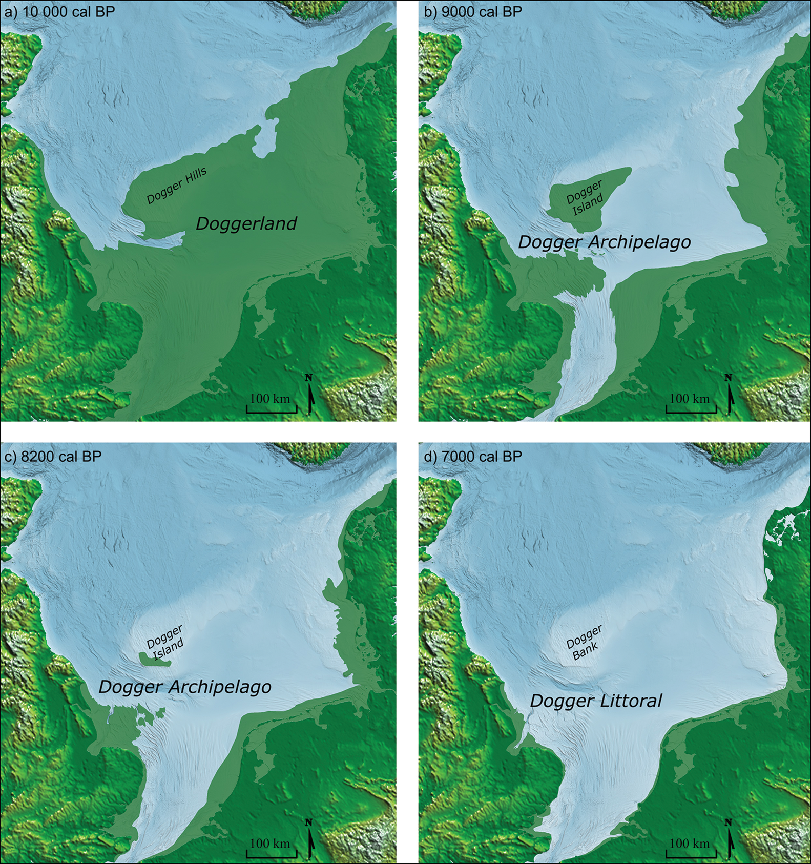
Doggerland was a large area of land in Northern Europe, now submerged beneath the southern North Sea. This region was repeatedly exposed at various times during the Pleistocene epoch due to the lowering of sea levels during glacial periods. However, the term "Doggerland" is generally specifically used for this region during the Late Pleistocene and Early Holocene. During the early Holocene following the glacial retreat at the end of the Last Glacial Period, the exposed land area of Doggerland stretched across the region between what is now the east coast of Great Britain, the Netherlands, north-west Germany, and the Danish peninsula of Jutland. Between 10,000 and 7,000 years ago, Doggerland was inundated by rising sea levels, disintegrating initially into a series of low-lying islands before submerging completely. The impact of the tsunami generated by the Storegga underwater landslide 8,200 years ago on Doggerland is controversial. The flooded land is known as the Dogger Lit ... [...More Info...] [...Related Items...] OR: [Wikipedia] [Google] [Baidu] |
Storegga Slide
The three Storegga Slides () are amongst the largest known submarine landslides. They occurred at the edge of Norway's continental shelf in the Norwegian Sea, approximately 6225–6170 BCE. The collapse involved an estimated length of coastal shelf, with a total volume of of debris, which caused a paleotsunami in the North Atlantic Ocean. Description Storegga ( Norwegian: ''Great Edge'') is located at the edge of Norway's continental shelf in the Norwegian Sea, north-west of the Møre coast. In around 6200 BCE, structural failures of the shelf caused three underwater landslides, which triggered very large tsunamis in the North Atlantic Ocean. The collapses involved an estimated length of coastal shelf, with a total volume of of debris. Based on carbon dating of plant material recovered from sediment deposited by the tsunamis, the latest incident occurred around 6225–6170 BCE. In Scotland, traces of the subsequent tsunami have been recorded, with deposited sediment bei ... [...More Info...] [...Related Items...] OR: [Wikipedia] [Google] [Baidu] |
Dogger Bank
Dogger Bank ( Dutch: ''Doggersbank'', German: ''Doggerbank'', Danish: ''Doggerbanke'') is a large sandbank in a shallow area of the North Sea about off the east coast of England. During the last ice age, the bank was part of a large landmass connecting mainland Europe and the British Isles, now known as Doggerland. It has long been known by fishermen to be a productive fishing bank; it was named after the '' doggers'', medieval Dutch fishing boats especially used for catching cod. At the beginning of the 21st century, the area was identified as a potential site for a UK round 3 wind farm, being developed as Dogger Bank Wind Farm. Name The name Dogger Bank was first recorded in the mid-17th century. It is probably derived from the word "'' dogger''" used for a two-masted boat of the type that trawled for fish in the area in medieval times. The area has similar names in Dutch, German, Swedish, and Danish. Geography The bank extends over about , and is about in exte ... [...More Info...] [...Related Items...] OR: [Wikipedia] [Google] [Baidu] |
North Sea
The North Sea lies between Great Britain, Denmark, Norway, Germany, the Netherlands, Belgium, and France. A sea on the European continental shelf, it connects to the Atlantic Ocean through the English Channel in the south and the Norwegian Sea in the north. It is more than long and wide, covering . It hosts key north European shipping lanes and is a major fishery. The coast is a popular destination for recreation and tourism in bordering countries, and a rich source of energy resources, including wind energy, wind and wave power. The North Sea has featured prominently in geopolitical and military affairs, particularly in Northern Europe, from the Middle Ages to the modern era. It was also important globally through the power northern Europeans projected worldwide during much of the Middle Ages and into the modern era. The North Sea was the centre of the Viking Age, Vikings' rise. The Hanseatic League, the Dutch Golden Age, Dutch Republic, and Kingdom of Great Britain, Brita ... [...More Info...] [...Related Items...] OR: [Wikipedia] [Google] [Baidu] |
Woolly Mammoth
The woolly mammoth (''Mammuthus primigenius'') is an extinct species of mammoth that lived from the Middle Pleistocene until its extinction in the Holocene epoch. It was one of the last in a line of mammoth species, beginning with the African ''Mammuthus subplanifrons'' in the early Pliocene. The woolly mammoth began to diverge from the steppe mammoth about 800,000 years ago in Siberia. Its closest extant relative is the Asian elephant. The Columbian mammoth (''Mammuthus columbi'') lived alongside the woolly mammoth in North America, and DNA studies show that the two Hybrid (biology), hybridised with each other. Mammoth remains were long known in Asia before they became known to Europeans. The origin of these remains was long debated and often explained as the remains of legendary creatures. The mammoth was identified as an extinct elephant species by Georges Cuvier in 1796. The appearance and behaviour of the woolly mammoth are among the best studied of any Prehistory, prehi ... [...More Info...] [...Related Items...] OR: [Wikipedia] [Google] [Baidu] |
Late Pleistocene
The Late Pleistocene is an unofficial Age (geology), age in the international geologic timescale in chronostratigraphy, also known as the Upper Pleistocene from a Stratigraphy, stratigraphic perspective. It is intended to be the fourth division of the Pleistocene Epoch within the ongoing Quaternary Period. It is currently defined as the time between 129,000 and c. 11,700 years ago. The late Pleistocene equates to the proposed Tarantian Age of the geologic time scale, preceded by the officially ratified Chibanian (commonly known as the Middle Pleistocene). The beginning of the Late Pleistocene is the transition between the end of the Penultimate Glacial Period and the beginning of the Last Interglacial around 130,000 years ago (corresponding with the beginning of Marine Isotope Stage 5). The Late Pleistocene ends with the termination of the Younger Dryas, some 10th millennium BC, 11,700 years ago when the Holocene Epoch began. The term Upper Pleistocene is currently in use as a p ... [...More Info...] [...Related Items...] OR: [Wikipedia] [Google] [Baidu] |
Hunter-gatherer
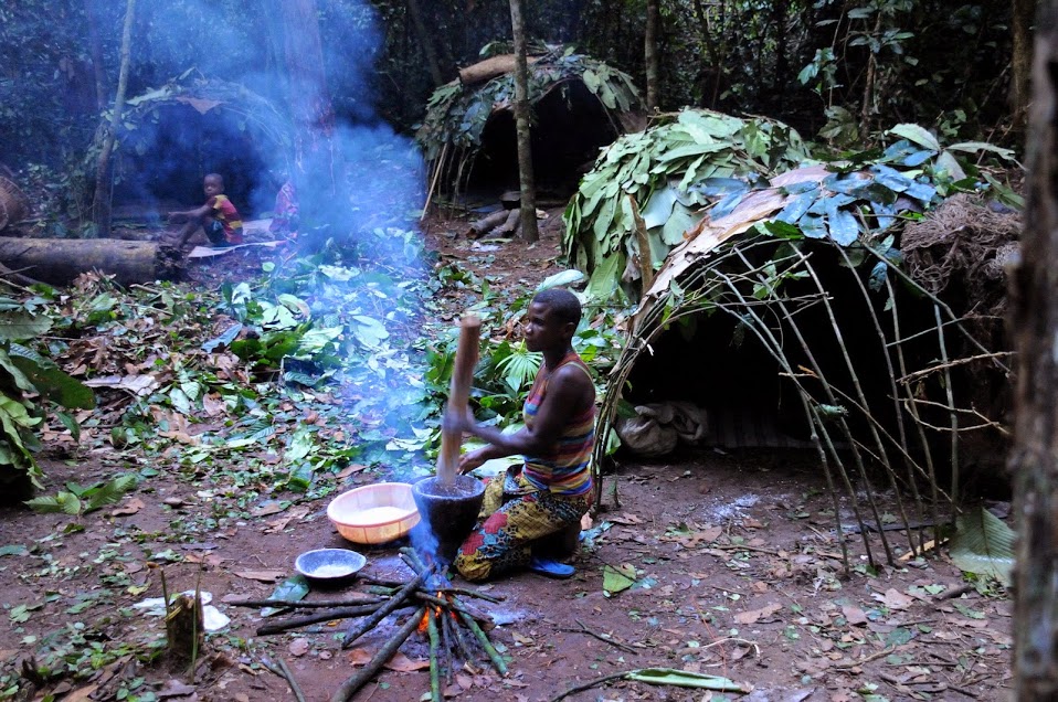
A hunter-gatherer or forager is a human living in a community, or according to an ancestrally derived Lifestyle, lifestyle, in which most or all food is obtained by foraging, that is, by gathering food from local naturally occurring sources, especially wild edible plants but also insects, Fungus, fungi, Honey hunting, honey, Eggs as food, bird eggs, or anything safe to eat, or by hunting game (pursuing or trapping and killing Wildlife, wild animals, including Fishing, catching fish). This is a common practice among most vertebrates that are omnivores. Hunter-gatherer Society, societies stand in contrast to the more Sedentism, sedentary Agrarian society, agricultural societies, which rely mainly on cultivating crops and raising domesticated animals for food production, although the boundaries between the two ways of living are not completely distinct. Hunting and gathering was humanity's original and most enduring successful Competition (biology), competitive adaptation in the nat ... [...More Info...] [...Related Items...] OR: [Wikipedia] [Google] [Baidu] |
Ecology
Ecology () is the natural science of the relationships among living organisms and their Natural environment, environment. Ecology considers organisms at the individual, population, community (ecology), community, ecosystem, and biosphere levels. Ecology overlaps with the closely related sciences of biogeography, evolutionary biology, genetics, ethology, and natural history. Ecology is a branch of biology, and is the study of abundance (ecology), abundance, biomass (ecology), biomass, and distribution of organisms in the context of the environment. It encompasses life processes, interactions, and adaptations; movement of materials and energy through living communities; ecological succession, successional development of ecosystems; cooperation, competition, and predation within and between species; and patterns of biodiversity and its effect on ecosystem processes. Ecology has practical applications in fields such as conservation biology, wetland management, natural resource m ... [...More Info...] [...Related Items...] OR: [Wikipedia] [Google] [Baidu] |
Tundra
In physical geography, a tundra () is a type of biome where tree growth is hindered by frigid temperatures and short growing seasons. There are three regions and associated types of tundra: #Arctic, Arctic, Alpine tundra, Alpine, and #Antarctic, Antarctic. Tundra vegetation is composed of dwarf shrubs, Cyperaceae, sedges, Poaceae, grasses, mosses, and lichens. Scattered trees grow in some tundra regions. The ecotone (or ecological boundary region) between the tundra and the forest is known as the tree line or timberline. The tundra soil is rich in nitrogen and phosphorus. The soil also contains large amounts of biomass and decomposed biomass that has been stored as methane and carbon dioxide in the permafrost, making the tundra soil a carbon sink. As global warming heats the ecosystem and causes soil thawing, the permafrost carbon cycle accelerates and releases much of these soil-contained greenhouse gases into the atmosphere, creating Climate change feedback, a feedback cycle t ... [...More Info...] [...Related Items...] OR: [Wikipedia] [Google] [Baidu] |
Computer Simulation
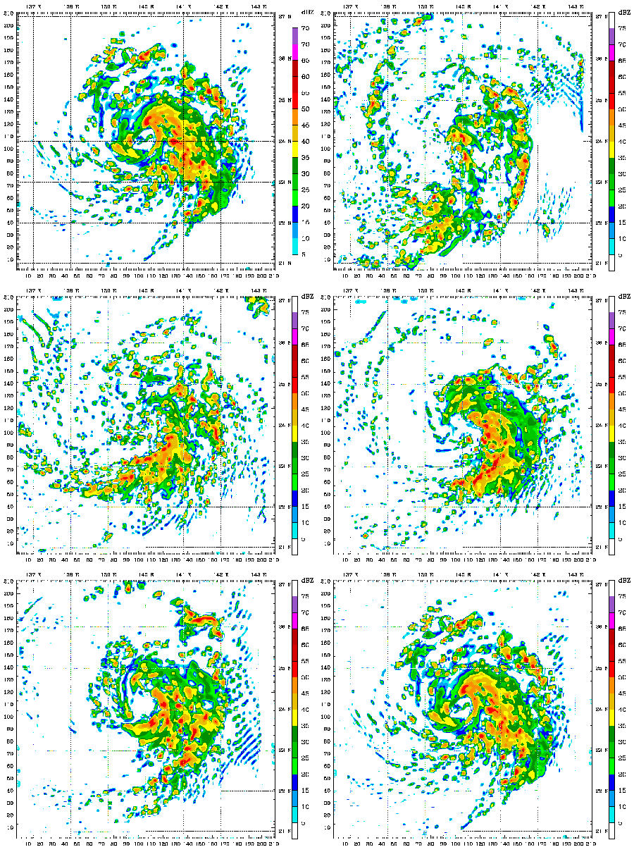
Computer simulation is the running of a mathematical model on a computer, the model being designed to represent the behaviour of, or the outcome of, a real-world or physical system. The reliability of some mathematical models can be determined by comparing their results to the real-world outcomes they aim to predict. Computer simulations have become a useful tool for the mathematical modeling of many natural systems in physics (computational physics), astrophysics, climatology, chemistry, biology and manufacturing, as well as human systems in economics, psychology, social science, health care and engineering. Simulation of a system is represented as the running of the system's model. It can be used to explore and gain new insights into new technology and to estimate the performance of systems too complex for analytical solutions. Computer simulations are realized by running computer programs that can be either small, running almost instantly on small devices, or large-scale ... [...More Info...] [...Related Items...] OR: [Wikipedia] [Google] [Baidu] |
Archaeo-geophysics
In archaeology, geophysical survey is ground-based physical sensing techniques used for archaeological imaging or mapping. Remote sensing and marine surveys are also used in archaeology, but are generally considered separate disciplines. Other terms, such as "geophysical prospection" and "archaeological geophysics" are generally synonymous. Overview Geophysical survey is used to create maps of subsurface archaeological features. Features are the non-portable part of the archaeological record, whether standing structures or traces of human activities left in the soil. Geophysical instruments can detect buried features when their physical properties contrast measurably with their surroundings. In some cases individual artifacts, especially metal, may be detected as well. Readings taken in a systematic pattern become a data set that can be rendered as image maps. Survey results can be used to guide excavation and to give archaeologists insight into the patterning of non-excavate ... [...More Info...] [...Related Items...] OR: [Wikipedia] [Google] [Baidu] |
Landscape
A landscape is the visible features of an area of land, its landforms, and how they integrate with natural or human-made features, often considered in terms of their aesthetic appeal.''New Oxford American Dictionary''. A landscape includes the physical elements of geophysically defined landforms such as mountains, hills, water bodies such as rivers, lakes, ponds and the sea, living elements of land cover including indigenous vegetation, human elements including different forms of land use, buildings, and structures, and transitory elements such as lighting and weather conditions. Combining both their physical origins and the cultural overlay of human presence, often created over millennia, landscapes reflect a living synthesis of people and place that is vital to local and national identity. The character of a landscape helps define the self-image of the people who inhabit it and a sense of place that differentiates one region from other regions. It is the dynamic ... [...More Info...] [...Related Items...] OR: [Wikipedia] [Google] [Baidu] |


