|
Djargurd Wurrong
The Djargurd Wurrong (also spelt Djargurd Wurrung) are Aboriginal Australian people of the Western district of the State of Victoria, and traditionally occupied the territory between Mount Emu Creek and Lake Corangamite. Language The Djargurd Wurrung people spoke the Djargurd Wurrung dialect of the Dhauwurd Wurrung language. Country The classification of the Groups on this territory has been subject to controversy. Norman Tindale, referring to the same area, and clans, called them the Kirrae, whose lands he stated comprised in his estimate around of territory from Warrnambool and the Hopkins River down to the coast at Princetown with the northerly reaches at Lake Bolac and Darlington, and extending easterly beyond Camperdown. The historian Ian Clark states that Tindale "failed to acknowledge the existence" of the Djargurd wurrung, while locating them in the same area. The Djagurd wurrung territory was bordered by the Wada wurrung in the north, the Dhauwurd wurrung ... [...More Info...] [...Related Items...] OR: [Wikipedia] [Google] [Baidu] |
Norman Tindale
Norman Barnett Tindale AO (12 October 1900 – 19 November 1993) was an Australian anthropologist, archaeologist, entomologist and ethnologist. He is best remembered for his work mapping the various tribal groupings of Aboriginal Australians at the time of European settlement, shown in his map published in 1940. This map provided the basis of a map published by David Horton in 1996 and widely used in its online form today. Tindale's major work was ''Aboriginal Tribes of Australia: Their terrain, Environmental Controls, Distribution, Limits and Proper Names'' (1974). Life Tindale was born on 12 October 1900 in Perth, Western Australia. His family moved to Tokyo and lived there from 1907 to 1915, where his father worked as an accountant at the Salvation Army mission in Japan. Norman attended the American School in Japan, where his closest friend was Gordon Bowles, a Quaker who, like him, later became an anthropologist. The family returned to Perth in August 1917, and soon ... [...More Info...] [...Related Items...] OR: [Wikipedia] [Google] [Baidu] |
List Of Massacres Of Indigenous Australians
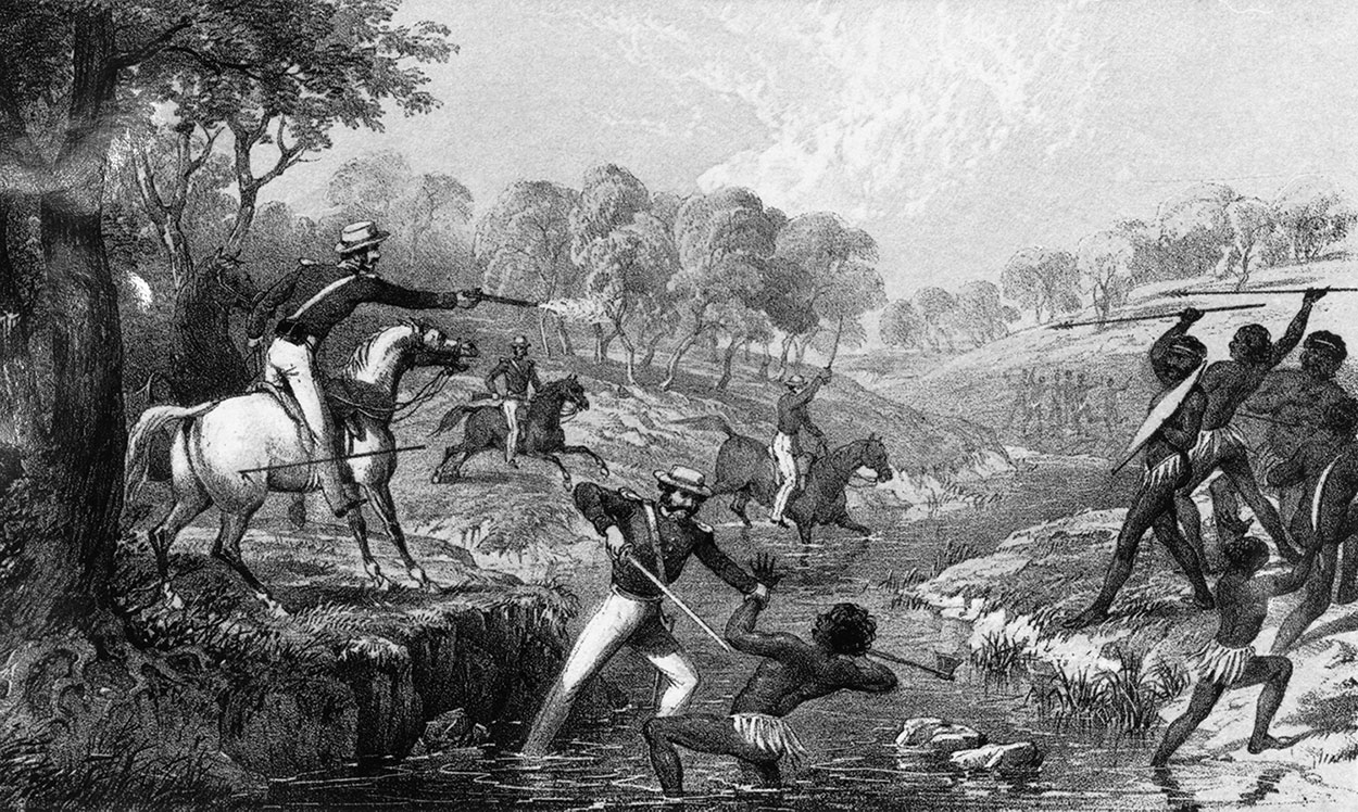
Colonial settlers frequently clashed with Indigenous people (on continental Australia) during and after the History of Australia (1788–1850), wave of mass immigration of Europeans into the continent, which began in the late 18th century and lasted until the early 20th. Throughout this period, settlers attacked and displaced Indigenous Australians, resulting in significant numbers of Indigenous deaths. These attacks are considered to be a direct and indirect (through displacement and hunger) cause of the decline of the Indigenous Australians, Indigenous population, during an ongoing colonising process of mass immigration and land clearing for agricultural and mining purposes. There are over 400 known massacres of Indigenous people on the continent. A project headed by historian Lyndall Ryan from the University of Newcastle (Australia), University of Newcastle and funded by the Australian Research Council has been researching and mapping the sites of these massacres. A massacre ... [...More Info...] [...Related Items...] OR: [Wikipedia] [Google] [Baidu] |
Midden
A midden is an old dump for domestic waste. It may consist of animal bones, human excrement, botanical material, mollusc shells, potsherds, lithics (especially debitage), and other artifacts and ecofacts associated with past human occupation. These features provide a useful resource for archaeologists who wish to study the diets and habits of past societies. Middens with damp, anaerobic conditions can even preserve organic remains in deposits as the debris of daily life are tossed on the pile. Each individual toss will contribute a different mix of materials depending upon the activity associated with that particular toss. During the course of deposition sedimentary material is deposited as well. Different mechanisms, from wind and water to animal digs, create a matrix which can also be analysed to provide seasonal and climatic information. In some middens individual dumps of material can be discerned and analysed. Shells A shell midden or shell mound is an arc ... [...More Info...] [...Related Items...] OR: [Wikipedia] [Google] [Baidu] |
Fish Trap
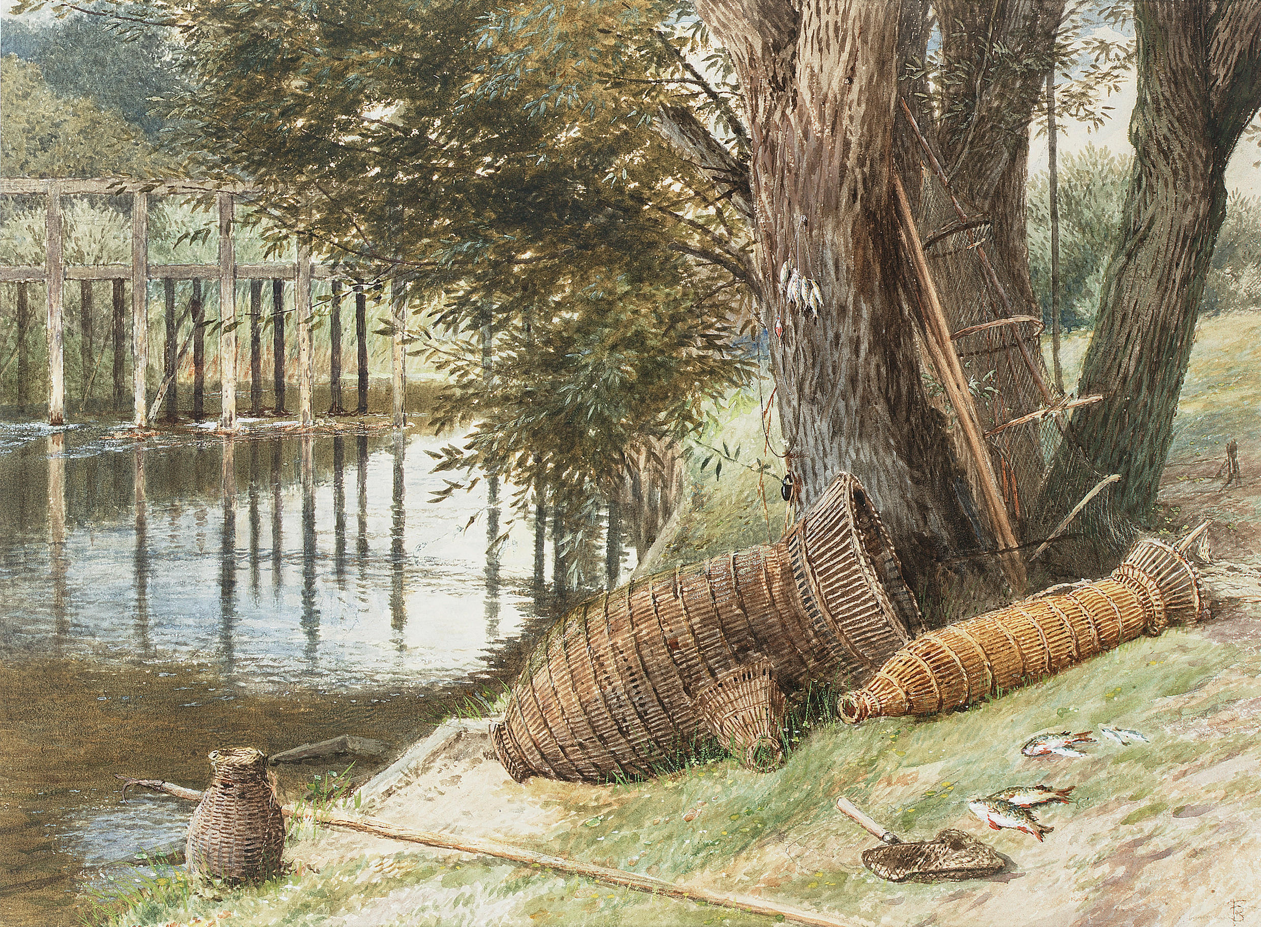
A fish trap is a animal trapping, trap used for fishing, catching fish and other aquatic animals of value. Fish traps include fishing weirs, lobster trap, cage traps, fish wheels and some fishing net rigs such as fyke nets. The use of traps are culturally almost universal around the world and seem to have been independently invented many times. There are two main types of trap, a permanent or semi-permanent structure placed in a river or tidal area and bottle or pot trap that are usually, but not always baited to attract prey, and are periodically lifted out of the water. A typical contemporary trap consists of a frame of thick steel wire in the shape of a heart, with chicken wire stretched around it. The mesh wraps around the frame and then tapers into the inside of the trap. Fishes that swim inside through this opening cannot get out, as the chicken wire opening bends back into its original narrowness. In earlier times, traps were constructed of wood and fibre. Fish traps con ... [...More Info...] [...Related Items...] OR: [Wikipedia] [Google] [Baidu] |
Ramsar Convention
The Ramsar Convention on Wetlands of International Importance Especially as Waterfowl Habitat is an international treaty for the conservation and sustainable use of Ramsar site, Ramsar sites (wetlands). It is also known as the Convention on Wetlands. It is named after the city of Ramsar, Mazandaran, Ramsar in Iran, where the convention was signed in 1971. Every three years, representatives of the contracting parties meet as the Ramsar Convention#Conference of the Contracting Parties, Conference of the Contracting Parties (COP), the policy-making organ of the wetland conservation, convention which adopts decisions (site designations, resolutions and recommendations) to administer the work of the convention and improve the way in which the parties are able to implement its objectives. In 2022, COP15 was held in Montreal, Canada. List of wetlands of international importance The list of wetlands of international importance included 2,531 Ramsar site, Ramsar sites in Februa ... [...More Info...] [...Related Items...] OR: [Wikipedia] [Google] [Baidu] |
Western District Lakes
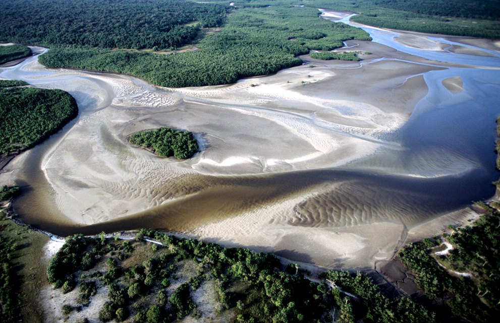
The Western District Lakes of Victoria, in the Western District of Victoria, south-eastern Australia, were recognised on 15 December 1982 as wetlands of international importance by listing under the Ramsar Convention, as Ramsar site no.268. Description The site comprises nine lakes with a combined area of , varying in depth and salinity from fresh water to hypersaline. They include State Wildlife Reserves and Lake Reserves and serve as drought refuges for tens of thousands of waterbirds. Several threatened plants occur within the site, including the endangered '' Lepidium ashersonii''. The lakes are used for various purposes, including recreational fishing and duck hunting as well as grazing, commercial fishing, and wastewater disposal. The lakes lie in a basaltic grassland landscape at an altitude of above sea level. Average annual rainfall (recorded at Beeac) is . Lakes included in the site are: * Lake Beeac; hypersaline; * Lake Bookar; * Lake Colongulac; saline; * ... [...More Info...] [...Related Items...] OR: [Wikipedia] [Google] [Baidu] |
Dhauwurd Wurrung
The Gunditjmara or Gunditjamara, also known as Dhauwurd Wurrung, are an Aboriginal people of southwestern Victoria in Australia. They are the Traditional Owners of the areas now encompassing Warrnambool, Port Fairy, Woolsthorpe and Portland. Their Country includes much of the Budj Bim heritage areas. The Kerrup Jmara (Kerrupjmara, Kerrup-Jmara) are a clan of the Gunditjmara, whose traditional lands are around Lake Condah. The Koroitgundidj (Koroit gundidj) are another clan group, whose lands are around Tower Hill. The Gunditjmara are famous for their extensive landscape engineering prowess shown in constructing kilometres of eel aquaculture channels, holding ponds, and fish traps in and around Budj Bim. The Gunditjmara are famously known as the Fighting Gunditjmara because of their extensive resistance against British invasion of their Country during the Eumeralla Wars. Name Gunditjmara is formed from two morphemes: ''Gunditj'', a suffix denoting belonging to a particular ... [...More Info...] [...Related Items...] OR: [Wikipedia] [Google] [Baidu] |
Ian D
Ian or Iain is a name of Scottish Gaelic origin, which is derived from the Hebrew given name (Yohanan, ') and corresponds to the English name John. The spelling Ian is an Anglicization of the Scottish Gaelic forename ''Iain''. This name is a popular name in Scotland, where it originated, as well as in other English-speaking countries. The name has fallen out of the top 100 male baby names in the United Kingdom, having peaked in popularity as one of the top 10 names throughout the 1960s. In 1900, Ian ranked as the 180th most popular male baby name in England and Wales. , the name has been in the top 100 in the United States every year since 1982, peaking at 65 in 2003. Other Gaelic forms of the name "John" include " Seonaidh" ("Johnny" from Lowland Scots), "Seon" (from English), "Seathan", and "Seán" and "Eoin" (from Irish). The Welsh equivalent is Ioan, the Cornish counterpart is Yowan and the Breton equivalent is Yann. Notable people named Ian Given name * Ian Agol (b ... [...More Info...] [...Related Items...] OR: [Wikipedia] [Google] [Baidu] |
Darlington, Victoria
Darlington is a locality in the Western District of Victoria, Australia. The locality is in the Shire of Corangamite and on the Hamilton Highway, south west of the state capital, Melbourne. Mount Emu Creek passes through the locality . The locality has one remaining pub A pub (short for public house) is in several countries a drinking establishment licensed to serve alcoholic drinks for consumption on the premises. The term first appeared in England in the late 17th century, to differentiate private ho ..., the Elephant Bridge Hotel. The Elephant Bridge Hotel is believed to be one of the oldest continuously licensed pubs in Victoria. The kitchen and cellar were built in 1842 and the rest of the building some years later. The pub claims to have four resident ghosts. References Towns in Victoria (state) Shire of Corangamite {{BarwonSouthWest-geo-stub ... [...More Info...] [...Related Items...] OR: [Wikipedia] [Google] [Baidu] |
Lake Bolac, Victoria
Lake Bolac is a town in the Western District region of Victoria, Australia. The town is on the shores of Lake Bolac, and the Glenelg Highway passes through the town. At the 2021 census, Lake Bolac and the surrounding area had a population of 368. The name derives from ''bulluc'', meaning swamp or lake in the Djab Wurrung language. The traditional owners of the area are the Girai wurrung people. History Pre-colonial inhabitation Lake Bolac was the northern boundary of the Girai wurrung people's traditional lands, according to Norman Tindale, while large groups of up to 1,000 Djab wurrung and other peoples gathered here for a couple of months during the annual short-finned eel migration. George Augustus Robinson recorded in 1841 that 800 Aboriginal people had gathered at Lake Bolac – 'Lake Boloke' – to feast on plentiful eels, when "...local tribes numbered only sixty individuals". The name of the lake and thence the town derives from ''bulluc'', meaning swamp or lak ... [...More Info...] [...Related Items...] OR: [Wikipedia] [Google] [Baidu] |
Princetown, Victoria
Princetown is a town in Victoria, Australia, located on the Great Ocean Road, east of the Twelve Apostles, in the Corangamite Shire. General Princetown is located east of Port Campbell in Victoria, Australia on the Great Ocean Road. It hosts a pub which doubles as a general store, a post office and some accommodation options. The hamlet provides access to beaches and the mouth of the Gellibrand River. At the , Princetown district had a population of 459. Redrawing of the census lines reduced the figure in 2016 to 241 persons. Princetown Cricket Club is the sole surviving sporting club in the township, boasting about 30 members playing in the local South West Cricket Association. The current club was formed in 1968, but cricket had been played in Princetown as far back as 1886. Attractions A river estuary and wetlands is adjacent to the township, with reed beds on the western branch of the estuary containing significant bird and plant life. Princetown is bounded on two si ... [...More Info...] [...Related Items...] OR: [Wikipedia] [Google] [Baidu] |


