|
Desert Pavement
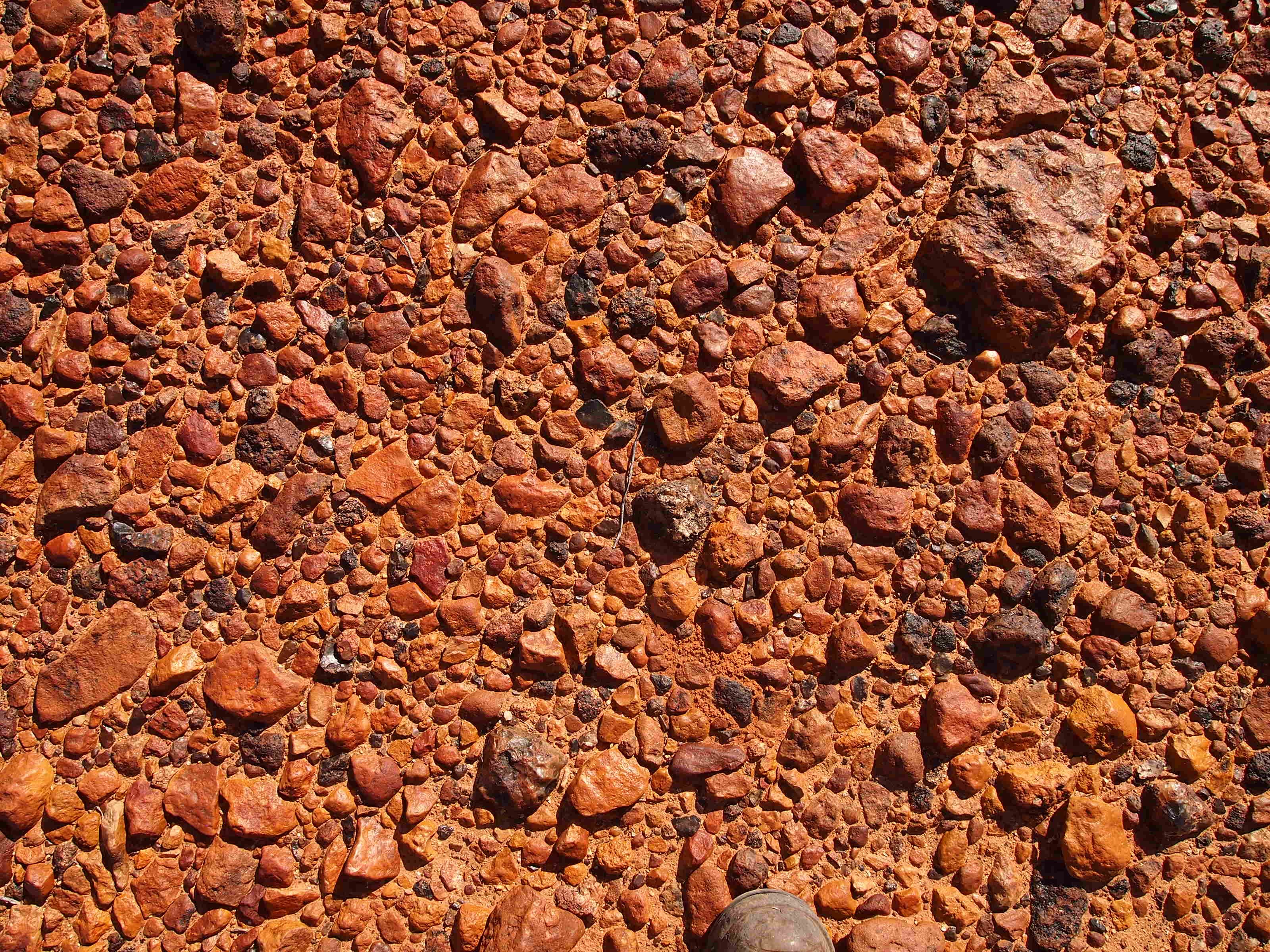
A desert pavement, also called reg (in western Sahara), serir (in eastern Sahara), gibber (in Australia), or saï (in central Asia) is a desert surface covered with closely packed, interlocking angular or rounded rock fragments of pebble and cobble size. They typically top alluvial fans. Desert varnish collects on the exposed surface rocks over time. Geologists debate the mechanics of pavement formation and their age. Formation Several theories have been proposed for the formation of desert pavements. A common theory suggests that they form through the gradual removal of sand, dust and other fine-grained material by the wind and intermittent rain, leaving the larger fragments behind. The larger fragments are shaken into place through the forces of rain, running water, wind, gravity, creep, thermal expansion and contraction, wetting and drying, frost heaving, animal traffic, and the Earth's constant microseismic vibrations. The removal of small particles by wind does not co ... [...More Info...] [...Related Items...] OR: [Wikipedia] [Google] [Baidu] [Amazon] |
Desert Pavement 2
A desert is a landscape where little precipitation occurs and, consequently, living conditions create unique biomes and ecosystems. The lack of vegetation exposes the unprotected surface of the ground to denudation. About one-third of the land surface of the Earth is arid or Semi-arid climate, semi-arid. This includes much of the Polar regions of Earth, polar regions, where little precipitation occurs, and which are sometimes called polar deserts or "cold deserts". Deserts can be classified by the amount of precipitation that falls, by the temperature that prevails, by the causes of desertification or by their geographical location. Deserts are formed by weathering processes as large variations in temperature between day and night strain the Rock (geology), rocks, which consequently break in pieces. Although rain seldom occurs in deserts, there are occasional downpours that can result in flash floods. Rain falling on hot rocks can cause them to shatter, and the resulting frag ... [...More Info...] [...Related Items...] OR: [Wikipedia] [Google] [Baidu] [Amazon] |
Helium Dating
Helium dating (abbreviated (U–Th)/He dating) refers to a variety of He diffusion methods that utilize the mobility of radiogenic He atoms to determine the thermal history of a rock. Helium diffusion experiments are often used to help interpret information retrieved from U–Th/He thermochronometric experiments. Kinematic parameters derived from He diffusion is done through estimating He diffusion over a range of temperatures. The use of density functional theory helps in estimating energy barriers for He to overcome as it diffuses across various crystallographic directions. Discrepancies, however, between observed and predicted He diffusion rates is still a problem and likely stem from unresolved problems in crystal defects and radiation damage in natural grains as opposed to theoretical grains. Depending on the mineral analyzed there are different assumptions to be made on He mobility. For example, He diffusion in minerals such as zircon, rutile, and monazite have been shown to ... [...More Info...] [...Related Items...] OR: [Wikipedia] [Google] [Baidu] [Amazon] |
Deserts
A desert is a landscape where little precipitation occurs and, consequently, living conditions create unique biomes and ecosystems. The lack of vegetation exposes the unprotected surface of the ground to denudation. About one-third of the land surface of the Earth is arid or semi-arid. This includes much of the polar regions, where little precipitation occurs, and which are sometimes called polar deserts or "cold deserts". Deserts can be classified by the amount of precipitation that falls, by the temperature that prevails, by the causes of desertification or by their geographical location. Deserts are formed by weathering processes as large variations in temperature between day and night strain the rocks, which consequently break in pieces. Although rain seldom occurs in deserts, there are occasional downpours that can result in flash floods. Rain falling on hot rocks can cause them to shatter, and the resulting fragments and rubble strewn over the desert floor are f ... [...More Info...] [...Related Items...] OR: [Wikipedia] [Google] [Baidu] [Amazon] |
Aeolian Landforms
Aeolian commonly refers to things related to either of two Greek mythological figures: * Aeolus (son of Hippotes), ruler of the winds * Aeolus (son of Hellen), son of Hellen and eponym of the Aeolians * Aeolians, an ancient Greek tribe thought to be descended from Aeolus, son of Hellen Aeolian or Eolian may also refer to: Music * ''Aeolian'' (album), an album by German post-metal band The Ocean Collective * Aeolian Company (1887–1985), a maker of organs, pianos, sheet music, and phonographs * Aeolian Hall (other), any one of a number of concert halls of that name * Aeolian harp, a harp that is played by the wind * Aeolian mode, a musical mode, the natural minor key * Aeolian Quartet (1952–1981), a string quartet based in London * Aeolian-Skinner (1932–1972), pipe organ builder Other uses * Aeolian dialect, a dialect of Ancient Greek * Aeolian Islands, islands in the Tyrrhenian Sea, named after Aeolus the ruler of the winds * Aeolian or Aeolic order, an ea ... [...More Info...] [...Related Items...] OR: [Wikipedia] [Google] [Baidu] [Amazon] |
Erg (landform)
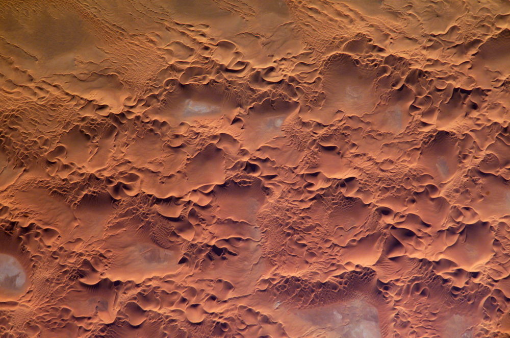
An erg (also sand sea or dune sea, or sand sheet if it lacks dunes) is a broad, flat area of desert covered with wind-swept sand with little or no vegetative cover. The word is derived from the Arabic language, Arabic word ''ʿirq'' (), meaning "dune field". Strictly speaking, an erg is defined as a desert area that contains more than of aeolian processes, aeolian or wind-blown sand and where sand covers more than 20% of the surface. Smaller areas are known as "dune fields". The largest hot desert in the world, the Sahara, covers and contains several ergs, such as the Chech Erg and the Issaouane Erg in Algeria. Approximately 85% of all the Earth's mobile sand is found in ergs that are greater than , the largest being the Rub' al Khali, the ''Empty Quarter'' of the Arabian Peninsula. Ergs are also found on other celestial bodies, such as Venus, Mars, and Saturn's moon Titan (moon), Titan. Geography Sand seas and dune fields generally occur in regions downwind of copious sourc ... [...More Info...] [...Related Items...] OR: [Wikipedia] [Google] [Baidu] [Amazon] |
North Africa
North Africa (sometimes Northern Africa) is a region encompassing the northern portion of the African continent. There is no singularly accepted scope for the region. However, it is sometimes defined as stretching from the Atlantic shores of the Western Sahara in the west, to Egypt and Sudan's Red Sea coast in the east. The most common definition for the region's boundaries includes Algeria, Egypt, Libya, Morocco, Tunisia, and Western Sahara, the territory territorial dispute, disputed between Morocco and the list of states with limited recognition, partially recognized Sahrawi Arab Democratic Republic. The United Nations’ definition includes all these countries as well as Sudan. The African Union defines the region similarly, only differing from the UN in excluding the Sudan and including Mauritania. The Sahel, south of the Sahara, Sahara Desert, can be considered as the southern boundary of North Africa. North Africa includes the Spanish cities of Ceuta and Melilla, and the ... [...More Info...] [...Related Items...] OR: [Wikipedia] [Google] [Baidu] [Amazon] |
Ecoregion
An ecoregion (ecological region) is an ecological and geographic area that exists on multiple different levels, defined by type, quality, and quantity of environmental resources. Ecoregions cover relatively large areas of land or water, and contain characteristic, geographically distinct assemblages of natural communities and species. The biodiversity of flora, fauna and ecosystems that characterise an ecoregion tends to be distinct from that of other ecoregions. In theory, biodiversity or conservation ecoregions are relatively large areas of land or water where the probability of encountering different species and communities at any given point remains relatively constant, within an acceptable range of variation (largely undefined at this point). Ecoregions are also known as "ecozones" ("ecological zones"), although that term may also refer to biogeographic realms. Three caveats are appropriate for all bio-geographic mapping approaches. Firstly, no single bio-geographic fram ... [...More Info...] [...Related Items...] OR: [Wikipedia] [Google] [Baidu] [Amazon] |
Australia
Australia, officially the Commonwealth of Australia, is a country comprising mainland Australia, the mainland of the Australia (continent), Australian continent, the island of Tasmania and list of islands of Australia, numerous smaller islands. It has a total area of , making it the list of countries and dependencies by area, sixth-largest country in the world and the largest in Oceania. Australia is the world's flattest and driest inhabited continent. It is a megadiverse countries, megadiverse country, and its size gives it a wide variety of landscapes and Climate of Australia, climates including deserts of Australia, deserts in the Outback, interior and forests of Australia, tropical rainforests along the Eastern states of Australia, coast. The ancestors of Aboriginal Australians began arriving from south-east Asia 50,000 to 65,000 years ago, during the Last Glacial Period, last glacial period. By the time of British settlement, Aboriginal Australians spoke 250 distinct l ... [...More Info...] [...Related Items...] OR: [Wikipedia] [Google] [Baidu] [Amazon] |
Utah
Utah is a landlocked state in the Mountain states, Mountain West subregion of the Western United States. It is one of the Four Corners states, sharing a border with Arizona, Colorado, and New Mexico. It also borders Wyoming to the northeast, Idaho to the north, and Nevada to the west. In comparison to all the U.S. states and territories, Utah, with a population of just over three million, is the List of U.S. states and territories by area, 13th largest by area, the List of U.S. states and territories by population, 30th most populous, and the List of U.S. states by population density, 11th least densely populated. Urban development is mostly concentrated in two regions: the Wasatch Front in the north-central part of the state, which includes the state capital, Salt Lake City, and is home to roughly two-thirds of the population; and Washington County, Utah, Washington County in the southwest, which has approximately 180,000 residents. Most of the western half of Utah lies in ... [...More Info...] [...Related Items...] OR: [Wikipedia] [Google] [Baidu] [Amazon] |
Newspaper Rock
Newspaper Rock State Historic Monument is a Utah state monument featuring a rock panel carved with one of the largest known collections of petroglyphs. It is located in San Juan County, Utah, San Juan County, along Utah State Route 211, northwest of Monticello, Utah, Monticello and south of Moab, Utah, Moab. It is along the relatively well-traveled access road into the Needles district of Canyonlands National Park, from US 191 and from the park boundary. The rock is a part of the vertical Wingate Sandstone, Wingate sandstone cliffs that enclose the upper end of Indian Creek Canyon, and is covered by hundreds of petroglyphs—one of the largest, best preserved and easily accessed groups in the American Southwest, Southwest. The petroglyphs feature a mixture of human, animal, material and abstract forms. Newspaper Rock was designated a State Historical Monument in 1961, and was added to the National Register of Historic Places listings in San Juan County, Utah as Indian ... [...More Info...] [...Related Items...] OR: [Wikipedia] [Google] [Baidu] [Amazon] |


