|
Chenango Forks, New York
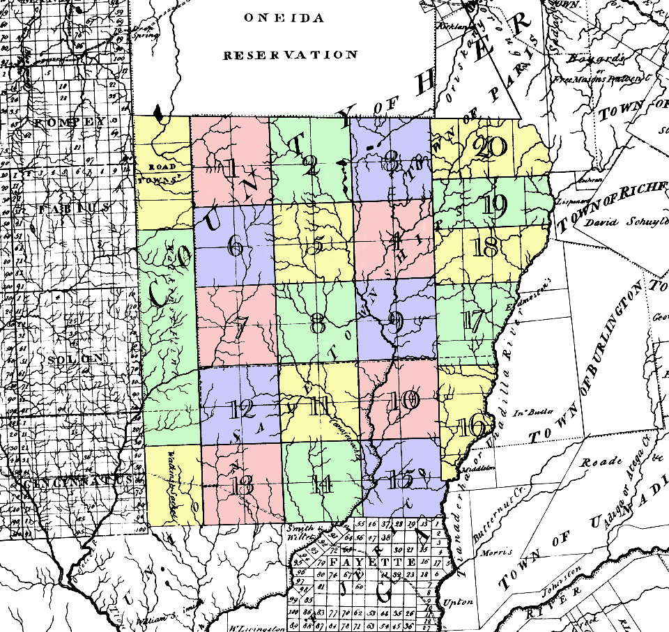
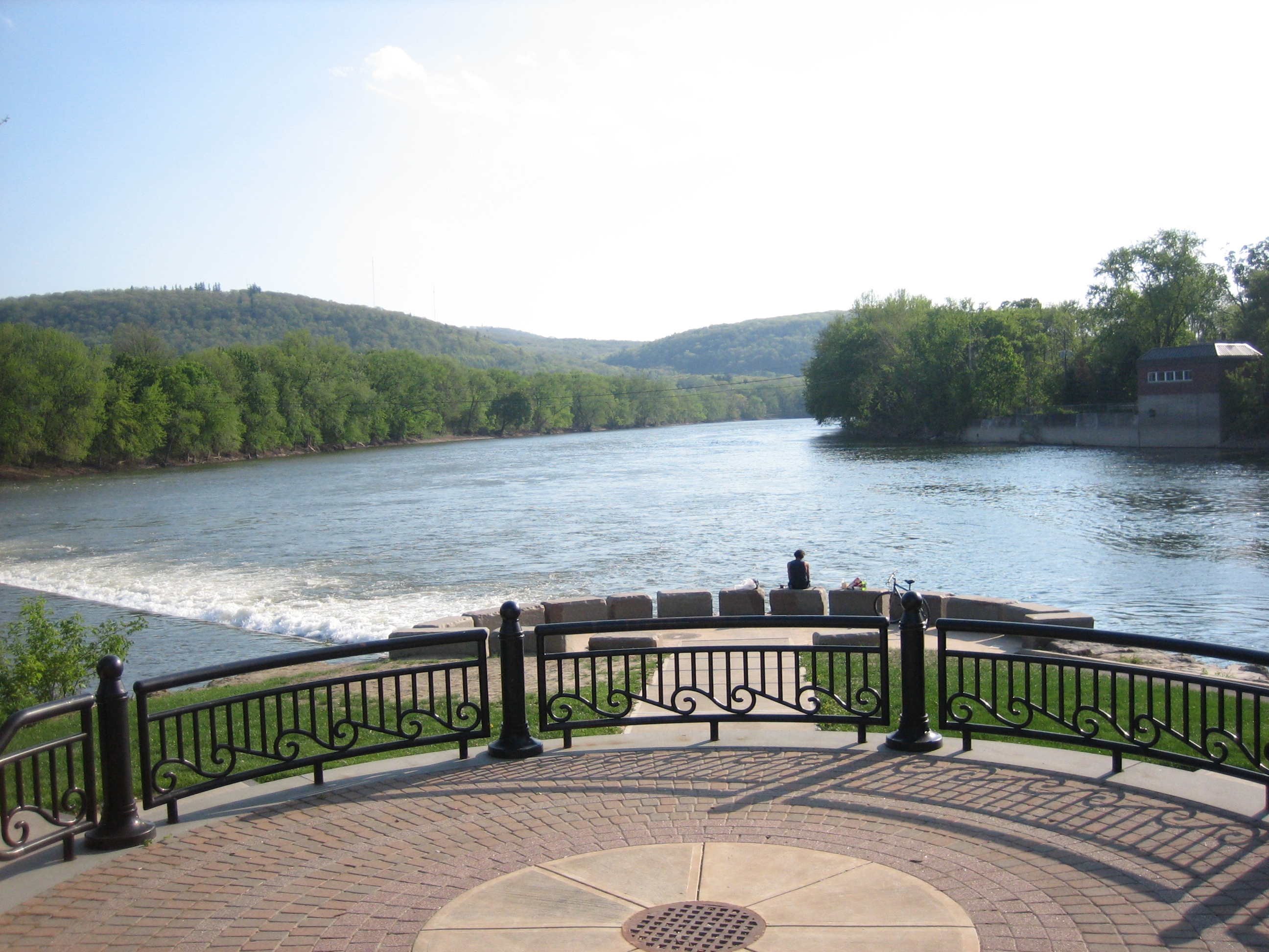
Chenango Forks is a hamlet located in Broome County, New York, United States. The community is situated partly in the town of Chenango and partly in the town of Barker. Chenango Forks is approximately north of Binghamton on Route 12 and is at the confluence of the Chenango and Tioughnioga rivers. Chenango Valley State Park is southwest of the hamlet. Chenango Forks is a few miles from the border of Chenango County. Chenango Forks is part of the Greater Binghamton Metropolitan Statistical Area. The Chenango Canal Prism and Lock 107 was listed on the National Register of Historic Places The National Register of Historic Places (NRHP) is the United States federal government's official list of districts, sites, buildings, structures and objects deemed worthy of preservation for their historical significance or "great artistic ... in 2010. References Hamlets in New York (state) Binghamton metropolitan area Hamlets in Broome County, New York {{BroomeCo ... [...More Info...] [...Related Items...] OR: [Wikipedia] [Google] [Baidu] |
Hamlet (New York)
The administrative divisions of New York are the various units of government that provide local services in the State of New York. The state is divided into boroughs, counties, cities, townships called "towns", and villages. (The only boroughs, the five boroughs of New York City, have the same boundaries as their respective counties.) They are municipal corporations, chartered (created) by the New York State Legislature, as under the New York Constitution the only body that can create governmental units is the state. All of them have their own governments, sometimes with no paid employees, that provide local services. Centers of population that are not incorporated and have no government or local services are designated hamlets. Whether a municipality is defined as a borough, city, town, or village is determined not by population or land area, but rather on the form of government selected by the residents and approved by the New York Legislature. Each type of local government ... [...More Info...] [...Related Items...] OR: [Wikipedia] [Google] [Baidu] |
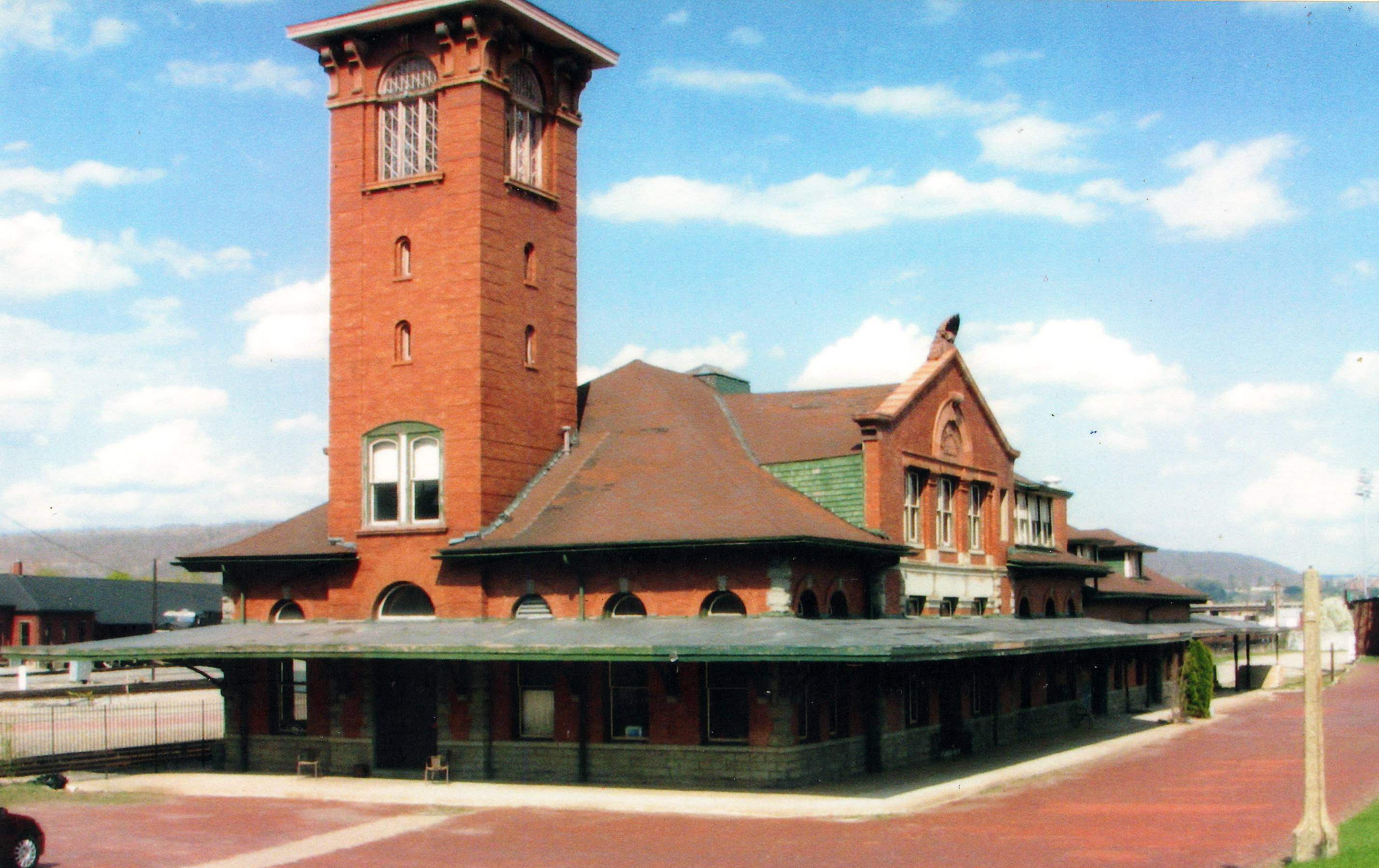
Chenango Forks, NY Early 1900s
Chenango, which means "Bull thistle" in the Oneida language, may refer to: * Chenango County, New York, a county in the United States of America * Chenango, New York, a town in Broome County * Chenango River, a river in New York * Chenango Forks, New York, a community in Broome County * Chenango Canal, a former canal in New York * USS Chenango, the name of two naval ships * Chenango, Texas Chenango is an unincorporated community in Brazoria County, Texas. It is a part of the Greater Houston metropolitan area. History The older town of Chenango, New York, is the namesake for this community. It was centered on Chenango Plantation, a ..., an unincorporated community in Brazoria County * Chenango Avenue, an avenue in Denver, Colorado * Chenango, a subdivision in Centennial, Colorado * Chenango Pl., street in West Lafayette, IN {{disambig ... [...More Info...] [...Related Items...] OR: [Wikipedia] [Google] [Baidu] |
National Register Of Historic Places
The National Register of Historic Places (NRHP) is the United States federal government's official list of districts, sites, buildings, structures and objects deemed worthy of preservation for their historical significance or "great artistic value". A property listed in the National Register, or located within a National Register Historic District, may qualify for tax incentives derived from the total value of expenses incurred in preserving the property. The passage of the National Historic Preservation Act (NHPA) in 1966 established the National Register and the process for adding properties to it. Of the more than one and a half million properties on the National Register, 95,000 are listed individually. The remainder are contributing resources within historic districts. For most of its history, the National Register has been administered by the National Park Service (NPS), an agency within the U.S. Department of the Interior. Its goals are to help property owners and inte ... [...More Info...] [...Related Items...] OR: [Wikipedia] [Google] [Baidu] |
Chenango Canal Prism And Lock 107
Chenango Canal Prism and Lock 107 is a national historic district located at Chenango Forks in Broome County, New York, United States. The district includes four contributing structures. They are the guard lock and dam constructed between 1834 and 1836 for navigation as part of the Chenango Canal. The district also includes the canal prism and adjacent tow path at Lock 107. ''See also:'' It was added to the National Register of Historic Places The National Register of Historic Places (NRHP) is the United States federal government's official list of districts, sites, buildings, structures and objects deemed worthy of preservation for their historical significance or "great artistic v ... in 2010. References Historic districts on the National Register of Historic Places in New York (state) Historic districts in Broome County, New York National Register of Historic Places in Broome County, New York {{BroomeCountyNY-NRHP-stub ... [...More Info...] [...Related Items...] OR: [Wikipedia] [Google] [Baidu] |
Binghamton Metropolitan Area
The Binghamton Metropolitan Statistical Area, also called Greater Binghamton or the Triple Cities, is a region of southern Upstate New York in the northeastern United States, anchored by the city of Binghamton. The United States metropolitan area, MSA encompasses Broome County, New York, Broome and Tioga County, New York, Tioga counties, which together had a population of 247,138 as of the 2020 United States Census, 2020 census. From 1963 to 1983, the MSA also included neighboring Susquehanna County, Pennsylvania, Susquehanna County in Pennsylvania, part of which still falls in the Binghamton, NY–PA Urban Area. In addition to these three counties, the greater region includes parts of Delaware County, New York, Delaware and Chenango County, New York, Chenango counties in New York; portions of Cortland County, New York, Cortland and Otsego County, New York, Otsego counties in New York and Wayne County, Pennsylvania are sometimes considered part of the region as well. Using the ... [...More Info...] [...Related Items...] OR: [Wikipedia] [Google] [Baidu] |
Chenango County, New York
Chenango County is a County (United States), county located in the south-central section U.S. state of New York (state), New York. As of the 2020 United States census, 2020 census, the population was 47,220. Its county seat is Norwich, New York, Norwich. The county's name originates from an Oneida language, Oneida word meaning 'large bull-thistle'. History This was long the territory of the Oneida people, one of the first Five Nations of the Iroquois Confederacy or ''Haudenosaunee''. They occupied the area until after the Revolutionary War, when they were forced off the land, although they had been allies of the patriot colonists. They were granted a small reservation, which settlers continued to encroach on. When English colonists organized counties in 1683 in what is now New York, the present Chenango County was part of Albany County, New York, Albany County. This was an enormous county, including the northern part of New York State as well as all of the present State of Ver ... [...More Info...] [...Related Items...] OR: [Wikipedia] [Google] [Baidu] |
Chenango Valley State Park
Chenango Valley State Park is a state park located in Broome County, New York in the United States. The park is located adjacent to the Chenango River in western part of the Town of Fenton. The park includes the 18-hole Chenango Valley State Park Golf Course. Park description Chenango Valley State Park offers a beach, picnic tables with pavilions, a playground, recreation programs, a 184-site campground, 24 cabins, sledding, a boat launch with boat rentals, and a food concession. Trails are available for hiking, biking, and cross-country skiing. The park includes forested and wetland habitats; forested areas contain populations of woodpeckers, nuthatches, warblers and thrushes, while the lake and wetland areas host herons, ducks and kingfishers. The mature woodlands are noted for a particularly large number of pileated woodpeckers. For anglers, Chenango Lake includes trout, bass, perch and bullhead. Two kettle lakes, Chenango Lake and Lily Lake, are found within the pa ... [...More Info...] [...Related Items...] OR: [Wikipedia] [Google] [Baidu] |
Tioughnioga River
The Tioughnioga River () is a U.S. Geological Survey. National Hydrography Dataset high-resolution flowline dataThe National Map accessed August 8, 2011 tributary of the Chenango River in central New York in the United States. It drains a dissected plateau area east of the Finger Lakes at the northernmost edge of the watershed of the Susquehanna River. The name comes from a native word for "forks of the river" or "meeting of waters". The river was also called "Tiohujodha" by the Moravian Indians. At one time it was called the Onondaga, as leading to that town, and Teyoghagoga was another early form. It rises in two branches in upstate New York southeast of the city of Syracuse, with the East Branch sometimes regarded as the main branch. The West Branch, long, issues from Tully Lake, approximately south of Tully on the Onondaga- Cortland county line, and flows south. The Tully Valley is a preglacial valley of a northward flowing river that flowed into the Ontarian River (preg ... [...More Info...] [...Related Items...] OR: [Wikipedia] [Google] [Baidu] |
Chenango River
The Chenango River is a U.S. Geological Survey. National Hydrography Dataset high-resolution flowline dataThe National Map, accessed August 8, 2011 tributary of the Susquehanna River in central New York in the United States. It drains a dissected plateau area in upstate New York at the northern end of the Susquehanna watershed. Named after the Oneida word for bull thistle, in the 19th century the Chenango furnished a critical link in the canal system of the northeastern United States. The Chenango Canal, built from 1836–1837 between Utica and Binghamton, connected the Erie Canal in the north to the Susquehanna River. The canal was rendered obsolete by railroads and was abandoned in 1878. Flooding is often a concern during the spring and fall. Course The Chenango River begins near Morrisville in Madison County, in central New York, in the Morrisville Swamp in the Town of Smithfield, about 25 miles southwest of Utica. The river flows from the Campbell Lakes in the swamp ... [...More Info...] [...Related Items...] OR: [Wikipedia] [Google] [Baidu] |
Binghamton, New York
Binghamton () is a city in the U.S. state of New York, and serves as the county seat of Broome County. Surrounded by rolling hills, it lies in the state's Southern Tier region near the Pennsylvania border, in a bowl-shaped valley at the confluence of the Susquehanna and Chenango Rivers. Binghamton is the principal city and cultural center of the Binghamton metropolitan area (also known as Greater Binghamton, or historically the Triple Cities, including Endicott and Johnson City), home to a quarter million people. The city's population, according to the 2020 census, is 47,969. From the days of the railroad, Binghamton was a transportation crossroads and a manufacturing center, and has been known at different times for the production of cigars, shoes, and computers. IBM was founded nearby, and the flight simulator was invented in the city, leading to a notable concentration of electronics- and defense-oriented firms. This sustained economic prosperity earned Binghamton the mon ... [...More Info...] [...Related Items...] OR: [Wikipedia] [Google] [Baidu] |
Geographic Names Information System
The Geographic Names Information System (GNIS) is a database of name and locative information about more than two million physical and cultural features throughout the United States and its territories, Antarctica, and the associated states of the Marshall Islands, Federated States of Micronesia, and Palau. It is a type of gazetteer. It was developed by the United States Geological Survey (USGS) in cooperation with the United States Board on Geographic Names (BGN) to promote the standardization of feature names. Data were collected in two phases. Although a third phase was considered, which would have handled name changes where local usages differed from maps, it was never begun. The database is part of a system that includes topographic map names and bibliographic references. The names of books and historic maps that confirm the feature or place name are cited. Variant names, alternatives to official federal names for a feature, are also recorded. Each feature receives a per ... [...More Info...] [...Related Items...] OR: [Wikipedia] [Google] [Baidu] |
List Of Sovereign States
The following is a list providing an overview of sovereign states around the world with information on their status and recognition of their sovereignty. The 206 listed states can be divided into three categories based on membership within the United Nations System: 193 UN member states, 2 UN General Assembly non-member observer states, and 11 other states. The ''sovereignty dispute'' column indicates states having undisputed sovereignty (188 states, of which there are 187 UN member states and 1 UN General Assembly non-member observer state), states having disputed sovereignty (16 states, of which there are 6 UN member states, 1 UN General Assembly non-member observer state, and 9 de facto states), and states having a special political status (2 states, both in free association with New Zealand). Compiling a list such as this can be a complicated and controversial process, as there is no definition that is binding on all the members of the community of nations concerni ... [...More Info...] [...Related Items...] OR: [Wikipedia] [Google] [Baidu] |


