|
Cerrillos State Forest
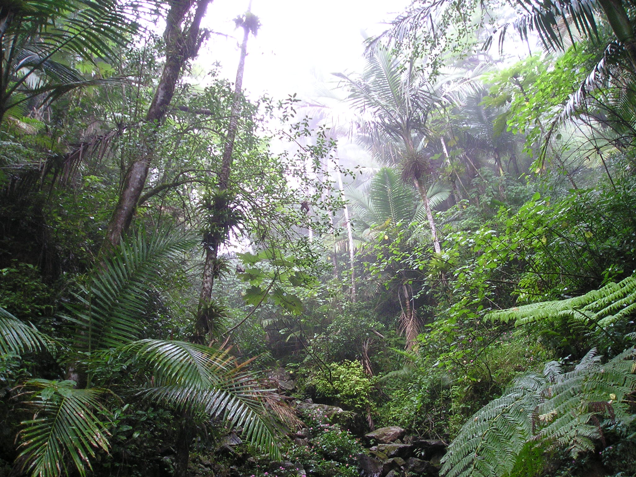
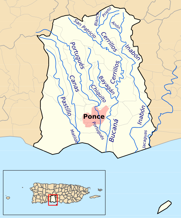
Cerrillos State Forest is one of the 21 state forests in Puerto Rico. It is located in barrio Maragüez, in the municipality of Ponce, and covers of valleys and mountains in the foothills of the Cordillera Central mountain range. The forest has several trails, observation areas, several picnic areas, complete with gazeebos and a man-made reservoir, Lake Cerrillos and the Lake Cerrillos dam. Location The forest is located at 18.08842 N, 66.58058 W (), in barrio Maragüez, which is located northeast of the city of Ponce, Puerto Rico. It can be reached via PR-139 Km 3.4. Its elevation varies from 400 to 1,000 feet above sea level. Recreation Recreational activities permitted in this forest include fishing, hiking, kayaking, photography, picnicking, scientific research, and bird watching. [...More Info...] [...Related Items...] OR: [Wikipedia] [Google] [Baidu] |
PR-139
Puerto Rico Highway 139 (PR-139) is a two-way secondary Manual de Especificaciones y Diseño; General Design Criteria. San Juan, Puerto Rico: Puerto Rico DTOP. Pages 1-2 and 1-3. Accessed 30 April 2019. highway in the municipality of . Route description The road runs north to south, and mostly alongside in barrio |
Cordillera Central (Puerto Rico)
Cordillera Central (English: Central Mountain Range), is the main mountain range in Puerto Rico. The range crosses the island from west to east and divides it into its northern and southern coastal plains. The Cordillera Central runs eastward from the municipality of Maricao in the west to Aibonito in the central eastern region, and on to the Caribbean in the southeast through the Sierra de Cayey. The Central Mountain Range consists of the ''Cordillera Central proper'' and numerous subranges (such as the Sierra de Cayey), foothills and ridges that extend throughout the island. Cerro de Punta is both the highest peak of the Cordillera Central and the highest point in Puerto Rico. The Sierra de Luquillo, where El Yunque is located, is sometimes included as a subrange or eastward extension of the Cordillera Central. History The region of the Cordillera Central has been inhabited since the pre-Hispanic era. During the Spanish colonization of Puerto Rico, the Cordillera Central w ... [...More Info...] [...Related Items...] OR: [Wikipedia] [Google] [Baidu] |
Puerto Rico State Forests
{{disambiguation, geo ...
Puerto, a Spanish word meaning ''seaport'', may refer to: Places *El Puerto de Santa María, Andalusia, Spain *Puerto, a seaport town in Cagayan de Oro City, Philippines *Puerto Colombia, Colombia *Puerto Cumarebo, Venezuela *Puerto Galera, Oriental Mindoro, Philippines * Puerto La Cruz, Venezuela *Puerto Píritu, Venezuela *Puerto Princesa, Palawan, Philippines *Puerto Rico, an unincorporated territory of the United States *Puerto Vallarta, Mexico Others * ''Puerto Rico'' (board game) *Operación Puerto doping case See also * * Puerta (other) Puerta refers to the old original gates of the Walled City of Intramuros in Manila. Puerta may also refer to: People *Antonio Puerta, Spanish footballer *Alonso José Puerta, Spanish politician *Lina Puerta, American artist *Mariano Puerta, Argent ... [...More Info...] [...Related Items...] OR: [Wikipedia] [Google] [Baidu] |
Tourist Attractions In Ponce, Puerto Rico
Ponce, Puerto Rico's second-largest city outside the San Juan metropolitan area, receives over 100,000 visitors annually. Ponce's sights include monuments and architecture, such as its Monumento a la Abolición de la Esclavitud and Residencia Armstrong-Poventud, and pink marble curbs and chamfered streets corners, as well as historic houses, castles and concert halls. There are also more modern attractions such as its seafront Tablado La Guancha as well as attractions that date back some 1500 years, like the Tibes Indigenous Ceremonial Center. The city has been called "the most Puerto Rican city in Puerto Rico."Aida Belen Rivera Ruiz, Certifying Official, and Juan Llanes Santos, Preparer, Puerto Rico Historic Preservation Office. (San Juan, Puerto Rico) 26 February 2008. In ''National Register of Historic Places Registration Form''. United States Department of the Interior. National Park Service. (Washington, D.C.) Page 13. Listing Reference Number 08000283 (McCabe Memori ... [...More Info...] [...Related Items...] OR: [Wikipedia] [Google] [Baidu] |
Porta Caribe
Porta Caribe is a tourism region in southern Puerto Rico. It was established in 2003 by the Puerto Rico Tourism Company, an agency of the Government of Puerto Rico. When created in 2003 it consisted of 14 municipalities in the south central zone (Adjuntas, Arroyo, Coamo, Guayama, Guayanilla, Jayuya, Juana Diaz, Patillas, Peñuelas, Ponce, Salinas, Santa Isabel, Villaba, Yauco). With the creation of the neighboring Porta Cordillera zone in July 2012, the municipalities of Adjuntas and Jayuya were transferred to the newly created Porta Cordillera zone and Porta Caribe became a 12-municipality tourism region. The name ''Porta Caribe'' translates to "Doorway to the Caribbean." Its executive director is Maritza W. Ruiz Cabán. History The southern region of Puerto Rico had traditionally been considered to consist of 16 municipalities. The establishment of the Porta Caribe region dates to the late 1990s when two bills to the effect were brought before the Puerto Rico Legisla ... [...More Info...] [...Related Items...] OR: [Wikipedia] [Google] [Baidu] |
Cerro De Punta
Cerro de Punta or just Cerro Punta is the highest peak in Puerto Rico, rising to above sea level.As of February, 1981, the US Geological Survey reports the height as 1,328 meters. (See''Geographic Names Information System: Feature Query Results.''United States Geological Survey. 13-FEB-1981. Retrieved 22 August 2013.) However, Gousha (1995) and Metrodata (1998) report the height as 1,338 meters. (See Universidad Interamericana de Puerto Rico en Bayamon. Departamento de Ciencias Naturales y Matematicas. Retrieved 22 August 2013.) The mountain is part of the Cordillera Central and is located in the municipality of Ponce. Location The mountain is part of the Cordillera Central and is located on the border between the municipalities of Jayuya and Ponce. The access road to the point closest to the highest elevation is from the municipality of Jayuya. It is part of the Toro Negro Forest Reserve, and it has been described as "an alpine runt." It is located on the western end of th ... [...More Info...] [...Related Items...] OR: [Wikipedia] [Google] [Baidu] |
List Of National Natural Landmarks In Puerto Rico
From List of National Natural Landmarks, these are the National Natural Landmarks in Puerto Rico. There are 5 in total. See also * List of National Historic Landmarks in Puerto Rico References * Puerto Rico Puerto Rico (; abbreviated PR; tnq, Boriken, ''Borinquen''), officially the Commonwealth of Puerto Rico ( es, link=yes, Estado Libre Asociado de Puerto Rico, lit=Free Associated State of Puerto Rico), is a Caribbean island and unincorporated ... Puerto Rico geography-related lists {{PuertoRico-stub ... [...More Info...] [...Related Items...] OR: [Wikipedia] [Google] [Baidu] |
List Of Puerto Rico State Forests
This article lists state forests in the Commonwealth of Puerto Rico. Puerto Rico state forests The following are Puerto Rico state forests. Note on the area: As of August 2013, the Government of Puerto Rico is engaged in an ongoing plan of land purchase for the purpose of increasing its inventory of state forest land area. As a result the area figures given in this table should only be taken as approximations. Also, land measurements in Puerto Rico are given in ''cuerdas'' (one cuerda equals to 0.97 acres), and, as such, references to forest size below have been converted to acres to keep all such measurements standard throughout this article. Key: B = Boating C = Camping F = Fishing G = Photography H = Hiking K = Kayaking O = Nature Observation P = Picnicking R = Scientific Research S = Swimming W = Bird Watching Other Puerto Rico government forests The following forest is owned by the Puerto Rico but managed by the ''Taller de Arte y Cultura'' community-based group at Casa P ... [...More Info...] [...Related Items...] OR: [Wikipedia] [Google] [Baidu] |
Cerrillos River
Cerrillos River (Spanish: Río Cerrillos) is a river in the municipality of Ponce, Puerto Rico. Río Cerrillos has its origin in barrio Anón and runs south until it feeds into Bucaná River. Río Cerrillos is commonly known by the locals as Maragüez River, because most of its course runs through Barrio Maragüez. This river is one of the 14 rivers in the municipality. The river has a discharge of 24,000 cubic feet per second, making it the second most affluent river in the municipality after Río Jacaguas. Course From its origin about 1 kilometer south of the intersection of PR-139 and PR-143, Río Cerrillos runs south for 1.8 kilometers where it is fed by Río Prieto west of PR-139. From this point on, Rio Cerrillos runs parallel to PR-139 for 2 kilometers in barrio Anón before reaching barrio Maragüez. Continuing on its southernly course for about 1.2 kilometers, Río Cerrillos is fed by Río San Patricio. Five kilometers further downstream Río Cerrillos forms Lake ... [...More Info...] [...Related Items...] OR: [Wikipedia] [Google] [Baidu] |
Lake Cerrillos
Lake Cerrillos (Spanish: Lago Cerrillos) is a man-made lake located in barrio Maragüez, Ponce, Puerto Rico. The lake was finished in 1992 by the U.S. Army Corps of Engineers. The main purposes of the reservoir are flood control, water supply, and recreation. There is a variety of fish available for fishing such as largemouth bass, bluegills, catfish and tilapias. The 1993 Central American and Caribbean Games that were held in Ponce staged the canoeing competitions in this lake. It was used in the 2010 Central American and Caribbean Games for the sports of Canoeing, Rowing. The lake is the main drinking water source for the city of Ponce. Dam The Lake Cerrillos Dam is located about four miles (6 km) northeast of Ponce. Construction of the dam started in 1984. After its completion in 1992, it still took a few more years for the initial filling of the reservoir. Lake Cerrillos Dam has a total capacity of 59 million cubic meters. In lieu of flood gates, it provides mor ... [...More Info...] [...Related Items...] OR: [Wikipedia] [Google] [Baidu] |
Gazeebo
A gazebo is a pavilion structure, sometimes octagonal or turret-shaped, often built in a park, garden or spacious public area. Some are used on occasions as bandstands. Etymology The etymology given by Oxford Dictionaries is "Mid 18th century: perhaps humorously from gaze, in imitation of Latin future tenses ending in -ebo: compare with lavabo." L. L. Bacon put forward a derivation from ''Casbah'', a Muslim quarter around the citadel in Algiers.Bacon, Leonard Lee. "Gazebos and Alambras", ''American Notes and Queries'' 8:6 (1970): 87–87 W. Sayers proposed Hispano-Arabic ''qushaybah'', in a poem by Cordoban poet Ibn Quzman (d. 1160).William Sayers, ''Eastern prospects: Kiosks, belvederes, gazebos''. Neophilologus 87: 299–305, 200/ref> The word ''gazebo'' appears in a mid-18th century English book by the architects John and William Halfpenny: ''Rural Architecture in the Chinese Taste''. There Plate 55, "Elevation of a Chinese Gazebo", shows "a Chinese Tower or Gazebo, situ ... [...More Info...] [...Related Items...] OR: [Wikipedia] [Google] [Baidu] |
Picnic
A picnic is a meal taken outdoors ( ''al fresco'') as part of an excursion, especially in scenic surroundings, such as a park, lakeside, or other place affording an interesting view, or else in conjunction with a public event such as preceding an open-air theater performance, and usually in summer. It is different from other meals because it requires free time to leave home. History shows us that the idea of a meal that was jointly contributed to and enjoyed out-of-doors was essential to picnic from the early 19th century. Picnickers like to sit on the ground on a rug or blanket. Picnics can be informal with throwaway plates or formal with silver cutlery and crystal wine glasses. Tables and chairs may be used but this is less common. Outdoor games or some other form of entertainment are common at large picnics. In public parks, a picnic area generally includes picnic tables and possibly built-in grills, water faucets (taps), garbage (rubbish) containers and restrooms (toi ... [...More Info...] [...Related Items...] OR: [Wikipedia] [Google] [Baidu] |


