|
Ceded Districts
Ceded Districts is the name of an area in the Deccan, India that was 'ceded' to the British East India Company by the Nizam in 1800. The name was in use during the whole period of the British Raj, even though the denomination had no official weight for legal or administrative purposes. The area largely corresponds to the modern region of Rayalaseema. History Following the Treaty of Seringapatam the Tippu Sultan accepted to give his northern territory to the Nizam of Hyderabad in 1792 AD. In 1796 AD, the then Nizam Asaf Jah II, harassed by the Marathas and Tipu Sultan, opted to get British military protection under Lord Wellesley's doctrine of Subsidiary Alliance. Now, as a part of this agreement, the Nizam ceded a large portion of the acquired territory to the British, to be added to the Madras Presidency. This area was also known as the ''Ceded Districts'', a term still used for the areas, and included the present day districts of Anantapuram, Kadapa (Cuddapah), much of ... [...More Info...] [...Related Items...] OR: [Wikipedia] [Google] [Baidu] |
British India
The provinces of India, earlier presidencies of British India and still earlier, presidency towns, were the administrative divisions of British governance on the Indian subcontinent. Collectively, they have been called British India. In one form or another, they existed between 1612 and 1947, conventionally divided into three historical periods: *Between 1612 and 1757 the East India Company set up Factory (trading post), factories (trading posts) in several locations, mostly in coastal India, with the consent of the Mughal emperors, Maratha Empire or local rulers. Its rivals were the merchant trading companies of Portugal, Denmark, the Netherlands, and France. By the mid-18th century, three ''presidency towns'': Madras, Bombay and Calcutta, had grown in size. *During the period of Company rule in India (1757–1858), the company gradually acquired sovereignty over large parts of India, now called "presidencies". However, it also increasingly came under British government over ... [...More Info...] [...Related Items...] OR: [Wikipedia] [Google] [Baidu] |
Arthur Wellesley, 1st Duke Of Wellington
Arthur Wellesley, 1st Duke of Wellington, (1 May 1769 – 14 September 1852) was an Anglo-Irish people, Anglo-Irish soldier and Tories (British political party), Tory statesman who was one of the leading military and political figures of United Kingdom of Great Britain and Ireland, 19th-century Britain, serving twice as prime minister of the United Kingdom. He is among the commanders who won and ended the Napoleonic Wars when the coalition defeated Napoleon at the Battle of Waterloo in 1815. Wellesley was born in Dublin into the Protestant Ascendancy in Kingdom of Ireland, Ireland. He was commissioned as an Ensign (rank), ensign in the British Army in 1787, serving in Ireland as aide-de-camp to two successive lords lieutenant of Ireland. He was also elected as a Member of Parliament (United Kingdom), member of Parliament in the Irish House of Commons. He was a colonel by 1796 and saw Flanders Campaign, action in the Netherlands and in India, where he fought in the Fourth Angl ... [...More Info...] [...Related Items...] OR: [Wikipedia] [Google] [Baidu] |
Wodeyar
The Wadiyar dynasty (formerly spelt Wodeyer or Odeyer, also referred to as the Wadiyars of Mysore), is a late-medieval/ early-modern South Indian Hindu royal family of former kings of Mysore from the Urs clan originally based in Mysore city. As Maharajas of Mysore, the Wadiyars ruled the Kingdom of Mysore from the late 1300s until 1950. Members of the Wadiyar dynasty and the Urs clan have also been royal advisers as Diwans to their reigning siblings, cousins, nephews, or distant relatives. Some members have also commanded army divisions as ''dalvoys'' (commander-in-chief) for their reigning monarch. During the late 14th century, the family was originally ''poleygars'' (Kannada for garrison) defending the regions in and around Mysore town for the Vijayanagara Empire, their feudal overlords. With the fall and decline of the empire in the 17th century, the Wadiyars declared independence when Raja Wadiyar seized the nearby town of Srirangapattana, the seat of Tirumala, Srir ... [...More Info...] [...Related Items...] OR: [Wikipedia] [Google] [Baidu] |
Kingdom Of Mysore
The Kingdom of Mysore was a realm in South India, southern India, traditionally believed to have been founded in 1399 in the vicinity of the modern city of Mysore. From 1799 until 1950, it was a princely state, until 1947 in a subsidiary alliance with Presidencies and provinces of British India, British India. The British took Direct Control over the Princely state, Princely State in 1831.Rajakaryaprasakta Rao Bahadur (1936), p383 It then became Mysore State (later enlarged and renamed to Karnataka) with its ruler remaining as Rajapramukh until 1956, when he became the first Governor of the reformed state. The kingdom, which was founded and ruled for most part by the Hindu Wodeyar family, initially served as feudatories under the Vijayanagara Empire. The 17th century saw a steady expansion of its territory and during the rule of Kanthirava Narasaraja I, Narasaraja Wodeyar I and Chikka Devaraja, Chikka Devaraja Wodeyar, the kingdom annexed large expanses of what is now southern ... [...More Info...] [...Related Items...] OR: [Wikipedia] [Google] [Baidu] |
Battle Of Srirangapattana
A battle is an occurrence of combat in warfare between opposing military units of any number or size. A war usually consists of multiple battles. In general, a battle is a military engagement that is well defined in duration, area, and force commitment. An engagement with only limited commitment between the forces and without decisive results is sometimes called a skirmish. The word "battle" can also be used infrequently to refer to an entire operational campaign, although this usage greatly diverges from its conventional or customary meaning. Generally, the word "battle" is used for such campaigns if referring to a protracted combat encounter in which either one or both of the combatants had the same methods, resources, and strategic objectives throughout the encounter. Some prominent examples of this would be the Battle of the Atlantic, Battle of Britain, and Battle of Stalingrad, all in World War II. Wars and military campaigns are guided by military strategy, wherea ... [...More Info...] [...Related Items...] OR: [Wikipedia] [Google] [Baidu] |
Fourth Anglo-Mysore War
The Fourth Anglo-Mysore War was a conflict in South India between the Kingdom of Mysore against the British East India Company and the Hyderabad Deccan in 1798–99. This was the final conflict of the four Anglo-Mysore Wars. The British captured the capital of Mysore. The ruler Tipu Sultan was killed in the battle. Britain took indirect control of Mysore, restoring the Wadiyar dynasty to the Mysore throne (with a British commissioner to advise him on all issues). Tipu Sultan's young heir, Fateh Ali, was sent into exile. The Kingdom of Mysore became a princely state in a subsidiary alliance with British India covering parts of present Kerala–Karnataka and ceded Coimbatore, Dakshina Kannada and Uttara Kannada to the British. Background Napoleon Bonaparte's landing in Ottoman Egypt in 1798 was intended to further the capture of the British possessions in India, and the Kingdom of Mysore was a key to that next step, as the ruler of Mysore, Tipu Sultan, sought France as an ally and ... [...More Info...] [...Related Items...] OR: [Wikipedia] [Google] [Baidu] |
Taluk
A tehsil (, also known as tahsil, taluka, or taluk) is a local unit of administrative division in some countries of South Asia. It is a subdistrict of the area within a district including the designated populated place that serves as its administrative centre, with possible additional towns, and usually a number of villages. The terms in India have replaced earlier terms, such as '' pargana'' (''pergunnah'') and ''thana''. In Andhra Pradesh and Telangana, a newer unit called mandal (circle) has come to replace the system of tehsils. It is generally smaller than a tehsil, and is meant for facilitating local self-government in the panchayat system. In West Bengal, Bihar, Jharkhand, community development blocks are the empowered grassroots administrative unit, replacing tehsils. As an entity of local government, the tehsil office (panchayat samiti) exercises certain fiscal and administrative power over the villages and municipalities within its jurisdiction. It is the ultimate exec ... [...More Info...] [...Related Items...] OR: [Wikipedia] [Google] [Baidu] |
Pavagada
Pavagada or Pavgada is a taluk in the Tumkur district in Karnataka, India. Historically it was part of the Mysore kingdom. Though it is geographically connected to Chitradurga district inside state of Karnataka, it comes under Tumkur district. It is from state capital of Bangalore. Uttara Pinakini river flows into this Taluk. Pavagada Taluk falls on the border of Karnataka, hence majority of the population are bilingual speaks Kannada and Telugu. The town is famous for its fort located on the hill, Kote Anjaneya temple at the foothills and also the temple of Sri Shani Mahatma. Agriculture Peanut The peanut (''Arachis hypogaea''), also known as the groundnut, goober (US), pindar (US) or monkey nut (UK), is a legume crop grown mainly for its edible seeds. It is widely grown in the tropics and subtropics, important to both small and ... was the main crop grown in various parts of the taluk but due to constant drought, people left their agricultural works and migrated ... [...More Info...] [...Related Items...] OR: [Wikipedia] [Google] [Baidu] |
Tumakuru District
Tumakuru District is an administrative district in the state of Karnataka in India. It is the third largest district in Karnataka by land area with an area of 10,598 km2, and fourth largest by Population. It is a one-and-a-half-hour drive from Bengaluru, the state capital. The district is known for the production of coconuts and is also called as 'Kalpataru Nadu'. It is the only discontiguous district in Karnataka (Pavagada Taluk has no geographical continuity with the rest of the district). As of census of 2011, the district has a population of 2,678,980, with a population density of 253 people /km2, the district has the literary rate of 75.14% and a sex ratio of 984 women/ 1000 men. Tumakuru district is surrounded by Chikkaballapura district and Bengaluru Rural in East, Ramanagara District in South-East, Mandya and Hassan Districts in South-West, Chikmagalur District in west, Chitradurga district in north-west and Sri Sathya Sai district and Anantapur district of Andh ... [...More Info...] [...Related Items...] OR: [Wikipedia] [Google] [Baidu] |
Bellary District
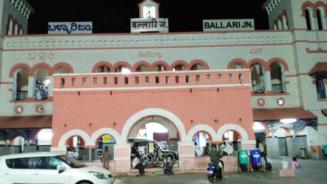
Bellary, officially known as Ballari (pronounced ), is a major district in Karnataka. It is located at north-eastern part of Karnataka. This district belongs to Kalyana-Karnataka. This district was one of the biggest districts in Karnataka until the Vijayanagara district was carved out of Ballari district in 2021 officially. This district has the highest deposits of iron ore in India. Historical sites, farm land and rich minerals characterize Ballari district. Recently making headlines with mining industry, Ballari, the district's capital, is known as Steel City and Gani Nadu (City of Mining). History Earlier Ballari district was part of Madras presidency. The area was severely affected by the Great Famine of 1876–78. After Indian independence, when the Indian states were reorganized along linguistic lines, Ballari became part of the Kalyana-Karnataka region of the state of Karnataka, now renamed as Kalyana-Karnataka. In 1882, Anantapur District was formed by carvin ... [...More Info...] [...Related Items...] OR: [Wikipedia] [Google] [Baidu] |
Kurnool District
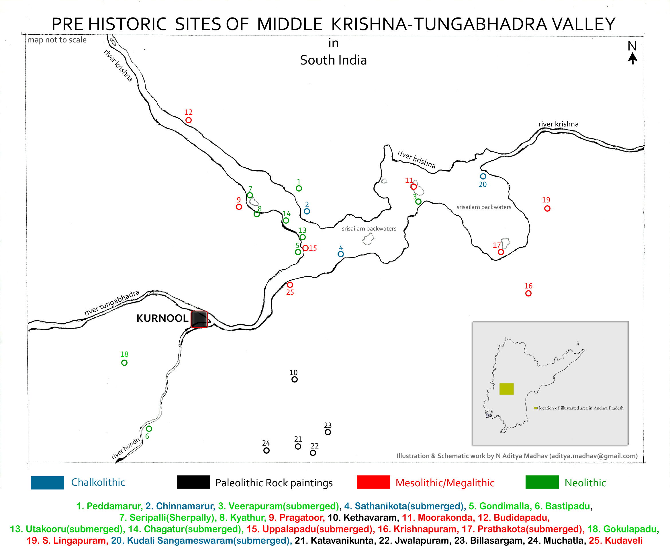
Kurnool district is one of the eight districts in the Rayalaseema region of the Indian state of Andhra Pradesh. It is located in the North western part of the state and is bounded by Jogulamba Gadwal district of Telangana in the north, Raichur district of Karnataka in the northwest, Bellary district of Karnataka in the west, Anantapur district in the south and Nandyal district in the east. The city of Kurnool is the headquarters of the district. It has a population of 4,053,463 of which 28.35% were urban as of 2011. History The Ketavaram rock paintings are dated back to the Paleolithic era (located at a distance of from Kurnool). Jurreru Valley, Katavani Kunta and Yaganti in the district have some important rock arts and paintings in their vicinity, which are dated back to 35,000 to 40,000 years ago. Belum Caves are geologically and historically important caves in the district. There are indications that Jain and Buddhist monks were occupying these caves centuries ... [...More Info...] [...Related Items...] OR: [Wikipedia] [Google] [Baidu] |
Cuddapah District
Kadapa district (officially: YSR district; formerly: Cuddapah district) is one of the twenty six districts in the Indian state of Andhra Pradesh. On 19 August 2005 nomenclature of “Cuddapah” has been changed as “Kadapa” by the Government of A.P. It was renamed as Y.S.R District during the year 2010, in honour of Y. S. Rajasekhara Reddy, commemorating the former chief minister of united Andhra Pradesh. It is also one of the eight districts in the Rayalaseema region. Kadapa is the administrative headquarters for this district. History Rock paintings Paleolithic rock paintings found at Chintakunta caves near Muddanur in Kadapa district are said to be the second largest group of paintings in India after Bhimbetika rock art paintings. The rock paintings with mystic figures are also found at Dappalle village near Mylavaram Dam in Jammalamadugu Taluk of the district. Prehistoric culture Many Paleolithic sites were found in Kadapa district, as the surroundings of ... [...More Info...] [...Related Items...] OR: [Wikipedia] [Google] [Baidu] |


