|
Transport In Kochi
Kochi (; Malayalam: കൊച്ചി ''Kochi'') is a major port city in the Indian state of Kerala. The city is widely known as the commercial or economic capital of the state of Kerala. The road infrastructure in Kochi has not been able to meet the growing traffic demand and hence traffic congestion is a major problem in the city. A comprehensive transport development plan has been included in the Kochi Masterplan hoping to improve the transport infrastructure. Kochi Metro, the rapid transit system for the city was inaugurated on 17 June 2017. A Suburban Railway system, intended to considerably ease congestion, is also to be built in the near future. Kochi bagged the city with most sustainable transport system award instituted by the Union ministry of housing and urban affairs in 2021. In April 2023, Kochi became the only city in the country to have water metro system along with the metro rail system after the inauguration of Kochi Water Metro. It is the first water metro ... [...More Info...] [...Related Items...] OR: [Wikipedia] [Google] [Baidu] |
Kochi
Kochi ( , ), List of renamed Indian cities and states#Kerala, formerly known as Cochin ( ), is a major port city along the Malabar Coast of India bordering the Laccadive Sea. It is part of the Ernakulam district, district of Ernakulam in the state of Kerala. The city is also commonly referred to as Ernakulam. As of 2011, the Kochi Municipal Corporation had a population of 677,381 over an area of 94.88 km2, and the larger Kochi metropolitan area, Kochi urban agglomeration had over 2.1 million inhabitants within an area of 440 km2, making it the largest and the Demographics of Kerala#Most populous urban agglomerations, most populous Kochi Metropolitan Area, metropolitan area in Kerala. Kochi city is also part of the Greater Cochin development region and is classified as a Tier-II city by the Government of India. The civic body that governs the city is the Kochi Municipal Corporation, which was constituted in the year 1967, and the statutory bodies that oversee its ... [...More Info...] [...Related Items...] OR: [Wikipedia] [Google] [Baidu] |
North–South And East–West Corridor
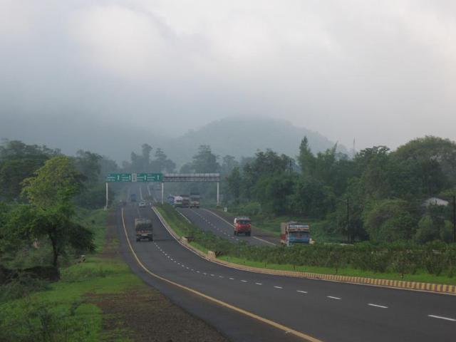
The North–South and East–West Corridor is a network of National Highway (India), national highways connecting major cities of India. It consists of two highway systems – the North–South highway extending from Srinagar in the north to Kanyakumari in the south with a spur to Kochi and the East–West highway extending from Silchar in the east to Porbandar in the west. The project was part of the first phase of the National Highways Development Project executed by the Government of India. The roads were constructed and are maintained by the National Highway Authority of India under the purview of the Ministry of Road Transport and Highways. The road system consists of access controlled four or six-lane highways, built at a cost of billion. , about of the project was complete. Background and planning In 1998, the Government of India launched the National Highways Development Project (NHDP). The project envisaged the development of about of four and six lane highwa ... [...More Info...] [...Related Items...] OR: [Wikipedia] [Google] [Baidu] |
Dhanushkodi
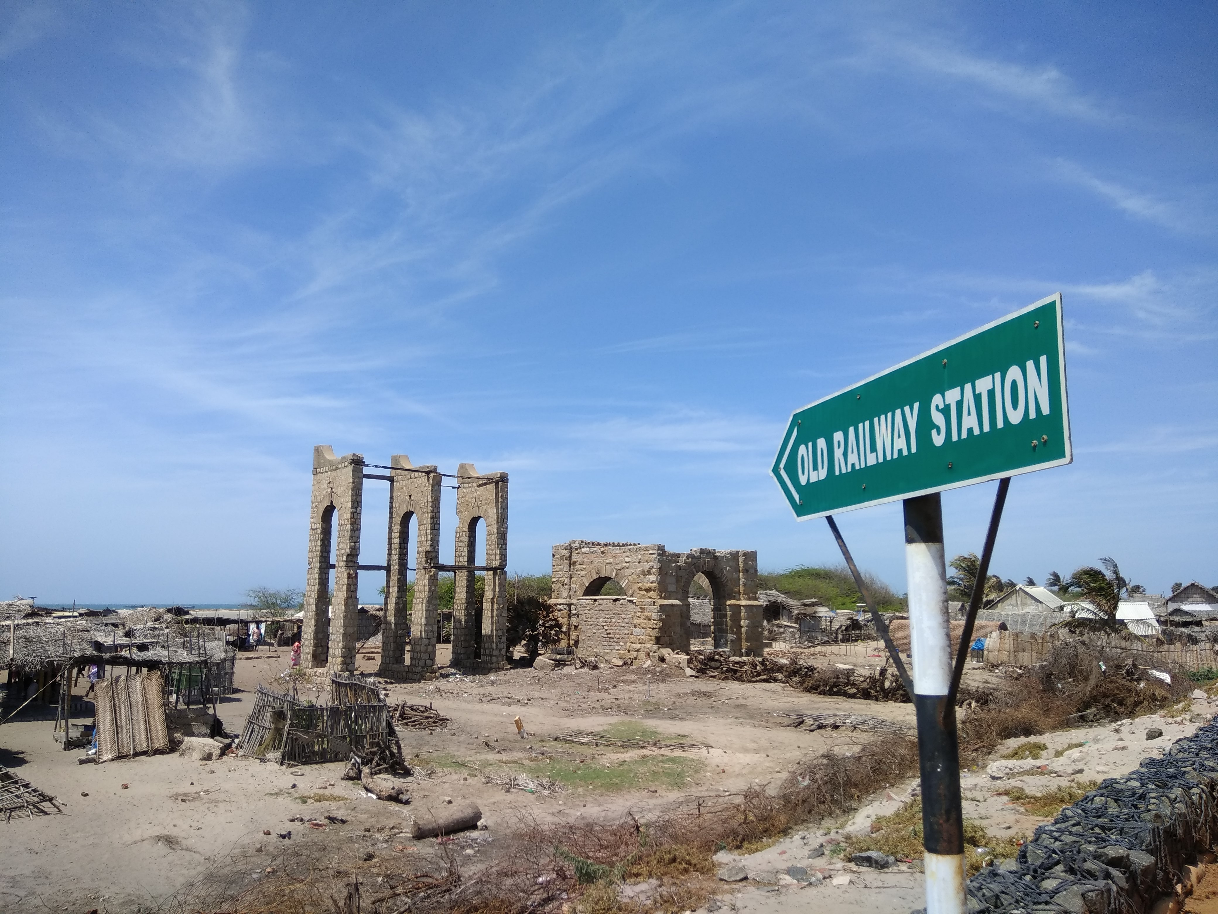
Dhanushkodi is an abandoned town at the south-eastern tip of Pamban Island of the state of Tamil Nadu in India. It is south-east of Pamban and is about west of Talaimannar in Sri Lanka. The town was destroyed during the 1964 Rameswaram cyclone and remains uninhabited in the aftermath. Although devoid of inhabitants, Dhanushkodi remains a tourist attraction due to its historical and mythological relevance. Geography Dhanushkodi is on the tip of Pamban island, separated from the Indian mainland by the Palk Strait. Transport The National Highway completed the 9.5-km-long road – 5 km from Mukuntharayar Chathiram to Dhanushkodi and 4.5 km from Dhanushkodi to Arichal Munai. Until 2016, Dhanushkodi was reachable either on foot along the seashore or in jeeps. In 2016, a road was completed from the village of Mukundarayar Chathiram. A metre gauge railway line connected Mandapam on mainland India to Dhanushkodi. Boat mail express ran from Chennai Egmore to Dhanushkodi till ... [...More Info...] [...Related Items...] OR: [Wikipedia] [Google] [Baidu] |
National Highway 85 (India)
National Highway 85 (or NH 85) is a National Highway in southern India. It links Kochi in Kerala with Thondi, Tamil Nadu. The Kochi–Theni Greenfield Highway has been proposed to decongest the traffic between the Kochi and Munnar stretch on the NH 85. Route Starting from NH66 intersection in Kundanoor Junction at Maradu, Kochi, Ernakulam, Kolenchery, Muvattupuzha, Kothamangalam, Neriamangalam, Adimali, Munnar, Devikulam, Poopara in Kerala. Bodi, Theni, Andippatti, Usilampatti, Madurai, Thiruppuvanam, Sivagangai, Kalayarkoil, and ending at Thondi at NH32 intersection in Tamil Nadu. Check the NH 85 videos. See also * List of national highways in India * Kochi–Theni Greenfield Highway * National Highways Development Project The National Highways Development Project (NHDP) was a project of four laning of existing national highways and six laning of selected major national highways of India. The project was started in 1998 under the leadership of Prime Minister of I ... [...More Info...] [...Related Items...] OR: [Wikipedia] [Google] [Baidu] |
Kanyakumari
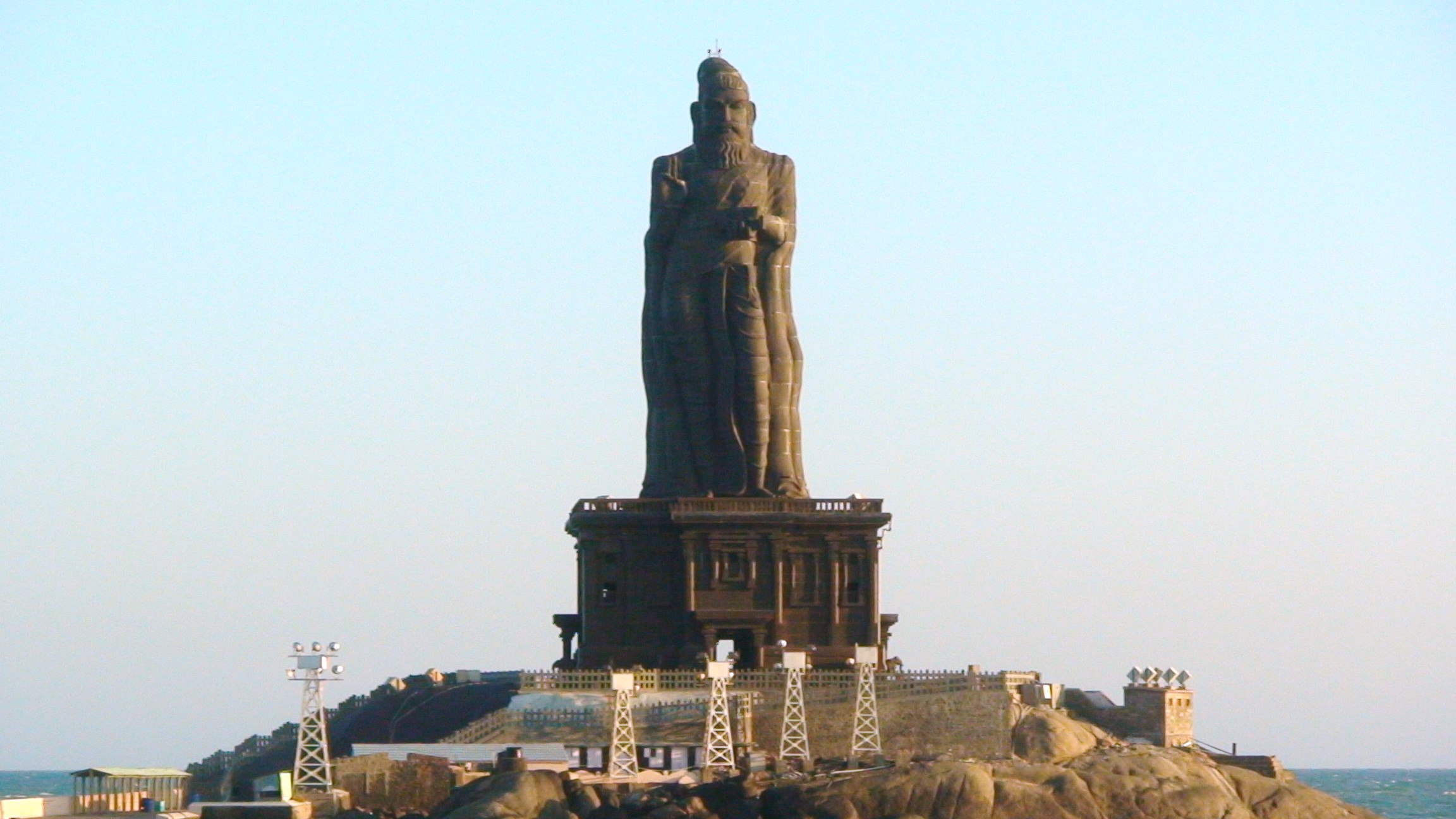
Kanyakumari (Tamil; / kəɳjɑkʊmɑɾiː/; referring to Devi Kanya Kumari, officially known as Kanniyakumari, formerly known as Cape Comorin) is a town and a municipality in Kanyakumari district in the state of Tamil Nadu, India. It is the southernmost tip of the contiguous Indian subcontinent and the southernmost city in mainland India, and thus it is informally referred to as "The Land's End". Kanyakumari town is about from Thiruvananthapuram and south of Nagercoil, the headquarters of Kanyakumari district. Kanyakumari is a popular tourist destination and pilgrimage centre in India. Notable tourist spots include its unique sunrise and sunset points, the '' Thiruvalluvar Statue'', and Vivekananda Rock Memorial off the coast. Lying at the tip of peninsular India, the town is bordered on the west, south, and east by the Laccadive Sea. It has a coastline of stretched along these three sides. On the shores of the city is a temple dedicated to the goddess Kanya Kumari ... [...More Info...] [...Related Items...] OR: [Wikipedia] [Google] [Baidu] |
Thiruvananthapuram
Thiruvananthapuram ( ), also known as Trivandrum, is the Capital city, capital city of the Indian state of Kerala. As of 2011, the Thiruvananthapuram Municipal Corporation had a population of 957,730 over an area of 214.86 sq. km, making it the largest and most populous city in Kerala. The larger Thiruvananthapuram metropolitan area had over 1.7 million inhabitants within an area of 543 sq. km..Trivandrum is one of the few cities in India that functions as a capital city, a maritime city, an information technology city, a space research city,a defence city,a bioscience city a tourism city, and a city known for its research and development institutions. Located on the west coast of India near the extreme south of the mainland, Thiruvananthapuram is a port city located from a heavily trafficked East-West shipping channel. The city is home to India’s first deep-water trans-shipment port, the Vizhinjam International Seaport Thiruvananthapuram. The city is characterised by its ... [...More Info...] [...Related Items...] OR: [Wikipedia] [Google] [Baidu] |
Palakkad
Palakkad (), Renaming of cities in India, also known as Palghat, historically known as Palakkattussery, is a city and a municipality in the States and union territories of India, Indian state of Kerala. It is the administrative headquarters of Palakkad District. Palakkad is the List of cities and towns in Kerala, most densely populated municipality and the List of cities and towns in Kerala, fourth-most densely populated city in the state. It was established before Indian independence under British Raj, British rule and known by the name Palghat. Palakkad is famous for the ancient Palakkad Fort, which is in the heart of the city and was captured and rebuilt by Hyder Ali in 1766 which later fell into the hands of Zamorin in 1784. The city is about northeast of the state capital, Thiruvananthapuram. The 18th-century Palakkad Fort has sturdy battlements, a moat, and a Hanuman temple on its grounds. North on the Kalpathy River, the 15th-century Viswanatha Swamy Temple, Palakkad, Vis ... [...More Info...] [...Related Items...] OR: [Wikipedia] [Google] [Baidu] |
Thrissur
Thrissur (, ), Renaming of cities in India, formerly Trichur, also known by its historical name Thrissivaperur, is a city and the headquarters of the Thrissur district in Kerala, India. It is the List of most populous urban agglomerations in Kerala, third largest urban agglomeration in Kerala after Kochi and Kozhikode, and the List of million-plus urban agglomerations in India, 21st largest in India. Thrissur is classified as a Classification_of_Indian_cities, Tier-2 city by the Government of India. The city is built around a hillock called Thekkinkadu Maidan, Thekkinkadu Maidanam (തേക്കിൻകാട് മൈതാനം) which seats the Vadakkunnathan Temple, Vadakkumnathan (വടക്കുംനാഥൻ) temple. It is located north-west of the state's capital city, Thiruvananthapuram, Thiruvananthapuram(തിരുവനന്തപുരം). Thrissur was once the capital of the Kingdom of Cochin, Kingdom of Cochin (കൊച്ചി രാജ്യം - k ... [...More Info...] [...Related Items...] OR: [Wikipedia] [Google] [Baidu] |
Coimbatore, Tamil Nadu
Coimbatore (Tamil: kōyamputtūr, ), also known as Kovai (), is one of the major Metropolitan cities of India, metropolitan cities in the States and union territories of India, Indian state of Tamil Nadu. It is located on the banks of the Noyyal River and surrounded by the Western Ghats. Coimbatore is the second largest city in Tamil Nadu after Chennai in terms of population and the 16th largest List of million-plus urban agglomerations in India, urban agglomeration in India as per the 2011 Census of India, census 2011. It is the administrative capital of Coimbatore District and is administered by the Coimbatore Municipal Corporation which was established in 1981. The region around Coimbatore was ruled by the Chera dynasty, Cheras during the Sangam period between the 1st and the 4th centuries CE and it served as the eastern entrance to the Palakkad Gap, the principal trade route between the west coast and Tamil Nadu. Coimbatore was located along the ancient trade route Rajakesa ... [...More Info...] [...Related Items...] OR: [Wikipedia] [Google] [Baidu] |
Salem, Tamil Nadu
Salem () is a major city in Salem district, located on the banks of the Thirumanimutharu river in the Indian state of Tamil Nadu surrounded by mountains. Salem is the List of cities in Tamil Nadu by population, fifth largest urban agglomeration in the state, and the List of metropolitan areas in Tamil Nadu, third largest metropolitan region. The city is large. History Early period Around the beginning of the common era, the existence of a culturally and economically advanced society in Salem two thousand years ago is evident from the discovery of silver coins of the Roman Emperor Nero, Tiberices Claudices Nero (37–68 CE) in Koneripatti of Salem in 1987. Later, the Pandya dynasty started ruling the region around Salem. Afterwards, the Pallava dynasty arose in Salem, followed by Mahendra Varma Pallava coming to Salem and the rise of Saivite principles. Mahendra Varma Pallava was succeeded by Narasimha Varma Pallava. Soon, the Pandya dynasty ruled over Salem. The Hoysala r ... [...More Info...] [...Related Items...] OR: [Wikipedia] [Google] [Baidu] |
Mangalore
Mangaluru (), formerly called Mangalore ( ), is a major industrial port city in the Indian state of Karnataka and on the west coast of India. It is located between the Laccadive Sea and the Western Ghats about west of Bengaluru, the state capital, north of Karnataka–Kerala border and south of Goa. Mangaluru is the state's only city to have all four modes of transport—air, road, rail and sea. The population of the urban agglomeration was 619,664 national census of India. It is known for being one of the locations of the Indian strategic petroleum reserves. The city developed as a port in the Laccadive Sea during ancient times, and after Independence a new port was constructed in 1968 and has since become a major port of India that handles 75 percent of India's coffee and cashew exports. It is also the country's seventh largest container port. Mangaluru has been ruled by several major powers, including the Mauryan empire, Kadambas, Alupas, Vij ... [...More Info...] [...Related Items...] OR: [Wikipedia] [Google] [Baidu] |
Kozhikode
Kozhikode (), also known as Calicut, is a city along the Malabar Coast in the state of Kerala in India. Known as the City of Spices, Kozhikode is listed among the City of Literature, UNESCO's Cities of Literature. It is the nineteenth largest urban agglomeration in the country and the second largest one in Kerala. Calicut city is the second largest city proper in the state with a corporation limit population of 609,224 Calicut is classified as a Tier-2 city by the Government of India. It is the largest city on the Malabar Coast and was the capital of the British-era Malabar District, Malabar district. It was the capital of an independent kingdom ruled by the Samoothiris (Zamorins). The port at Kozhikode acted as the gateway to the medieval South Indian coast for the Chinese people, Chinese, the Persians, the Arabs, and finally the Europeans. According to data compiled by economics research firm Indicus Analytics in 2009 on residences, earnings and investments, Kozhikode was ... [...More Info...] [...Related Items...] OR: [Wikipedia] [Google] [Baidu] |


