|
Crestview, FL
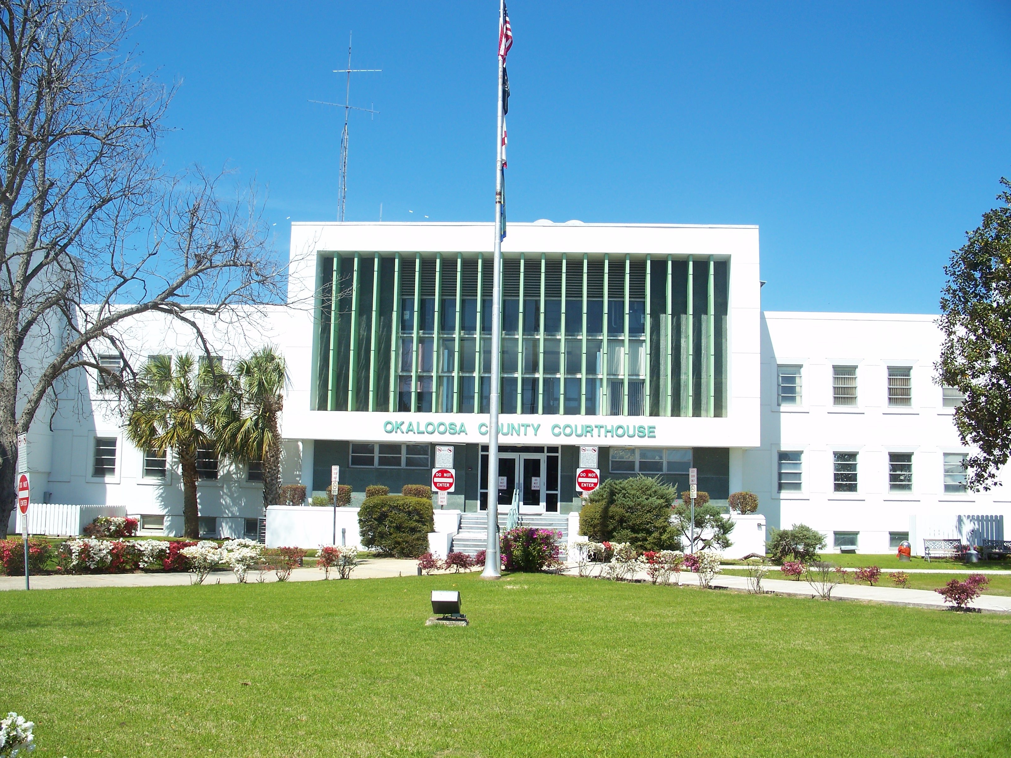
Crestview is the largest city and county seat of Okaloosa County, Florida, United States. The population was 27,134 at the 2020 census, up from 20,978 at the 2010 census. With an elevation of above sea level, it is one of the highest points in the state. Crestview is a principal city of the Crestview–Fort Walton Beach–Destin, Florida Metropolitan Statistical Area. History Crestview was largely an outgrowth of the arrival of railroad service to the western Panhandle of Florida. The Pensacola and Atlantic Railroad Company, chartered in 1881, opened its line between Pensacola and Chattahoochee in January 1883. Two express passenger trains, the ''Atlantic Express'' and the ''Gulf Express'', as well as a local accommodation train that made stops along the route, were in daily operation. The express trains took about six hours for the journey, while the local train took thirteen hours. When the railroad company was unable to cover its debt obligations, the Louisville and Na ... [...More Info...] [...Related Items...] OR: [Wikipedia] [Google] [Baidu] |
City (Florida)
Local governments in Florida are established by the state government, and are given varying amounts of non-exclusive authority over their jurisdictions. The laws governing the creation of local governments are contained in the Florida Constitution and the Florida Statutes. Local governments are incorporated by special acts of the Florida Legislature. These include four types: counties, municipalities, school districts, and special districts.Dye, T.R., Jewett, A. & MacManus, S.A. (2007) ''Politics in Florida''. Tallahassee: John Scott Dailey Florida Institute of Government. In some cases, municipal and county governments have merged into a consolidated government. However, smaller municipal governments can be created inside of a consolidated municipality/county. In Jacksonville, Florida, Jacksonville, the municipal government has taken over the responsibilities normally given to Duval County, Florida, Duval County, and smaller municipalities exist within it. Both counties and citi ... [...More Info...] [...Related Items...] OR: [Wikipedia] [Google] [Baidu] |
Geographic Names Information System
The Geographic Names Information System (GNIS) is a database of name and location information about more than two million physical and cultural features, encompassing the United States and its territories; the Compact of Free Association, associated states of the Marshall Islands, Federated States of Micronesia, and Palau; and Antarctica. It is a type of gazetteer. It was developed by the United States Geological Survey (USGS) in cooperation with the United States Board on Geographic Names (BGN) to promote the standardization of feature names. Data were collected in two phases. Although a third phase was considered, which would have handled name changes where local usages differed from maps, it was never begun. The database is part of a system that includes topographic map names and bibliographic references. The names of books and historic maps that confirm the feature or place name are cited. Variant names, alternatives to official federal names for a feature, are also recor ... [...More Info...] [...Related Items...] OR: [Wikipedia] [Google] [Baidu] |
Florala, Alabama
Florala is a town in Covington County, Alabama, United States. At the 2020 census, the population was 1,923. Geography Florala is located along the Alabama–Florida state line at (31.007712, -86.324957). It is bordered by the town of Lockhart to the west and the town of Paxton, Florida, to the south. According to the U.S. Census Bureau, the city has a total area of , of which is land and , or 4.07%, is water. Lake Jackson lies on the state line, half in Florala. Florala City Park occupies all of the lake's shoreline in Alabama. Climate Demographics 2020 Census data As of the 2020 United States census, there were 1,923 people, 646 households, and 352 families residing in the town. 2010 Census data As of the census of 2010, there were 1,980 people, 839 households, and 514 families living in the city. The population density was . There were 1,107 housing units at an average density of . The racial makeup of the city was 80.1% White, 15.8% Black or African American, 0 ... [...More Info...] [...Related Items...] OR: [Wikipedia] [Google] [Baidu] |
Yellow River Railroad
Yellow is the color between green and orange on the spectrum of light. It is evoked by light with a dominant wavelength of roughly 575585 nm. It is a primary color in subtractive color systems, used in painting or color printing. In the RGB color model, used to create colors on television and computer screens, yellow is a secondary color made by combining red and green at equal intensity. Carotenoids give the characteristic yellow color to autumn leaves, corn, canaries, daffodils, and lemons, as well as egg yolks, buttercups, and bananas. They absorb light energy and protect plants from photo damage in some cases. Sunlight has a slight yellowish hue when the Sun is near the horizon, due to atmospheric scattering of shorter wavelengths (green, blue, and violet). Because it was widely available, yellow ochre pigment was one of the first colors used in art; the Lascaux cave in France has a painting of a yellow horse 17,000 years old. Ochre and orpiment pigments were used ... [...More Info...] [...Related Items...] OR: [Wikipedia] [Google] [Baidu] |


