|
Collyweston
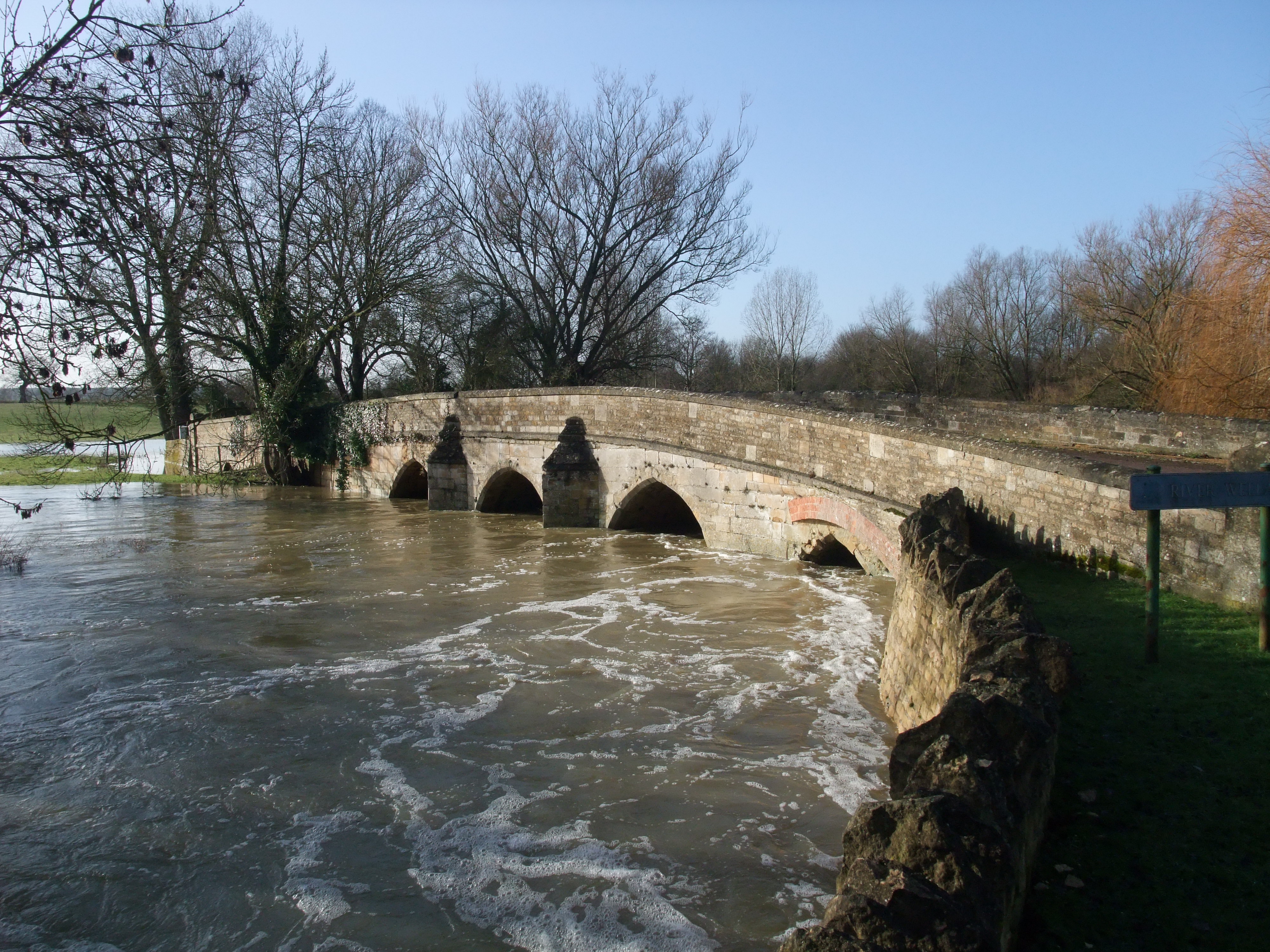
Collyweston is a village and Civil parishes in England, civil parish in North Northamptonshire, about three miles southwest of Stamford, Lincolnshire, on the road (the A43 road, A43) to Kettering. The population of the civil parish at the 2011 census was 514. Geography The village is on the southern side of the River Welland, Welland valley east of Tixover. The River Welland, at the point nearby to the northwest, is the boundary between Rutland and Northamptonshire. Ketton and Collyweston railway station was closed in 1966. Collyweston is currently served by buses on the Stamford–to–Peterborough ''via'' Duddington route. The Jurassic Way and Hereward Way pass through the village to the north, crossing the Welland at Collyweston Bridge, near Geeston. The A47 road passes through the parish to the south, with Collyweston Great Wood to the south. The road from the A47, continuing in a straight line to the village is called Kingscliffe Road. Nature reserve The local Wildlife T ... [...More Info...] [...Related Items...] OR: [Wikipedia] [Google] [Baidu] |
Collyweston Quarries
The Collyweston Quarries are a biological Site of Special Scientific Interest located near the village of Collyweston in Northamptonshire, England. They are known for producing the distinctive Collyweston stone slate, a traditional Roofing slates, roofing material that has played a significant role in the region’s architectural heritage. In recent years, the quarries have evolved into vibrant ecological sites with a variety of flora and fauna. History Origins and early use Collyweston stone slate is a Sedimentary rock, sedimentary limestone from the Jurassic, Jurassic period, approximately 140–190 million years old. Unlike Metamorphic rock, metamorphic slate, this limestone naturally splits along its Bed (geology), bedding planes, making it suitable for roofing. The material is named after the village of Collyweston, situated centrally within the quarrying area. Its use as a roofing material dates back to Ancient Rome, Roman times, with Archaeological excavation, archaeo ... [...More Info...] [...Related Items...] OR: [Wikipedia] [Google] [Baidu] |
Collyweston Great Wood And Easton Hornstocks
Collyweston Great Wood and Easton Hornstocks is a biological Site of Special Scientific Interest north of King's Cliffe in Northamptonshire. The site is a National Nature Reserve and a Nature Conservation Review site, Grade I. The site is west of Peterborough and the nearest villages are Collyweston, which is north west of the site, and Duddington which is a similar distance to the west. Wildlife These woods have ash, lime and sessile oak, together with wild service-tree, which is an indicator of ancient woodland. The ground flora is very rich, including locally unusual plants such as lily-of-the-valley, wood spurge, great wood-rush, violet helleborine and columbine. Animals found in the woods include slowworm, red kite, common buzzard, lesser spotted woodpecker and great spotted woodpecker. Historically these woods were once part of Rockingham Forest. and they were continuous with Bedford Purlieus woodland until the mid 19th century. An area of the centre of E ... [...More Info...] [...Related Items...] OR: [Wikipedia] [Google] [Baidu] |
Ketton And Collyweston Railway Station
Ketton and Collyweston railway station is a former station serving the villages of Ketton, Geeston, Aldgate and Collyweston, Rutland. It is located in Geeston adjacent to a level crossing on the Ketton to Collyweston road. It is under half a mile from Ketton but over a mile from Collyweston. It closed in 1966. History The contract for the erection of the station was obtained by Groocock and Yates of Leicester in 1847. The station was opened by the Midland Railway as Ketton on 1 May 1848, on the Syston and Peterborough Railway about two years after the rest of the line opened. From 1851, trains using the LNWR Rugby and Stamford Railway railway which joined at Luffenham railway station, Luffenham passed through the station but generally did not stop. Although much of the line had opened in 1846, there was a dispute with Lord Harborough over the course of the line and this section was not opened until 1848. It was built next to a level crossing on the road between Ketton and Col ... [...More Info...] [...Related Items...] OR: [Wikipedia] [Google] [Baidu] |
Wildlife Trust For Bedfordshire, Cambridgeshire And Northamptonshire
The Wildlife Trust for Bedfordshire, Cambridgeshire and Northamptonshire (WTBCN) is a registered charity which manages 126 nature reserves covering . It has over 35,000 members, and 95% of people in Bedfordshire, Cambridgeshire and Northamptonshire live within five miles of a reserve. As of 31 March 2016 it employed 105 people and had an income of £5.1 million. It aims to conserve wildlife, inspire people to take action for wildlife, offer advice and share knowledge. The WTBCN is one of 36 wildlife trusts covering England, and 46 covering the whole of the United Kingdom. In 1912 Charles Rothschild formed the Society for the Promotion of Nature Reserves to protect sites considered "worthy of preservation". The society worked to secure statutory protection, and this began with the National Parks and Access to the Countryside Act 1949. In 1959 the society took on a coordinating role for local wildlife trusts, which covered the whole of Britain and Northern Ireland by 1978. The ... [...More Info...] [...Related Items...] OR: [Wikipedia] [Google] [Baidu] |
A47 Road
The A47 is a major trunk road in England linking Birmingham to Lowestoft, Suffolk, maintained and operated by National Highways. Most of the section between Birmingham and Nuneaton is now classified as the B4114 road, B4114. From Peterborough eastwards, it is a trunk road (sections west of the A1 road (Great Britain), A1 road have been downgraded as alternative roads have been built). History The original (1923) route of the A47 was Birmingham to Great Yarmouth, but there were some changes made to its route in the early years. At its eastern end, the A47 originally ran through Filby and Caister-on-Sea, with the Acle Straight bearing the number B1140. A change took place in 1925. The original route of the A47 between Guyhirn and Wisbech in the Isle of Ely was via Wisbech St Mary, with the direct route being part of the A141. This is because there was no road bridge over the River Nene at Guyhirn, and hence no junction between the A47 and the A141. In April 1925 a steel road b ... [...More Info...] [...Related Items...] OR: [Wikipedia] [Google] [Baidu] |
Lincolnshire Limestone
The Lincolnshire Limestone Formation is a geological formation in England, part of the Inferior Oolite Group of the ( Bajocian) Middle Jurassic strata of eastern England. It was formed around 170 million years ago, in a shallow, warm sea on the margin of the London Platform and has estuarine beds above and below it. There are two sub-divisions, the Upper and Lower Lincolnshire Limestone. It is typically about 30 m thick, reaching a maximum of over 40 m in south Lincolnshire. The lower division varies in thickness between 15 m and 21 m and the upper is typically between 10 m and 16 m thick. The dividing marker is the 'Crossi' bed which is distinguished by the fossils of the brachiopod ''Acanthothris crossi'' it contains. The Crossi bed forms the top of the Lower Lincolnshire limestone. The bottom of the Lower Lincolnshire limestone has some of the characteristics of the underlying Lower Estuarine Series, in that it tends to contain more than usual amounts of sand. A stone from ... [...More Info...] [...Related Items...] OR: [Wikipedia] [Google] [Baidu] |
A43 Road
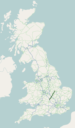
The A43 is a primary route in the English Midlands and northern South East England, that runs from the M40 motorway near Ardley in Oxfordshire to Stamford in Lincolnshire. Through Northamptonshire it bypasses the towns of Northampton, Kettering and Corby which are the three principal destinations on the A43 route. The A43 also links to the M1 motorway. The section of the road between the M40 and M1 is designated a trunk road, managed and maintained by National Highways. The remainder of the route is the responsibility of local authorities. Route of road M40 to M1 The A43 starts at M40 junction 10 (the location of Cherwell Valley Services) which is widely regarded as being one of the worst motorway junctions in the country despite improvements made in the early 2000s. There are sometimes tailbacks at the junction, even at off-peak times. Following the junction with the M40, the A43 first meets a roundabout with the B4100 for traffic headed north-west for the village of A ... [...More Info...] [...Related Items...] OR: [Wikipedia] [Google] [Baidu] |
Duddington
Duddington is a village and former civil parish, now in the parish of Duddington-with-Fineshade, in the North Northamptonshire district, in the ceremonial county of Northamptonshire, England. It is by the junction of the A47 and A43 roads, and is southwest of the town of Stamford. The village is on the east bank of the River Welland which is the county boundary of Rutland. In 1961 the parish had a population of 184. History The villages name means 'Farm/settlement connected with Dud(d)a/Dod(d)a'. Duddington appears in the Domesday survey as ''Dodintone''. On 1 April 1988 the parish was abolished and merged with Fineshade to form "Duddington with Fineshade". Church The church, a Grade II Listed Building, is dedicated to Saint Mary and is made of stone in the Norman and Early English styles. It was built in the late 12th century, with additions in the next two centuries. The chancel was rebuilt and the church restored in 1844. Manor House The Manor House is a Grade II L ... [...More Info...] [...Related Items...] OR: [Wikipedia] [Google] [Baidu] |
North Northamptonshire
North Northamptonshire is a Unitary authorities of England, unitary authority area in the Ceremonial counties of England, ceremonial county of Northamptonshire, England, and was created in 2021. The council is based in Corby, the district's largest town. Other notable towns are Kettering, Wellingborough, Rushden, Raunds, Desborough, Rothwell, Northamptonshire, Rothwell, Irthlingborough, Thrapston and Oundle. North Northamptonshire borders the City of Peterborough, Rutland, City of Milton Keynes, Milton Keynes, Huntingdonshire, Borough of Bedford, Bedford, Harborough District, Harborough, West Northamptonshire and South Kesteven districts. It has a string of lakes along the River Nene, Nene Valley Conservation Park, associated Nene Valley Railway, heritage railway, the village of Fotheringhay which has tombs of the House of York as well as a towering church supported by flying buttresses. This division has a well-preserved medieval castle in private hands next to Corby – ... [...More Info...] [...Related Items...] OR: [Wikipedia] [Google] [Baidu] |
Stamford, Lincolnshire
Stamford is a market town and civil parish in the South Kesteven district of Lincolnshire, England. The population at the 2011 census was 19,701 and estimated at 20,645 in 2019. The town has 17th- and 18th-century stone buildings, older timber-framed buildings and five medieval parish churches. Stamford is a frequent film location. In 2013 it was rated a top place to live in a survey by ''The Sunday Times''. Its name has been passed on to Stamford, Connecticut, founded in 1641. Etymology The place-name Stamford is first attested in the Anglo-Saxon Chronicle, where it appears as ''Steanford'' in 922 and ''Stanford'' in 942. It appears as ''Stanford'' in the Domesday Book of 1086. The name means "stony ford". History Roman and Medieval Stamford image:Stamford features (32) - geograph.org.uk - 7139889.jpg, 250px, Stamford The Romans built Ermine Street across what is now Burghley Park and forded the River Welland to the west of Stamford, eventually reaching Lincoln, England, ... [...More Info...] [...Related Items...] OR: [Wikipedia] [Google] [Baidu] |
Rutland
Rutland is a ceremonial county in the East Midlands of England. It borders Leicestershire to the north and west, Lincolnshire to the north-east, and Northamptonshire to the south-west. Oakham is the largest town and county town. Rutland has an area of and a population of 41,049, the second-smallest ceremonial county population after the City of London. The county is rural, and the only towns are Oakham (12,149) and Uppingham (4,745), both in the west of the county; the largest settlement in the east is the village of Ketton (1,926). For Local government in England, local government purposes Rutland is a Unitary authorities of England, unitary authority area. The county was the smallest of the historic counties of England. The geography of Rutland is characterised by low, rolling hills, the highest of which is a point in Cold Overton Park. Rutland Water was created in the centre of the county in the 1970s; the Water reservoir, reservoir is a nature reserve that serves as an o ... [...More Info...] [...Related Items...] OR: [Wikipedia] [Google] [Baidu] |
Glowworm
Glowworm or glow-worm is the common name for various groups of insect larvae and adult larviform females that glow through bioluminescence. They include the European common glow-worm and other members of the Lampyridae, but bioluminescence also occurs in the families Elateridae, Phengodidae and Rhagophthalmidae among beetles; as well as members of the genera ''Arachnocampa'', '' Keroplatus'' and '' Orfelia'' among keroplatid fungus gnats. Beetles Four families of beetles are bioluminescent. The wingless larviform females and larvae of these bioluminescent species are usually known as "glowworms". Winged males may or may not also exhibit bioluminescence. Their light may be emitted as flashes or as a constant glow, and usually range in colour from green, yellow, to orange. The families are closely related, and are all members of the beetle superfamily, Elateroidea. Phylogenetic analyses have indicated that bioluminescence may have a single evolutionary origin among the ... [...More Info...] [...Related Items...] OR: [Wikipedia] [Google] [Baidu] |


