|
Cochise County, Arizona
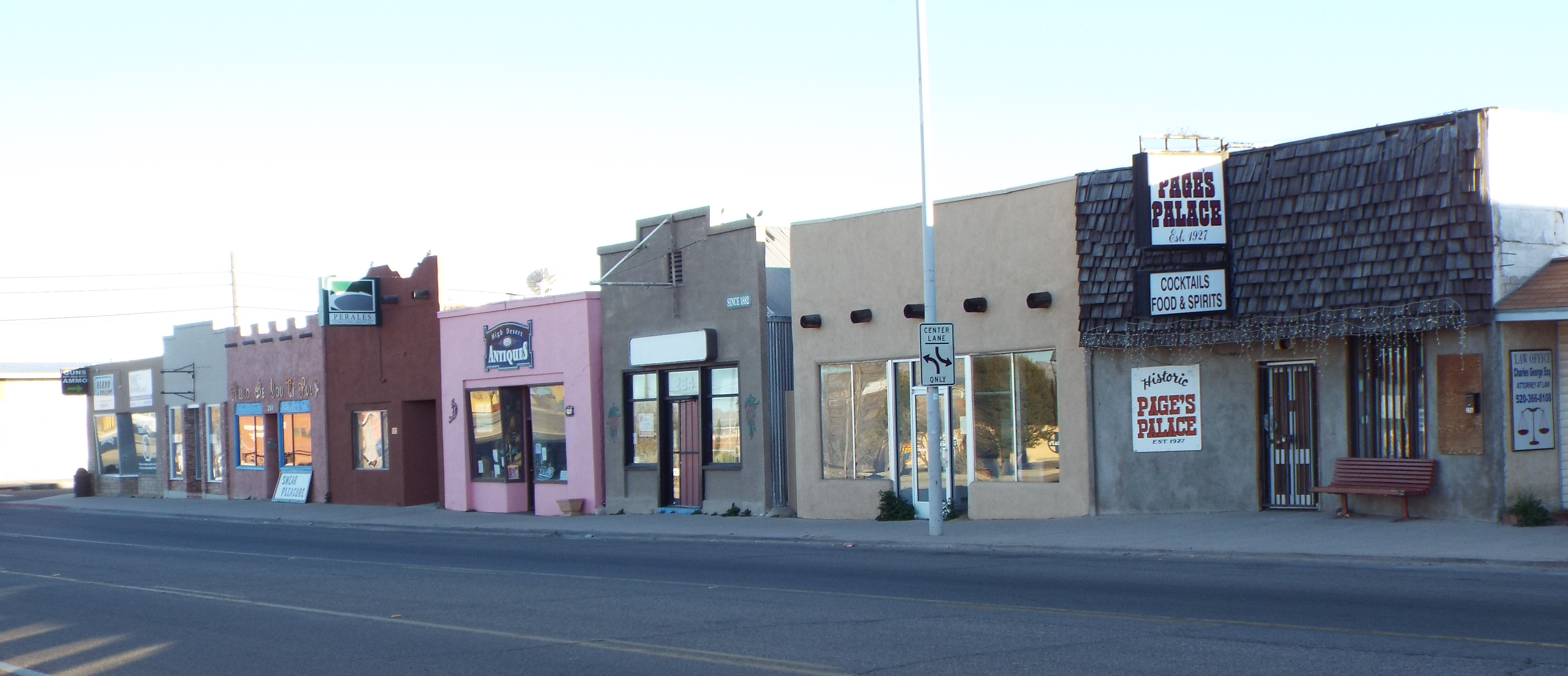
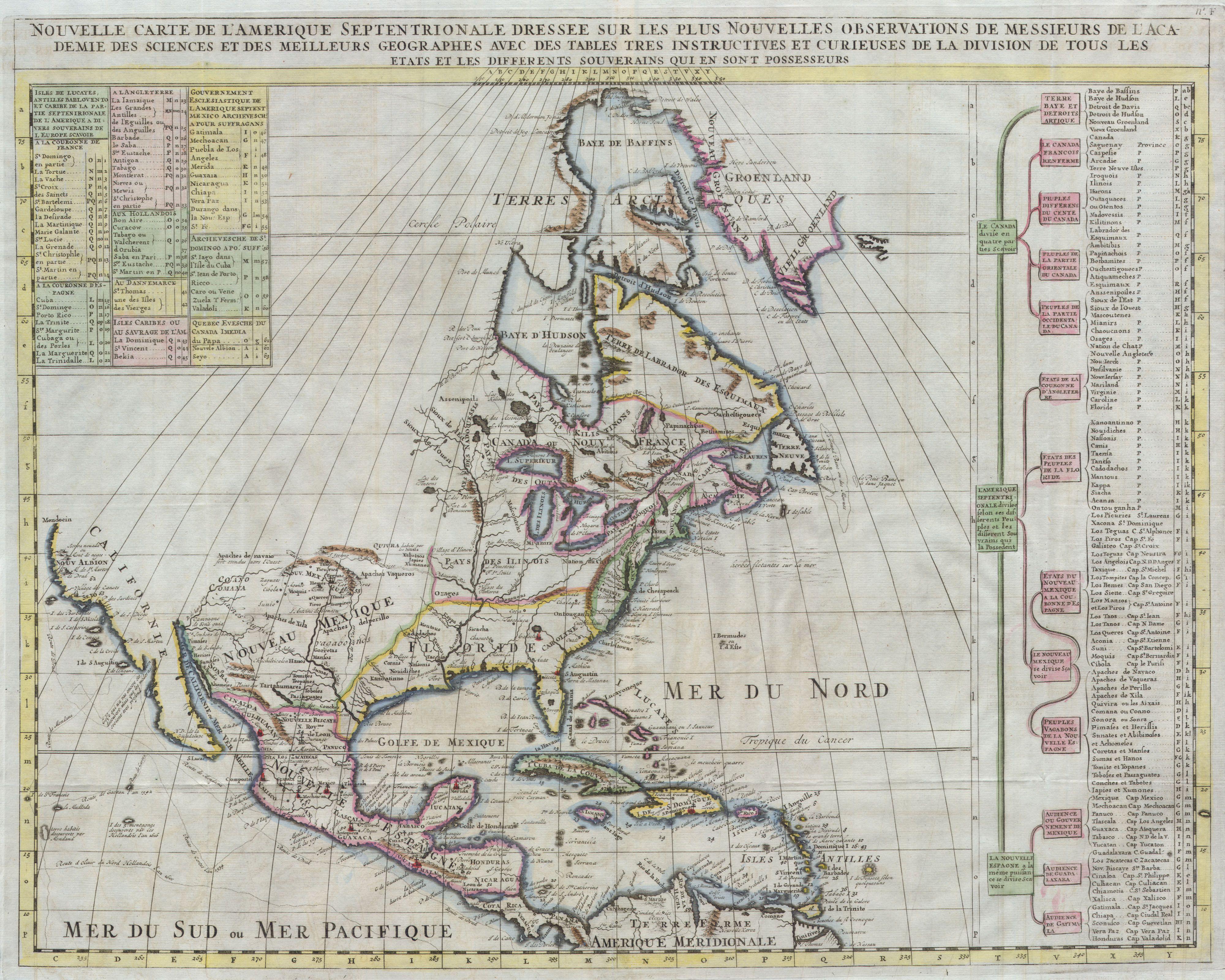
Cochise County ( ) is a county in the southeastern corner of the U.S. state of Arizona. It is named after Cochise, a Chiricahua Apache who was a key war leader during the Apache Wars. The population was 125,447 at the 2020 census. The county seat is Bisbee and the most populous city is Sierra Vista. Cochise County includes the Sierra Vista- Douglas, Arizona Metropolitan Statistical Area. The county borders southwestern New Mexico and the northwestern Mexican state of Sonora. History In 1528, Spanish explorers Álvar Núñez Cabeza de Vaca, Estevanico, and Fray Marcos de Niza survived a shipwreck off the Texas coast. Captured by Native Americans, they spent eight years finding their way back to Mexico City, via the San Pedro Valley. Their journals, maps, and stories led to the Cibola, seven cities of gold myth. The Expedition of Francisco Vásquez de Coronado in 1539 using it as his route north through what they called the Guachuca Mountains of Pima ( Tohono O'odham ... [...More Info...] [...Related Items...] OR: [Wikipedia] [Google] [Baidu] |
Art Deco
Art Deco, short for the French (), is a style of visual arts, architecture, and product design that first Art Deco in Paris, appeared in Paris in the 1910s just before World War I and flourished in the United States and Europe during the 1920s to early 1930s, through styling and design of the exterior and interior of anything from large structures to small objects, including clothing, fashion, and jewelry. Art Deco has influenced buildings from skyscrapers to cinemas, bridges, ocean liners, trains, cars, trucks, buses, furniture, and everyday objects, including radios and vacuum cleaners. The name Art Deco came into use after the 1925 (International Exhibition of Modern Decorative and Industrial Arts) held in Paris. It has its origin in the bold geometric forms of the Vienna Secession and Cubism. From the outset, Art Deco was influenced by the bright colors of Fauvism and the Ballets Russes, and the exoticized styles of art from Chinese art, China, Japanese art, Japan, Indian ... [...More Info...] [...Related Items...] OR: [Wikipedia] [Google] [Baidu] |
Álvar Núñez Cabeza De Vaca
Álvar Núñez Cabeza de Vaca (; 1488/90/92"Cabeza de Vaca, Alvar Núñez (1492?-1559?)." American Eras. Vol. 1: Early American Civilizations and Exploration to 1600. Detroit: Gale, 1997. 50-51. Gale Virtual Reference Library. Web. 10 December 2014. after 19 May 1559) was a Spanish explorer of the New World, and one of four survivors of the 1527 Narváez expedition. During eight years of traveling across what is now the US Southwest, he became a trader, evangelist, and Faith healing, faith healer to various Indigenous peoples of the Americas, Native American tribes before reconnecting with Spanish civilization in Mexico in 1536. After returning to Spain in 1537, he wrote an account of his experiences, first published in 1542 as ''La relación y comentarios'' ("The Account and Commentaries"), and later retitled ''Naufragios y comentarios'' ("Shipwrecks and Commentaries"). Cabeza de Vaca is sometimes considered a proto-anthropologist for his detailed accounts of the many tribes of ... [...More Info...] [...Related Items...] OR: [Wikipedia] [Google] [Baidu] |
Presidio Santa Cruz De Terrenate
The Presidio Santa Cruz de Terrenate is a former Spanish military presidio, or fortress, located roughly west of the town of Tombstone, Arizona, in the United States of America. History The Presidio Santa Cruz de Terrenate was established on a bluff overlooking the San Pedro River by an Irish-born Spanish Army Colonel, Hugo Oconór (Hugh O'Conor), in 1775, for the King of Spain Charles III. This is one of the best preserved sites from among the chain of similar presidios that extended from Los Adaes, Louisiana, in the east to Alta California in the west. Like all frontier presidios in the Viceroyalty of New Spain, Santa Cruz de Terrenate was garrisoned by soldados de cuera. The presidio was never completed to specifications due to the attacks of the Apache, administrative greed, corruption and poor morale. The failure of the presidio was due to numerous problems like the lack of crops, raids on the horse herds, surprise attacks on the mule trains carrying supplies, and the ... [...More Info...] [...Related Items...] OR: [Wikipedia] [Google] [Baidu] |
Dragoon Mountains
The Dragoon Mountains is a range of mountains located in Cochise County, Arizona. The range is about long, running on an axis extending south-south east through Willcox. The name originates from the 3rd U.S. Cavalry Dragoons who battled the Chiricahua, including Cochise, during the Apache Wars. The Dragoons established posts around 1856 after the Gadsden Purchase made it a U.S. territory. History Fossilized horn coral has been discovered on exposed limestone rock. Ancient pictographs and matate dating to AD 1200 exist in the area and are attributed to the Mogollon people. The Apache people resided in this area beginning in the 15th century. The warrior Cochise and his army defeated a small force of Confederate soldiers here at the First Battle of Dragoon Springs but was defeated at the Second Battle of Dragoon Springs a few days later. Cochise Stronghold Memorial Park lies near Mount Glenn on the eastern slope of the range and the historic town of Tombstone can b ... [...More Info...] [...Related Items...] OR: [Wikipedia] [Google] [Baidu] |
Texas Canyon
Texas Canyon is a valley in Cochise County, Arizona, about 20 miles east of Benson on Interstate 10. Lying between the Little Dragoon Mountains to the north and the Dragoon Mountains to the south and known for its giant granite boulders, the canyon attracts rockhounds and photographers. History The stagecoach route of the Butterfield Overland Mail passed through Texas Canyon from 1858 until the outbreak of the Civil War in 1862, when the stage line suspended operations. The canyon is historically within the range of the Chiricahua Apache, and Cochise made his last stronghold near here in the Dragoon Mountains during the mid-1870s. In the mid to late 1880s, David A. Adams, a Cochise County pioneer, moved to the area from Coleman County, Texas, soon to be followed by other family members. Descendants still live and raise cattle on the old family ranch. The Amerind Foundation, a privately funded archaeological and ethnographic Ethnography is a branch of anthropology and ... [...More Info...] [...Related Items...] OR: [Wikipedia] [Google] [Baidu] |
Father Kino
Eusebio Francisco Kino, SJ (, ; 10 August 1645 – 15 March 1711), often referred to as Father Kino, was an Italian Jesuit, missionary, geographer, explorer, cartographer, mathematician and astronomer born in the Bishopric of Trent, Holy Roman Empire. For the last 24 years of his life he worked in the region then known as the Pimería Alta, modern-day Sonora in Mexico and southern Arizona in the United States. He explored the region and worked with the indigenous Native American population, including primarily the Tohono O'Odham, Sobaipuri and other Upper Piman groups. He proved that the Baja California Territory was not an island but a peninsula by leading an overland expedition there. By the time of his death he had established 24 missions and visitas (country chapels or visiting stations). Early life Kino was born Eusebio Chini (the spelling Kino was the version for use in Spanish-speaking domains) in the village of Segno, (now part of the municipality of Predaia), the ... [...More Info...] [...Related Items...] OR: [Wikipedia] [Google] [Baidu] |
Whetstone, Arizona
Whetstone is a census-designated place (CDP) in Cochise County, Arizona, United States, north of Sierra Vista. The population was 3,236 at the 2020 census. History Whetstone was often referred to as the "Y" because the intersection of State Routes 82 and 90 had an eastbound lane on 90 and a southbound lane on 82 that created a Y at the intersection. Highway 90 ended one to two miles further north, and people traveling north had to go via Highway 82 east or west and then north on either Highway 83 or Highway 80. Parks and Outdoors Whetstone is known for its tranquil desert and proximity to Parks and Recreational Areas such as Kartchner Caverns State Park and Coronado National Forest. Geography According to the United States Census Bureau, the CDP has a total area of , all land. Demographics As of the census of 2000, there were 2,354 people, 904 households, and 664 families residing in the CDP. The population density was . There were 1,056 housing units at an average d ... [...More Info...] [...Related Items...] OR: [Wikipedia] [Google] [Baidu] |
Benson, Arizona
Benson is a city in Cochise County, Arizona, Cochise County, Arizona, United States. As of the 2020 United States census, 2020 census, the population of the city was 5,355. It was founded as a rail terminal for the area, and is located approximately east-southeast of the city of Tucson, Arizona, Tucson. History The city was founded in 1880 when the Southern Pacific Railroad came through. It was named after Judge William S. Benson, a friend of Charles Crocker, president of the Southern Pacific. The railroad, coming overland from California, chose the Benson site to cross the San Pedro River (Arizona), San Pedro River. Benson then served as a rail junction point to obtain ore and refined metal by wagon, in turn shipping rail freight back to the mines at Tombstone, Arizona, Tombstone, Fairbank, Arizona, Fairbank, Contention City, Arizona, Contention City and Bisbee, Arizona, Bisbee. For example, the railhead in Benson was about from Tombstone, and was the closest rail connection ... [...More Info...] [...Related Items...] OR: [Wikipedia] [Google] [Baidu] |
Hohokam
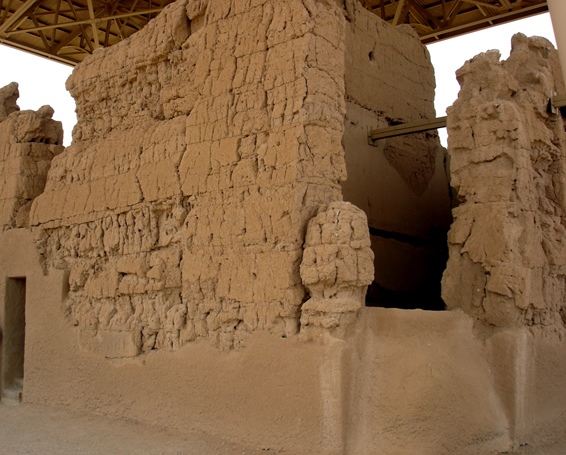
Hohokam was a culture in the Indigenous peoples of the North American Southwest, North American Southwest in what is now part of south-central Arizona, United States, and Sonora, Mexico. It existed between 300 and 1500 CE, with cultural precursors possibly as early as 300 BCE. Archaeologists disagree about whether communities that practiced the culture were related or politically united. According to local oral tradition, Hohokam societies may be the ancestors of the historic Akimel Oʼodham, Akimel and Tohono Oʼodham in Southern Arizona. The origin of the culture is debated. Most archaeologists either argue it emerged locally or in Mesoamerica, but it was also influenced by the Northern Pueblo culture. Hohokam settlements were located on trade routes that extended past the Hohokam area, as far east as the Great Plains and west to the Pacific coast. Hohokam societies received a remarkable amount of immigration. Some communities established significant markets, such a ... [...More Info...] [...Related Items...] OR: [Wikipedia] [Google] [Baidu] |
Sobaipuri
The Sobaipuri were one of many Indigenous groups occupying Sonora and what is now Arizona at the time Europeans first entered the American Southwest. They were a Piman or O'odham group who occupied southern Arizona and northern Sonora (the Pimería Alta) in the 15th–19th centuries. They were a subgroup of the O'odham or Pima, surviving members of which include the residents of San Xavier del Bac which is now part of the Tohono O'odham Nation and the Akimel O'odham. Debate sometimes still arises as to whether the Sobaipuri and other O'odham groups are related to the prehistoric Hohokam who occupied a portion of the same geographic area and were present until about the 15th century. This question is sometimes phrased as the "Hohokam-Pima" or "Salado-Pima continuum", a phraseology that questions whether there is a connection between the prehistoric Hohokam and the first historic groups cited in the area. A key piece of the puzzle has recently been found when it was discovered t ... [...More Info...] [...Related Items...] OR: [Wikipedia] [Google] [Baidu] |
Seven Cities Of Gold
The myth of the Seven Cities of Gold, also known as the Seven Cities of Cíbola (), was popular in the 16th century and later featured in several works of popular culture. According to legend, the seven cities of gold referred to Aztec mythology revolving around the Pueblos of the Spanish Santa Fe de Nuevo México, Nuevo México, modern New Mexico and Southwestern United States. Besides "Cíbola", names associated with similar lost cities of gold also included El Dorado, Paititi, City of the Caesars, Lake Parime, Lake Parime at Manoa, Antilia, and Quivira. Origins of myth/legend In the 16th century, the Spanish people, Spaniards in New Spain (Mexico) began to hear rumors of "Seven Cities of Gold" called Zuni-Cibola Complex, "Cíbola" located across the desert, hundreds of miles to the north. The stories may have their root in an earlier Portugal, Portuguese legend about seven cities founded on the island of Antillia by a Catholic expedition in the 8th century, or one based on th ... [...More Info...] [...Related Items...] OR: [Wikipedia] [Google] [Baidu] |


