|
Clearview, Philadelphia, Pennsylvania
Clearview is a neighborhood in Southwest Philadelphia. It is located from South 78th Street to South 84th Street, east of Cobbs Creek to Lindbergh Boulevard. Education Free Library of Philadelphia operates the Eastwick Branch, which serves Clearview and other subdivisions, at 2581 Island Avenue. " '' Free Library of Philadelphia
The Free Library of Philadelphia is the public library system that serves Philadelphia. It is the 13th-largest public library system in the United States. The Free Library of Philadelphia is a non-Mayoral agency of the City of Philadelphia gover ... ''. Retrieved on January 3, 2008.
References< ...
|
List Of Philadelphia Neighborhoods
The following is a list of neighborhoods, districts and other places located in the city of Philadelphia, Pennsylvania. The list is organized by broad geographical sections within the city. Common usage for Philadelphia's neighborhood names does not respect "official" borders used by the city's police, planning commission or other entities. Therefore, some of the places listed here may overlap geographically, and residents do not always agree where one neighborhood ends and another begins. Philadelphia has 41 ZIP-codes, which are often used for neighborhood analysis. Historically, many neighborhoods were defined by incorporated townships (Blockley, Roxborough), districts (Belmont, Kensington, Moyamensing, Richmond) or boroughs (Bridesburg, Frankford, Germantown, Manayunk) before being incorporated into the city with the Act of Consolidation of 1854. [...More Info...] [...Related Items...] OR: [Wikipedia] [Google] [Baidu] |
Pennsylvania
Pennsylvania (; (Pennsylvania Dutch: )), officially the Commonwealth of Pennsylvania, is a state spanning the Mid-Atlantic, Northeastern, Appalachian, and Great Lakes regions of the United States. It borders Delaware to its southeast, Maryland to its south, West Virginia to its southwest, Ohio to its west, Lake Erie and the Canadian province of Ontario to its northwest, New York to its north, and the Delaware River and New Jersey to its east. Pennsylvania is the List of U.S. states and territories by population, fifth-most populous state in the nation with over 13 million residents 2020 United States census, as of 2020. It is the List of U.S. states and territories by area, 33rd-largest state by area and ranks List of states and territories of the United States by population density, ninth among all states in population density. The southeastern Delaware Valley metropolitan area comprises and surrounds Philadelphia, the state's List of cities in Pennsylvania, largest ... [...More Info...] [...Related Items...] OR: [Wikipedia] [Google] [Baidu] |
Philadelphia County, Pennsylvania
Philadelphia County is a County (United States), county in the Commonwealth (U.S. state), Commonwealth of Pennsylvania. It is the List of counties in Pennsylvania, most populous county in Pennsylvania. As of the 2020 United States Census, 2020 census, Philadelphia County had a population of 1,603,797. The county is the second smallest county in Pennsylvania by land area, after Montour County, Pennsylvania, Montour County. Philadelphia County is one of the three original counties, along with Chester County, Pennsylvania, Chester and Bucks County, Pennsylvania, Bucks counties, created by William Penn in November 1682. Act of Consolidation, 1854, Since 1854, the county has been coextensive with the Philadelphia, City of Philadelphia which is also its county seat. Philadelphia County is the core county in the Philadelphia-Camden, New Jersey, Camden-Wilmington, Delaware, Wilmington List of Combined Statistical Areas, Combined Statistical Area (PA-New Jersey, NJ-Delaware, DE-Maryland, ... [...More Info...] [...Related Items...] OR: [Wikipedia] [Google] [Baidu] |
Philadelphia
Philadelphia, often called Philly, is the largest city in the Commonwealth of Pennsylvania, the sixth-largest city in the U.S., the second-largest city in both the Northeast megalopolis and Mid-Atlantic regions after New York City. Since 1854, the city has been coextensive with Philadelphia County, the most populous county in Pennsylvania and the urban core of the Delaware Valley, the nation's seventh-largest and one of world's largest metropolitan regions, with 6.245 million residents . The city's population at the 2020 census was 1,603,797, and over 56 million people live within of Philadelphia. Philadelphia was founded in 1682 by William Penn, an English Quaker. The city served as capital of the Pennsylvania Colony during the British colonial era and went on to play a historic and vital role as the central meeting place for the nation's founding fathers whose plans and actions in Philadelphia ultimately inspired the American Revolution and the nation's inde ... [...More Info...] [...Related Items...] OR: [Wikipedia] [Google] [Baidu] |
Area Codes 215, 267, And 445
Area codes 215, 267, and 445 are the North American telephone area codes for the City of Philadelphia as well as adjacent portions of Bucks and Montgomery counties in the Commonwealth of Pennsylvania. The original area code is 215, which was established in 1947, while 267 and 445 are overlay codes for the same numbering plan area (NPA). In 1947, when AT&T established the North American Numbering Plan, 215 included the entire southeastern part of the Commonwealth, from the Delaware border to the Lehigh Valley. Pennsylvania was divided into four numbering plan areas, the second most in the Bell System after New York State, a status shared with Illinois, Ohio, and Texas. On January 8, 1994, the western and northern portions of the original 215 territory, ''i.e.'', Philadelphia's western suburbs, most of Berks County, and the Lehigh Valley, changed to area code 610, while Philadelphia and its northern suburbs retained 215. However, three central office codes were moved from 2 ... [...More Info...] [...Related Items...] OR: [Wikipedia] [Google] [Baidu] |
Southwest Philadelphia
Southwest Philadelphia (formerly Kingsessing Township) is a section of Philadelphia, Pennsylvania, United States. The section can be described as extending from the western side of the Schuylkill River to the city line, with the SEPTA. The northern border is defined by the Philadelphia City Planning Commission as east from the city line along Baltimore Avenue moving south along 51st Street to Springfield Ave. It follows the train tracks until 49th Street. From 49th and Kingsessing Ave the line moves east along Kingsessing Ave. The line then moves south along 46th St to Paschall Ave where it jogs to join Grays Ferry where the line runs to the Schuylkill River. Southwest Philadelphia is also described by the city as being the area south of Baltimore Avenue; at the turn of the 20th century, Baltimore Avenue between 49th and 52nd Streets was known as "The Hub of Southwest Philadelphia" . Historically home to many Irish American neighborhoods, the section now has a large African Amer ... [...More Info...] [...Related Items...] OR: [Wikipedia] [Google] [Baidu] |
Cobbs Creek, Philadelphia, Pennsylvania
Cobbs Creek is a neighborhood located in the West Philadelphia section of Philadelphia, Pennsylvania, United States, named for the creek which forms part of Philadelphia's western border. Cobbs Creek is generally bounded by Market Street to the north, Baltimore Avenue to the south, 52nd Street to the east, and the border of Upper Darby along Cobbs Creek to the West. In 1998, the Cobbs Creek Automobile Suburb Historic District was created, with Cobbs Creek Parkway, Spruce Street, 52nd Street, and Angora Street its boundaries. The District protects 1049 buildings, with Tudor Revival, Colonial Revival, and Bungalow/Craftsman architectural styles contained within the district. Philadelphia architect William Alesker, who was involved in the plans for a Trump Tower in Center City, and Evangelical minister Tony Campolo, one of Bill Clinton's spiritual advisers, lived, respectively, in the 6200 blocks of Pine and Delancey Streets back in the 1940s and 1950s. Fires from the 1985 bom ... [...More Info...] [...Related Items...] OR: [Wikipedia] [Google] [Baidu] |
Free Library Of Philadelphia
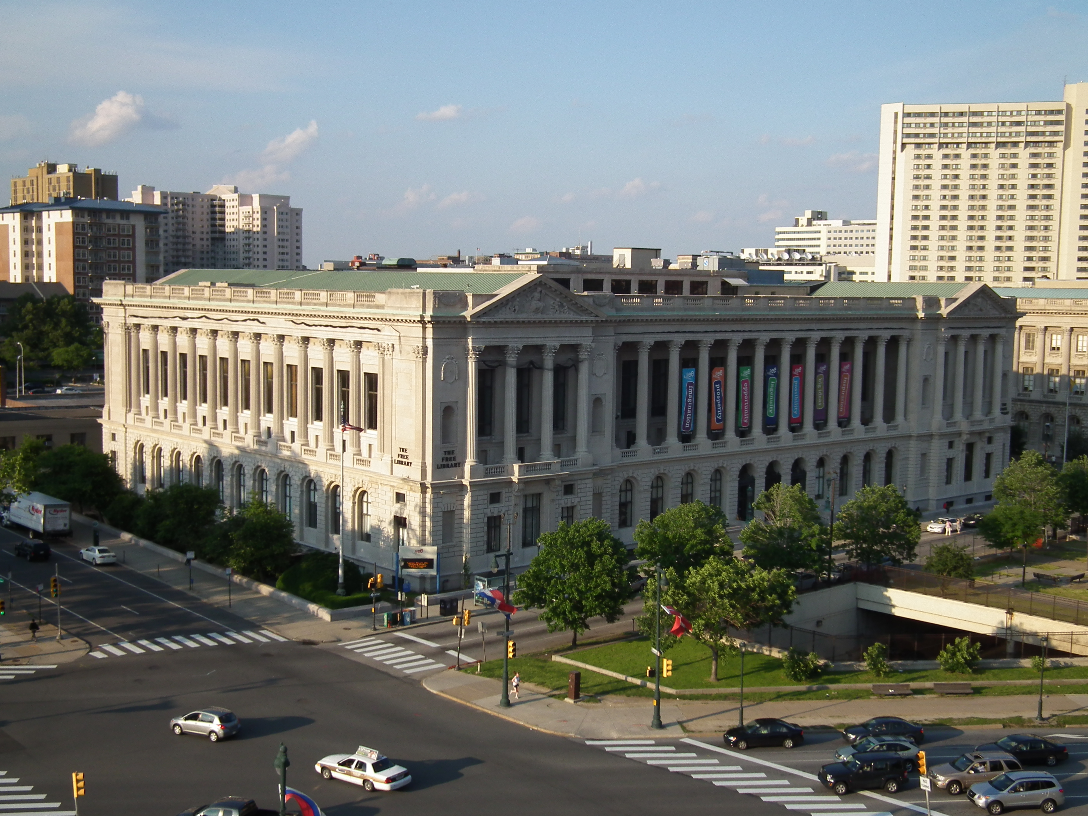
The Free Library of Philadelphia is the public library system that serves Philadelphia. It is the 13th-largest public library system in the United States. The Free Library of Philadelphia is a non-Mayoral agency of the City of Philadelphia governed by an independent Board of Trustees as per the Charter of the City of Philadelphia. The Free Library of Philadelphia Foundation is a separate 501c3 non-profit with its own board of directors and serves to support the mission of the Free Library of Philadelphia through philanthropic dollars. History Founding The Free Library of Philadelphia was chartered in 1891 as "a general library which shall be free to all", through efforts led by Dr. William Pepper, who secured initial funding through a $225,000 bequest from his wealthy uncle, George S. Pepper. However, several libraries claimed the bequest, and only after the courts decided the money was intended to found a new public library did the Free Library finally open in March 1894. I ... [...More Info...] [...Related Items...] OR: [Wikipedia] [Google] [Baidu] |
Neighborhoods In Philadelphia
The following is a list of neighborhoods, districts and other places located in the city of Philadelphia, Pennsylvania. The list is organized by broad geographical sections within the city. Common usage for Philadelphia's neighborhood names does not respect "official" borders used by the city's police, planning commission or other entities. Therefore, some of the places listed here may overlap geographically, and residents do not always agree where one neighborhood ends and another begins. Philadelphia has 41 ZIP-codes, which are often used for neighborhood analysis. Historically, many neighborhoods were defined by incorporated townships (Blockley, Roxborough), districts (Belmont, Kensington, Moyamensing, Richmond) or boroughs (Bridesburg, Frankford, Germantown, Manayunk) before being incorporated into the city with the Act of Consolidation of 1854. [...More Info...] [...Related Items...] OR: [Wikipedia] [Google] [Baidu] |


