|
Chesterbrook, Pennsylvania
Chesterbrook is a census-designated place (CDP) in Chester County, Pennsylvania. It is located within the Philadelphia metropolitan area and just south of Valley Forge National Historical Park. The population was 4,589 at the 2010 census. Geography According to the U.S. Census Bureau, Chesterbrook has a total area of , all of it land. Chesterbrook is located about 23 miles away from Philadelphia. Demographics At the 2000 census there were 4,625 people, 2,356 households, and 1,175 families living in the CDP. The population density was 2,871.7 people per square mile (1,109.1/km). There were 2,413 housing units at an average density of 1,498.3/sq mi (578.7/km). The racial makeup of the CDP was 89.71% White, 1.84% African American, 0.17% Native American, 7.07% Asian, 0.52% from other races, and 0.69% from two or more races. Hispanic or Latino of any race were 2.03%. There were 2,356 households, 20.4% had children under the age of 18 living with them, 39.2% were married coupl ... [...More Info...] [...Related Items...] OR: [Wikipedia] [Google] [Baidu] |
Census-designated Place
A census-designated place (CDP) is a concentration of population defined by the United States Census Bureau for statistical purposes only. CDPs have been used in each decennial census since 1980 as the counterparts of incorporated places, such as self-governing cities, towns, and villages, for the purposes of gathering and correlating statistical data. CDPs are populated areas that generally include one officially designated but currently unincorporated community, for which the CDP is named, plus surrounding inhabited countryside of varying dimensions and, occasionally, other, smaller unincorporated communities as well. CDPs include small rural communities, edge cities, colonias located along the Mexico–United States border, and unincorporated resort and retirement communities and their environs. The boundaries of any CDP may change from decade to decade, and the Census Bureau may de-establish a CDP after a period of study, then re-establish it some decades later. Mo ... [...More Info...] [...Related Items...] OR: [Wikipedia] [Google] [Baidu] |
Race And Ethnicity In The United States Census
Race and ethnicity in the United States census, defined by the federal Office of Management and Budget (OMB) and the United States Census Bureau, are the self-identified categories of race or races and ethnicity chosen by residents, with which they most closely identify, and indicate whether they are of Hispanic or Latino origin (the only categories for ethnicity). The racial categories represent a social-political construct for the race or races that respondents consider themselves to be and, "generally reflect a social definition of race recognized in this country." OMB defines the concept of race as outlined for the U.S. census as not "scientific or anthropological" and takes into account "social and cultural characteristics as well as ancestry", using "appropriate scientific methodologies" that are not "primarily biological or genetic in reference." The race categories include both racial and national-origin groups. Race and ethnicity are considered separate and dist ... [...More Info...] [...Related Items...] OR: [Wikipedia] [Google] [Baidu] |
Paoli Station
Paoli station is a passenger rail station located in the western suburbs of Philadelphia at 13 Lancaster Avenue (US 30), Paoli, Pennsylvania. It is served by Amtrak's ''Keystone Service'' and ''Pennsylvanian'' trains, and most SEPTA Paoli/Thorndale Line trains. The station has Amtrak and SEPTA ticket offices, a waiting room, vending machines, restrooms, and a coffee shop. The one-story tan brick building was constructed by the Pennsylvania Railroad in 1953 at a cost of $140,000; it replaced an earlier Victorian depot built in 1893. This station is track from Philadelphia's Suburban Station. In 2017, the average total weekday SEPTA boardings at this station was 1,114 and the average total weekday SEPTA alightings was 1,136. Paoli Intermodal Transportation Center Project The Paoli Intermodal Transportation Center (ITC) Project was proposed as a relocation and expansion of the Paoli station to a new site near the existing facility. Improvements in the plans for the new intermodal ... [...More Info...] [...Related Items...] OR: [Wikipedia] [Google] [Baidu] |
SEPTA
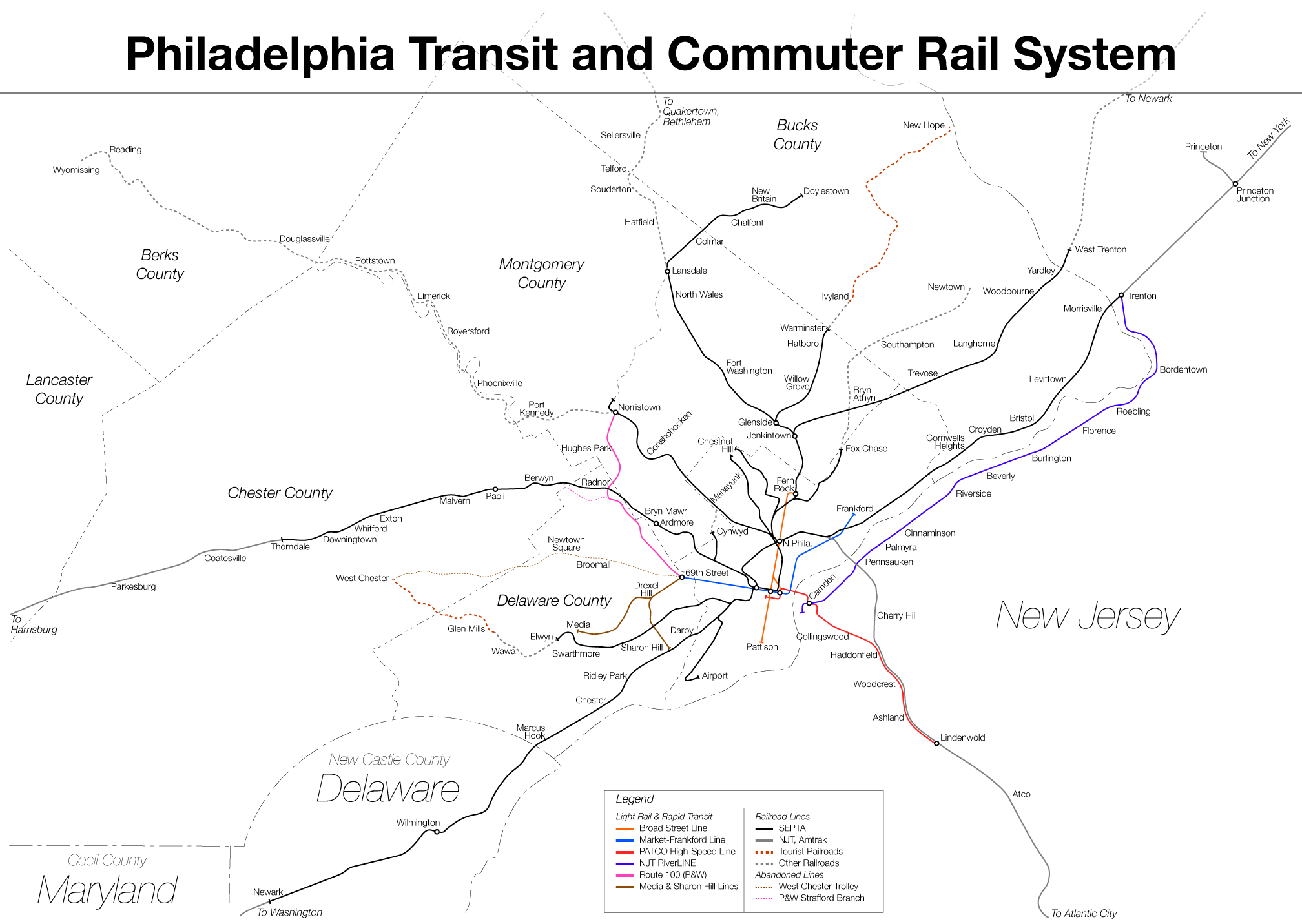
The Southeastern Pennsylvania Transportation Authority (SEPTA) is a regional public transportation authority that operates transit bus, bus, rapid transit, commuter rail, light rail, and electric trolleybus services for nearly 4 million people in five counties in and around Philadelphia, Pennsylvania. It also manages projects that maintain, replace and expand its infrastructure, facilities and vehicles. SEPTA is the major transit provider for Philadelphia and the counties of Delaware County, Pennsylvania, Delaware, Montgomery County, Pennsylvania, Montgomery, Bucks County, Pennsylvania, Bucks, and Chester County, Pennsylvania, Chester. It is a state-created authority, with the majority of its board appointed by the five Pennsylvania counties it serves. While several SEPTA commuter rail lines terminate in the nearby states of Delaware and New Jersey, additional service to Philadelphia from those states is provided by other agencies: the PATCO Speedline from Camden County, New Jer ... [...More Info...] [...Related Items...] OR: [Wikipedia] [Google] [Baidu] |
Center City, Philadelphia
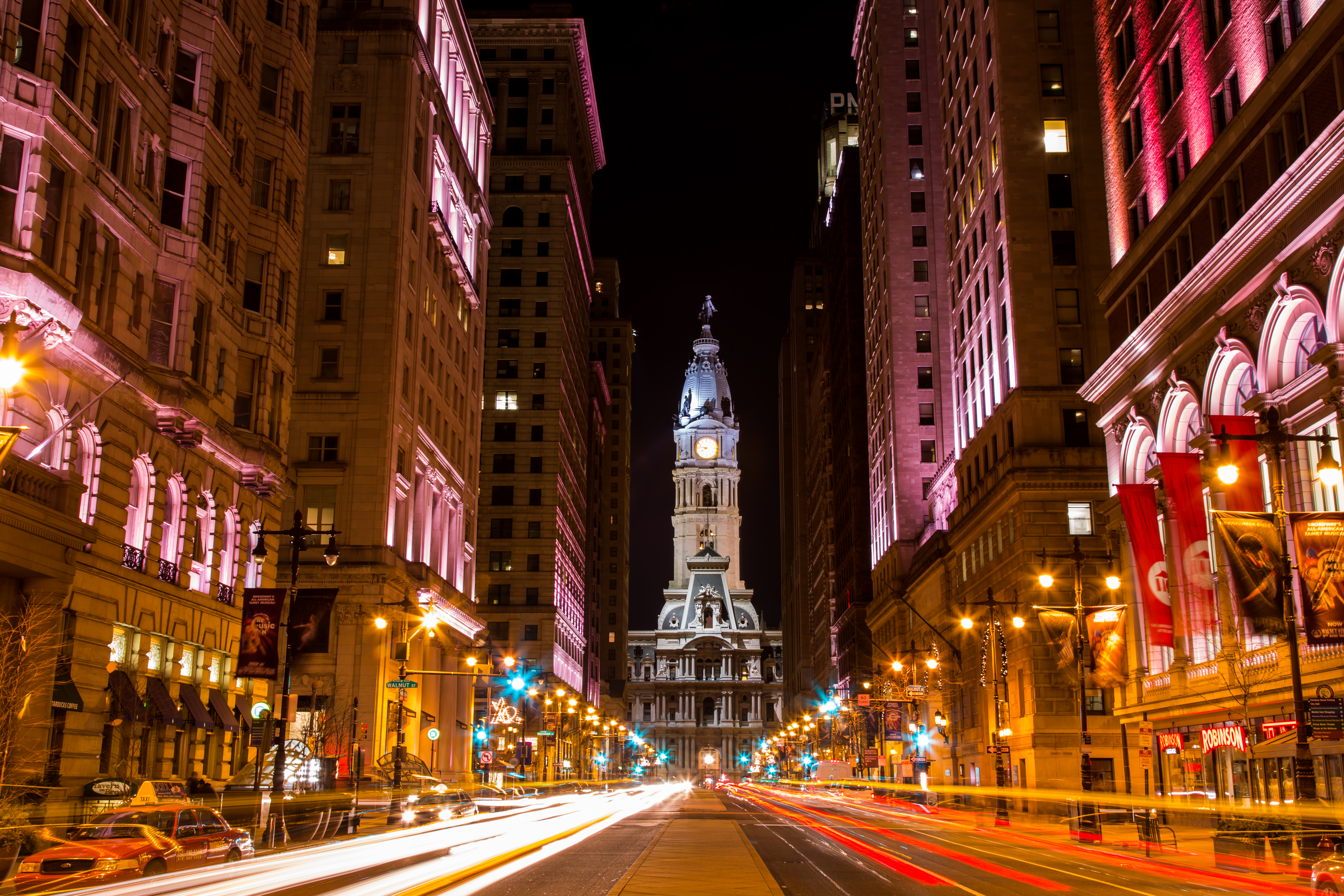
Center City includes the central business district and central neighborhoods of Philadelphia. It comprises the area that made up the City of Philadelphia prior to the Act of Consolidation, 1854, which extended the city borders to be coterminous with Philadelphia County. Greater Center City (defined from Girard Avenue to Tasker Street) has grown into the second-most densely populated downtown area in the United States, after Midtown Manhattan in New York City, with an estimated 202,100 residents in 2020 and a population density of 26,284 per square mile. Geography Boundaries Center City is bounded by South Street to the south, the Delaware River to the east, the Schuylkill River to the west, and Vine Street to the north. The district occupies the old boundaries of the City of Philadelphia before the city was made coterminous with Philadelphia County in 1854. The Center City District, which has special powers of taxation, has a complicated, irregularly shaped boundary that i ... [...More Info...] [...Related Items...] OR: [Wikipedia] [Google] [Baidu] |
King Of Prussia (shopping Mall)
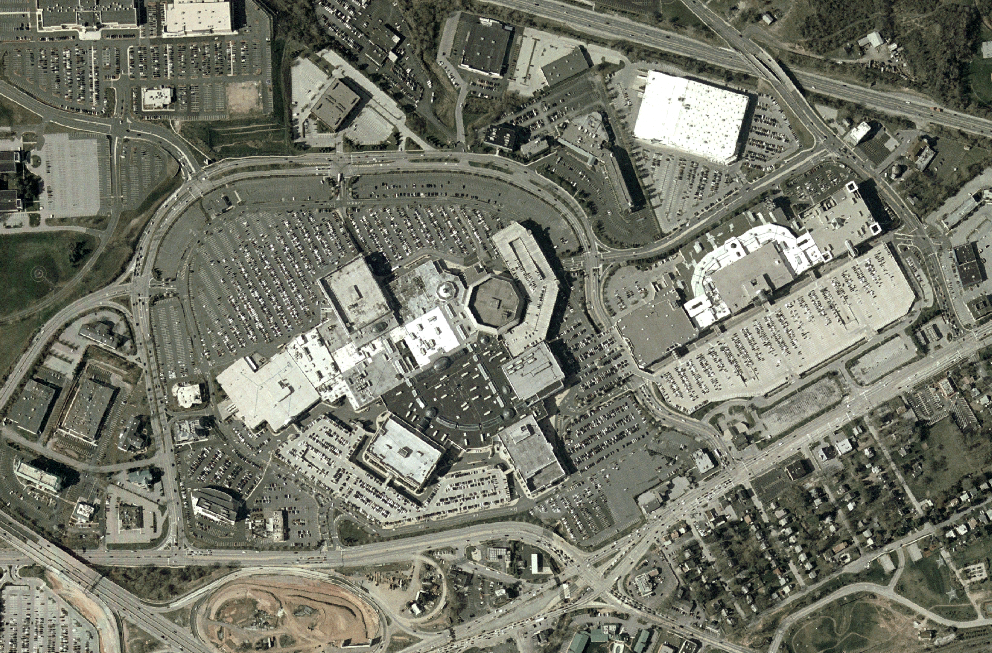
King of Prussia (also referred to as King of Prussia Mall) is a shopping mall located in the community of King of Prussia in Upper Merion Township in the U.S. state of Pennsylvania. It is the largest shopping mall in Pennsylvania and the third-largest shopping mall in the United States in terms of gross leasable area. It is an upscale mall with 450 retailers. Its anchor stores include Bloomingdale's, Dick's Sporting Goods, Macy's, Neiman Marcus, Nordstrom, and Primark with two vacant anchor spots last occupied by JCPenney and Lord & Taylor. The mall, which opened in 1963, consisted of two distinct buildings known as ''The Plaza'' and ''The Court'' until August 2016, when a major expansion was completed and the two buildings were connected to create one large shopping mall. Location The King of Prussia mall is located in the census-designated place of King of Prussia, in Upper Merion Township, Montgomery County, Pennsylvania, northwest of Philadelphia. The mall is ... [...More Info...] [...Related Items...] OR: [Wikipedia] [Google] [Baidu] |
King Of Prussia Transit Center
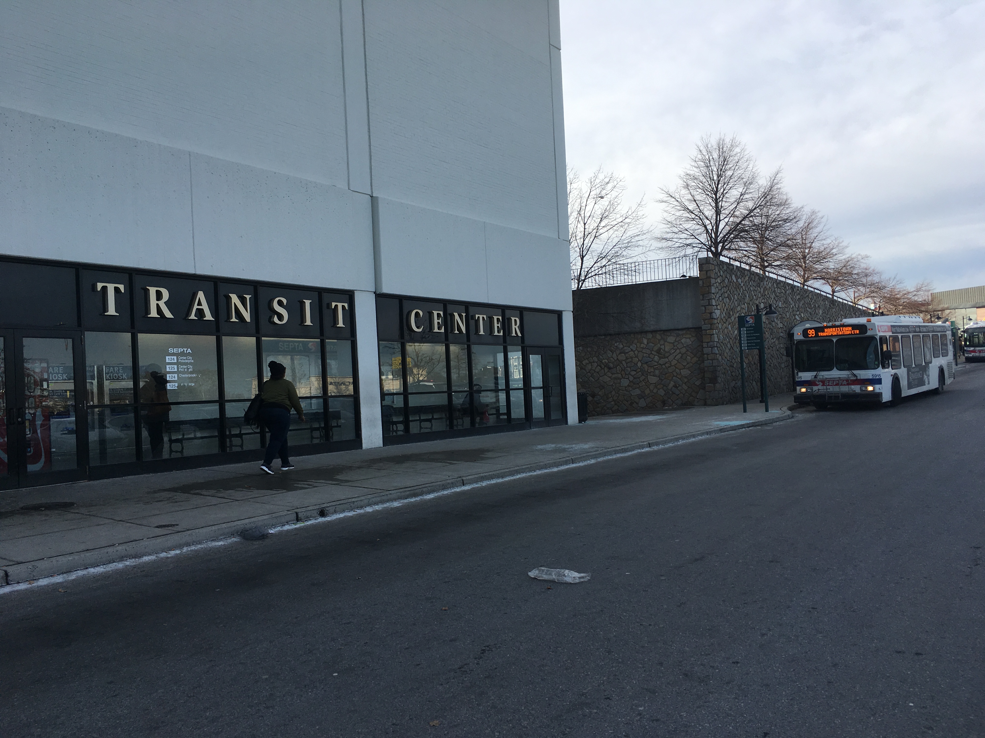
The King of Prussia Transit Center is a major bus terminal located at the King of Prussia mall in King of Prussia, Pennsylvania for SEPTA buses. The transit center serves SEPTA Suburban Division buses traveling to Center City Philadelphia via Route 124 or Route 125, Chesterbrook via Route 124, Valley Forge via Route 125, 69th Street station via Route 123, the Norristown Transportation Center and Phoenixville via Route 99, the West Chester Transportation Center via Route 92, and Limerick via Route 139. Location and layout The King of Prussia Transit Center is located at the King of Prussia mall next to the former JCPenney. A mall entrance adjacent to the transit center provides access to the lower level. The transit center has an interior waiting area attached to the former JCPenney that has seating, a vending machine, SEPTA Key Fare Kiosks, bus schedules, and a system map. The interior waiting area is accessible 24 hours a day. Additional bus shelters are located along th ... [...More Info...] [...Related Items...] OR: [Wikipedia] [Google] [Baidu] |
SEPTA Suburban Division Bus Routes
The Southeastern Pennsylvania Transportation Authority operates or contracts operations of these routes serving points in Bucks, Chester, Delaware, and Montgomery counties, with a few routes operating into the city of Philadelphia. The Suburban Transit Division is broken down into three districts: Victory (Formerly: Red Arrow Division), Frontier, and Contract Operations. Routes Victory District These routes are operated from the Victory District, located at the 69th Street Transportation Center in Upper Darby Township, Delaware County. This also includes Norristown High Speed Line (Route 100 before 2009), 101 Media, and 102 Sharon Hill rail operations. These routes were once operated by the Philadelphia Suburban Transportation Company, better known by its nickname "Red Arrow Lines". Routes in the Chester area of Delaware County as well as Chester Pike operations were once operated by Southern Penn Bus Lines, which the Red Arrow took control of on June 30, 1960. Today, Rou ... [...More Info...] [...Related Items...] OR: [Wikipedia] [Google] [Baidu] |
ADC Map
Kappa Publishing Group, Inc. is a Blue Bell, Pennsylvania-based publishing company concentrating on adult puzzle books and magazines as well as children's magazines and maps. It is a private company founded in 1955 with $11.5 million in annual sales. History In January 2012, Kappa announced that they had acquired Modern Publishing. Subsidiaries It has a number of subsidiary companies, such as London Publishing or GAMES Publications. It original owner, H.L. Herbert ("Larry") founded his puzzle business, Official Publications in Manhattan with titles including Teen Word-Finds, Superb Word-Finds, Variety Word-Finds and countless crossword puzzle, crosspatch and fill-it-in titles. Sons Anthony Herbert (Editorial Director) and Paul Herbert (Sales) helped the business grow to the success it became. Edward Tobias was the Editor. Prior to Mr. Herbert, Sr.'s passing in the 1980s, he sold the business to Nick Karabots, who owned the printer where the titles were being printed. The b ... [...More Info...] [...Related Items...] OR: [Wikipedia] [Google] [Baidu] |
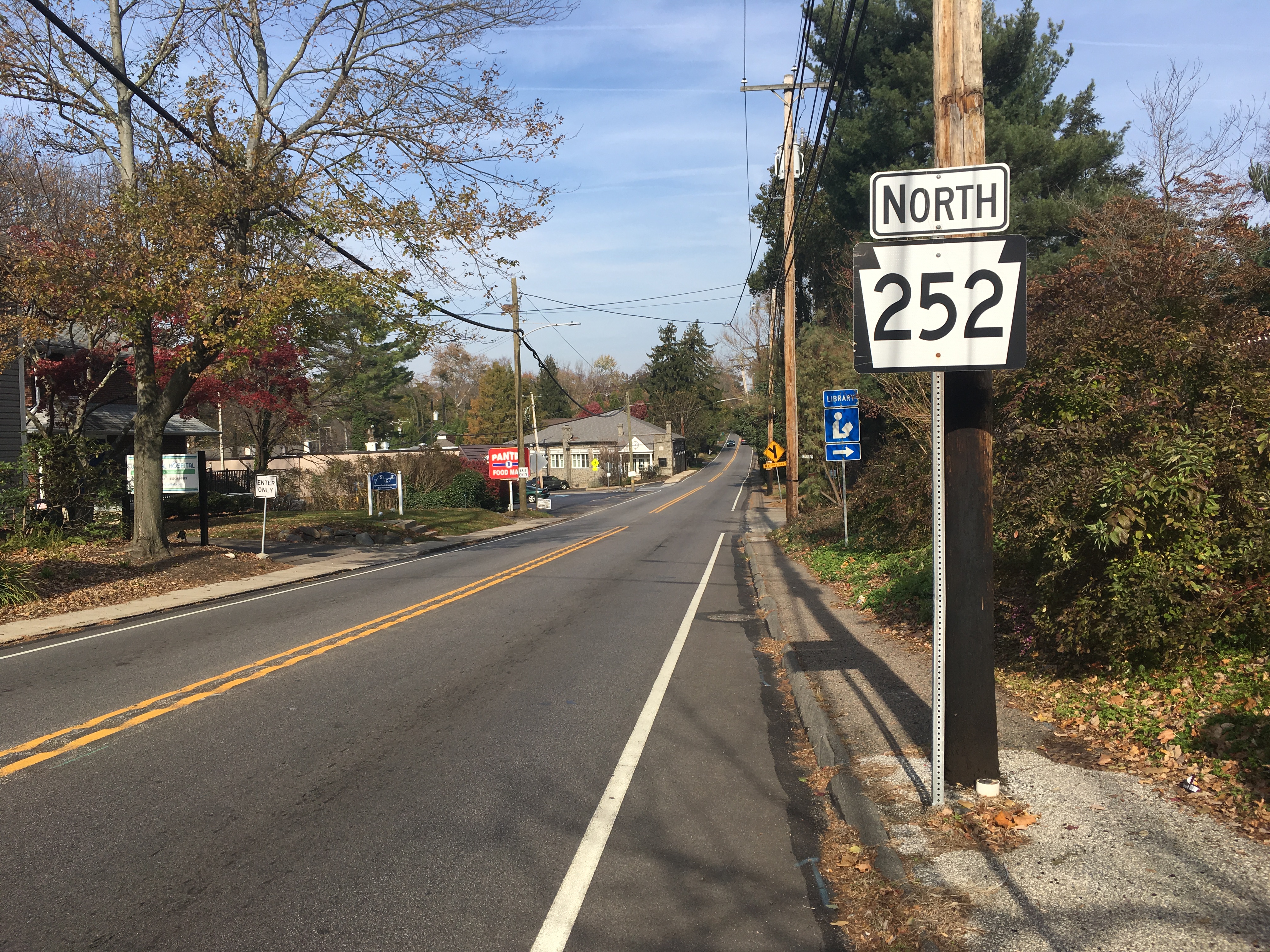
Pennsylvania Route 252
Pennsylvania Route 252 (PA 252) is a north–south state highway in the U.S. state of Pennsylvania that connects PA 320 in Nether Providence Township at its southern terminus to PA 23 in Valley Forge at its northern terminus. The route runs through the western suburbs of Philadelphia in Delaware, Chester, and Montgomery counties, including Nether Providence Township, the borough of Media, Upper Providence Township, Marple Township, Newtown Township, Easttown Township, Tredyffrin Township, and Upper Merion Township. The route intersects many roads including U.S. Route 1 (US 1) north of Media, PA 3 in Newtown Square, US 30 in Paoli, and US 202 near Berwyn. The southernmost part of PA 252 was originally built as part of the Providence Road in 1684. PA 252 was designated by 1928 to run from PA 320 north of Chester north to US 122/ PA 52 (now US 202) in King of Prussia. By 1960, the northern terminus was moved to PA 23 in King of Prussia. PA 252 was realigned to head t ... [...More Info...] [...Related Items...] OR: [Wikipedia] [Google] [Baidu] |
Conestoga High School
Conestoga High School, located in Tredyffrin Township, Pennsylvania, is the only upper secondary school in the Tredyffrin/Easttown School District. It has a Berwyn post office address, though it is not in the Berwyn census-designated place. Conestoga, commonly referred to as "Stoga", is northwest of Philadelphia in the suburbs known as the Main Line. College and university matriculation 97% of Conestoga graduates advance to colleges and universities, 92% of them to four-year colleges and universities. Graduating classes from 2009 to 2014 sent one or more students to each of the Ivy League colleges, Massachusetts Institute of Technology, Duke University, Johns Hopkins University, University of Chicago, The California Institute of Technology, Carnegie Mellon University, and The University of California, Berkeley. The most popular university choice for Conestoga students is Pennsylvania State University. The second most popular choice is the University of Pittsburgh. Fifty-two ... [...More Info...] [...Related Items...] OR: [Wikipedia] [Google] [Baidu] |
Tredyffrin/Easttown School District
Tredyffrin/Easttown School District (T/E in short) is a school district based in Tredyffrin Township, Chester County, Pennsylvania. T/E School District serves the townships of Tredyffrin Township and Easttown Township, and is one of the several school districts serving the Philadelphia Main Line. T/E serves all or portions of several communities wholly or partly in the two townships, including Berwyn, Malvern, Chesterbrook, Daylesford, Devon, Paoli, Strafford, Wayne, and Radnor. In the 2010-2011 school year, the school district had 6,323 enrolled students. In 2008, ''Philadelphia magazine'' ranked the school district the best in the Philadelphia area. Administration Tredyffrin/Easttown School District Administrators: Dr. Richard Gusick Superintendent of Schools Schools There is one high school, two middle schools, and five elementary schools in the Tredyffrin/Easttown School District. High school 1 in Tredyffrin Township * Conestoga High School (CHS, Tredyffrin To ... [...More Info...] [...Related Items...] OR: [Wikipedia] [Google] [Baidu] |


