|
Chaoyang District, Changchun
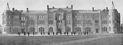
Chaoyang District () is one of seven districts of the prefecture-level city of Changchun, the capital of Jilin Province, Northeast China. It borders the districts of Luyuan and Kuancheng to the north, Nanguan to the east, as well as the prefecture-level city of Siping to the south and west. Administrative divisions There are 9 subdistricts and 2 towns A town is a type of a human settlement, generally larger than a village but smaller than a city. The criteria for distinguishing a town vary globally, often depending on factors such as population size, economic character, administrative stat .... * Qianjin Subdistrict () * Guilin Subdistrict () * Nanhu Subdistrict () * Yongchang Subdistrict () * Chongqing Subdistrict () * Qinghe Subdistrict () * Hongqi Subdistrict () * Huxi Subdistrict () * Fufeng Subdistrict () * Leshan Town () * Yongchun Town () References External links County-level divisions of Jilin Changchun {{Jilin-geo-stub ... [...More Info...] [...Related Items...] OR: [Wikipedia] [Google] [Baidu] |
Changchun
Changchun is the capital and largest city of Jilin, Jilin Province, China, on the Songliao Plain. Changchun is administered as a , comprising seven districts, one county and three county-level cities. At the 2020 census of China, Changchun had a population of 9,066,906; its metro area, comprising five districts and one development area, had a population of 5,019,477. Shuangyang and Jiutai districts are not urbanized yet. It is one of the biggest cities in Northeast China, along with Shenyang, Dalian and Harbin. The name of the city means "long spring" in Chinese language, Chinese. Between 1932 and 1945, Changchun was renamed Xinjing ( zh, c=新京 , p=Xīnjīng, l=new capital) or Hsinking by the Kwantung Army as the capital of the Imperial Japanese puppet state of Manchukuo, occupying modern Northeast China. After the Proclamation of the founding of the People's Republic of China, foundation of the People's Republic of China in 1949, Changchun was established as the provincial ... [...More Info...] [...Related Items...] OR: [Wikipedia] [Google] [Baidu] |
China
China, officially the People's Republic of China (PRC), is a country in East Asia. With population of China, a population exceeding 1.4 billion, it is the list of countries by population (United Nations), second-most populous country after India, representing 17.4% of the world population. China spans the equivalent of five time zones and Borders of China, borders fourteen countries by land across an area of nearly , making it the list of countries and dependencies by area, third-largest country by land area. The country is divided into 33 Province-level divisions of China, province-level divisions: 22 provinces of China, provinces, 5 autonomous regions of China, autonomous regions, 4 direct-administered municipalities of China, municipalities, and 2 semi-autonomous special administrative regions. Beijing is the country's capital, while Shanghai is List of cities in China by population, its most populous city by urban area and largest financial center. Considered one of six ... [...More Info...] [...Related Items...] OR: [Wikipedia] [Google] [Baidu] |
Chongqing Subdistrict
Chongqing Subdistrict () is a subdistrict in Chaoyang District, Changchun, Jilin province, China. , it has 4 residential communities under its administration. See also * List of township-level divisions of Jilin This is a list of Administrative divisions of the People's Republic of China#Township level, township-level divisions of the province of Jilin, People's Republic of China (PRC). After Province-level divisions of the People's Republic of China, ... References Township-level divisions of Jilin Changchun {{Jilin-geo-stub ... [...More Info...] [...Related Items...] OR: [Wikipedia] [Google] [Baidu] |
Town (China)
When referring to Administrative divisions of China#Township level (4th), political divisions of China, town is the standard English translation of the Chinese (traditional: ; zh, p=zhèn , w=chen4). The Constitution of the People's Republic of China classifies towns as fourth-level administrative units, along with, for example, Townships of China, townships ( zh, s=乡 , p=xiāng). A township is typically smaller in population and more remote than a town. Similar to higher-level administrative units, the borders of a town would typically include an urban core (a small town with the population on the order of 10,000 people), as well as a rural area with some Villages of China, villages ( zh, labels=no, s=村 , p=cūn, or zh, labels=no, s=庄 , p=zhuāng). Map representation A typical provincial map would merely show a town as a circle centered at its urban area and labeled with its name, while a more detailed one (e.g., a map of a single county-level division) would also s ... [...More Info...] [...Related Items...] OR: [Wikipedia] [Google] [Baidu] |
Subdistrict (China)
A subdistrict ( zh, c= / , p=jiēdào / jiē, l=streets and avenues / streets) is one of the smaller administrative divisions of China, administrative divisions of China. It is a form of townships of China, township-level division which is typically part of a larger urban area, as opposed to a discrete towns of China, town (zhèn, 镇) surrounded by rural areas, or a rural townships of China, township (xiāng, 乡). In general, urban areas are divided into subdistricts and a subdistrict is sub-divided into several residential community, residential communities or neighbourhoods as well as into villagers' groups (居民区/居住区, 小区/社区, 村民小组). The subdistrict's administrative agency is the subdistrict office ( zh, s=街道办事处, p=jīedào bànshìchù)"【街道办事处】 jiēdào bànshìchù 市辖区、不设区的市的人民政府派出机关。在上一级政府领导下,负责本辖区内的社区服务、经济发展、社会治安等工� ... [...More Info...] [...Related Items...] OR: [Wikipedia] [Google] [Baidu] |
Siping, Jilin
Siping ( zh, s=四平, p=Sìpíng), formerly Sipingjie ( zh, s=四平街, p=Sìpíngjiē, w=Ssupingchieh), is a prefecture-level city in the west of Jilin province, China, People's Republic of China. It has a total population of 1,814,733 inhabitants, as of the 2020 census. Siping covers an area of and is located in the middle of the Songliao Plain, near the border with Liaoning and Inner Mongolia provinces. History Siping's history can be stretched to 3,000 years ago during the Shang dynasty. The Yan (state), Kingdom of Yan Ruins indicate that the Han Chinese People started moving into Northeast region of China during the Spring and Autumn period. Ancient ethnic tribes such as the Buyeo kingdom, Fuyu, the Goguryeo, the Khitan people, Khitans, the Jurchen people, Jurchen, the Mongols, the Manchus, and Koreans have left behind cultural artifacts, including Hanzhou, Xinzhou, and the Yehe Tribe Cultural Artifacts. Yehe Town in Siping is also the hometown of two empresses of the Qin ... [...More Info...] [...Related Items...] OR: [Wikipedia] [Google] [Baidu] |
Nanguan District
Nanguan District () is one of seven districts of the prefecture-level city of Changchun, the capital of Jilin Province, Northeast China, and forms part of the urban core. It borders the districts of Kuancheng to the north, Erdao to the northeast, Shuangyang to the southeast, Chaoyang to the west, and the prefecture-level city of Siping to the south. Administrative divisions There are 12 subdistricts, three towns A town is a type of a human settlement, generally larger than a village but smaller than a city. The criteria for distinguishing a town vary globally, often depending on factors such as population size, economic character, administrative stat ..., and two townships. Subdistricts: *Nanjie Subdistrict (南街街道) *Taoyuan Subdistrict (桃源街道) *Quan'an Subdistrict (全安街道) *Yongji Subdistrict (永吉街道) *Shuguang Subdistrict (曙光街道) *Nanling Subdistrict (南岭街道) *Ziqiang Subdistrict (自强街道) *Minkang Subdistrict (民康街 ... [...More Info...] [...Related Items...] OR: [Wikipedia] [Google] [Baidu] |
Kuancheng District
Kuancheng District () is one of seven districts of the prefecture-level city of Changchun, the capital of Jilin Province, Northeast China. It is part of Changchun's main urban area, located north of downtown. It borders Dehui to the northeast, Jiutai to the east, Erdao District to the southeast, Nanguan and Chaoyang Districts to the south, Luyuan District to the southwest, and Nong'an County to the northwest. History In May 1898, as Russians were building a railway from Harbin to Lüshun (the southern branch of the Chinese Eastern Railway), Kuancheng became the location of Changchun's first railway station.Changchun II- Le chemin de fer de Changchun After Russia's loss of the southernmost section of this branch as a result of the |
Luyuan
Luyuan District () is one of seven districts of the prefecture-level city of Changchun, the capital of Jilin Province, Northeast China, forming part of the city's urban core. It borders Kuancheng District to the north and east, Chaoyang District to the south, and Nong'an County to the north and west, as well as the prefecture-level city of Siping to the west. Administrative divisions There are seven subdistricts, one town, and two townships A township is a form of human settlement or administrative subdivision. Its exact definition varies among countries. Although the term is occasionally associated with an urban area, this tends to be an exception to the rule. In Australia, Canad .... Subdistricts: *Chuncheng Subdistrict (), Puyang Subdistrict (), Zhengyang Subdistrict (), Dongfeng Subdistrict (), Jincheng Subdistrict (), Tiexi Subdistrict (), Qingnian Road Subdistrict () The only town is Hexin () Townships: *Chengxi Township (), Xixin Township () Notes References E ... [...More Info...] [...Related Items...] OR: [Wikipedia] [Google] [Baidu] |
Northeast China
Northeast China () is a geographical region of China, consisting officially of three provinces Liaoning, Jilin and Heilongjiang. The heartland of the region is the Northeast China Plain, the largest plain in China with an area of over . The region is separated from the Russian Far East to the north and east by the Amur, Argun and Ussuri Rivers; from North Korea to the south by the Yalu and Tumen Rivers; and from the neighboring North China to the west by the Greater Khingan Range and Yan Mountains. It is also bounded by the Bohai Bay and Yellow Sea to the southwest, about away from East China's Jiaodong Peninsula across the Bohai Strait, due to be connected via a proposed undersea tunnel. The four prefectures of Inner Mongolia (which is part of North China) east of the Greater Khingan, i.e. Chifeng, Tongliao, Hinggan and Hulunbuir, are sometimes also considered broader parts of Northeast China, and together with the aforementioned three provinces formed what was h ... [...More Info...] [...Related Items...] OR: [Wikipedia] [Google] [Baidu] |
District (China)
The term ''district'', in the context of China, is used to refer to several unrelated political divisions in both ancient and modern China. In the modern context, district ( zh, s=区, labels=no), formally city-governed district, city-controlled district, or municipal district ( zh, s=市辖区, links=no, labels=no), are subdivisions of a Direct-administered municipality, municipality or a prefecture-level city. The rank of a district derives from the rank of its city. Districts of a municipality are prefectures of China, prefecture-level; districts of a sub-provincial division, sub-provincial city are sub-prefecture-level; and districts of a prefecture-level city are counties of China, county-level. The term was also formerly used to refer to obsolete District (China)#County-controlled districts (obsolete), county-controlled districts (also known as district public office). However, if the word ''district'' is encountered in the context of ancient history of China, Chinese ... [...More Info...] [...Related Items...] OR: [Wikipedia] [Google] [Baidu] |
Prefecture-level City
A prefecture-level city () or prefectural city is an administrative division of the China, People's Republic of China (PRC), ranking below a province of China, province and above a Counties of the People's Republic of China, county in China's administrative structure. Details During the Republican era, many of China's prefectural cities were designated as Counties of Taiwan, counties as the country's second level division below a province. From 1949 to 1983, the official term was a province-administrated city (Chinese: 省辖市). Prefectural level cities form the second level of the administrative structure (alongside prefecture of China, prefectures, Leagues of China, leagues and autonomous prefectures). Administrative chiefs (mayors) of prefectural level cities generally have the same rank as a division chief () of a national ministry. Since the 1980s, most former prefectures have been renamed into prefecture-level cities. A prefectural level city is a "city" () and "p ... [...More Info...] [...Related Items...] OR: [Wikipedia] [Google] [Baidu] |


