|
Chagos–Laccadive Ridge
The Chagos–Lakshadweep Ridge (CLR), also known as the Chagos–Lakshadweep Plateau, is a prominent volcanic ridge and oceanic plateau extending between the Northern and the Central Indian Ocean. Laccadive is an anglicized adaptation of the word Lakshadweep which means "One Hundred Thousand Islands". After 1973, the Indian government de-recognized the colonial word "Laccadive " and renamed it "Lakshadweep" as per local lingua franca. Extending from 10°S to 15°N, the CLR includes the Lakshadweep, Maldives, and Chagos archipelagos and can be divided into three corresponding blocks, of which the first is continental and the two latter are oceanic. The CLR is asymmetrical with a steeper eastern slope and has an average depth of less than . It formed south of or near the Equator together with the remaining western continental margin of India, when India separated first from Madagascar in the Mid-Cretaceous and then from the Seychelles Islands in the Late Cretaceous. Exten ... [...More Info...] [...Related Items...] OR: [Wikipedia] [Google] [Baidu] |
Lakshadweep
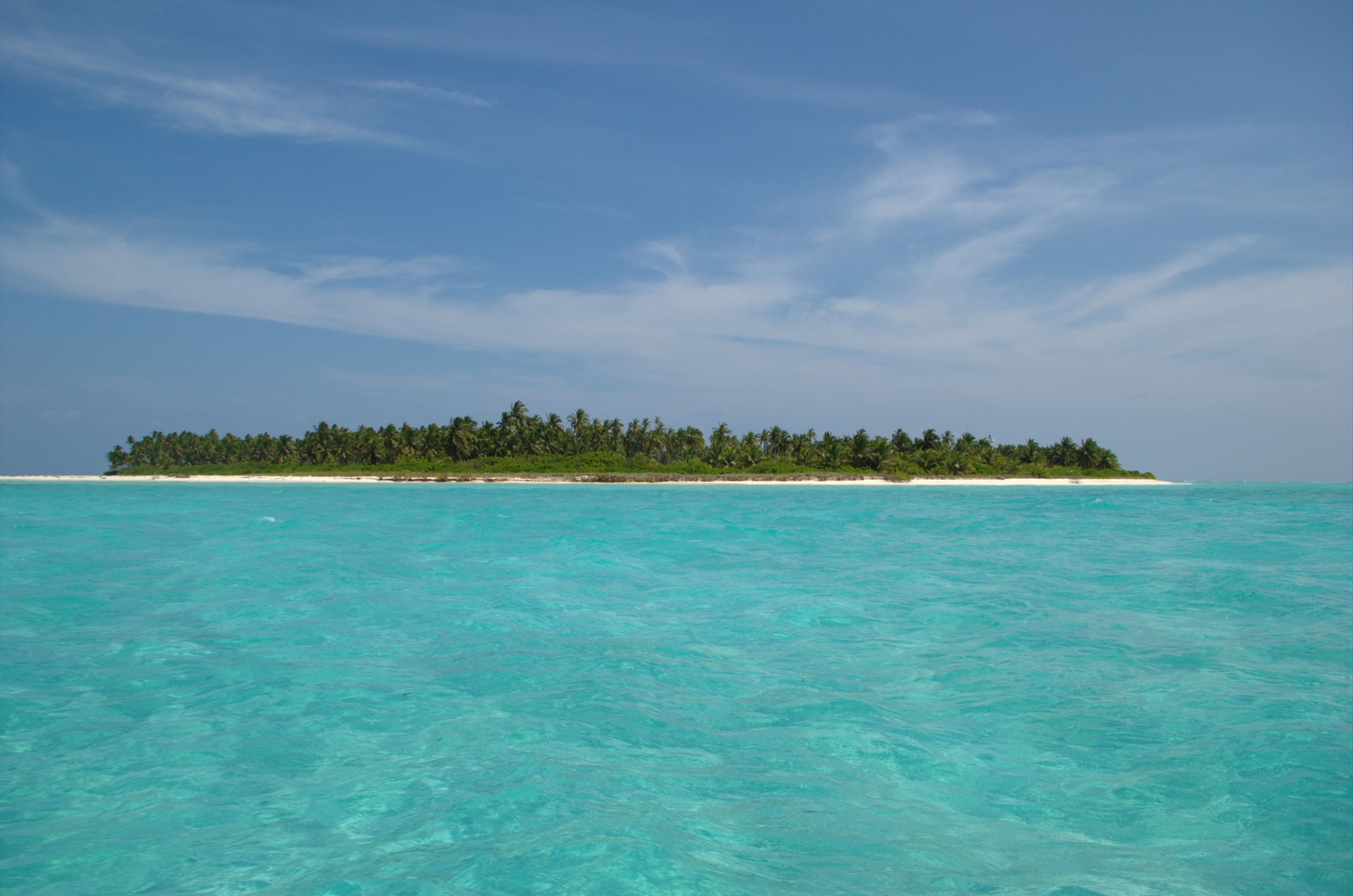
Lakshadweep () is a union territory of India. It is an archipelago of 36 islands divided into three island subgroups: the Amindivi Islands in the north, the Laccadive Islands (separated from Amindivi roughly by the 11th parallel north), and the atoll of Minicoy to the south of the Nine Degree Channel. The islands are located between the Arabian Sea to the west and the Laccadive Sea to the east, about off the Malabar Coast of mainland India. The islands occupy a total land area of approximately with a population of 64,473 as per the 2011 Census of India, 2011 census across the ten inhabited islands. There is a long coastline with a lagoon area of , territorial waters of and an exclusive economic zone of . Lakshadweep is the northernmost island group of the exposed undersea mountain range, the Chagos-Laccadive Ridge, Chagos-Lakshadweep Ridge. The entire union territory is administered as a List of districts in India, single Indian district, district with Kavaratti as its capi ... [...More Info...] [...Related Items...] OR: [Wikipedia] [Google] [Baidu] |
Great Chagos Bank
The Great Chagos Bank, in the Chagos Archipelago, about south of Maldives, is the largest atoll structure in the world, with a total area of . Islands Despite its enormous size, the Great Chagos Bank is largely a submarine structure. There are only four emerging reefs, mostly located on the western rim of the atoll, except for lonely Nelson Island, which lies wholly isolated in the middle of the northern fringe. These reefs have eight individual low and sandy islands, with a total land area of about . All islands and their surrounding waters are a Strict Nature Reserve since 1998. The total length of the eastern and southern expanses of the bank, as well as the reefs in its central area, are wholly submerged. The islands of the Great Chagos Bank, starting clockwise from the south, are: * Danger Island (slightly more than long from North to South, by wide, land area , vegetated with palm trees up to high. * Eagle Islands ** Île Aigle (Eagle Island, vegetated with hig ... [...More Info...] [...Related Items...] OR: [Wikipedia] [Google] [Baidu] |
Earthquake
An earthquakealso called a quake, tremor, or tembloris the shaking of the Earth's surface resulting from a sudden release of energy in the lithosphere that creates seismic waves. Earthquakes can range in intensity, from those so weak they cannot be felt, to those violent enough to propel objects and people into the air, damage critical infrastructure, and wreak destruction across entire cities. The seismic activity of an area is the frequency, type, and size of earthquakes experienced over a particular time. The seismicity at a particular location in the Earth is the average rate of seismic energy release per unit volume. In its most general sense, the word ''earthquake'' is used to describe any seismic event that generates seismic waves. Earthquakes can occur naturally or be induced by human activities, such as mining, fracking, and nuclear weapons testing. The initial point of rupture is called the hypocenter or focus, while the ground level directly above it is the ... [...More Info...] [...Related Items...] OR: [Wikipedia] [Google] [Baidu] |
Aseismic
In geology, aseismic creep or fault creep is measurable surface displacement along a fault in the absence of notable earthquakes. Aseismic creep may also occur as "after-slip" days to years after an earthquake. Notable examples of aseismic slip include faults in California (e.g. Calaveras Fault, Hayward Fault, and San Andreas Fault). Causes Aseismic creep accommodates far-field motions on localized zones of deformation at tectonic plate boundaries. The underlying causes of aseismic creep are primarily attributed to poor frictional strength of the fault, low normal stress acting on the fault in the shallow crust, and excessive pore-fluid pressures, which limit the viable amount of normal stress on a fault. The frictional reaction of geologic materials can explain the transition from seismic to aseismic deformation with depth. Friction along faults can cause sudden slips with associated stress drops (earthquakes), along with phases of no motion as stress recharges. Measurem ... [...More Info...] [...Related Items...] OR: [Wikipedia] [Google] [Baidu] |
Mascarene Plateau
The Mascarene Plateau is a submarine plateau in the Indian Ocean, north and east of Madagascar. The plateau extends approximately , from Seychelles in the north to Réunion in the south. The plateau covers an area of over of shallow water, with depths ranging from , plunging to to the abyssal plain at its edges. It is the second-largest oceanic plateau in the Indian Ocean after the Kerguelen Plateau. Geography The northern part of the Mascarene Plateau includes the Agaléga Islands and the Seychelles Islands. The southern part of the Mascarene Plateau includes Hawkins Bank, the Mascarene Islands, Nazareth Bank, the Saya de Malha Bank, and the Soudan Banks. The Mascarene Islands are the mountainous islands of the Cargados Carajos Shoals, Mauritius, Réunion, and Rodrigues. Geology The Indian subcontinent was at one time next to the east coast of Seychelles, but seafloor spreading has moved the landmass to its current position, where it has collided and fused w ... [...More Info...] [...Related Items...] OR: [Wikipedia] [Google] [Baidu] |
Panikkar Ridge
Panikkar is a variation of the Panicker title used in India, specifically in the state of Kerala, which roughly comprises the former (British) Madras Presidency district of Malabar and the princely states of Cochin and Travancore. This title was usually conferred by the kings of Travancore on those individuals who are proficient in Kalaripayattu. * Achyuta Panikkar, an astronomer of Kerala * Ayyappa Panikkar, (1930–2006), a Malayalam poet, critic. *Kadammanitta Ramakrishnan (1935–2008), an Indian writer *Madhava Panikkar, one of the Niranam Poets *Sankara Panikkar, one of the Niranam Poets *Sean Panikkar (born 1981), American operatic tenor *Rama Panikkar, one of the Niranam Poets *Kavalam Madhava Panikkar (1894–1963), Indian diplomat and writer * Kavalam Narayan Panikkar (1928-2016), dramatist and poet * K. N. Panikkar (born 1936), Indian historian * Raimon Panikkar (1918–2010), a Catalan scholar Note: The main article is under Panicker Panicker was an honorary title ... [...More Info...] [...Related Items...] OR: [Wikipedia] [Google] [Baidu] |
Laxmi Ridge
Lakshmi (; , , sometimes spelled Laxmi, ), also known as Shri (, , ), is one of the principal goddesses in Hinduism, revered as the goddess of wealth, fortune, prosperity, beauty, fertility, sovereignty, and abundance. She along with Parvati and Sarasvati, form the trinity of goddesses called the Tridevi. Lakshmi has been a central figure in Hindu tradition since pre-Buddhist times (1500 to 500 BCE) and remains one of the most widely worshipped goddesses in the Hindu pantheon. Although she does not appear in the earliest Vedic literature, the personification of the term ''shri''—auspiciousness, glory, and high rank, often associated with kingship—eventually led to the development of Sri-Lakshmi as a goddess in later Vedic texts, particularly the ''Shri Suktam''. Her importance grew significantly during the late epic period (around 400 CE), when she became particularly associated with the preserver god Vishnu as his consort. In this role, Lakshmi is seen as the ideal H ... [...More Info...] [...Related Items...] OR: [Wikipedia] [Google] [Baidu] |
Large Igneous Province
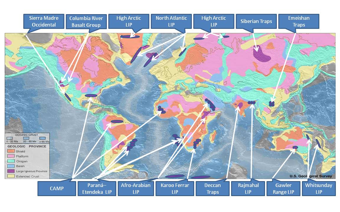
A large igneous province (LIP) is an extremely large accumulation of igneous rocks, including intrusive ( sills, dikes) and extrusive (lava flows, tephra deposits), arising when magma travels through the crust towards the surface. The formation of LIPs is variously attributed to mantle plumes or to processes associated with divergent plate tectonics. The formation of some of the LIPs in the past 500 million years coincide in time with mass extinctions and rapid climatic changes, which has led to numerous hypotheses about causal relationships. LIPs are fundamentally different from any other currently active volcanoes or volcanic systems. Overview Definition In 1992, Coffin and Eldholm initially defined the term "large igneous province" as representing a variety of mafic igneous provinces with areal extent greater than 100,000 km2 that represented "massive crustal emplacements of predominantly mafic (magnesium- and iron-rich) extrusive and intrusive rock, and origin ... [...More Info...] [...Related Items...] OR: [Wikipedia] [Google] [Baidu] |
Cretaceous–Paleogene Boundary
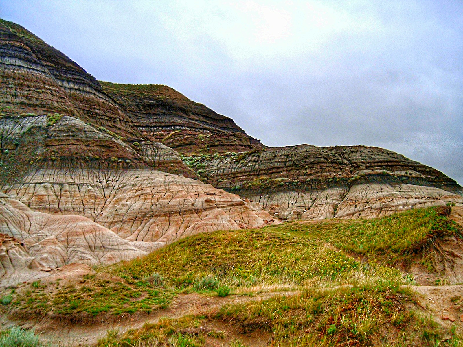
The Cretaceous–Paleogene (K–Pg) boundary, formerly known as the Cretaceous–Tertiary (K–T) boundary, is a geological signature, usually a thin band of rock containing much more iridium than other bands. The K–Pg boundary marks the end of the Cretaceous Period, the last period of the Mesozoic Era, and marks the beginning of the Paleogene Period, the first period of the Cenozoic Era. Its age is usually estimated at 66 million years, with radiometric dating yielding a more precise age of 66.043 ± 0.043 Ma. The K–Pg boundary is associated with the Cretaceous–Paleogene extinction event, a mass extinction which destroyed a majority of the world's Mesozoic species, including all dinosaurs except for some birds. Strong evidence exists that the extinction coincided with a large meteorite impact at the Chicxulub crater and the generally accepted scientific theory is that this impact triggered the extinction event. The word "Cretaceous" is derived from the Latin "creta" ( ... [...More Info...] [...Related Items...] OR: [Wikipedia] [Google] [Baidu] |
Lakshadweep Islands
Lakshadweep () is a union territory of India. It is an archipelago of 36 islands divided into three island subgroups: the Amindivi Islands in the north, the Laccadive Islands (separated from Amindivi roughly by the 11th parallel north), and the atoll of Minicoy to the south of the Nine Degree Channel. The islands are located between the Arabian Sea to the west and the Laccadive Sea to the east, about off the Malabar Coast of mainland India. The islands occupy a total land area of approximately with a population of 64,473 as per the 2011 census across the ten inhabited islands. There is a long coastline with a lagoon area of , territorial waters of and an exclusive economic zone of . Lakshadweep is the northernmost island group of the exposed undersea mountain range, the Chagos-Lakshadweep Ridge. The entire union territory is administered as a single district with Kavaratti as its capital. Archaeological evidence from Kalpeni indicates human settlement in the region ... [...More Info...] [...Related Items...] OR: [Wikipedia] [Google] [Baidu] |
Volcano
A volcano is commonly defined as a vent or fissure in the crust of a planetary-mass object, such as Earth, that allows hot lava, volcanic ash, and gases to escape from a magma chamber below the surface. On Earth, volcanoes are most often found where tectonic plates are diverging or converging, and because most of Earth's plate boundaries are underwater, most volcanoes are found underwater. For example, a mid-ocean ridge, such as the Mid-Atlantic Ridge, has volcanoes caused by divergent tectonic plates whereas the Pacific Ring of Fire has volcanoes caused by convergent tectonic plates. Volcanoes resulting from divergent tectonic activity are usually non-explosive whereas those resulting from convergent tectonic activity cause violent eruptions."Mid-ocean ridge tectonics, volcanism and geomorphology." Geology 26, no. 455 (2001): 458. https://macdonald.faculty.geol.ucsb.edu/papers/Macdonald%20Mid-Ocean%20Ridge%20Tectonics.pdf Volcanoes can also form where there is str ... [...More Info...] [...Related Items...] OR: [Wikipedia] [Google] [Baidu] |


