|
Caxcan
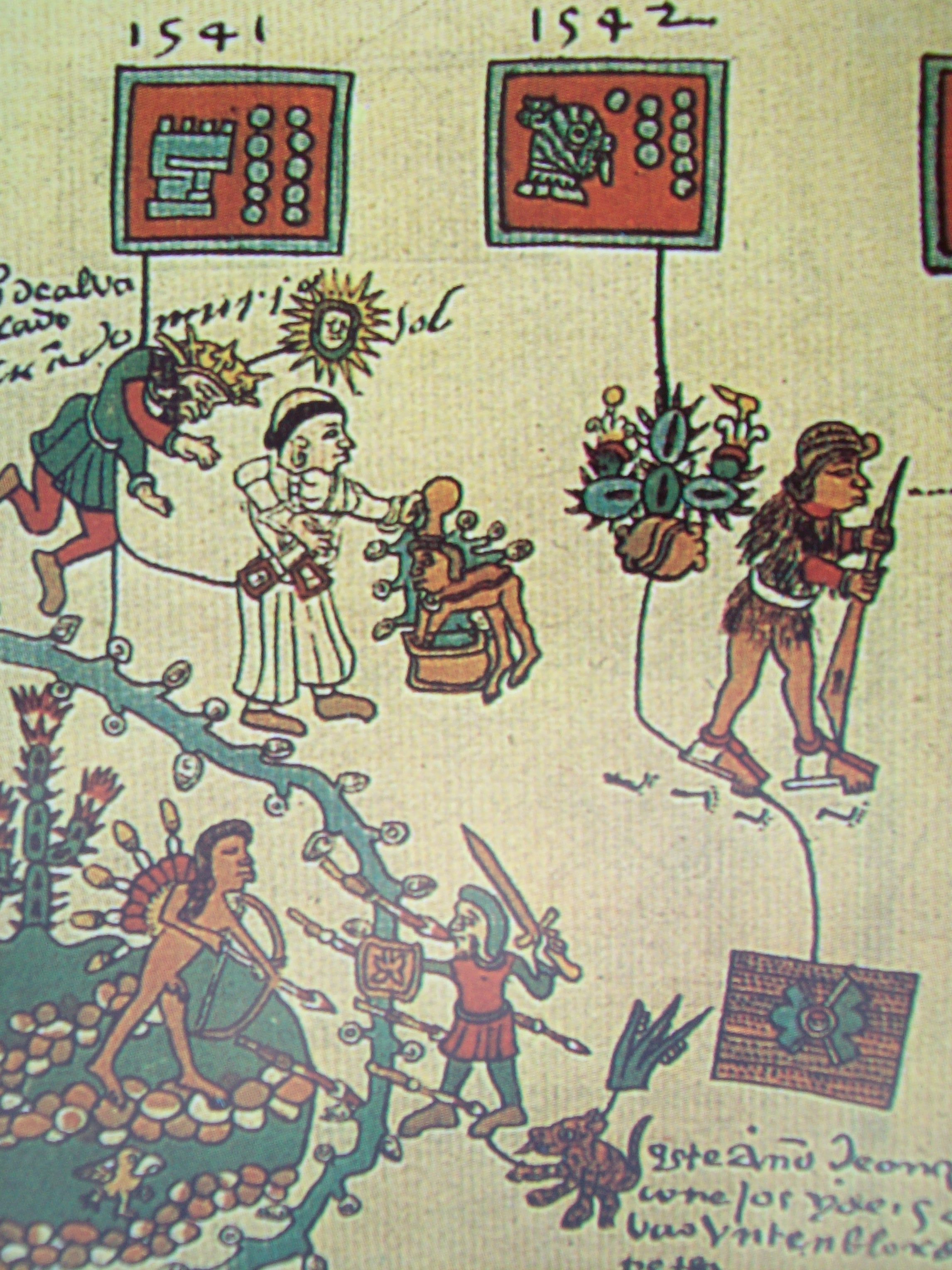
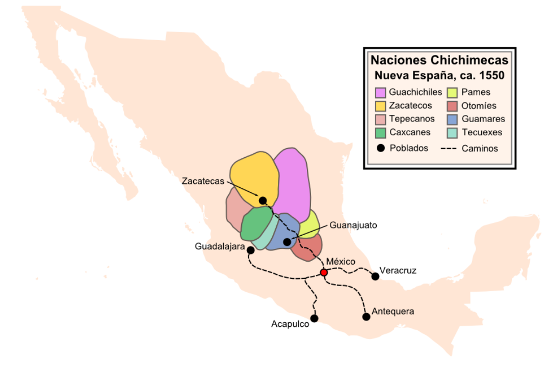
The Caxcan are an ethnic group who are Indigenous to western and north-central Mexico, particularly the regions corresponding to modern-day Zacatecas, southern Durango, Jalisco, Colima, Aguascalientes, Nayarit. The Caxcan language is most often documented as an ancient variant of Nahuatl and is a member of the Uto-Aztecan language family. The last generation of natively fluent Caxcan language speakers came to an end in the 1890s. Despite this having long been conflated by anthropologists with an extinction of the Caxcan people themselves, much of Caxcan culture has persisted via oral tradition. There is currently an ongoing revitalization of Caxcan language, scholarship, and culture. History Pre-1550 The Caxcan were a partly nomadic, partly sedentary people. Under their leader, Tenamaztle, the Caxcan were allied with the Zacatecos against the Spaniards during the Mixtón Rebellion in 1540-42. During the rebellion, they were described as "the heart and the center of the ... [...More Info...] [...Related Items...] OR: [Wikipedia] [Google] [Baidu] |
Francisco Tenamaztle
Francisco Tenamaztle (fl. 1540s–1550s), also Tenamaxtlan, Tenamaxtli or Tenamaxtle, was a leader of the Caxcan Indigenous peoples in Mexico during the Mixtón War of 1540–1542. He was later put on trial in Spain. With the support of Bartolomé de las Casas he defended the justice of his cause by appealing to King Carlos I. Background The first contact of the Caxcan and other indigenous peoples of northwestern Mexico with the Spanish, was in 1529 when Nuño Beltrán de Guzmán set forth from Mexico City with 300–400 Spaniards and 5,000 to 8,000 Aztec and Tlaxcaltec allies on a march through the future states of Nayarit, Jalisco, Durango, Sinaloa, and Zacatecas. Over a six-year period Guzmán conducted frequent violent slave raids throughout Northern Mexico, enslaving thousands of natives. Guzmán and his lieutenants founded towns and Spanish settlements in the region, called Nueva Galicia, including Guadalajara, the first temporary site of which was at Tenamaztle� ... [...More Info...] [...Related Items...] OR: [Wikipedia] [Google] [Baidu] |
Caxcan Language
Cazcan or Caxcan (Kaskán), was the language of the Caxcan, one of the Chichimeca peoples of Mexico. It is known only from a few word lists recorded in the 16th and 17th centuries. The language was definitely part of the Uto-Aztecan family, probably related to Huichol or possibly Southern Tepehuan. There appear to have been dialectal differences between the major Caxcan valleys, and it is likely that several other languages were spoken in Caxcan territory. Lexicon Among the few words attested are ''cazcan'' "there isn't any" (the response to the first Spanish demand for food), "quemedor", ''aguano'' "war chief".Robert Barlow & George Smisor, eds. (1943), Faustino Galicia Chimalpopoca, ''Nombre de Dios, Durango: Two Documents in Náhuatl Concerning Its Foundation: Memorial of the Indians Concerning Their Services, C. 1563; Agreement of the Mexicans and Michoacanos, 1585'' See also * List of extinct Uto-Aztecan languages A large number of languages known only from brief me ... [...More Info...] [...Related Items...] OR: [Wikipedia] [Google] [Baidu] |
Zacatecas
Zacatecas, officially the Free and Sovereign State of Zacatecas, is one of the Political divisions of Mexico, 31 states of Mexico. It is divided into Municipalities of Zacatecas, 58 municipalities and its capital city is Zacatecas City, Zacatecas. It is located in north-central Mexico and is bordered by the states of Durango to the northwest, Coahuila to the north, Nayarit to the west, San Luis Potosí and Nuevo León to the east, and Jalisco, Guanajuato and Aguascalientes to the south. The state is best known for its rich deposits of silver and other minerals, its Spanish Colonial architecture, colonial architecture and its importance during the Mexican Revolution. Its main economic activities are mining, agriculture and tourism. Geography Zacatecas is located in the center-north of Mexico, and covers an area of 75,284 km2, the tenth-largest state in the country. It borders the states of Nayarit, Jalisco, Aguascalientes, San Luis Potosí, Coahuila and Durango and is divided in ... [...More Info...] [...Related Items...] OR: [Wikipedia] [Google] [Baidu] |
Juchipila
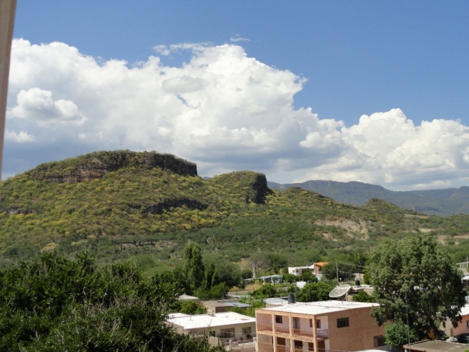
Juchipila (Caxcan: ''Xuchipilan'', "place of flowered nobles") is a Municipalities of Zacatecas, municipality in the Mexico, Mexican state of Zacatecas, located approximately southwest of the state capital Zacatecas City. Geography The municipality of Juchipila is located at an elevation between in the Sierra Madre Occidental in southwestern Zacatecas. The municipality spans the canyon of the Juchipila River, a tributary of the Río Grande de Santiago, which is flanked by the Sierra de Morones to the west and the Sierra de Nochistlán to the east. The municipality borders the municipalities of Apozol Municipality, Apozol to the north, Nochistlán de Mejía Municipality, Nochistlán de Mejía to the east, Moyahua de Estrada to the south, Mezquital del Oro to the southwest, Teúl de González Ortega Municipality, Teúl de González Ortega to the west, and Santa María de la Paz to the northwest. The municipality covers an area of and comprises 0.4% of the state's area. As of 2009, ... [...More Info...] [...Related Items...] OR: [Wikipedia] [Google] [Baidu] |
Jalisco
Jalisco, officially the Free and Sovereign State of Jalisco, is one of the 31 states which, along with Mexico City, comprise the 32 Political divisions of Mexico, Federal Entities of Mexico. It is located in western Mexico and is bordered by six states, Nayarit, Zacatecas, Aguascalientes, Guanajuato, Michoacán, and Colima. Jalisco is divided into Municipalities of Jalisco, 125 municipalities, and its capital and largest city is Guadalajara. Jalisco is one of the most economically and culturally important states in Mexico, owing to its natural resources as well as its long history and culture. Many of the characteristic traits of Mexican culture are originally from Jalisco, such as mariachi, tequila, ranchera, ranchera music, birria, jaripeo, etc., hence the state's motto: ('Jalisco is Mexico'). Economically, it is ranked third in the country, with industries centered in the Guadalajara metropolitan area, the third largest metropolitan area in Mexico. The state is home to two ... [...More Info...] [...Related Items...] OR: [Wikipedia] [Google] [Baidu] |
Chichimeca War
The Chichimeca War (1550–1600) was a military conflict between the Spanish Empire and the Chichimeca Confederation established in the territories today known as the Central Mexican Plateau, called by the Conquistadores La Gran Chichimeca. The epicenter of the hostilities was the region now called the Bajío. The Chichimeca War is recorded as the longest and most expensive military campaign confronting the Spanish Empire and indigenous people in Aridoamerica. The forty-year conflict was settled through several peace treaties driven by the Spaniards which led to the pacification and, ultimately, the streamlined integration of the native populations into the New Spain society. The Chichimeca War (1550–1600) began eight years after the two-year Mixtón War. It can be considered a continuation of the rebellion as the fighting did not come to a halt in the intervening years. The war was fought in what are the present-day Mexican states of Zacatecas, Guanajuato, Aguascaliente ... [...More Info...] [...Related Items...] OR: [Wikipedia] [Google] [Baidu] |
Zacatecos
The Zacatecos (or Zacatecas) are an indigenous group, one of the peoples called Chichimecas by the Aztecs. They lived in most of what is now the state of Zacatecas and the northeastern part of Durango. They have many direct descendants, but most of their culture and traditions have disappeared with time. Large concentrations of modern-day descendants may reside in Zacatecas and Durango, as well as other large cities of Mexico. Name "Zacateco" is a Mexican Spanish derivation from the original Nahuatl ''Zacatecatl'', pluralized in early Mexican Spanish as ''Zacatecas'', the name given to the state and city. The name was given by the Aztecs to the people inhabiting a region in which a grass they called the ''zacatl'' was abundant. The region was thus called ''Zacatlan'' by the Aztecs. (Mexica) Language The Zacateco language is extinct and poorly attested. It has been suspected to be a Nahuan language, or be close to Huichol. History The Chichimeca War The Zacateco unite ... [...More Info...] [...Related Items...] OR: [Wikipedia] [Google] [Baidu] |
Teúl De González Ortega Municipality
Teúl de González Ortega Municipality () is a town and municipality located in the south of the Mexican state of Zacatecas, between the state capital of Zacatecas and the city of Guadalajara. Unlike most of the rest of the state, its economy has been based on agriculture and livestock, rather than mining, and it is noted for its production of agave and mezcal. The town has been named a Pueblo Mágico to promote a tourism industry. Geography The municipality extends over , and borders the municipalities of Tepechitlán, Mezquital del Oro, Garcia de la Cadena and Florencia de Benito Juárez with the state of Jalisco to the south and the state of Nayarit to the west. Outside the seat, other important communities include Ignacio Allende with 1,800 residents, Huitzila with 800 and www.milpillas.com with 500. In addition there are sixteen other communities with representation in the municipal government. The municipality has mountains, small mesas, plain and rolling hills with an ave ... [...More Info...] [...Related Items...] OR: [Wikipedia] [Google] [Baidu] |
Durango
Durango, officially the Free and Sovereign State of Durango, is one of the 31 states which make up the Political divisions of Mexico, 32 Federal Entities of Mexico, situated in the northwest portion of the country. With a population of 1,832,650, the 8th lowest of Mexico's states, Durango has Mexico's second-lowest population density, after Baja California Sur. The capital city, Durango, Durango, Victoria de Durango, is named after the first President of Mexico, Guadalupe Victoria. Geography General information The area of Durango is ; this accounts for about 6.3% of the entire territory of Mexico. It is the fourth largest state, lying at the extreme northwest of the Mexican Plateau, Central Mexican Plateau, where it meets the Sierra Madre Occidental—the highest peaks in the state. The state has an average elevation of 1,775 meters above sea level, with a mean elevation of 1,750 m in the Valleys region and 2,450 m in the Sierra region. The Durango City, city of Durango is on t ... [...More Info...] [...Related Items...] OR: [Wikipedia] [Google] [Baidu] |
Guerra De Juchipila
Guerra is a Portuguese, Spanish and Italian term meaning "war". Notable people with the surname Guerra include: People Arts * Aaron Guerra, American guitarist * Adam Daniel Guerra, American drag queen also known as Venus D-Lite * Ana Clara Guerra Marques, Angolan dancer * Andrea Guerra (composer), Italian composer * Aureliano Fernández-Guerra, Spanish historian, poet and playwright * Carlos Rivera Guerra, Mexican singer * Carolina Guerra, Colombian model and actress * Cástulo Guerra, Argentine actor * César Guerra-Peixe, Brazilian violinist * Ciro Guerra, Colombian film director, screenwriter * Ely Guerra, Mexican singer * Gabriel Guerra, Mexican sculptor * Giovanni Guerra, Italian painter * Gregório de Matos e Guerra, Brazilian poet * Juan Luis Guerra, Dominican singer * Marcelino Guerra, Cuban singer * María Inés Guerra, Mexican singer * Pedro Guerra, Spanish singer * Pia Guerra, Canadian comic book artist * Raquel Guerra, Portuguese singer * Rita Guerra, Portugu ... [...More Info...] [...Related Items...] OR: [Wikipedia] [Google] [Baidu] |


